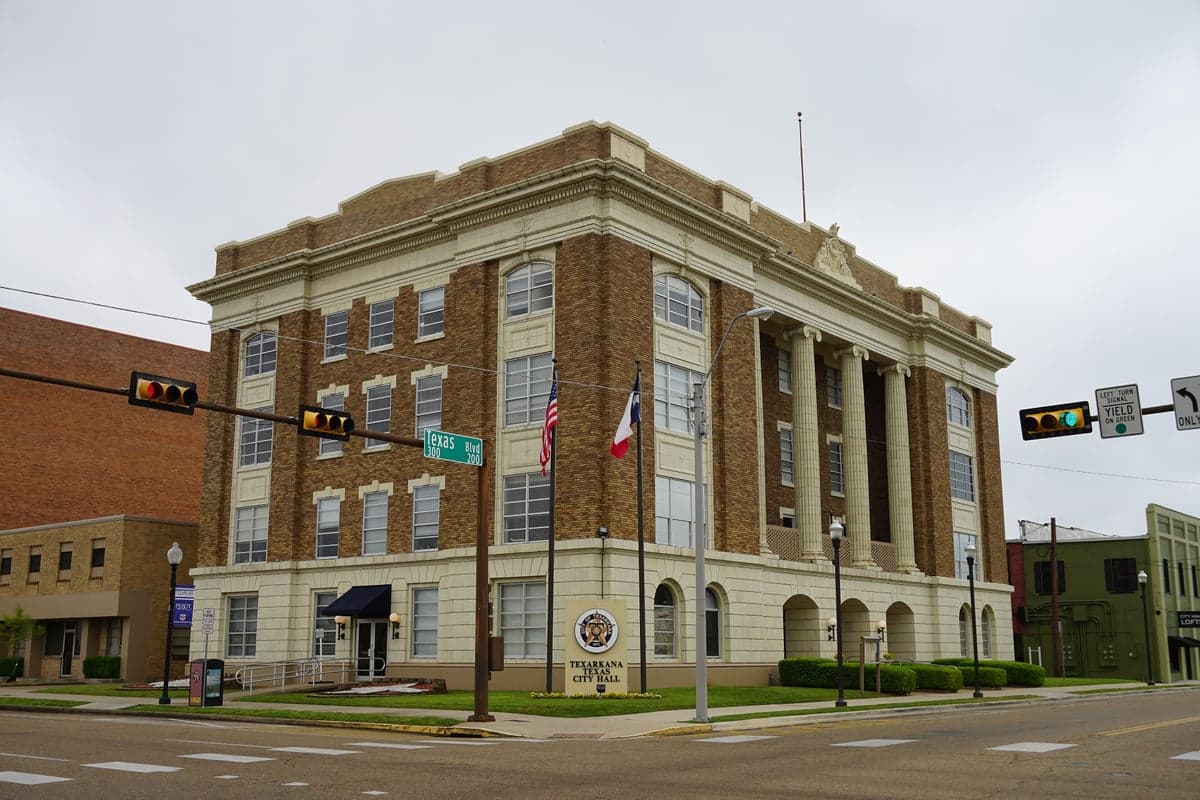
Photo: Wikipedia
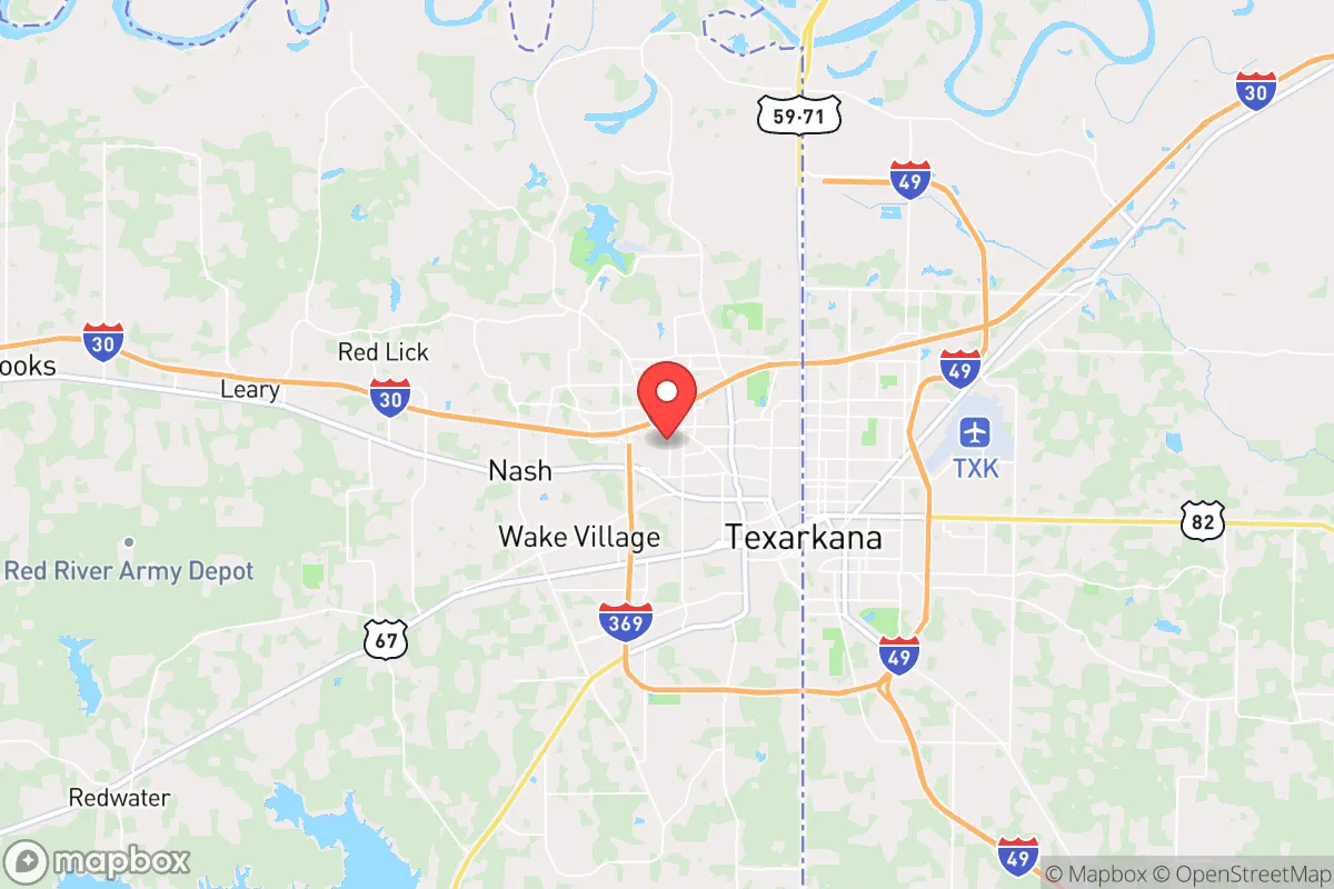
Strategic Assessment of Texarkana, TX
Workable tactical position. Some exposure to population density or targets, but generally defensible in a crisis.
What does the Strategic Assessment tell us?
Our Strategic Assessment grades tactical survivability of an area. Major population centers, military targets, fallout zones, natural disasters, and border exposure all drive risk — lower exposure means a more defensible position in a crisis.
This is heavily inspired by Joel Skousen's Strategic Relocation book. Highly recommended you checkout the book ($)What does this tell us?
Our Strategic Assessment grades tactical survivability of an area. Major population centers, military targets, fallout zones, natural disasters, and border exposure all drive risk — lower exposure means a more defensible position in a crisis.
This is heavily inspired by Joel Skousen's Strategic Relocation book. Highly recommended you checkout the book ($)Strategic Pillars

Key Distances
Regional Safe Places
Below is our recommended "safe zones" in Texas and the surrounding area based on our strategic heuristics. For most people, it's unrealistic to live in a “safe zone” full-time due to work, family or other personal reasons. They tend to be more rural. However, many of these areas are perfect for second homes and retreat properties that double as a vacation home or even a short-term rental.


Important Note: For informational purposes only. This does not mean nothing bad ever happens in the green zones. Please use common sense. This is based on public data and modeled with AI. We tried to take a conservative approach but mistakes happen. We update this regularly as new information becomes available.
Solar Generator Recommendations
Backup power matters more here than in safer locations. We've picked three solar generators across budgets and capacity tiers — start with the budget unit if you only need a few essentials, or step up if you want to run a fridge and HVAC for days at a time.

Jackery Portable Power Station Explorer 300
Budget OptionPower on the Go: Weighing only 11 lbs, it's convenient to set up and store with book-sized foldable solar panels

BLUETTI Portable Power Station AC180
Designed for both indoor and outdoor scenarios, AC180 is highly capable as it has a robost capacity and continuous output power.

EF ECOFLOW DELTA Pro Ultra Power Station
Upgraded PickEcoFlow DELTA Pro Ultra is a whole-home energy system designed to grow with your family. Integrated with the Smart Home Panel 2, it scales to meet your evolving energy needs — keeping your home powered, intelligent, and secure through every stage of life.
We earn a commission, at no additional cost to you.
Strategic Assessment Analysis
Texarkana, straddling the Texas-Arkansas state line, offers a strategic relocation option for those prioritizing resilience and geographic buffer from major metropolitan vulnerabilities. Its location places it roughly 70 miles from Shreveport, 140 miles from Little Rock, and 180 miles from Dallas—close enough for supply runs or medical access, but far enough to avoid the immediate fallout zones of a major urban collapse or mass casualty event. The region’s dual-state status also provides legal and logistical flexibility, with Texas offering no state income tax and Arkansas providing lower property taxes on certain parcels, a practical advantage for long-term resource preservation.
Geographic position and natural advantages for long-term security
Texarkana sits at the intersection of two major interstates—I-30 and I-49—which historically function as evacuation corridors and supply routes, but also as potential chokepoints during a crisis. The area is part of the Piney Woods ecoregion, characterized by dense forests, rolling hills, and abundant water sources, including the Red River and numerous creeks and reservoirs like Wright Patman Lake and Lake Millwood. These natural features provide ample opportunities for off-grid water collection, hunting, and timber for construction or fuel. The climate is humid subtropical, with hot summers and mild winters, allowing for year-round gardening and livestock management, though tornadoes and occasional ice storms are real hazards. The region’s low population density—Burnet County (TX) and Miller County (AR) combined have under 150,000 residents—means less competition for resources during a breakdown, and the rural outskirts offer defensible terrain with natural cover and limited road access.
Risks, exposures, and proximity to fallout-relevant landmarks
While Texarkana avoids the direct blast radius of major cities, it is not without strategic vulnerabilities. The Red River Army Depot, located about 20 miles southwest, is a major ammunition and vehicle storage facility—a potential target in a conflict scenario or a source of looted military-grade hardware during civil unrest. Similarly, the nearby Lone Star Army Ammunition Plant and the Texarkana Regional Airport could become focal points for federal response or refugee movement. The region sits within the New Madrid Seismic Zone’s outer influence, meaning a major earthquake could disrupt infrastructure, though the risk is lower than in Memphis or St. Louis. Tornadoes are a seasonal threat, with the area averaging 40-50 twisters annually in the broader region, so a storm shelter or reinforced safe room is a non-negotiable for any serious prepper. Proximity to the Louisiana border also means potential exposure to hurricane-related supply chain disruptions, though direct storm impacts are rare. On the positive side, the lack of major nuclear power plants, chemical refineries, or military command centers within 50 miles reduces the likelihood of targeted strikes or industrial accidents.
Practical resilience for a relocator: food, water, energy, and defensibility
For a relocator focused on self-sufficiency, Texarkana’s practical assets are strong but require upfront investment. The water table is high—most rural properties can drill a well at 100-200 feet, and surface water from creeks and lakes is plentiful, though filtration is essential due to agricultural runoff and industrial history. The soil in the Piney Woods is sandy loam, suitable for raised-bed gardening, and the growing season runs from March to November, allowing for two crop cycles of staples like corn, beans, and squash. Local livestock options include cattle, goats, and poultry, with ample grazing land available on the Arkansas side. Energy resilience is mixed: the grid is served by Southwestern Electric Power Company (SWEPCO), which has a history of outages during ice storms, so solar panels with battery storage are a wise investment. Natural gas is available in most towns, but rural properties may rely on propane, which requires storage and supply chain access. Defensibility is best on the outskirts—properties with tree cover, limited road frontage, and a clear line of sight to approach routes are common. The local gun culture is strong, with multiple gun shops and ranges, and Texas’s constitutional carry law means no permit is needed for open or concealed carry. The Texarkana Police Department and Bowie County Sheriff’s Office are professional but understaffed, with response times in rural areas often exceeding 20 minutes, reinforcing the need for personal security measures.
The overall strategic picture for Texarkana is one of moderate resilience with clear trade-offs. It offers a buffer from coastal and urban collapse scenarios, abundant natural resources, and a politically conservative population that largely values self-reliance and community cooperation. However, the presence of military logistics infrastructure and the region’s position along major transit corridors introduce risks that cannot be ignored. For a single individual or family willing to invest in off-grid capabilities—well, solar, storm shelter, and a defensible property—Texarkana provides a viable base for weathering short-term disruptions or long-term societal shifts. The key is to avoid the city limits and focus on the rural fringes of Bowie County, TX, or Miller County, AR, where land is affordable, neighbors are sparse, and the Red River Valley offers both sustenance and separation from the chaos of the urban core.
* Values derived from national, state, county, city and local statistics and may differ in a specific area. Last updated: 2026-04-29T02:34:15.000Z
Narrative content on this page is AI-generated and may contain mistakes. Verify any details that matter before acting on them.
ReloMaps may earn a commission from affiliate links at no extra cost to you.