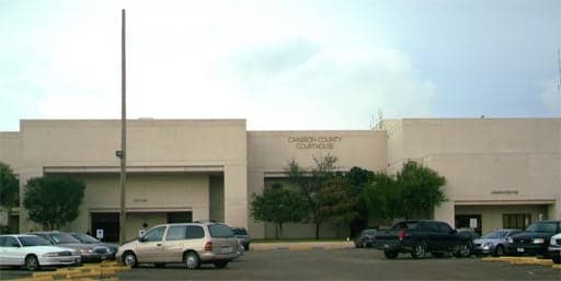
Photo: Wikipedia
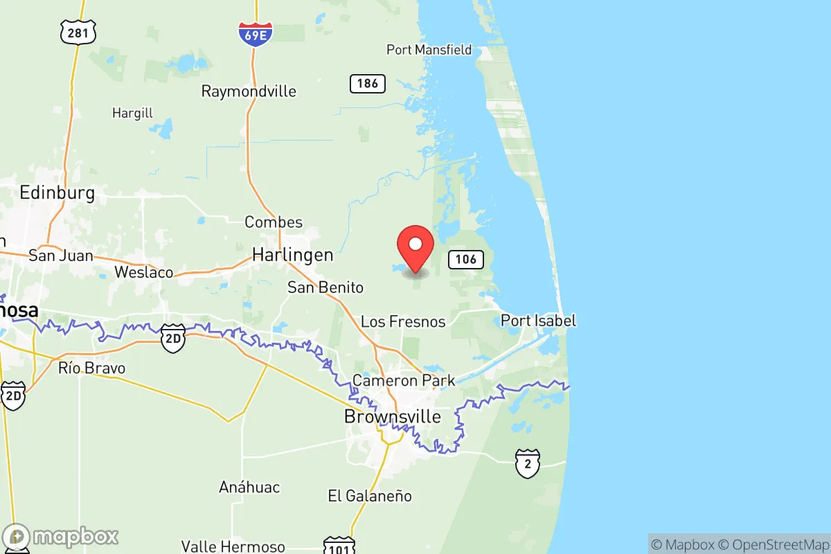
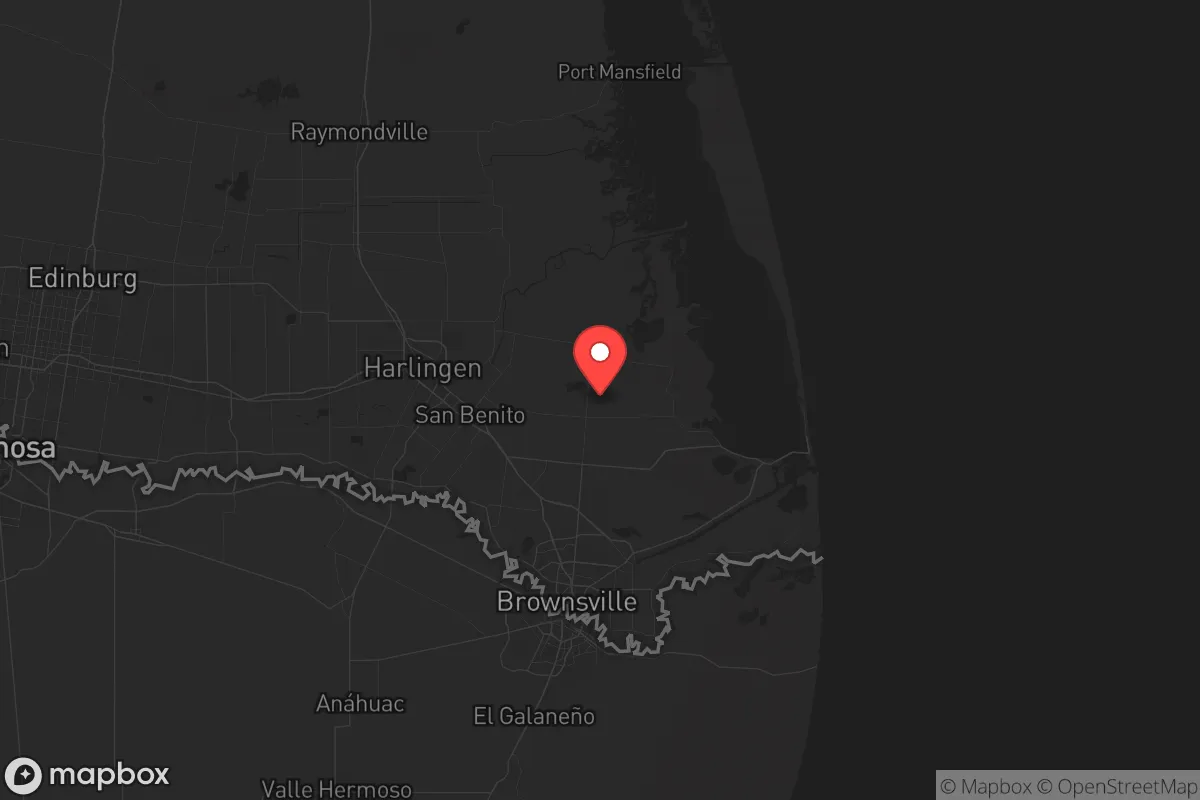
Strategic Assessment of Cameron County
Meaningful friction. Expect exposure to either population pressure, blast zones, or natural disaster risk. Consider buying a retreat property.
What does the Strategic Assessment tell us?
Our Strategic Assessment grades tactical survivability of an area. Major population centers, military targets, fallout zones, natural disasters, and border exposure all drive risk — lower exposure means a more defensible position in a crisis.
This is heavily inspired by Joel Skousen's Strategic Relocation book. Highly recommended you checkout the book ($)What does this tell us?
Our Strategic Assessment grades tactical survivability of an area. Major population centers, military targets, fallout zones, natural disasters, and border exposure all drive risk — lower exposure means a more defensible position in a crisis.
This is heavily inspired by Joel Skousen's Strategic Relocation book. Highly recommended you checkout the book ($)Strategic Pillars

Key Distances
Strategic Assessment Analysis
Cameron County, Texas, offers a unique strategic position for those prioritizing resilience, but it comes with trade-offs that demand clear-eyed assessment. Located at the southernmost tip of the state along the Rio Grande and the Gulf of Mexico, this region is geographically isolated from the major population centers of the interior, which can be a double-edged sword. For a relocator with a conservative, preparedness-minded outlook, the county provides a mix of agricultural self-sufficiency, border-adjacent logistics, and exposure to both natural and man-made risks that require careful planning.
Geographic position and natural advantages for long-term stability
Cameron County's location is defined by its access to the Gulf Intracoastal Waterway and the Port of Brownsville, a deep-water port that serves as a critical hub for international trade and energy shipments. This port, along with the nearby Port Isabel, gives the area a direct line to global supply chains, which could prove valuable during disruptions to inland distribution networks. The county's flat, fertile terrain supports extensive agriculture—particularly citrus, sugarcane, and cotton—meaning local food production is a realistic option for those with land. The climate is subtropical, with mild winters and a long growing season, allowing for year-round gardening and livestock grazing. For a prepper, this means a lower reliance on external food sources compared to colder, more arid regions. The proximity to the Rio Grande also provides a consistent surface water source, though its quality and legal access require verification. The county's population is concentrated in Brownsville (the county seat), Harlingen, and San Benito, with vast rural stretches offering privacy and defensible space. The lack of major interstate highways—only US 77 and US 83 serve the area—limits the flow of refugees from larger cities during a crisis, a distinct advantage over counties near Houston or San Antonio.
Risks, exposures, and proximity to fallout-relevant landmarks
The most significant vulnerability for Cameron County is its exposure to hurricane storm surge and flooding. The entire coastline, from Boca Chica Beach to South Padre Island, is at high risk during Atlantic hurricane season. The 2020 Hurricane Hanna and 2021 Winter Storm Uri both demonstrated the region's fragility: power outages, road closures, and supply chain interruptions are recurring realities. For a survivalist, this means robust backup power, water storage, and evacuation planning are non-negotiable. Beyond weather, the county sits within 50 miles of the SpaceX launch facility at Boca Chica, a high-profile target for both accidental explosions and deliberate attacks. The Port of Brownsville handles petrochemical products, including refined fuels and ammonia, making it a potential secondary hazard zone. The nearby border crossing at Brownsville and the Los Indios International Bridge are chokepoints that could see civil unrest or military checkpoints during a national emergency. While the area is far from the major refinery corridor of Houston (roughly 350 miles north), the concentration of energy infrastructure at the port and the presence of the US Border Patrol's Rio Grande Valley Sector headquarters in Harlingen mean the region is not a blank spot on any adversary's map. The proximity to Matamoros, Mexico, across the river introduces cross-border crime and cartel activity as a persistent low-level threat, though it rarely spills into residential areas. For those concerned with fallout from a nuclear event, the prevailing winds from the Gulf would carry contamination inland, but the county's distance from major strategic targets like Fort Hood (400+ miles) or the Dallas-Fort Worth metroplex (500+ miles) provides a buffer.
Practical resilience for a relocator: food, water, energy, and defensibility
Water access is the strongest point for Cameron County. The Rio Grande is a reliable surface water source, but it is heavily regulated and subject to treaty agreements with Mexico. During drought years, water allotments can be cut, so drilling a private well (depths vary from 100 to 400 feet) is a wise investment. The county's groundwater from the Gulf Coast Aquifer is generally potable but may require treatment for salinity. For food, the local farmers' markets in Brownsville and Harlingen offer fresh produce year-round, and the region's hunting opportunities—white-tailed deer, feral hogs, and waterfowl—are excellent. The climate supports solar energy with high insolation rates, making off-grid solar panels a practical choice for reducing grid dependence. Defensibility is mixed: the flat terrain offers few natural chokepoints, but the rural areas allow for perimeter security with clear sightlines. The county's law enforcement presence is concentrated in the cities, so rural landowners should plan for self-defense. The local economy is anchored by healthcare (Valley Baptist Medical Center in Harlingen), education (University of Texas Rio Grande Valley), and government (county and border patrol jobs), which means a stable base of employment for those who need it. For a relocator, the key is to secure property outside the floodplain (FEMA maps are essential) and away from the immediate border zone to reduce exposure to cartel activity. The lack of major military bases within 100 miles reduces the risk of the area becoming a staging ground for federal operations, but it also means less immediate support during a large-scale disaster.
The overall strategic picture for Cameron County is one of calculated trade-offs. It offers genuine advantages in food production, water access, and isolation from the most likely fallout targets in the US interior. The climate supports long-term self-sufficiency, and the port provides a lifeline for trade if supply chains fragment. However, the hurricane risk, border proximity, and presence of energy and space infrastructure mean it is not a low-maintenance retreat. For a conservative-minded individual or family willing to invest in hardening a property—elevated construction, backup power, water storage, and a solid security plan—the county can serve as a viable base for weathering both natural disasters and broader societal disruptions. It is not a bug-out location for a short-term crisis; it is a long-term homesteading play that requires active management. Those who treat it as such will find a resilient, self-reliant community that values independence and preparedness. Those who expect a hands-off paradise will be disappointed by the first hurricane or border closure.
* Values derived from national, state, county, city and local statistics and may differ in a specific area. Last updated: 2026-05-20T18:41:18.000Z
Narrative content on this page is AI-generated and may contain mistakes. Verify any details that matter before acting on them.
ReloMaps may earn a commission from affiliate links at no extra cost to you.