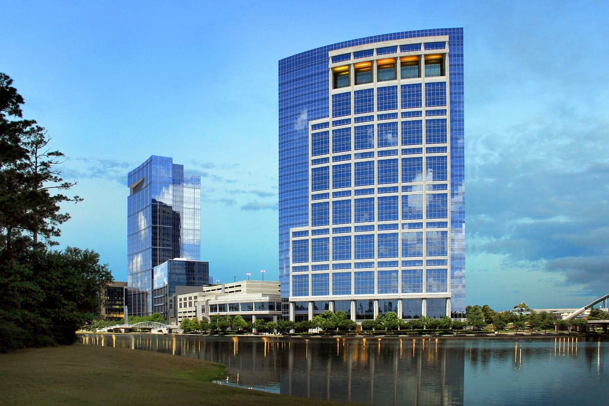
Photo: Wikipedia
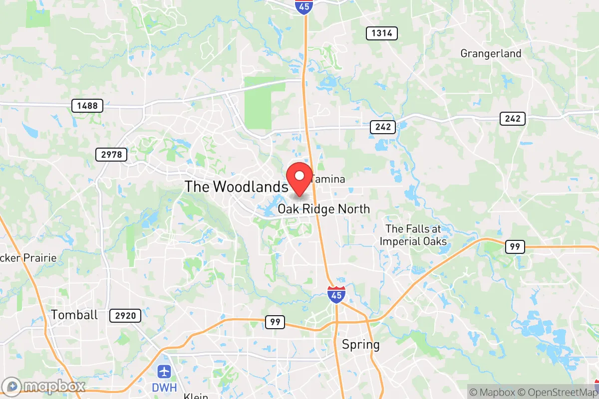
Strategic Assessment of The Woodlands, TX
Meaningful friction. Expect exposure to either population pressure, blast zones, or natural disaster risk. Consider buying a retreat property.
What does the Strategic Assessment tell us?
Our Strategic Assessment grades tactical survivability of an area. Major population centers, military targets, fallout zones, natural disasters, and border exposure all drive risk — lower exposure means a more defensible position in a crisis.
This is heavily inspired by Joel Skousen's Strategic Relocation book. Highly recommended you checkout the book ($)What does this tell us?
Our Strategic Assessment grades tactical survivability of an area. Major population centers, military targets, fallout zones, natural disasters, and border exposure all drive risk — lower exposure means a more defensible position in a crisis.
This is heavily inspired by Joel Skousen's Strategic Relocation book. Highly recommended you checkout the book ($)Strategic Pillars

Key Distances
Regional Safe Places
Below is our recommended "safe zones" in Texas and the surrounding area based on our strategic heuristics. For most people, it's unrealistic to live in a “safe zone” full-time due to work, family or other personal reasons. They tend to be more rural. However, many of these areas are perfect for second homes and retreat properties that double as a vacation home or even a short-term rental.


Important Note: For informational purposes only. This does not mean nothing bad ever happens in the green zones. Please use common sense. This is based on public data and modeled with AI. We tried to take a conservative approach but mistakes happen. We update this regularly as new information becomes available.
Solar Generator Recommendations
Backup power matters more here than in safer locations. We've picked three solar generators across budgets and capacity tiers — start with the budget unit if you only need a few essentials, or step up if you want to run a fridge and HVAC for days at a time.

Jackery Portable Power Station Explorer 300
Budget OptionPower on the Go: Weighing only 11 lbs, it's convenient to set up and store with book-sized foldable solar panels

BLUETTI Portable Power Station AC180
Designed for both indoor and outdoor scenarios, AC180 is highly capable as it has a robost capacity and continuous output power.

EF ECOFLOW DELTA Pro Ultra Power Station
Upgraded PickEcoFlow DELTA Pro Ultra is a whole-home energy system designed to grow with your family. Integrated with the Smart Home Panel 2, it scales to meet your evolving energy needs — keeping your home powered, intelligent, and secure through every stage of life.
We earn a commission, at no additional cost to you.
Strategic Assessment Analysis
The Woodlands, Texas, occupies a strategic position roughly 30 miles north of downtown Houston, offering a blend of suburban insulation and proximity to critical infrastructure that appeals to those prioritizing long-term resilience. Its location along Interstate 45 and the Hardy Toll Road provides multiple egress routes, while the area’s master-planned design—with extensive greenbelts, lakes, and tree cover—offers natural advantages for both daily living and contingency planning. For a conservative-leaning relocator concerned with civic stability, mass casualty events, or systemic disruptions, The Woodlands presents a mixed picture: strong local governance and resource access, but with significant exposure to Houston’s vulnerabilities.
Geographic position and natural advantages for long-term stability
The Woodlands sits within Montgomery County, which has a population density of roughly 400 people per square mile—far lower than Harris County’s 2,600. This lower density reduces the risk of rapid contagion during health emergencies and limits the chaos of urban evacuation scenarios. The area is built around the heavily wooded banks of Spring Creek and the Lake Woodlands reservoir, providing natural water sources and shade that moderate summer temperatures. The terrain is flat but well-drained, with sandy loam soils that support gardening and small-scale agriculture. The region’s subtropical climate means a year-round growing season, though it also brings hurricane threats from the Gulf of Mexico, roughly 60 miles south. The Woodlands’ elevation of about 130 feet above sea level offers some protection against storm surge, but heavy rainfall can still cause flash flooding in low-lying areas near creeks. The extensive network of hike-and-bike trails—over 220 miles—doubles as a movement corridor during gridlock, allowing foot or bike travel between neighborhoods without relying on main roads. The area’s 8,000 acres of preserved green space also provide cover and foraging potential in a prolonged disruption.
Risks, exposures, and proximity to fallout-relevant landmarks
The Woodlands’ greatest vulnerability is its proximity to Houston, a major petrochemical hub and port city. The Houston Ship Channel, roughly 40 miles southeast, contains over 200 chemical plants and refineries, making it a prime target for industrial accidents, sabotage, or military strikes. A catastrophic release at a facility like the ExxonMobil Baytown complex or the LyondellBasell refinery could send toxic plumes northward depending on wind patterns, potentially affecting The Woodlands within hours. Additionally, the area lies within 50 miles of the Texas Medical Center, the world’s largest medical complex, which could become a focal point for disease outbreaks or mass casualty triage. The Woodlands is also near the George Bush Intercontinental Airport (IAH), about 15 miles south—a potential target for terrorism or a vector for pandemic spread. On the positive side, Montgomery County has a strong law enforcement presence, with the Montgomery County Sheriff’s Office and local constables maintaining a visible patrol footprint. The Woodlands Fire Department operates 10 stations with advanced life support capabilities, and the area’s hospital system—including Houston Methodist The Woodlands and St. Luke’s—provides solid trauma care. However, during a regional crisis, these resources could be overwhelmed by Houston evacuees. The area’s power grid is part of the ERCOT system, which has shown fragility during winter storms (e.g., 2021’s Uri), leaving residents exposed to prolonged blackouts if natural gas supplies falter.
Practical resilience for a relocator: food, water, energy, and defensibility
For a relocator focused on self-sufficiency, The Woodlands offers a mixed set of assets. The Lake Woodlands and several smaller ponds provide surface water, but treatment would require filtration or boiling due to runoff and recreational use. The area’s water utility, San Jacinto River Authority, draws from Lake Conroe, but a grid-down scenario would cut pumping. Private wells are rare in the master-planned core, though homes on larger lots in nearby communities like Shenandoah or Oak Ridge North may have them. Food resilience is moderate: the area has numerous grocery stores (H-E-B, Kroger, Whole Foods) but limited local farming. Community gardens exist but are small-scale. For long-term storage, the humid climate (average 75% humidity) makes dry goods prone to mold without proper sealing. Energy-wise, solar adoption is growing, but many homes lack battery backup. Natural gas is widely available for cooking and heating, but the grid’s fragility during winter storms is a known risk. Defensibility is a key strength: The Woodlands is a gated community in spirit, with controlled access points, neighborhood watch programs, and a low crime rate (violent crime at roughly 1.5 per 1,000 residents, compared to Houston’s 10+). The area’s layout—winding roads, cul-de-sacs, and dense tree cover—makes it difficult for large groups to move through quickly, offering natural chokepoints. However, the very features that make it livable—open parks, mixed-use villages, and pedestrian connectivity—also mean that a determined adversary could infiltrate easily. The local population is predominantly conservative and family-oriented, which can foster mutual aid networks, but also means that outsiders may be viewed with suspicion during a crisis.
Overall, The Woodlands is a viable relocation option for those seeking a balance between suburban safety and access to urban resources, but it is not a bug-out location. Its proximity to Houston’s industrial and medical infrastructure creates a double-edged sword: you benefit from the economic engine but inherit its risks. For a prepper or survivalist, the area’s best use is as a base for building local networks, stockpiling supplies, and establishing a retreat further north—toward the Piney Woods or East Texas—where population density drops and natural resources increase. The Woodlands’ strong HOA governance and community policing provide a stabilizing force during low-grade disruptions, but a major event—whether a hurricane, chemical release, or civil unrest—would test its capacity to remain a safe haven. The strategic takeaway: treat The Woodlands as a forward operating base, not a final redoubt. Invest in a backup power source, a water filtration system, and a vehicle capable of navigating flooded or debris-strewn roads. Build relationships with neighbors who share your mindset, and have a plan to relocate 100+ miles north if the situation deteriorates. The area’s comforts are real, but so are its exposures—and in a world of increasing uncertainty, that’s the honest assessment any relocator needs to hear.
* Values derived from national, state, county, city and local statistics and may differ in a specific area. Last updated: 2026-04-16T01:01:31.000Z
Narrative content on this page is AI-generated and may contain mistakes. Verify any details that matter before acting on them.
ReloMaps may earn a commission from affiliate links at no extra cost to you.