Photo: Wikipedia
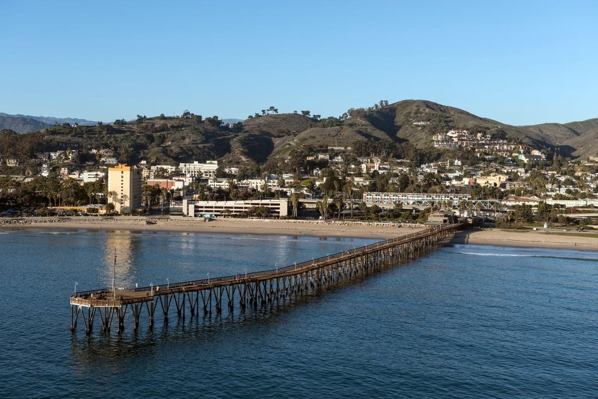
Strategic Assessment of Ventura, CA
Multiple tactical vulnerabilities. Population density, target proximity, or disaster risk are likely compounding. A retreat property and exit planning is required.
What does the Strategic Assessment tell us?
Our Strategic Assessment grades tactical survivability of an area. Major population centers, military targets, fallout zones, natural disasters, and border exposure all drive risk — lower exposure means a more defensible position in a crisis.
This is heavily inspired by Joel Skousen's Strategic Relocation book. Highly recommended you checkout the book ($)What does this tell us?
Our Strategic Assessment grades tactical survivability of an area. Major population centers, military targets, fallout zones, natural disasters, and border exposure all drive risk — lower exposure means a more defensible position in a crisis.
This is heavily inspired by Joel Skousen's Strategic Relocation book. Highly recommended you checkout the book ($)Strategic Pillars

Key Distances
Regional Safe Places
Below is our recommended "safe zones" in California and the surrounding area based on our strategic heuristics. For most people, it's unrealistic to live in a “safe zone” full-time due to work, family or other personal reasons. They tend to be more rural. However, many of these areas are perfect for second homes and retreat properties that double as a vacation home or even a short-term rental.


Important Note: For informational purposes only. This does not mean nothing bad ever happens in the green zones. Please use common sense. This is based on public data and modeled with AI. We tried to take a conservative approach but mistakes happen. We update this regularly as new information becomes available.
Solar Generator Recommendations
Backup power matters more here than in safer locations. We've picked three solar generators across budgets and capacity tiers — start with the budget unit if you only need a few essentials, or step up if you want to run a fridge and HVAC for days at a time.

Jackery Portable Power Station Explorer 300
Budget OptionPower on the Go: Weighing only 11 lbs, it's convenient to set up and store with book-sized foldable solar panels

BLUETTI Portable Power Station AC180
Designed for both indoor and outdoor scenarios, AC180 is highly capable as it has a robost capacity and continuous output power.

EF ECOFLOW DELTA Pro Ultra Power Station
Upgraded PickEcoFlow DELTA Pro Ultra is a whole-home energy system designed to grow with your family. Integrated with the Smart Home Panel 2, it scales to meet your evolving energy needs — keeping your home powered, intelligent, and secure through every stage of life.
We earn a commission, at no additional cost to you.
Strategic Assessment Analysis
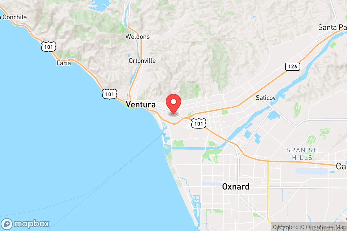
Ventura, California, presents a complex strategic picture for the conservative prepper or survivalist. While its coastal location offers some natural advantages, its proximity to major population centers and critical infrastructure makes it a high-risk, high-reward proposition for those prioritizing long-term resilience. The city’s position between the Pacific Ocean and the Los Padres National Forest creates a narrow corridor that is both defensible and vulnerable, depending on the scenario. For the relocator seeking a balance between access to resources and escape from urban collapse, Ventura demands a sober, unvarnished assessment.
Geographic position and natural advantages for long-term survival
Ventura’s geographic position is a double-edged sword. On the plus side, it sits at the mouth of the Ventura River, providing a reliable freshwater source that is less contested than in the arid interior. The surrounding Los Padres National Forest offers vast, rugged terrain for retreat, hunting, and foraging, with limited road access that can be easily monitored or blocked. The Pacific Ocean provides a potential food source (fishing, kelp) and a natural barrier against threats from the west. The climate is Mediterranean—mild winters and dry summers—reducing the need for extreme heating or cooling and allowing for year-round gardening. The Santa Clara River Valley to the east offers a fertile agricultural corridor, though it also funnels traffic from the inland valleys. For a small, well-prepared group, the area’s topography—canyons, ridges, and coastal bluffs—provides natural chokepoints and observation points. However, the same geography that offers defensibility also limits egress: the 101 freeway and the Pacific Coast Highway are the only major routes out, making them obvious targets for roadblocks or ambushes during a mass evacuation.
Risks, exposures, and proximity to fallout-relevant landmarks
The negatives are substantial and cannot be ignored. Ventura is only 60 miles northwest of Los Angeles, a megacity of over 10 million people that would become a catastrophic humanitarian disaster zone in any major crisis—be it earthquake, civil unrest, or economic collapse. The 101 freeway would be a river of desperate humanity heading north, and Ventura sits directly in that path. The city is also within 30 miles of the Naval Base Ventura County (Point Mugu), a major military installation that includes an airfield, missile testing range, and naval construction battalion. In a war scenario or domestic breakdown, this base becomes a primary target for both foreign and domestic adversaries. The nearby Port of Hueneme is a strategic deep-water port handling military cargo, further increasing the area’s target value. Additionally, the Santa Susana Field Laboratory (a former nuclear research site) is roughly 40 miles inland, and while not an active reactor, its history of partial meltdowns and contamination raises long-term environmental concerns. The San Andreas Fault runs through the region, and a major quake could sever water, power, and gas lines for weeks or months. For the prepper, these are not abstract risks—they are concrete, high-probability threats that demand a robust contingency plan.
Practical resilience for a relocator: food, water, energy, and defensibility
For those who choose Ventura despite the risks, practical resilience requires a layered approach. Water is the first priority: the Ventura River and its tributaries are perennial but subject to seasonal drought and contamination from upstream agriculture. A well on private property is ideal, but many homes rely on municipal water from Lake Casitas, which is vulnerable to earthquake damage and political mismanagement. Rainwater catchment is viable given the 15-20 inches of annual rainfall, but storage capacity must be substantial. Food production is feasible with year-round growing seasons, but soil quality varies and coastal fog can limit sunlight. Community gardens and local farms exist, but land prices are high, and zoning restrictions can hinder livestock or large-scale gardening. Energy independence is achievable with solar panels, but the marine layer and frequent overcast skies reduce solar efficiency compared to inland areas. Backup generators and fuel storage are essential, as grid outages are common during Santa Ana wind events. Defensibility is mixed: the city itself is dense and urban, with limited defensible space. The surrounding foothills and canyons offer better options, but access is often via narrow, winding roads that can be easily blocked. A rural property in the Ojai Valley or upper Ventura River valley would be far more defensible, but those areas are also more exposed to wildfire. The local population is politically mixed—Ventura County leans slightly conservative compared to Los Angeles, but the city itself is more liberal, meaning a prepper may face social friction or scrutiny. Building a trusted network of like-minded neighbors is critical, as isolation in a crisis is a liability.
The overall strategic picture for the conservative relocator
Ventura is not a bug-out location for the faint of heart. It offers genuine natural advantages—water, mild climate, ocean access, and rugged terrain—but these are offset by its proximity to Los Angeles, a major military base, and critical infrastructure that would be overwhelmed in a crisis. For the single individual or family willing to invest in a well-fortified property with independent water, power, and food systems, and who has a clear evacuation plan for the worst-case scenarios, Ventura can be a viable base. However, for those seeking a low-profile, low-risk retreat far from population centers and strategic targets, the Central Valley, the Sierra foothills, or even the inland Pacific Northwest offer better odds. Ventura is a high-stakes play—one that rewards preparation and punishes complacency. If you are serious about resilience, treat it as a forward operating base, not a final redoubt. Have a secondary location inland, maintain operational security, and never underestimate the speed at which a coastal corridor can become a trap.
* Values derived from national, state, county, city and local statistics and may differ in a specific area. Last updated: 2026-04-22T01:17:10.000Z
Narrative content on this page is AI-generated and may contain mistakes. Verify any details that matter before acting on them.
ReloMaps may earn a commission from affiliate links at no extra cost to you.