Photo: Wikipedia
Strategic Assessment of Franklin County
Meaningful friction. Expect exposure to either population pressure, blast zones, or natural disaster risk. Consider buying a retreat property.
What does the Strategic Assessment tell us?
Our Strategic Assessment grades tactical survivability of an area. Major population centers, military targets, fallout zones, natural disasters, and border exposure all drive risk — lower exposure means a more defensible position in a crisis.
This is heavily inspired by Joel Skousen's Strategic Relocation book. Highly recommended you checkout the book ($)What does this tell us?
Our Strategic Assessment grades tactical survivability of an area. Major population centers, military targets, fallout zones, natural disasters, and border exposure all drive risk — lower exposure means a more defensible position in a crisis.
This is heavily inspired by Joel Skousen's Strategic Relocation book. Highly recommended you checkout the book ($)Strategic Pillars

Key Distances
Strategic Assessment Analysis
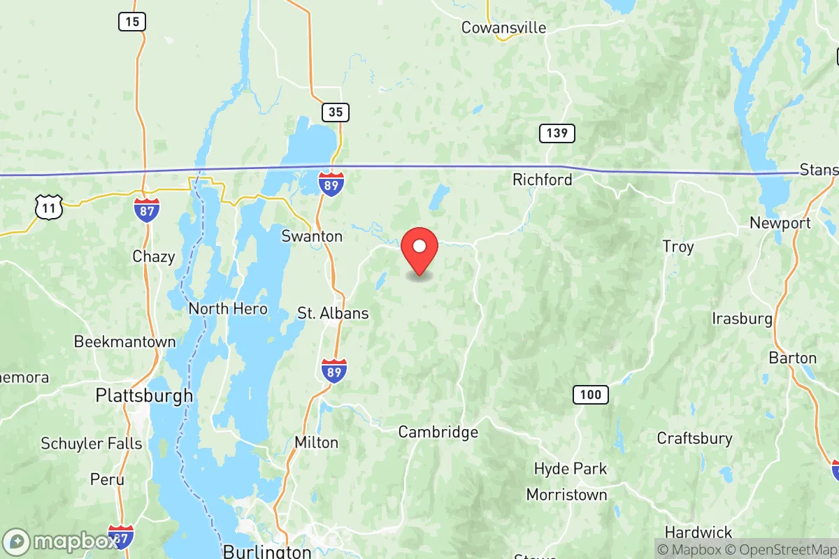
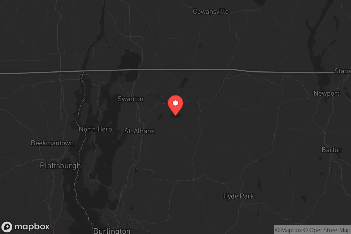
Franklin County, Vermont, offers a strategic relocation option for those prioritizing resilience and distance from major population centers, sitting roughly 30 miles from the Canadian border and 40 miles from Burlington. Its position in the northwestern corner of the state provides a buffer from the denser corridors of the Eastern Seaboard while maintaining access to essential infrastructure. For a conservative-leaning individual or family assessing long-term preparedness, this county presents a mix of geographic insulation and practical self-sufficiency potential that warrants serious consideration.
Geographic position and natural advantages for long-term security
Franklin County’s location is its primary strategic asset. The county is anchored by the town of St. Albans, the county seat, which sits roughly 15 miles from the Canadian border crossing at Highgate Springs. This proximity to Canada offers a potential secondary egress route or supply line in a crisis scenario, a feature absent from most inland U.S. counties. The county is bordered by Lake Champlain to the west, providing a natural defensive barrier and a massive freshwater resource. The Missisquoi River and Lamoille River systems run through the area, offering additional water sources and fertile valley land. The terrain is a mix of rolling hills and agricultural flats, with the Green Mountains forming a natural eastern boundary that limits easy access from the more populated central Vermont corridor. This geography creates a natural chokepoint: any large-scale movement from the south or east would have to funnel through a few key passes, making the county inherently more defensible than open plains or coastal zones.
Risks, exposures, and proximity to fallout-relevant landmarks
While Franklin County is far from the high-risk zones of major metropolitan areas, it is not without exposure. The most significant nearby risk is the Vermont Yankee nuclear power plant in Vernon, roughly 120 miles south—outside the immediate fallout zone but within a plausible secondary contamination radius depending on wind patterns. More immediately, the county sits within 50 miles of the Plattsburgh Air Force Base (now a redevelopment area but still a former military installation) and the Burlington International Airport, which could become a target or staging area during conflict. The Interstate 89 corridor runs directly through St. Albans, connecting to Burlington and the Canadian border—this highway is a double-edged sword: it provides supply access but also a potential route for displaced populations. The county’s agricultural character means it has fewer industrial targets than southern Vermont or New Hampshire, but the Swanton area has a small industrial park and rail lines that could be secondary targets. The primary risk is not a direct strike but the secondary effects of a major event in Boston, Montreal (90 miles north), or the New York City metro area (300 miles south), which could push refugees north along I-89. The county’s low population density—roughly 50,000 residents across 660 square miles—means it can absorb some influx, but the limited road network (primarily I-89 and VT-105) would quickly become congested.
Practical resilience for a relocator: food, water, energy, and defensibility
Franklin County’s agricultural base is its strongest resilience feature. The county is one of Vermont’s top dairy producers, with St. Albans home to a major creamery and processing facilities. The Missisquoi Valley and Fairfield areas have extensive farmland suitable for small-scale crop production, and the local Amish and Mennonite communities in the Montgomery and Richford areas provide a network of traditional skills and barter economies that preppers can tap into. Water is abundant: Lake Champlain provides an inexhaustible surface water source, and the Missisquoi River runs through the county’s center. Groundwater is generally good, though well depth varies—properties near the lake or rivers have more reliable shallow wells. Energy infrastructure is a mixed bag: the county is served by Vermont Electric Cooperative, which has a decent reliability record, but the grid is vulnerable to ice storms and wind events. Solar potential is moderate due to northern latitude and frequent cloud cover, but micro-hydro on the Missisquoi or Lamoille tributaries is viable for those with stream access. Wood heating is the norm here—most rural homes have wood stoves or boilers, and firewood is abundant from the surrounding forests. Defensibility is good at the property level: the county’s rural character means most homes are set back from main roads, with natural cover from tree lines and hills. The Enosburg Falls and Berkshire areas offer particularly good terrain for a retreat-style property, with narrow valleys and limited access points. The local culture is independent and self-reliant, with a strong tradition of hunting, fishing, and gardening—neighbors tend to know each other and look out for one another, which is a soft but critical resilience factor.
The overall strategic picture for Franklin County is one of moderate-to-high resilience with manageable trade-offs. It avoids the extreme risks of coastal zones, major military targets, and urban centers while offering abundant natural resources and a self-sufficient local culture. The primary vulnerabilities are the I-89 corridor risk from I-89 and the potential for refugee flow from Montreal or Burlington, but these are mitigated by the county’s agricultural capacity and the natural defensive terrain. For a conservative relocator who values distance from federal overreach, community independence, and the ability to live off the land, Franklin County ranks as a solid B+ option—not as remote as northern Maine or the Idaho panhandle, but far more practical for those who still need occasional access to medical care, supplies, or cross-border options. The key is to secure property with water access, wood heat, and a defensible position away from the main highways—preferably in the Montgomery or Richford areas near the Canadian border, where the population is thinnest and the escape route is closest.
* Values derived from national, state, county, city and local statistics and may differ in a specific area. Last updated: 2026-05-17T09:02:27.000Z
Narrative content on this page is AI-generated and may contain mistakes. Verify any details that matter before acting on them.
ReloMaps may earn a commission from affiliate links at no extra cost to you.