Photo: Wikipedia
Strategic Assessment of Walkersville, MD
Meaningful friction. Expect exposure to either population pressure, blast zones, or natural disaster risk. Consider buying a retreat property.
What does the Strategic Assessment tell us?
Our Strategic Assessment grades tactical survivability of an area. Major population centers, military targets, fallout zones, natural disasters, and border exposure all drive risk — lower exposure means a more defensible position in a crisis.
This is heavily inspired by Joel Skousen's Strategic Relocation book. Highly recommended you checkout the book ($)What does this tell us?
Our Strategic Assessment grades tactical survivability of an area. Major population centers, military targets, fallout zones, natural disasters, and border exposure all drive risk — lower exposure means a more defensible position in a crisis.
This is heavily inspired by Joel Skousen's Strategic Relocation book. Highly recommended you checkout the book ($)Strategic Pillars

Key Distances
Regional Safe Places
Below is our recommended "safe zones" in Maryland and the surrounding area based on our strategic heuristics. For most people, it's unrealistic to live in a “safe zone” full-time due to work, family or other personal reasons. They tend to be more rural. However, many of these areas are perfect for second homes and retreat properties that double as a vacation home or even a short-term rental.


Important Note: For informational purposes only. This does not mean nothing bad ever happens in the green zones. Please use common sense. This is based on public data and modeled with AI. We tried to take a conservative approach but mistakes happen. We update this regularly as new information becomes available.
Solar Generator Recommendations
Backup power matters more here than in safer locations. We've picked three solar generators across budgets and capacity tiers — start with the budget unit if you only need a few essentials, or step up if you want to run a fridge and HVAC for days at a time.

Jackery Portable Power Station Explorer 300
Budget OptionPower on the Go: Weighing only 11 lbs, it's convenient to set up and store with book-sized foldable solar panels

BLUETTI Portable Power Station AC180
Designed for both indoor and outdoor scenarios, AC180 is highly capable as it has a robost capacity and continuous output power.

EF ECOFLOW DELTA Pro Ultra Power Station
Upgraded PickEcoFlow DELTA Pro Ultra is a whole-home energy system designed to grow with your family. Integrated with the Smart Home Panel 2, it scales to meet your evolving energy needs — keeping your home powered, intelligent, and secure through every stage of life.
We earn a commission, at no additional cost to you.
Strategic Assessment Analysis
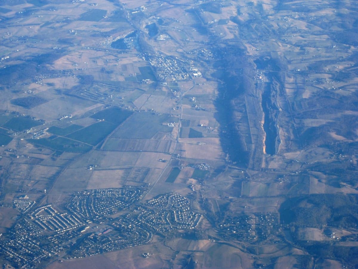
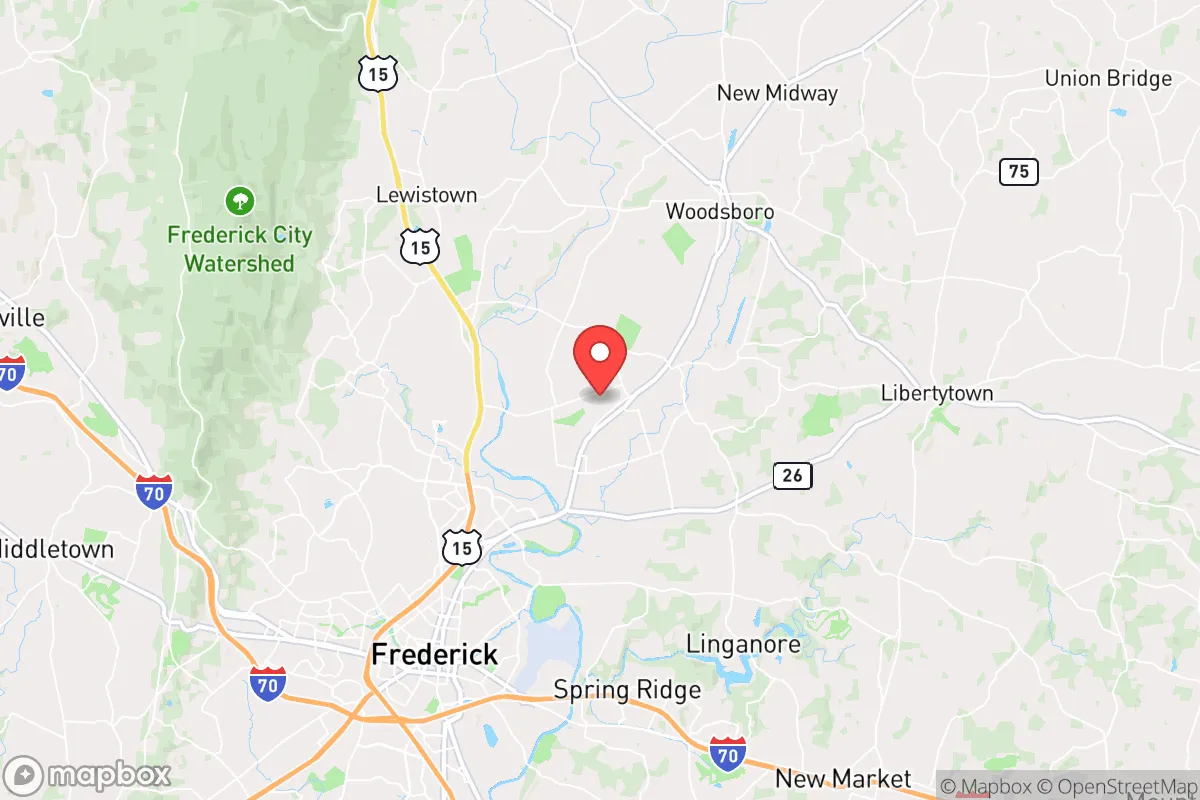
Walkersville, Maryland, sits in a deceptive pocket of Frederick County that offers genuine strategic depth for those prioritizing resilience and self-sufficiency, but its proximity to the I-270 corridor and the Baltimore-Washington metroplex introduces serious trade-offs. The town’s location—roughly 50 miles northwest of D.C. and 55 miles west of Baltimore—places it within the outer ring of the National Capital Region’s fallout zone, yet its position along the Monocacy River and amid working farmland provides a buffer that many closer-in suburbs lack. For a relocator weighing civic unrest, mass casualty events, or grid-down scenarios, Walkersville is a mixed bag: it has the bones of a resilient community, but the surrounding infrastructure and population density demand careful planning and a clear-eyed assessment of risks.
Geographic position and natural advantages for long-term survival
Walkersville’s geography is its strongest card. The town sits on the eastern edge of Frederick County’s agricultural preserve, where large tracts of farmland and forest create a natural buffer against urban sprawl. The Monocacy River runs along its western flank, providing a reliable surface water source—critical for any extended grid-down situation. The area’s rolling hills and limestone bedrock offer decent groundwater potential, and many older homes in the vicinity still have functional wells. The Catoctin Mountains lie just to the west, offering rugged terrain for retreat or caching supplies, while the Potomac River is about 20 miles south. For a prepper, this means multiple water sources, varied terrain for concealment, and agricultural land that could support local food production in a crisis. The town’s elevation—around 300 feet—keeps it above the worst flood risks from the Monocacy, though low-lying areas near the river are still vulnerable during heavy rains. Walkersville’s position also places it outside the immediate blast radius of any major military or government target, but that advantage is relative, as we’ll cover next.
Risks, exposures, and proximity to fallout-relevant landmarks
The elephant in the room is Walkersville’s proximity to the Baltimore-Washington corridor, one of the most target-dense regions in the United States. Within a 50-mile radius lie the Pentagon, the White House, Fort Meade (NSA), Camp David (about 25 miles north), and multiple nuclear research facilities, including the National Institute of Standards and Technology in Gaithersburg. In a major conflict or terror event, prevailing winds from the southwest would carry fallout directly toward Frederick County. The town is also within 30 miles of the Calvert Cliffs Nuclear Power Plant (though that’s southeast, so prevailing winds are less of a direct threat). On the ground, Walkersville is bisected by Maryland Route 26 (Liberty Road), a major evacuation artery from the D.C. suburbs. In a mass evacuation scenario, this road would become a choke point, potentially turning the town into a traffic nightmare. The Frederick Municipal Airport (about 8 miles south) and the nearby Fort Detrick (a U.S. Army biodefense lab in Frederick city) add another layer of risk—Fort Detrick has a history of biosafety incidents, and its research into select agents makes it a potential target or accidental release point. For a relocator, the calculus is clear: Walkersville is far enough from ground zero to survive a direct strike, but close enough to be affected by fallout, refugee flows, and secondary effects like supply chain disruption and civil unrest in the metro area.
Practical resilience for a relocator: food, water, energy, and defensibility
Walkersville’s practical resilience is a study in contrasts. On the plus side, the town is surrounded by active farmland—corn, soybeans, and livestock operations—which means local food production is a reality, not a fantasy. The Walkersville Farmers Market and nearby Frederick County Farm Tour connect residents to growers, and the area’s many CSAs (community-supported agriculture programs) offer a direct line to fresh produce. Water is less certain: while the Monocacy River is a viable source, it’s also a public water supply for Frederick city, meaning it could be contaminated or monitored in a crisis. Well water is the gold standard here, and any serious relocator should prioritize a property with a tested well and a hand pump or solar-powered backup. The electric grid is typical for the region—overhead lines vulnerable to storms and cyberattacks—but the rural character means many homes already have propane tanks, wood stoves, or generators. Solar potential is decent, with about 4.5 peak sun hours per day, though tree cover in the older neighborhoods can limit panel placement. Defensibility is where Walkersville falls short. The town’s layout—a mix of suburban subdivisions, strip malls, and historic homes along Main Street—offers few natural chokepoints. The open farmland to the north and east provides clear sightlines but also makes the town vulnerable to approach from multiple directions. The best defensive posture would be a property on the western edge, near the Catoctin foothills, where terrain and tree cover offer some concealment. The local police and fire services are competent but stretched thin; Frederick County Sheriff’s Office covers the area, with response times that can exceed 15 minutes in the more rural pockets. For a single individual or family, the key is to build a network of like-minded neighbors—Walkersville has a small but active prepper community, often connected through local churches or the Frederick County Preparedness Group.
The overall strategic picture for Walkersville is one of calculated risk. It offers genuine advantages—farmland, water access, mountain proximity, and a community that still values self-reliance—but those come with the heavy baggage of being within the D.C. orbit. For a relocator who can secure a well-watered property on the town’s western fringe, stockpile supplies for at least 90 days, and establish relationships with local farmers and tradespeople, Walkersville can be a viable base of operations. But it is not a bug-out location; it’s a semi-rural suburb that will feel the shockwaves of any major event in the capital. The smart play is to treat it as a forward operating base—close enough to monitor the situation, far enough to have options, and equipped with the resources to either ride out a crisis or exfiltrate west into the Appalachians if the situation degrades beyond recovery. For those willing to put in the work, Walkersville is a solid B+ on the resilience scale. For anyone expecting a safe haven, it’s a hard reality check.
* Values derived from national, state, county, city and local statistics and may differ in a specific area. Last updated: 2026-04-22T02:42:05.000Z
Narrative content on this page is AI-generated and may contain mistakes. Verify any details that matter before acting on them.
ReloMaps may earn a commission from affiliate links at no extra cost to you.