
Photo: Wikipedia
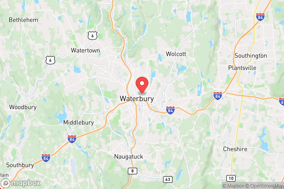
Strategic Assessment of Waterbury, CT
Multiple tactical vulnerabilities. Population density, target proximity, or disaster risk are likely compounding. A retreat property and exit planning is required.
What does the Strategic Assessment tell us?
Our Strategic Assessment grades tactical survivability of an area. Major population centers, military targets, fallout zones, natural disasters, and border exposure all drive risk — lower exposure means a more defensible position in a crisis.
This is heavily inspired by Joel Skousen's Strategic Relocation book. Highly recommended you checkout the book ($)What does this tell us?
Our Strategic Assessment grades tactical survivability of an area. Major population centers, military targets, fallout zones, natural disasters, and border exposure all drive risk — lower exposure means a more defensible position in a crisis.
This is heavily inspired by Joel Skousen's Strategic Relocation book. Highly recommended you checkout the book ($)Strategic Pillars

Key Distances
Regional Safe Places
Below is our recommended "safe zones" in Connecticut and the surrounding area based on our strategic heuristics. For most people, it's unrealistic to live in a “safe zone” full-time due to work, family or other personal reasons. They tend to be more rural. However, many of these areas are perfect for second homes and retreat properties that double as a vacation home or even a short-term rental.


Important Note: For informational purposes only. This does not mean nothing bad ever happens in the green zones. Please use common sense. This is based on public data and modeled with AI. We tried to take a conservative approach but mistakes happen. We update this regularly as new information becomes available.
Solar Generator Recommendations
Backup power matters more here than in safer locations. We've picked three solar generators across budgets and capacity tiers — start with the budget unit if you only need a few essentials, or step up if you want to run a fridge and HVAC for days at a time.

Jackery Portable Power Station Explorer 300
Budget OptionPower on the Go: Weighing only 11 lbs, it's convenient to set up and store with book-sized foldable solar panels

BLUETTI Portable Power Station AC180
Designed for both indoor and outdoor scenarios, AC180 is highly capable as it has a robost capacity and continuous output power.

EF ECOFLOW DELTA Pro Ultra Power Station
Upgraded PickEcoFlow DELTA Pro Ultra is a whole-home energy system designed to grow with your family. Integrated with the Smart Home Panel 2, it scales to meet your evolving energy needs — keeping your home powered, intelligent, and secure through every stage of life.
We earn a commission, at no additional cost to you.
Strategic Assessment Analysis
Waterbury, Connecticut, sits in a precarious strategic position that demands a hard look from anyone serious about long-term preparedness. While its location in the Naugatuck River Valley offers some natural defensive advantages, its proximity to major population centers and critical infrastructure creates a complex risk profile that cannot be ignored. For the conservative prepper weighing relocation, Waterbury presents a mixed bag: it is close enough to urban resources to be useful, but dangerously close to the fallout zones and civil unrest that make those same cities a liability.
Geographic position and natural defensive advantages in the Naugatuck Valley
Waterbury is nestled in a narrow valley carved by the Naugatuck River, flanked by steep hills and ridges that provide a degree of natural isolation. The city itself sits at roughly 260 feet above sea level, but the surrounding terrain rises sharply to over 800 feet in places, creating chokepoints on the major roads—Routes 8, 84, and 73—that could be monitored or defended in a crisis. The valley floor is only about a mile wide in places, which means any large-scale movement through the area is funneled into predictable corridors. This is a double-edged sword: it makes the city harder to approach, but also harder to escape if things go sideways. The nearby Mattatuck State Forest and the Naugatuck State Forest offer thousands of acres of wooded terrain for hunting, foraging, and temporary retreat, though they are not remote enough to be considered a true bug-out location. The area's water supply is a genuine asset: the city draws from the Lake Whitney system and several reservoirs in the surrounding hills, which are fed by reliable rainfall and are less vulnerable to contamination than surface water sources near industrial zones. However, the valley's geography also traps air pollution and could concentrate fallout from a nuclear event, as prevailing winds from the southwest would push debris directly up the valley.
Risks, exposures, and proximity to fallout-relevant landmarks
Waterbury's biggest strategic liability is its location within the New York City–Boston corridor, a densely populated megalopolis that is a prime target for any large-scale attack or civil disruption. The city is only about 90 miles from New York City and 30 miles from Hartford, the state capital and a major insurance hub. In the event of a nuclear detonation at either location, Waterbury would be within the moderate fallout zone, depending on wind direction. The city itself hosts several infrastructure targets: the Waterbury–Oakville Dam on the Naugatuck River, the Connecticut Light & Power substation on East Main Street, and the Waterbury Hospital complex, which is a designated trauma center. The nearby Naugatuck Railroad line carries hazardous materials through the valley, including propane and chemicals, which could become secondary hazards in a crisis. Civil unrest is a real concern: Waterbury has a population of roughly 110,000, with a poverty rate around 20% and a crime index that is consistently above the national average. The city's Downtown area and the Brookside and East End neighborhoods have seen gang activity and periodic violence, which could escalate rapidly during a breakdown of order. The presence of Waterbury Police Department and the Connecticut State Police Troop I provides some law enforcement presence, but in a widespread emergency, these resources would be stretched thin. The city's location on the Route 8 and I-84 corridors means it would be a natural chokepoint for refugees fleeing the coast, potentially turning the valley into a bottleneck of desperate people.
Practical resilience for a relocator: food, water, energy, and defensibility
For a relocator looking to hunker down, Waterbury offers a mixed bag of practical resources. The city's water supply is robust, with the Lake Whitney system providing a gravity-fed source that does not rely on pumps, a critical advantage during a power grid failure. However, the water treatment plant on Bunker Hill Avenue is a single point of failure; a determined actor could disrupt it, and the city's backup wells are limited. Food security is a weak point: Waterbury is a food desert in many neighborhoods, with limited grocery stores and a heavy reliance on convenience stores and fast food. The Waterbury Farmers' Market operates seasonally, but year-round local food production is minimal. The surrounding farmland in the Naugatuck Valley is mostly suburban or industrial, not agricultural. For energy, the city is served by Eversource, and the grid is vulnerable to storms and sabotage. The Waterbury Generation Station on Freight Street is a natural gas peaker plant that could be a target, but it also provides a potential local power source if you can tap into it—though that is a high-risk move. Defensibility is the strongest card: the valley's geography means a prepared group could secure a neighborhood like Bunker Hill or Town Plot by controlling the few roads in and out. The Waterbury Armory on Elm Street is a National Guard facility that could become a rallying point or a target, depending on the situation. The city's hospital system—Waterbury Hospital and Saint Mary's Hospital—are assets for medical care, but they would be overwhelmed in a mass casualty event. The Waterbury-Oxford Airport (KOXC) is a general aviation field about 15 minutes away, offering a potential extraction point if you have access to aircraft.
The overall strategic picture for Waterbury is one of calculated risk. It is not a true retreat location—too close to the coast, too many people, too many targets. But for the relocator who cannot afford rural land in Vermont or New Hampshire, it offers a defensible valley with decent water and a position that is far enough from the worst fallout zones to survive, provided you have a plan. The key is to avoid the city center and instead secure a property on the hillsides—Bunker Hill, Buckingham, or East Mountain—where you can observe the valley below and control access. Stockpile food, because the local supply chain will break fast. Invest in a water filtration system that can handle the river and the reservoirs. And make peace with the fact that you are living in a buffer zone: close enough to the chaos to be useful, but close enough to be caught in it. Waterbury is a place to hold, not to hide. For the conservative prepper who understands that survival is about position, not isolation, it is a viable option—but only if you are ready to move when the valley becomes a trap.
* Values derived from national, state, county, city and local statistics and may differ in a specific area. Last updated: 2026-04-30T00:57:17.000Z
Narrative content on this page is AI-generated and may contain mistakes. Verify any details that matter before acting on them.
ReloMaps may earn a commission from affiliate links at no extra cost to you.