
Photo: Wikipedia
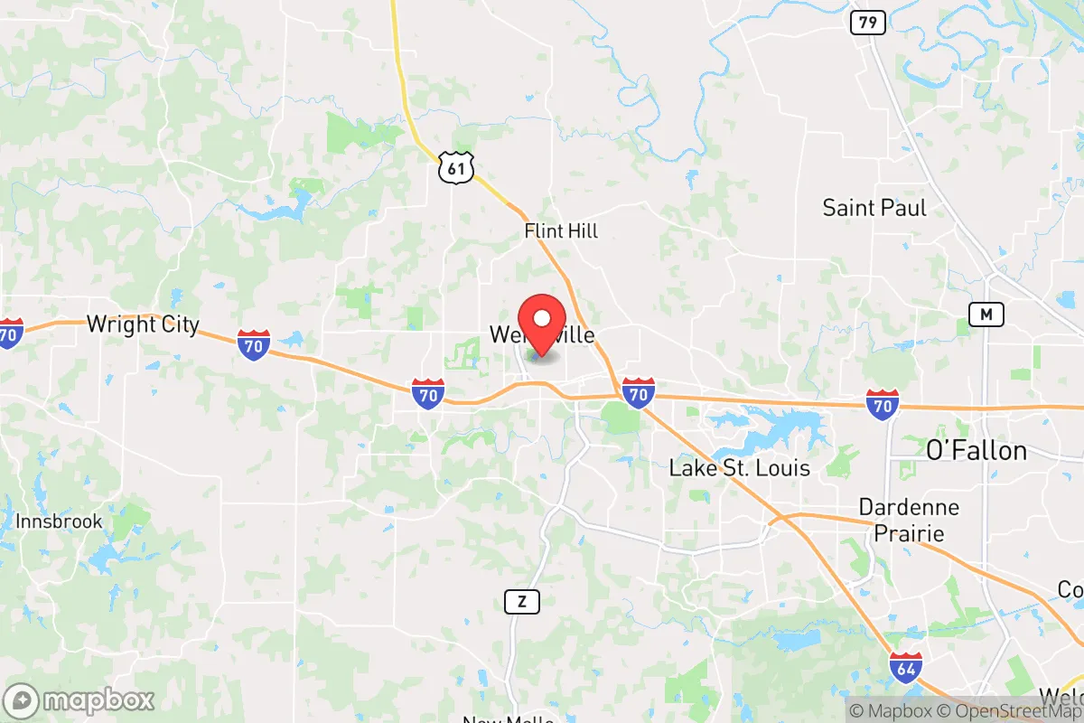
Strategic Assessment of Wentzville, MO
Workable tactical position. Some exposure to population density or targets, but generally defensible in a crisis.
What does the Strategic Assessment tell us?
Our Strategic Assessment grades tactical survivability of an area. Major population centers, military targets, fallout zones, natural disasters, and border exposure all drive risk — lower exposure means a more defensible position in a crisis.
This is heavily inspired by Joel Skousen's Strategic Relocation book. Highly recommended you checkout the book ($)What does this tell us?
Our Strategic Assessment grades tactical survivability of an area. Major population centers, military targets, fallout zones, natural disasters, and border exposure all drive risk — lower exposure means a more defensible position in a crisis.
This is heavily inspired by Joel Skousen's Strategic Relocation book. Highly recommended you checkout the book ($)Strategic Pillars

Key Distances
Regional Safe Places
Below is our recommended "safe zones" in Missouri and the surrounding area based on our strategic heuristics. For most people, it's unrealistic to live in a “safe zone” full-time due to work, family or other personal reasons. They tend to be more rural. However, many of these areas are perfect for second homes and retreat properties that double as a vacation home or even a short-term rental.


Important Note: For informational purposes only. This does not mean nothing bad ever happens in the green zones. Please use common sense. This is based on public data and modeled with AI. We tried to take a conservative approach but mistakes happen. We update this regularly as new information becomes available.
Solar Generator Recommendations
Backup power matters more here than in safer locations. We've picked three solar generators across budgets and capacity tiers — start with the budget unit if you only need a few essentials, or step up if you want to run a fridge and HVAC for days at a time.

Jackery Portable Power Station Explorer 300
Budget OptionPower on the Go: Weighing only 11 lbs, it's convenient to set up and store with book-sized foldable solar panels

BLUETTI Portable Power Station AC180
Designed for both indoor and outdoor scenarios, AC180 is highly capable as it has a robost capacity and continuous output power.

EF ECOFLOW DELTA Pro Ultra Power Station
Upgraded PickEcoFlow DELTA Pro Ultra is a whole-home energy system designed to grow with your family. Integrated with the Smart Home Panel 2, it scales to meet your evolving energy needs — keeping your home powered, intelligent, and secure through every stage of life.
We earn a commission, at no additional cost to you.
Strategic Assessment Analysis
Wentzville, Missouri, sits at a strategic crossroads that offers genuine resilience advantages for those prioritizing preparedness, but its proximity to major population centers introduces trade-offs that demand careful consideration. Located roughly 40 miles west of St. Louis along Interstate 70, this fast-growing exurb of about 45,000 residents has become a magnet for families and individuals seeking lower taxes, newer infrastructure, and a slower pace of life. For the prepper or survivalist, Wentzville’s position on the edge of the St. Louis metro area provides a buffer zone—close enough to access urban resources in a pinch, but far enough to avoid the worst of a cascading collapse scenario. The area’s recent growth, driven by major employers like General Motors’ Wentzville Assembly Plant and a robust logistics corridor, also means the local economy has some independent muscle, though that same growth brings population density that could strain resources in a crisis.
Geographic position and natural advantages for long-term survival
Wentzville’s geographic setting offers several natural advantages that align with a prepper mindset. The city sits in the Missouri River Valley, with the Missouri River itself about 10 miles to the south, providing a reliable water source for those with the means to treat or haul it. The surrounding landscape is a mix of rolling hills, farmland, and hardwood forests—terrain that supports hunting, foraging, and small-scale agriculture. The area’s karst topography, with its limestone bedrock and caves, offers potential for natural shelter or storage, though it also means groundwater can be vulnerable to contamination. The climate is four-season, with hot, humid summers and cold winters, which demands a well-rounded preparedness plan—think freeze-proof water storage, winterized shelter, and food preservation methods that work in both extremes. The region’s position in the central U.S. also means it’s far from coastal threats like hurricanes or tsunamis, and while tornadoes are a real risk (Missouri averages about 45 tornadoes annually), the terrain allows for effective storm shelters and early warning systems. For the relocator, the key takeaway is that Wentzville’s natural environment is workable but not forgiving—it rewards those who come with skills, not just supplies.
Risks, exposures, and proximity to fallout-relevant landmarks
The biggest strategic weakness of Wentzville is its proximity to St. Louis, a major metropolitan area with a population of over 2.8 million in the metro region. In a mass casualty event—whether from civil unrest, a pandemic, or a coordinated attack—St. Louis would become a liability. The city has a history of social tension, with the 2014 Ferguson unrest and 2020 George Floyd protests both spilling into the metro area, and its crime rates remain elevated (St. Louis consistently ranks among the most dangerous U.S. cities). A collapse scenario would likely see a mass exodus westward along I-70, and Wentzville sits directly in that path. The interstate itself, along with nearby rail lines and the Lambert-St. Louis International Airport (about 30 miles east), are potential targets for disruption or attack. More concerning for the prepper: Wentzville is within 50 miles of the Callaway Nuclear Plant (about 40 miles southwest), a facility that, while well-regulated, represents a worst-case fallout risk. A major incident there could contaminate the Missouri River watershed and force a long-term evacuation. The area also has several chemical plants and fuel depots along the I-70 corridor, including a major propane storage facility in nearby Foristell. For the survivalist, these risks mean that a bug-in plan must account for potential contamination and that a bug-out route west toward the Ozarks or Kansas is essential.
Practical resilience for a relocator: food, water, energy, and defensibility
For the individual or family looking to establish a resilient homestead, Wentzville offers a mixed bag. The city’s water supply comes from the Missouri River via the St. Louis County Water Company, which means a single-point-of-failure vulnerability—if that system goes down, you’re on your own. Well water is an option in rural parts of the county, but the karst geology means wells can be shallow and prone to contamination from surface runoff. A deep well with a hand pump or solar-powered pump is a wise investment. Food resilience is more promising: the surrounding farmland produces corn, soybeans, and livestock, and local farmers’ markets and CSAs are common. The area’s growing season runs about 180 days (April to October), enough for a productive garden, and the soil is generally fertile loam. For energy, the grid is reliable day-to-day, but winter ice storms and summer derecho winds can knock out power for days—solar panels with battery storage or a backup generator are standard recommendations. Defensibility is where Wentzville’s exurban layout helps: many homes sit on 1-5 acre lots with some tree cover, offering natural screening and space for perimeter security. The local police department is well-funded (the city’s tax base is strong), but response times in a crisis could stretch to 30 minutes or more for outlying properties. The community itself is predominantly conservative, with a strong church and civic network—useful for mutual aid, but also a double-edged sword if outsiders flood in. For the prepper, the practical takeaway is that Wentzville is a decent base camp, not a fortress. It’s a place to build skills and stockpile, but you’ll need to invest in off-grid infrastructure and have a plan for the first 72 hours of a crisis.
The overall strategic picture for Wentzville is one of cautious optimism for the prepared relocator. It’s not a remote bunker—it’s a growing exurb with all the conveniences and vulnerabilities that implies. The area’s economic stability, conservative culture, and access to natural resources make it a solid choice for those who want to be part of a functioning community while maintaining a low profile. But the risks are real: proximity to St. Louis, the nuclear plant, and major transportation corridors mean that a major event could turn Wentzville from a safe haven into a pressure cooker. For the survivalist, the key is to treat Wentzville as a staging ground—a place to build a resilient home base while keeping a bug-out bag packed and a route to the Ozarks or rural Kansas mapped out. If you’re willing to put in the work—dig a well, plant a garden, and make friends with your neighbors—Wentzville can work. If you’re looking for a place where you can just hunker down and wait out the storm, you’ll want to look further west.
* Values derived from national, state, county, city and local statistics and may differ in a specific area. Last updated: 2026-04-22T13:45:13.000Z
Narrative content on this page is AI-generated and may contain mistakes. Verify any details that matter before acting on them.
ReloMaps may earn a commission from affiliate links at no extra cost to you.