Photo: Wikipedia
Strategic Assessment of Marshall County
Workable tactical position. Some exposure to population density or targets, but generally defensible in a crisis.
What does the Strategic Assessment tell us?
Our Strategic Assessment grades tactical survivability of an area. Major population centers, military targets, fallout zones, natural disasters, and border exposure all drive risk — lower exposure means a more defensible position in a crisis.
This is heavily inspired by Joel Skousen's Strategic Relocation book. Highly recommended you checkout the book ($)What does this tell us?
Our Strategic Assessment grades tactical survivability of an area. Major population centers, military targets, fallout zones, natural disasters, and border exposure all drive risk — lower exposure means a more defensible position in a crisis.
This is heavily inspired by Joel Skousen's Strategic Relocation book. Highly recommended you checkout the book ($)Strategic Pillars

Key Distances
Strategic Assessment Analysis
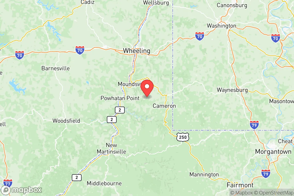
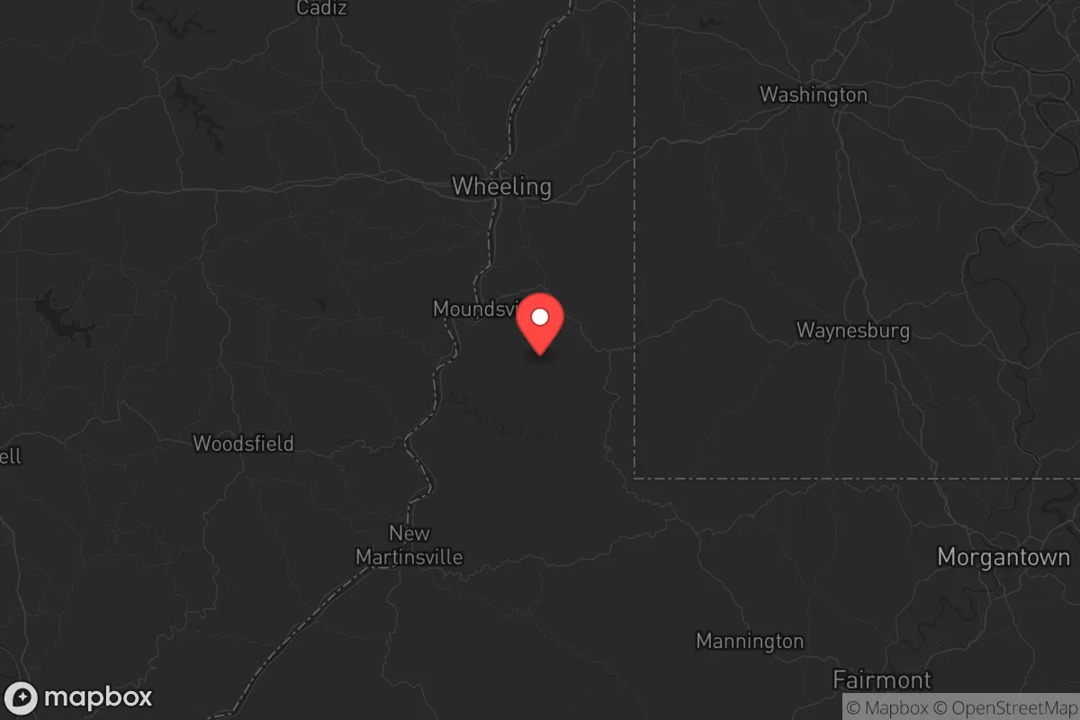
Marshall County, West Virginia, offers a compelling strategic position for those prioritizing resilience and distance from major population centers, sitting squarely in the Northern Panhandle along the Ohio River. Its location provides a buffer from the immediate fallout zones of major cities like Pittsburgh (about 60 miles east) and Columbus (about 130 miles west), while still being within a practical driving distance for supply runs or family visits. The county’s hilly terrain and river access create a natural defensive posture, and its small-town character—anchored by the county seat of Moundsville and the town of Glen Dale—means fewer people competing for resources in a crisis. For a conservative-leaning relocator focused on self-reliance and strategic depth, this area deserves a serious look.
Geographic position and natural advantages for long-term security
Marshall County’s geography is its first line of defense. The Ohio River forms its western border, providing a reliable water source and a natural barrier that complicates approach from that direction. The county sits within the Appalachian Plateau, meaning rolling hills, forested ridges, and narrow valleys—terrain that slows movement and offers countless defensible homestead sites. The area is far enough from the East Coast’s major population corridors (Interstate 70 runs through the southern part of the county, but it’s a secondary route compared to I-79 or I-77) to avoid the worst of any evacuation chaos. The town of Cameron, in the county’s northern reaches, sits on a high ridge with long views of the surrounding countryside, a classic lookout position. The county’s elevation averages around 1,000 feet, which reduces flood risk compared to low-lying river towns, though the Ohio River floodplain near Moundsville and Benwood does require careful site selection. The presence of the Marshall County Airport near Moundsville offers a potential airlift point for supplies or evacuation, but it’s small enough to avoid being a target.
Risks, exposures, and proximity to fallout-relevant landmarks
No location is without risk, and Marshall County has a few significant exposures that a strategic relocator must weigh. The most obvious is the Moundsville Power Plant, a coal-fired facility on the Ohio River that could be a target for sabotage or a source of hazardous material release in a disaster. It’s a large industrial complex, and while it’s not a nuclear plant, its coal ash ponds and chemical storage are a concern if you’re within a few miles downwind. The county also sits within 100 miles of the Bellefonte Nuclear Plant in Alabama? No—correction: the nearest nuclear facility is the Beaver Valley Power Station in Shippingport, Pennsylvania, about 40 miles north. That’s close enough that a major release could affect the northern part of the county, depending on wind patterns. The Ohio River itself is a double-edged sword: it’s a water source, but it also carries barge traffic with industrial chemicals and fuels. A spill or attack on a barge could contaminate the river for miles. On the plus side, Marshall County has no major military bases, refineries, or ports that would make it a primary target. The closest large city is Wheeling, about 15 miles north, which is small enough (population ~27,000) to be a secondary concern. The real risk is proximity to the Pittsburgh metropolitan area—if a major event hits that region, expect refugees streaming down Route 2 and I-70. The county’s limited road network (primarily US-250 and WV-2) means choke points at bridges and tunnels, which could be both a defensive advantage and a logistical nightmare.
Practical resilience for a relocator: food, water, energy, and defensibility
For someone serious about self-sufficiency, Marshall County offers a mix of assets and gaps. Water is abundant—the Ohio River is the obvious source, but dozens of smaller creeks and springs (like Fish Creek and Grave Creek) provide backup. The county’s groundwater is generally good, though well drilling can be expensive in the rocky hills. Food production is viable: the Ohio River floodplain has rich alluvial soil, and the hillsides support orchards and livestock. The county has a handful of small farms and farmers’ markets (the Moundsville Farmers Market runs seasonally), but it’s not an agricultural powerhouse—you’ll need to plan for significant gardening and animal husbandry. Energy is a strong point: the Moundsville Power Plant means the grid is locally supported, but in a long-term outage, the county’s coal and natural gas history (there are still active gas wells) means fuel for generators is available if you have the means to extract or barter. Wood is plentiful for heating, but you’ll need a chainsaw and a strong back. Defensibility is where the county shines. The terrain creates natural kill zones and observation points. The town of Glen Dale, for example, sits on a bluff overlooking the river, giving residents a commanding view of approach routes. The county’s low population density (about 31,000 people across 312 square miles) means you can find a homestead with significant standoff distance from neighbors. The biggest practical weakness is medical access: the only hospital is Reynolds Memorial Hospital in Glen Dale, a small facility that would be overwhelmed in a crisis. You’ll want a robust medical kit and training. Also, the county’s economy is weak (coal and manufacturing have declined), which means many locals are already struggling—this could lead to desperation in a collapse, but it also means property is cheap and you can buy land for a fraction of what it costs in safer suburban areas.
The overall strategic picture for Marshall County is one of moderate safety with specific trade-offs. It’s not a remote bunker in the Rockies, but it’s also not a suburb of a major target. The Ohio River gives you water and a barrier, the hills give you defensibility, and the distance from Pittsburgh and Columbus gives you a buffer. The risks—the power plant, the nuclear plant to the north, the river’s industrial traffic—are manageable with good site selection and preparation. For a conservative relocator who wants to be part of a small, tight-knit community (Marshall County is heavily Republican, with a strong gun culture and a “live and let live” attitude), this area offers a realistic path to resilience without requiring a complete off-grid transformation. The key is to buy land on high ground, away from the river floodplain and the power plant, and to build relationships with neighbors before trouble arrives. Marshall County won’t save you from a direct nuclear strike on Pittsburgh, but for the more likely scenarios—economic collapse, civil unrest, or a prolonged grid-down event—it’s a solid, underrated choice.
* Values derived from national, state, county, city and local statistics and may differ in a specific area. Last updated: 2026-05-22T03:43:42.000Z
Narrative content on this page is AI-generated and may contain mistakes. Verify any details that matter before acting on them.
ReloMaps may earn a commission from affiliate links at no extra cost to you.