
Photo: Wikipedia
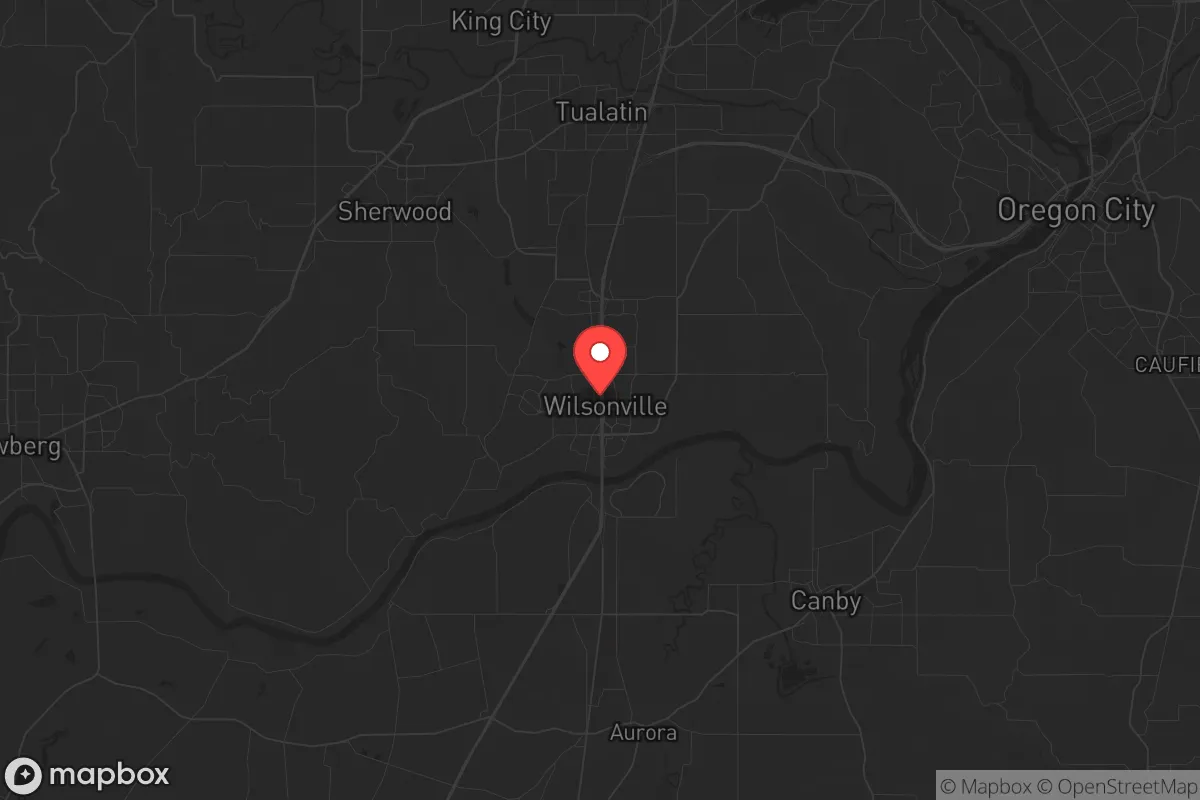
Strategic Assessment of Wilsonville, OR
Multiple tactical vulnerabilities. Population density, target proximity, or disaster risk are likely compounding. A retreat property and exit planning is required.
What does the Strategic Assessment tell us?
Our Strategic Assessment grades tactical survivability of an area. Major population centers, military targets, fallout zones, natural disasters, and border exposure all drive risk — lower exposure means a more defensible position in a crisis.
This is heavily inspired by Joel Skousen's Strategic Relocation book. Highly recommended you checkout the book ($)What does this tell us?
Our Strategic Assessment grades tactical survivability of an area. Major population centers, military targets, fallout zones, natural disasters, and border exposure all drive risk — lower exposure means a more defensible position in a crisis.
This is heavily inspired by Joel Skousen's Strategic Relocation book. Highly recommended you checkout the book ($)Strategic Pillars

Key Distances
Regional Safe Places
Below is our recommended "safe zones" in Oregon and the surrounding area based on our strategic heuristics. For most people, it's unrealistic to live in a “safe zone” full-time due to work, family or other personal reasons. They tend to be more rural. However, many of these areas are perfect for second homes and retreat properties that double as a vacation home or even a short-term rental.


Important Note: For informational purposes only. This does not mean nothing bad ever happens in the green zones. Please use common sense. This is based on public data and modeled with AI. We tried to take a conservative approach but mistakes happen. We update this regularly as new information becomes available.
Solar Generator Recommendations
Backup power matters more here than in safer locations. We've picked three solar generators across budgets and capacity tiers — start with the budget unit if you only need a few essentials, or step up if you want to run a fridge and HVAC for days at a time.

Jackery Portable Power Station Explorer 300
Budget OptionPower on the Go: Weighing only 11 lbs, it's convenient to set up and store with book-sized foldable solar panels

BLUETTI Portable Power Station AC180
Designed for both indoor and outdoor scenarios, AC180 is highly capable as it has a robost capacity and continuous output power.

EF ECOFLOW DELTA Pro Ultra Power Station
Upgraded PickEcoFlow DELTA Pro Ultra is a whole-home energy system designed to grow with your family. Integrated with the Smart Home Panel 2, it scales to meet your evolving energy needs — keeping your home powered, intelligent, and secure through every stage of life.
We earn a commission, at no additional cost to you.
Strategic Assessment Analysis
Wilsonville, OR offers a surprisingly strong strategic position for a strategic relocation, balancing proximity to economic hubs with a geographic setup that lends itself to defensibility and resource access. While the Pacific Northwest carries its own set of vulnerabilities, Wilsonville’s location at the confluence of the Willamette River and the I-5 corridor provides a unique blend of logistical advantage and natural buffer zones that a prepper-minded relocator should weigh carefully. The town’s resilience isn’t about being a remote bunker, but about being a well-connected node that doesn’t run dry when the grid gets shaky.
Geographic Position and Natural Advantages: The I-5 Chokepoint and River Access Wilsonville sits at a strategic chokepoint roughly 20 miles south of Portland and 20 miles north of Salem, straddling the Willamette River. This position gives you control over a key north-south artery, but it also means you’re living on a major evacuation and supply route. The river itself is a double-edged sword: it provides a reliable water source for filtration and small-scale agriculture, but it also creates a natural barrier that can be both a defensive asset and a liability. The surrounding topography is a mix of low hills and farmland, with the Chehalem Mountains to the west and the Cascade foothills to the east, offering multiple egress routes if I-5 becomes a parking lot or a target. The area’s mild climate—rarely below freezing or above 90°F—means you can grow food year-round with minimal infrastructure, and the abundant rainfall (40+ inches annually) reduces dependence on municipal water for basic survival. The proximity to the Willamette Valley’s agricultural heartland means that, in a prolonged disruption, you’re within a day’s walk of working farms and orchards, not just suburban lawns. This isn’t a remote mountain redoubt, but it’s a place where you can leverage existing natural resources without being completely off-grid. Risks, Exposures, and Proximity to Fallout-Relevant Landmarks Here’s where the prepper calculus gets serious. Wilsonville’s biggest vulnerability is its proximity to Portland and the I-5 corridor. In a scenario involving civil unrest, mass casualty events, or a major disaster, the city becomes a funnel for refugees and looters moving south from Portland or north to Portland. The I-5 bridge over the Willamette at Wilsonville is a single-point failure: if it’s compromised, you’re cut off from the bottleneck. The town is also within the blast radius of the Portland International Airport (PDX) and the Port of Portland, both of which are high-value targets in a conflict scenario. More concerning for the fallout-minded: Wilsonville is roughly 30 miles from the Columbia Generating Station nuclear plant near Richland, Washington, and within 50 miles of the Portland metro area’s industrial and chemical facilities. A dirty bomb or a conventional strike on the port could send a plume down the Willamette Valley. The area’s prevailing winds are from the west, which means fallout from a Portland event would push east toward Wilsonville in the direct path. For a conservative-leaning relocator worried about federal overreach or state-level collapse, the town’s location on a major transit corridor makes it a likely staging ground for federal or state forces, which could bring unwanted attention. The nearby Chehalem Mountains offer some shielding, but they’re not the Rockies. You’re not in a blast shadow, you’re in a blast zone’s waiting room. Practical Resilience for a Relocator: Food, Water, Energy, and Defensibility Let’s get tactical. Wilsonville’s municipal water comes from the Willamette River, treated at the Wilsonville Water Treatment Plant. In a grid-down scenario, that plant is a target and a single point of failure. A prepper here needs a backup: a well (the water table is high, 20-40 feet deep in most areas) or a reliable river filtration system. The Willamette is navigable but not pristine—industrial runoff and agricultural chemicals are a concern, so a multi-stage filter (ceramic, carbon, UV) is non-negotiable. For food, the town has a strong local food scene—the Wilsonville Farmers Market and nearby farms like Smith Berry Barn and the Willamette Valley’s vineyards—but you’re not self-sufficient on a suburban lot. The average lot size is 0.2-0.5 acres, enough for a large garden and a few chickens, but not for long-term caloric independence. You’ll need to build relationships with local farmers or secure a rural property within 10-adjacent. Energy resilience is better: the area has decent solar potential (though cloudy winters reduce output by 40-50%), and the local utility, Portland General Electric, has a history of grid instability during heatwaves and ice storms. A backup generator with a 200-gallon propane tank is a baseline. Defensibility is the weak link. Wilsonville is a suburban grid with cul-de-sacs and a few choke points (the I-5 bridges, Boones Ferry Road), but it’s not a fortress. The town’s population of roughly 25,000 means you’re not anonymous, but you’re also not in a tight-knit rural community where everyone knows your business. The local police force is small (about 30 officers), and in a crisis, they’ll be overwhelmed. Your best bet is to form a neighborhood watch-style network with like-minded neighbors, focusing on mutual aid rather than lone-wolf survival. The nearby forests (the Tillamook River National Recreation Trail, the Chehalem Ridge) offer bug-out locations for caches or bug-out points, but they’re not remote enough for long-term evasion. The Overall Strategic Picture: A Calculated Risk Wilsonville is not a survivalist’s paradise. It’s a calculated risk for someone who wants to stay connected to the West Coast’s economy while maintaining a reasonable level of preparedness. The town’s strengths—water access, mild climate, agricultural proximity, and logistical positioning—are real, but they come with the baggage of being a corridor town in a politically volatile region. For a conservative-leaning relocator, the calculus is this: you’re trading the safety of deep rural isolation for the ability to maintain a professional income and access to medical and supply networks. The key in a slow-burn collapse. The threat profile is moderate: high risk from civil unrest and infrastructure failure, moderate risk from natural disasters (earthquakes, wildfires, and low risk from direct military action. The best strategy here is to treat Wilsonville as a base camp, not a final redoubt. Secure a property with a well, solar, and a defensible perimeter, but have a bug-out plan for the Cascades or the Oregon coast if things go hot. The town’s resilience is in its redundancy—multiple routes, multiple water sources, multiple community networks—but that redundancy is also its vulnerability. If you’re looking for a place to ride out the storm while still being able to work a job and send your kids to school, Wilsonville High School, this is a viable option. If you’re looking for a place to disappear, keep driving south.
* Values derived from national, state, county, city and local statistics and may differ in a specific area. Last updated: 2026-05-14T20:57:32.000Z
Narrative content on this page is AI-generated and may contain mistakes. Verify any details that matter before acting on them.
ReloMaps may earn a commission from affiliate links at no extra cost to you.