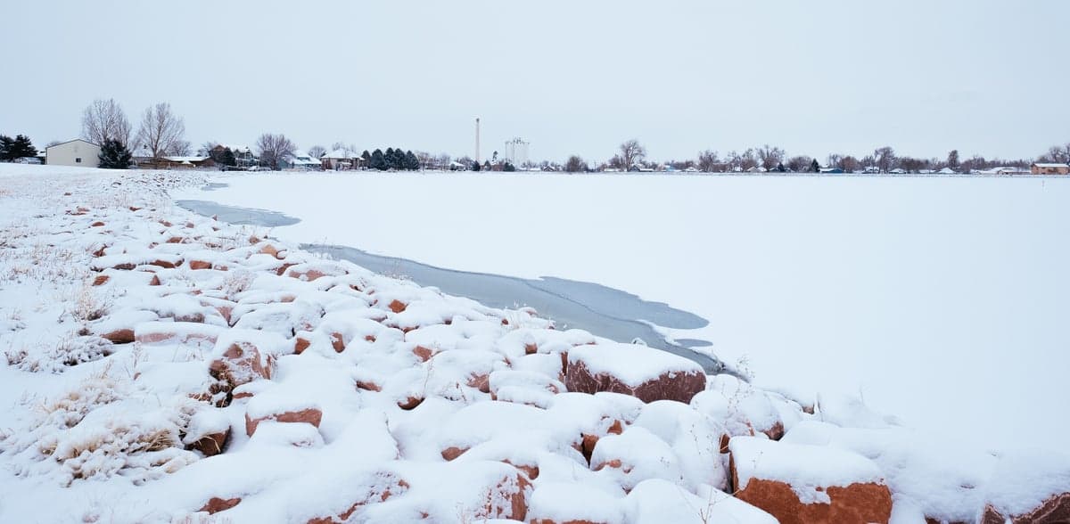
Photo: Wikipedia
Strategic Assessment of Windsor, CO
Meaningful friction. Expect exposure to either population pressure, blast zones, or natural disaster risk. Consider buying a retreat property.
What does the Strategic Assessment tell us?
Our Strategic Assessment grades tactical survivability of an area. Major population centers, military targets, fallout zones, natural disasters, and border exposure all drive risk — lower exposure means a more defensible position in a crisis.
This is heavily inspired by Joel Skousen's Strategic Relocation book. Highly recommended you checkout the book ($)What does this tell us?
Our Strategic Assessment grades tactical survivability of an area. Major population centers, military targets, fallout zones, natural disasters, and border exposure all drive risk — lower exposure means a more defensible position in a crisis.
This is heavily inspired by Joel Skousen's Strategic Relocation book. Highly recommended you checkout the book ($)Strategic Pillars

Key Distances
Regional Safe Places
Below is our recommended "safe zones" in Colorado and the surrounding area based on our strategic heuristics. For most people, it's unrealistic to live in a “safe zone” full-time due to work, family or other personal reasons. They tend to be more rural. However, many of these areas are perfect for second homes and retreat properties that double as a vacation home or even a short-term rental.


Important Note: For informational purposes only. This does not mean nothing bad ever happens in the green zones. Please use common sense. This is based on public data and modeled with AI. We tried to take a conservative approach but mistakes happen. We update this regularly as new information becomes available.
Solar Generator Recommendations
Backup power matters more here than in safer locations. We've picked three solar generators across budgets and capacity tiers — start with the budget unit if you only need a few essentials, or step up if you want to run a fridge and HVAC for days at a time.

Jackery Portable Power Station Explorer 300
Budget OptionPower on the Go: Weighing only 11 lbs, it's convenient to set up and store with book-sized foldable solar panels

BLUETTI Portable Power Station AC180
Designed for both indoor and outdoor scenarios, AC180 is highly capable as it has a robost capacity and continuous output power.

EF ECOFLOW DELTA Pro Ultra Power Station
Upgraded PickEcoFlow DELTA Pro Ultra is a whole-home energy system designed to grow with your family. Integrated with the Smart Home Panel 2, it scales to meet your evolving energy needs — keeping your home powered, intelligent, and secure through every stage of life.
We earn a commission, at no additional cost to you.
Strategic Assessment Analysis
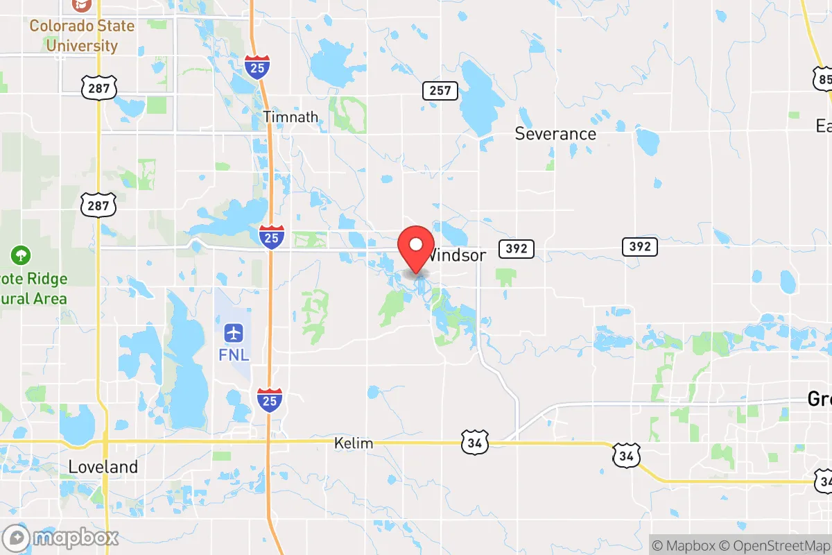
Windsor, Colorado, sits in a sweet spot that few relocation analysts can point to with a straight face: close enough to the Front Range’s economic engine to keep a career alive, but far enough from the urban core to offer genuine strategic depth. The town’s position along the Cache la Poudre River and its proximity to I-25 give it a logistical backbone that matters when supply chains hiccup or when you need to move people and gear without relying on a single chokepoint. For a conservative-leaning relocator who’s thinking about the next decade—not just the next real estate cycle—Windsor offers a rare combination of agricultural self-sufficiency, water access, and a community that hasn’t yet been hollowed out by the cultural and political pressures that have turned so many other Colorado towns into extensions of Denver’s sprawl.
Geographic position and natural advantages for long-term stability
Windsor’s geography is its first and most underrated asset. The town sits at roughly 4,800 feet elevation, straddling the boundary between the shortgrass prairie and the foothills of the Rocky Mountains. That elevation gives it a climate that’s more forgiving than the high mountain valleys—winters are cold but not brutal, summers are warm but dry—and the growing season is long enough (about 140 days) to support serious gardening, small-scale livestock, and even some orchard crops if you’re willing to manage frost pockets. The Cache la Poudre River runs through the northern edge of town, and the area sits atop the Laramie-Fox Hills aquifer, which means groundwater is more reliable here than in many parts of the Front Range that are already seeing wells go dry. Windsor’s water rights are senior and well-documented, a detail that becomes existential when you consider that the entire Denver metro area is effectively one drought away from a water crisis. The town is also ringed by working agricultural land—corn, alfalfa, sugar beets—which means that even in a supply-chain disruption, local food production is not a hypothetical; it’s an ongoing reality. The flat-to-rolling terrain makes it easy to set up a defensible property without needing to live in a canyon that turns into a kill box, and the prevailing westerly winds keep most wildfire smoke and airborne contaminants from lingering.
Risks, exposures, and proximity to fallout-relevant landmarks
No strategic assessment is honest without naming the liabilities, and Windsor has a few that demand attention. The most obvious is I-25, which runs about five miles west of town. That highway is the primary north-south artery for the entire Front Range, and in a crisis—whether it’s a coordinated attack, a major earthquake along the Front Range fault system, or a civil unrest event that shuts down Denver—I-25 becomes a chokepoint, a target, and a funnel for displaced populations. Windsor is close enough to hear the traffic on a quiet night, and that proximity means you’re within a day’s walk of any chaos that erupts along that corridor. The town is also roughly 45 miles from the Rocky Flats National Wildlife Refuge, the former nuclear weapons plant that remains a Superfund site with ongoing plutonium contamination concerns. While the site is capped and monitored, a major wildfire or a deliberate attack on the area could resuspend contaminated soil, and Windsor sits within the prevailing wind pattern that would carry fallout east-northeast. On the plus side, Windsor is far enough from Denver International Airport (about 50 miles) and the major rail yards in Denver and Pueblo to avoid being in the immediate blast or fallout zone of a conventional attack on those targets. The town’s population of roughly 40,000 is large enough to have infrastructure—a hospital, multiple grocery stores, a police department—but small enough that you’re not competing with 100,000 other people for the same gallon of gas or bag of rice when things go sideways. The biggest risk is probably complacency: Windsor feels safe, and that feeling can lead people to underprepare.
Practical resilience for a relocator: food, water, energy, and defensibility
For someone serious about resilience, Windsor checks boxes that most Front Range towns don’t. Food security is the standout. The town is surrounded by active farms, and the Windsor Farmers Market is one of the better ones in northern Colorado, but the real play is in establishing direct relationships with local producers. Several small-scale ranchers and vegetable growers within a 10-mile radius are open to private purchasing agreements, and the area has a strong network of home gardeners who share seeds and knowledge through local extension offices and church groups. Water is the second pillar. Windsor’s municipal water comes from a mix of the Poudre River and groundwater wells, and the town has invested in a water treatment plant that can handle surge demand. For a relocator with a well on a private property, the water table in the area is generally accessible at 50 to 150 feet, and the quality is good enough that only basic filtration is needed. Energy is more of a mixed bag. The local utility, Platte River Power Authority, has been pushing renewables, but the grid is still connected to the larger Front Range system, which means a regional blackout takes Windsor down too. Solar panels with battery storage are a smart investment here—the area averages over 300 sunny days a year—and natural gas backup is widely available. Defensibility is where Windsor gets interesting. The town’s layout is mostly suburban grid with some rural acreage on the outskirts, which means you can choose your level of exposure. Properties along the river or on the eastern edge of town offer good sightlines and limited approach vectors. The local law enforcement is professional and well-funded, but in a prolonged crisis, you’re going to be relying on your own network. Windsor has a strong church presence and a culture of mutual aid among conservative families, which is worth more than any piece of gear you can buy.
The overall strategic picture for Windsor is one of calculated optimism. It’s not a remote bunker—you can’t disappear here—but it’s also not a place where you’ll be caught flat-footed when the next wave of unrest or disruption hits the Front Range. The town’s agricultural base, water security, and community cohesion give it a resilience profile that outperforms most of Colorado’s more famous relocation destinations. The risks are real: proximity to I-25, the lingering shadow of Rocky Flats, and the fact that Windsor is growing fast enough that its small-town character is under pressure. But for a relocator who wants to be prepared without living off-grid in a yurt, Windsor offers a workable middle ground. The key is to arrive with eyes open, build relationships before you need them, and treat the town as a base of operations rather than a final refuge. If you do that, Windsor can carry you through the next decade with fewer surprises than most places in the lower 48.
* Values derived from national, state, county, city and local statistics and may differ in a specific area. Last updated: 2026-05-01T18:42:05.000Z
Narrative content on this page is AI-generated and may contain mistakes. Verify any details that matter before acting on them.
ReloMaps may earn a commission from affiliate links at no extra cost to you.