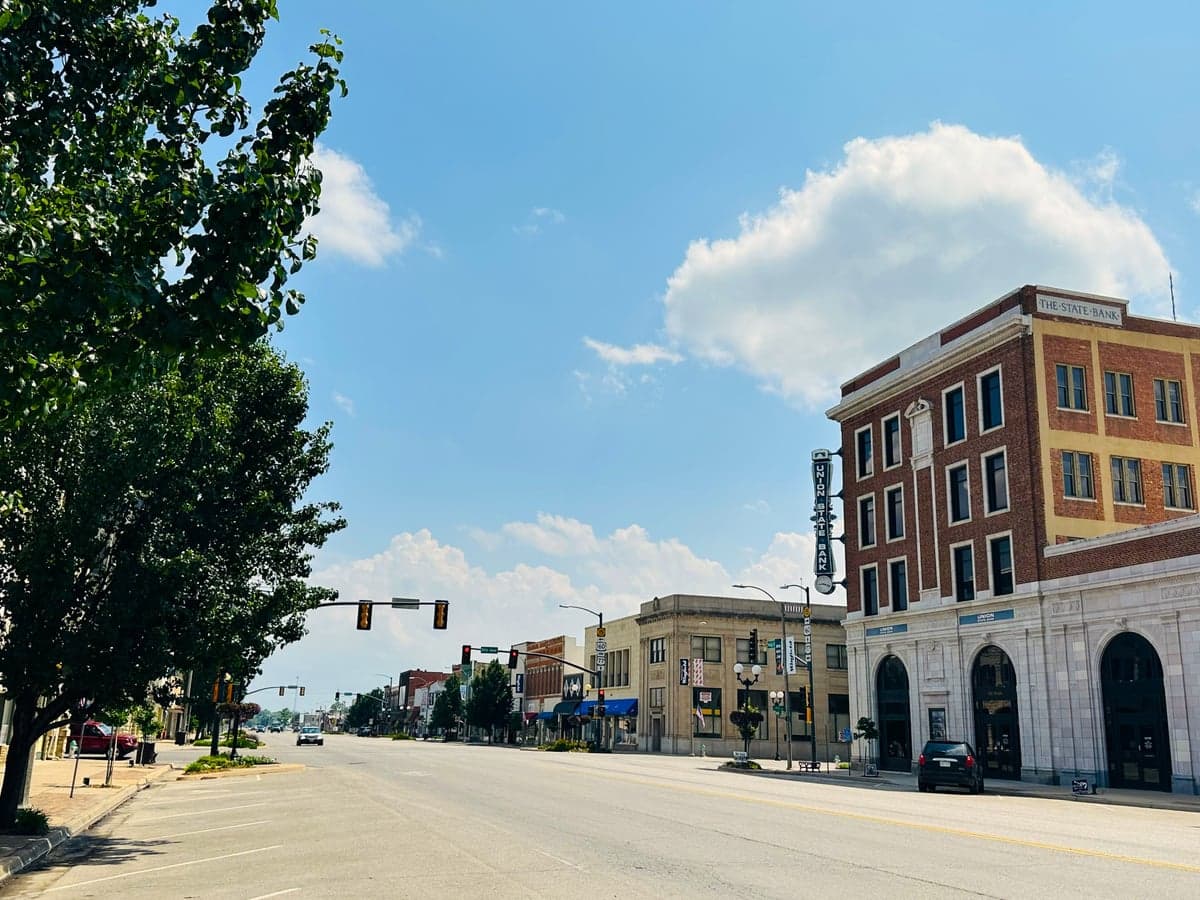
Photo: Wikipedia
Strategic Assessment of Winfield, KS
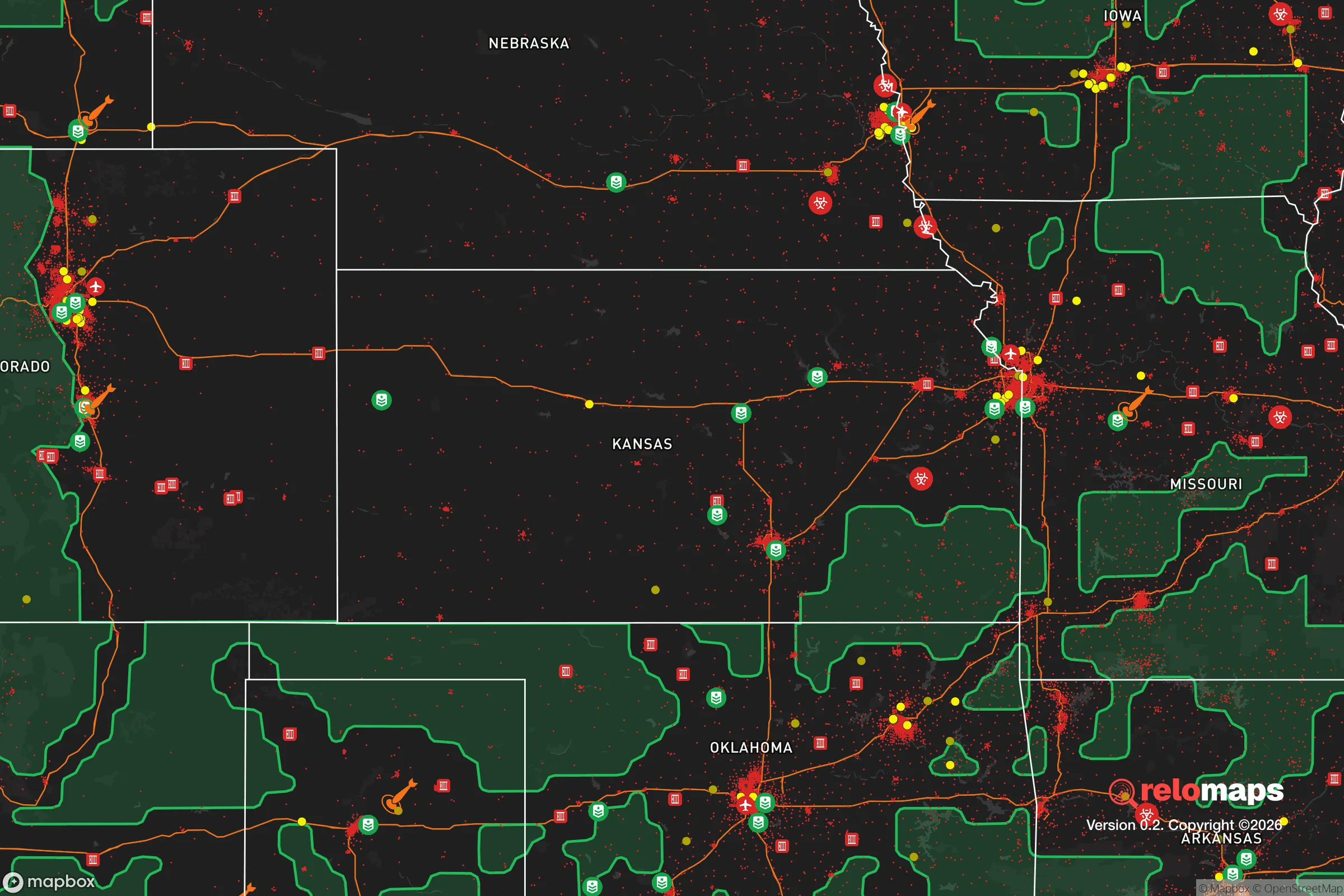
Workable tactical position. Some exposure to population density or targets, but generally defensible in a crisis.
What does the Strategic Assessment tell us?
Our Strategic Assessment grades tactical survivability of an area. Major population centers, military targets, fallout zones, natural disasters, and border exposure all drive risk — lower exposure means a more defensible position in a crisis.
This is heavily inspired by Joel Skousen's Strategic Relocation book. Highly recommended you checkout the book ($)What does this tell us?
Our Strategic Assessment grades tactical survivability of an area. Major population centers, military targets, fallout zones, natural disasters, and border exposure all drive risk — lower exposure means a more defensible position in a crisis.
This is heavily inspired by Joel Skousen's Strategic Relocation book. Highly recommended you checkout the book ($)Strategic Pillars

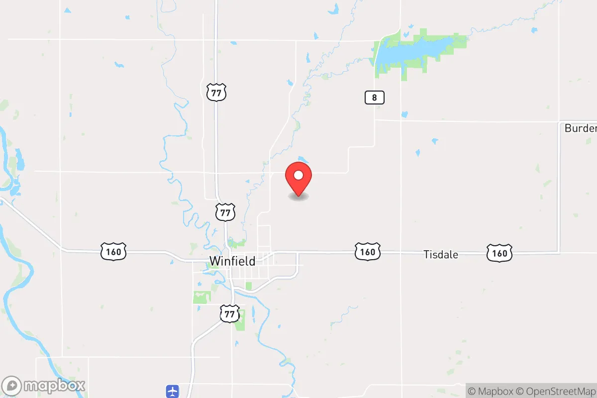
Key Distances
Regional Safe Places
Below is our recommended "safe zones" in Kansas and the surrounding area based on our strategic heuristics. For most people, it's unrealistic to live in a “safe zone” full-time due to work, family or other personal reasons. They tend to be more rural. However, many of these areas are perfect for second homes and retreat properties that double as a vacation home or even a short-term rental.
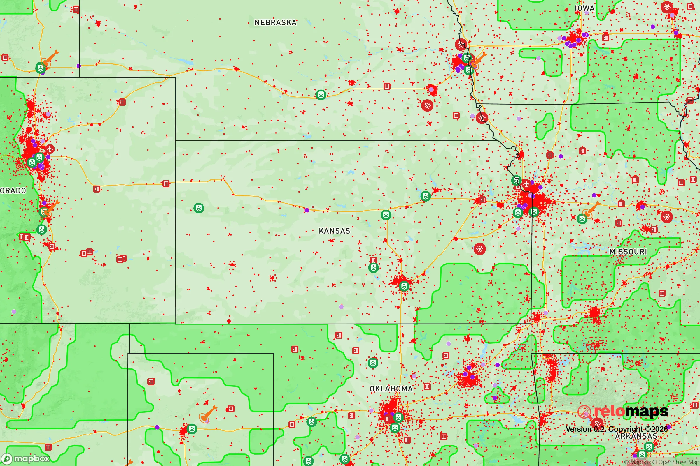
Important Note: For informational purposes only. This does not mean nothing bad ever happens in the green zones. Please use common sense. This is based on public data and modeled with AI. We tried to take a conservative approach but mistakes happen. We update this regularly as new information becomes available.
Solar Generator Recommendations
Backup power matters more here than in safer locations. We've picked three solar generators across budgets and capacity tiers — start with the budget unit if you only need a few essentials, or step up if you want to run a fridge and HVAC for days at a time.

Jackery Portable Power Station Explorer 300
Budget OptionPower on the Go: Weighing only 11 lbs, it's convenient to set up and store with book-sized foldable solar panels

BLUETTI Portable Power Station AC180
Designed for both indoor and outdoor scenarios, AC180 is highly capable as it has a robost capacity and continuous output power.

EF ECOFLOW DELTA Pro Ultra Power Station
Upgraded PickEcoFlow DELTA Pro Ultra is a whole-home energy system designed to grow with your family. Integrated with the Smart Home Panel 2, it scales to meet your evolving energy needs — keeping your home powered, intelligent, and secure through every stage of life.
We earn a commission, at no additional cost to you.
Strategic Assessment Analysis
Winfield, Kansas, offers a compelling strategic position for those prioritizing resilience and self-reliance, largely due to its location in the south-central part of the state, roughly 50 miles from the Oklahoma border and 90 miles from Wichita. The town of roughly 12,000 people sits at the confluence of the Walnut and Arkansas Rivers, providing a natural water source and a degree of geographic insulation from the chaos of major metropolitan areas. For a relocator with a prepper mindset, Winfield’s combination of agricultural hinterland, modest population density, and distance from primary fallout targets makes it a viable base for long-term sustainability, though it is not without its own vulnerabilities.
Geographic position and natural advantages for long-term security
Winfield’s primary strategic asset is its position within the Arkansas River Valley, a corridor that offers fertile soil, reliable water, and a temperate climate conducive to year-round food production. The surrounding Cowley County is predominantly rural, with vast tracts of farmland and ranchland that reduce the risk of being caught in a cascading urban collapse. The town itself is situated on a bluff above the Arkansas River, providing a natural defensive elevation advantage and reducing flood risk compared to low-lying areas. The Walnut River joins the Arkansas just north of town, creating a dual-waterfront that could support off-grid water collection, small-scale hydroponics, or emergency fishing. The Flint Hills to the east offer rugged terrain for retreat or caching, while the open plains to the west provide long sightlines—a tactical advantage for anyone concerned with perimeter security. Critically, Winfield is far enough from the major interstate corridors (I-35 runs 40 miles east, I-135 runs 60 miles west) to avoid the immediate refugee flows that would follow a major disaster, yet close enough to access those routes for resupply if they remain functional.
Risks, exposures, and proximity to fallout-relevant landmarks
The most significant risk for Winfield is its proximity to McConnell Air Force Base near Wichita, roughly 90 miles north-northwest. In a major conflict scenario, McConnell—home to KC-135 tankers and, as of 2026, a growing presence of remotely piloted aircraft—is a plausible first-strike target. While 90 miles provides substantial fallout attenuation, prevailing winds from the north or northwest could carry radioactive particles into the Winfield area within 6-12 hours, depending on yield and weather. A secondary concern is the nearby Kansas City metropolitan area (200 miles northeast), which hosts major rail yards, a Federal Reserve Bank, and critical infrastructure that could be targeted in a coordinated attack. Winfield itself has no high-value military or industrial targets, which is a net positive, but the town’s location along the Arkansas River corridor means it could become a natural chokepoint for displaced populations moving south from Wichita or north from Tulsa (120 miles south). The 2024 closure of the Westar Energy coal plant in nearby El Dorado reduced the area’s industrial profile, but the remaining grain elevators, fertilizer depots, and rail lines in Winfield could attract secondary disruptions during supply chain breakdowns. Tornado risk is high—Cowley County averages 12-15 tornado warnings per year—so any preparedness plan must include a reinforced safe room or basement.
Practical resilience for a relocator: food, water, energy, and defensibility
For a relocator serious about self-sufficiency, Winfield’s practical resilience is solid but requires deliberate investment. The Arkansas River is a perennial water source, but it carries agricultural runoff and upstream industrial residue, so a high-quality filtration system (e.g., Berkey or reverse osmosis) is non-negotiable. The town’s municipal water comes from the Arkansas River via a treatment plant, but grid failure would cut that supply within hours; a well-drilling permit is relatively easy to obtain in unincorporated Cowley County, with groundwater at depths of 50-150 feet. Food resilience is strong: Cowley County is among Kansas’s top producers of wheat, soybeans, and cattle, and the Winfield Farmers Market operates from April through October. Local grain elevators and feed stores mean bulk purchasing of staples like wheat berries, oats, and corn is feasible without drawing attention. Energy-wise, the area has decent solar potential (4.5-5.0 peak sun hours per day), and the rural electric cooperative (Sumner-Cowley Electric) allows net metering for grid-tied systems. For off-grid setups, propane is widely available from local suppliers like Ferrellgas, and wood-burning stoves are common in older homes. Defensibility is moderate: the town’s layout is a traditional grid, with the downtown core offering some natural chokepoints at the bridges over the Walnut River. The surrounding farmland provides open fields of fire but also limits concealment. A better defensive posture would be a property on the bluffs east of town, overlooking the river valley, with a single access road that can be monitored. The local sheriff’s office (Cowley County Sheriff) is understaffed at roughly 30 deputies for the entire county, so in a prolonged crisis, residents would largely be on their own—a fact that aligns with the conservative ethos of local firearm ownership and mutual aid networks.
The overall strategic picture for Winfield is one of moderate-to-high resilience for a relocator willing to put in the work. It avoids the worst fallout risks of the coasts and major inland cities, offers reliable water and food access, and sits in a region where conservative values and self-reliance are the cultural baseline rather than an outlier. The downsides are real but manageable: tornadoes, a non-trivial proximity to a military target, and the potential for refugee pressure from Wichita. For a single individual or family looking to plant roots in a place where you can grow your own food, store your own water, and keep your own counsel, Winfield is a solid B+ play—not a fortress, but a defensible, resource-rich position in a part of the country that still remembers how to handle its own problems.
* Values derived from national, state, county, city and local statistics and may differ in a specific area. Last updated: 2026-04-30T03:55:13.000Z
Narrative content on this page is AI-generated and may contain mistakes. Verify any details that matter before acting on them.
ReloMaps may earn a commission from affiliate links at no extra cost to you.