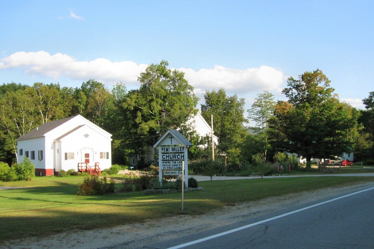
Photo: Wikipedia
Strategic Assessment of Woodstock, NH
Meaningful friction. Expect exposure to either population pressure, blast zones, or natural disaster risk. Consider buying a retreat property.
What does the Strategic Assessment tell us?
Our Strategic Assessment grades tactical survivability of an area. Major population centers, military targets, fallout zones, natural disasters, and border exposure all drive risk — lower exposure means a more defensible position in a crisis.
This is heavily inspired by Joel Skousen's Strategic Relocation book. Highly recommended you checkout the book ($)What does this tell us?
Our Strategic Assessment grades tactical survivability of an area. Major population centers, military targets, fallout zones, natural disasters, and border exposure all drive risk — lower exposure means a more defensible position in a crisis.
This is heavily inspired by Joel Skousen's Strategic Relocation book. Highly recommended you checkout the book ($)Strategic Pillars

Key Distances
Regional Safe Places
Below is our recommended "safe zones" in New Hampshire and the surrounding area based on our strategic heuristics. For most people, it's unrealistic to live in a “safe zone” full-time due to work, family or other personal reasons. They tend to be more rural. However, many of these areas are perfect for second homes and retreat properties that double as a vacation home or even a short-term rental.
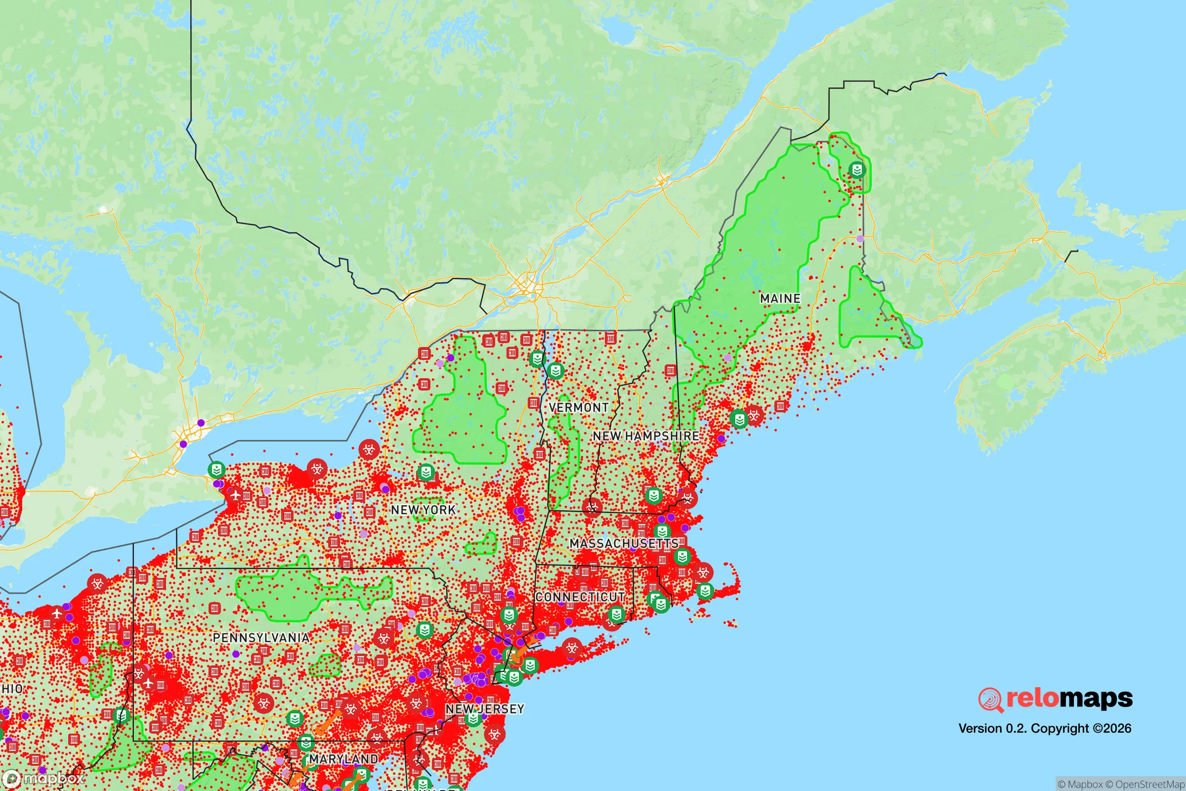
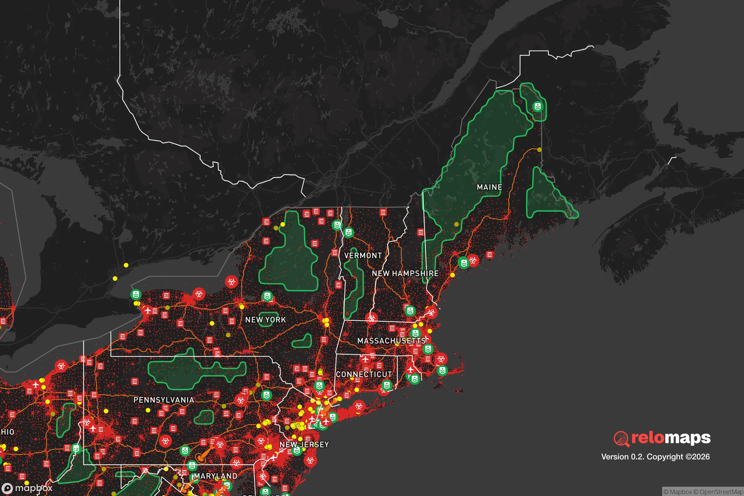


Important Note: For informational purposes only. This does not mean nothing bad ever happens in the green zones. Please use common sense. This is based on public data and modeled with AI. We tried to take a conservative approach but mistakes happen. We update this regularly as new information becomes available.
Solar Generator Recommendations
Backup power matters more here than in safer locations. We've picked three solar generators across budgets and capacity tiers — start with the budget unit if you only need a few essentials, or step up if you want to run a fridge and HVAC for days at a time.

Jackery Portable Power Station Explorer 300
Budget OptionPower on the Go: Weighing only 11 lbs, it's convenient to set up and store with book-sized foldable solar panels

BLUETTI Portable Power Station AC180
Designed for both indoor and outdoor scenarios, AC180 is highly capable as it has a robost capacity and continuous output power.

EF ECOFLOW DELTA Pro Ultra Power Station
Upgraded PickEcoFlow DELTA Pro Ultra is a whole-home energy system designed to grow with your family. Integrated with the Smart Home Panel 2, it scales to meet your evolving energy needs — keeping your home powered, intelligent, and secure through every stage of life.
We earn a commission, at no additional cost to you.
Strategic Assessment Analysis
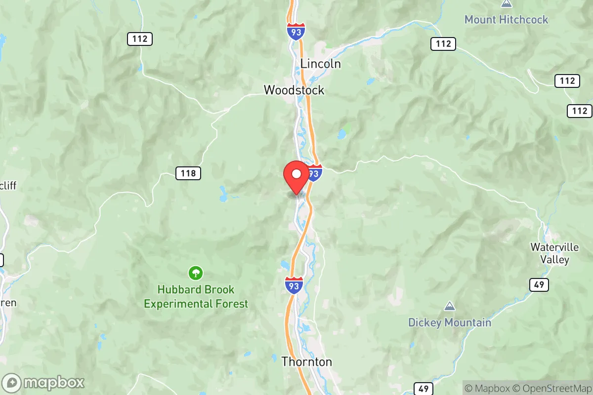
Woodstock, New Hampshire, offers a compelling mix of strategic depth and practical vulnerability for the relocation-minded reader focused on resilience. Nestled in the White Mountains along the Pemigewasset River, this small town of roughly 1,300 year-round residents sits at the intersection of U.S. Route 3 and Route 112, placing it roughly 30 miles north of Plymouth and about 100 miles north of Boston. Its position provides a meaningful buffer from major urban centers while retaining access to critical supply routes, though the same geography that grants seclusion also introduces specific risks that demand honest assessment.
Geographic position and natural advantages for long-term stability
Woodstock’s primary resilience asset is its location within the White Mountain National Forest, which surrounds the town on three sides. This federal land designation limits dense development, preserves watersheds, and creates a natural barrier against sprawl. The town sits at an elevation of roughly 750 feet, with surrounding peaks rising above 4,000 feet, offering natural defensive terrain and multiple egress options via forest service roads and trails that would remain usable if primary highways were compromised. The Pemigewasset River, which flows through the center of town, provides a reliable surface water source, and the region’s annual precipitation of roughly 45 inches supports robust groundwater recharge. The area’s cold climate—average January lows around 8°F—acts as a natural deterrent to many biological and insect-borne threats, while the short growing season (roughly 100 frost-free days) limits year-round food production without greenhouse infrastructure. The town’s low population density, roughly 25 people per square mile, reduces competition for resources in a crisis scenario compared to more populated areas of southern New Hampshire or the Seacoast region.
Risks, exposures, and proximity to fallout-relevant landmarks
Woodstock’s most significant vulnerability is its proximity to the Boston–Portsmouth–Manchester corridor, which lies within a 100-mile radius and would be a primary target in a major conflict scenario. The town sits roughly 90 miles from the Portsmouth Naval Shipyard and about 100 miles from Boston’s Logan International Airport and the adjacent Coast Guard base—both plausible targets. Fallout patterns from a strike on Boston would depend heavily on prevailing westerly winds, which in this region typically blow from the west-northwest, meaning Woodstock could be downwind of a Boston-area detonation under certain conditions. The town is also roughly 60 miles from the Seabrook Nuclear Power Plant in New Hampshire, a potential industrial accident or sabotage target. On the natural hazard side, the area faces moderate risks from ice storms and nor’easters, which can knock out power for days or weeks—the 1998 ice storm left parts of the region without electricity for up to two weeks. Flooding along the Pemigewasset River is a periodic concern, particularly during spring snowmelt and heavy rain events, with the 2011 Tropical Storm Irene causing significant road washouts and bridge damage in the area. Wildfire risk is low due to the moist forest environment, but not zero, particularly during drought years like 2020–2022. The town’s reliance on a single primary road—U.S. Route 3—for north-south travel creates a chokepoint; if the bridge over the Pemigewasset were compromised, access to Lincoln and points north would require lengthy detours via Route 112 or forest roads.
Practical resilience for a relocator: food, water, energy, and defensibility
For the individual or family serious about self-sufficiency, Woodstock presents a mixed picture. Water availability is excellent: the town’s location on the Pemigewasset River and its numerous tributaries, plus the high water table in the valley, make well drilling viable for most properties. The town’s municipal water system serves the village center, but most outlying homes rely on private wells, which is preferable for resilience. Food production is challenging due to the short growing season and rocky, acidic soils typical of the White Mountain region. Raised beds, cold frames, and a greenhouse are essentially requirements for any serious gardening effort. The area does support wild edibles—ramps, berries, and mushrooms in season—and the surrounding national forest allows hunting (deer, bear, turkey) and fishing (brook trout in the Pemigewasset and smaller streams) with proper licensing. Local agriculture is limited; the nearest significant farm stands are in Plymouth and Thornton, roughly 20–30 minutes south. Energy resilience requires planning: grid power is moderately reliable but vulnerable to ice storms and wind events. Wood heat is the dominant backup heating source, and the area’s abundant hardwood forests make firewood procurement feasible for those with a chainsaw and a splitter. Solar potential is moderate—the region averages 160–180 sunny days per year, with winter cloud cover being a limiting factor. Off-grid solar with battery storage is viable but requires oversizing for winter months. Propane is widely available for cooking and backup heating, delivered by local suppliers like Eastern Propane. Defensibility is a strong point: the town’s layout, with homes scattered along river valleys and forest roads, makes it difficult to approach without detection. The surrounding national forest provides both cover and multiple escape routes via trail networks. The local population is generally self-reliant and familiar with firearms, though the town itself has no organized militia or formal neighborhood watch structure. The nearest law enforcement presence is the New Hampshire State Police barracks in Twin Mountain, roughly 20 minutes north, and the Grafton County Sheriff’s Office in North Haverhill, about 30 minutes west. Medical services are limited to a small clinic in Lincoln (5 miles east) and Speare Memorial Hospital in Plymouth (30 minutes south); serious trauma care requires a 90-minute drive to Dartmouth-Hitchcock Medical Center in Lebanon.
The overall strategic picture for Woodstock is one of strong natural advantages tempered by real logistical constraints. Its location within the White Mountain National Forest provides a buffer from urban chaos, reliable water, and defensible terrain, while its distance from major targets is meaningful but not absolute—the Boston corridor’s shadow extends further than many realize. The short growing season and limited local food production mean that true self-sufficiency requires significant upfront investment in infrastructure: a greenhouse, a woodlot, a well, and a robust solar or generator system. For the relocator who can afford that investment and is willing to accept the trade-offs of a cold, remote mountain town, Woodstock offers a defensible, low-density position with good natural resources. For those seeking a turnkey homestead with mild winters and abundant local agriculture, this is not the place. But for the strategic thinker who values terrain, water, and seclusion over convenience, Woodstock deserves a serious look—provided you bring a chainsaw, a greenhouse kit, and a realistic understanding of what it means to live in a place where winter lasts five months and the nearest trauma center is an hour and a half away.

* Values derived from national, state, county, city and local statistics and may differ in a specific area. Last updated: 2026-10-20T07:45:58.000Z
Narrative content on this page is AI-generated and may contain mistakes. Verify any details that matter before acting on them.
ReloMaps may earn a commission from affiliate links at no extra cost to you.

