Photo: Wikipedia
Strategic Assessment of Big Horn County
Deep buffer from population centers and strategic targets. Low natural disaster risk and minimal exposure to border or coastal threats.
What does the Strategic Assessment tell us?
Our Strategic Assessment grades tactical survivability of an area. Major population centers, military targets, fallout zones, natural disasters, and border exposure all drive risk — lower exposure means a more defensible position in a crisis.
This is heavily inspired by Joel Skousen's Strategic Relocation book. Highly recommended you checkout the book ($)What does this tell us?
Our Strategic Assessment grades tactical survivability of an area. Major population centers, military targets, fallout zones, natural disasters, and border exposure all drive risk — lower exposure means a more defensible position in a crisis.
This is heavily inspired by Joel Skousen's Strategic Relocation book. Highly recommended you checkout the book ($)Strategic Pillars

Key Distances
Strategic Assessment Analysis
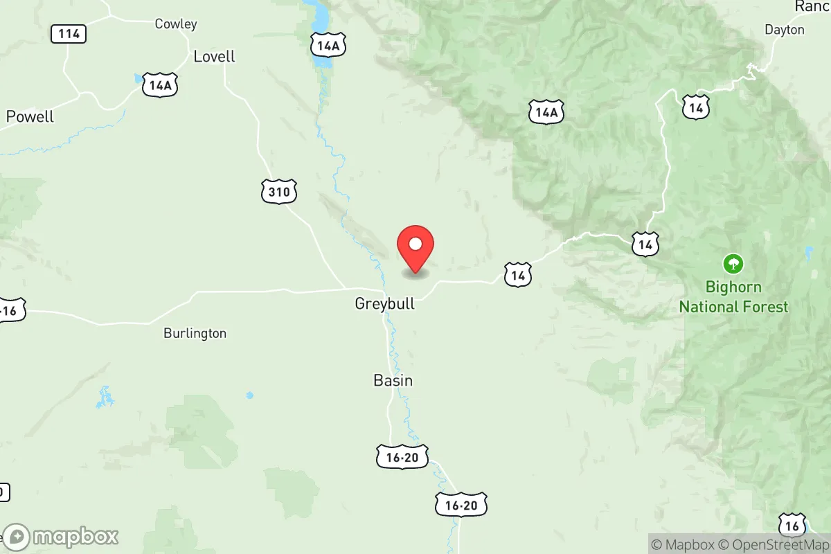
Big Horn County, Wyoming, offers a strategic resilience profile that stands apart from the typical "bug-out" destinations in the Mountain West, primarily because it sits in a sparsely populated basin shielded by the Big Horn Mountains to the east and the Absaroka Range to the west. This positioning creates a natural buffer against the chaos radiating from larger population centers, while the county's agricultural base—centered around the towns of Basin, Greybull, and Lovell—provides a tangible foundation for long-term self-sufficiency. For a relocator assessing civic stability and disaster preparedness, this area presents a compelling mix of geographic isolation, resource availability, and low strategic-target density, though it is not without its own vulnerabilities.
Geographic position and natural advantages for long-term stability
The county's location is its primary asset. It lies roughly 100 miles east of Yellowstone National Park and 60 miles south of the Montana border, placing it well outside the immediate fallout zones of any major military or industrial targets. The Big Horn Mountains themselves act as a massive rain shadow, creating a semi-arid climate that reduces wildfire risk compared to forested mountain communities, while the Bighorn River and its tributaries—the Shoshone and Greybull Rivers—provide reliable surface water. The towns of Basin (the county seat) and Greybull sit in the fertile Bighorn Basin, an area historically used for dryland farming and irrigated agriculture. This means a relocator can access locally grown hay, grains, and livestock without relying on fragile supply chains. The elevation (roughly 3,800 to 4,500 feet) also mitigates the worst of winter extremes, keeping the area accessible year-round via US Highway 20 and US Highway 310, which connect to Interstate 90 in Sheridan to the east. Critically, the county has no major interstate running through it, reducing the risk of refugee flows from a collapsed urban corridor.
Risks, exposures, and proximity to fallout-relevant landmarks
While Big Horn County avoids the worst of strategic targeting, it is not a zero-risk zone. The closest military installation of note is the Wyoming Air National Guard base at Cheyenne (roughly 250 miles southeast), which is a potential target but far enough away to avoid direct blast or fallout effects under most scenarios. More concerning is the proximity to the Yellowstone Caldera—a supervolcano that, if it erupted, would devastate the region with ashfall. However, the prevailing winds in a major eruption would likely carry ash eastward, sparing the Bighorn Basin from the worst of it. The county also sits near the Powder River Basin coal fields to the east, which include active mines and coal-fired power plants like the Dave Johnston Plant near Glenrock. These are not primary nuclear targets but could be secondary targets in a broader conflict. The real risk here is not blast or radiation but economic isolation: the county's economy is heavily tied to agriculture and energy extraction (oil and gas wells dot the landscape near Byron and Cowley), meaning a prolonged grid-down scenario would hit local employment hard. For a relocator, the key is that there are no major refineries, ports, or military command centers within 150 miles, making this a low-priority area for any adversary.
Practical resilience for a relocator: food, water, energy, and defensibility
For a single individual or family looking to establish a resilient homestead, Big Horn County offers concrete advantages. Water rights are the most critical factor: the Bighorn River system is adjudicated and heavily allocated, but properties with senior water rights or access to irrigation canals are common in the Basin-Greybull corridor. Groundwater is also accessible via wells, though depths vary. Food production is viable: the growing season is short (roughly 100-120 frost-free days) but sufficient for cold-hardy crops like potatoes, carrots, and grains, and the area is known for its alfalfa and cattle operations. Local food sources include the Big Horn Cooperative in Basin and the Greybull Farmers Market, but a serious prepper should plan to grow or raise their own. Energy resilience is mixed: the county is served by Rocky Mountain Power, but grid outages from winter storms are common. Solar potential is good—the area averages over 200 sunny days per year—and wind is a constant presence, making small-scale wind turbines a viable supplement. Defensibility is strong: the towns are small (Basin has about 1,200 residents, Greybull around 1,800), and the surrounding terrain is open sagebrush steppe with limited cover, making it difficult for large groups to approach undetected. The county's population density is roughly 2.5 people per square mile, which means neighbors are few and far between—a double-edged sword that reduces social friction but also limits mutual aid. The local sheriff's office in Basin is professional but understaffed, so self-reliance in security is a given.
Overall, Big Horn County presents a solid strategic option for the conservative-minded relocator who values isolation, resource access, and low target profile over convenience or economic opportunity. It is not a prepper's paradise—the harsh winters, limited medical infrastructure (the nearest hospital with a trauma center is in Cody, 45 miles west), and dependence on a narrow agricultural base are real constraints. But for someone willing to invest in water rights, solar panels, and a good rifle, this area offers a defensible, low-visibility base from which to weather the storms of civic unrest or national disruption. The key is to secure a property with its own water source and to build relationships with the local ranching community—these are the people who will know how to survive when the trucks stop running. If you're looking for a place that's off the radar but not off the map, Big Horn County deserves a serious look.
* Values derived from national, state, county, city and local statistics and may differ in a specific area. Last updated: 2026-05-12T12:21:12.000Z
Narrative content on this page is AI-generated and may contain mistakes. Verify any details that matter before acting on them.
ReloMaps may earn a commission from affiliate links at no extra cost to you.