Photo: Wikipedia
Strategic Assessment of Yerington, NV
Workable tactical position. Some exposure to population density or targets, but generally defensible in a crisis.
What does the Strategic Assessment tell us?
Our Strategic Assessment grades tactical survivability of an area. Major population centers, military targets, fallout zones, natural disasters, and border exposure all drive risk — lower exposure means a more defensible position in a crisis.
This is heavily inspired by Joel Skousen's Strategic Relocation book. Highly recommended you checkout the book ($)What does this tell us?
Our Strategic Assessment grades tactical survivability of an area. Major population centers, military targets, fallout zones, natural disasters, and border exposure all drive risk — lower exposure means a more defensible position in a crisis.
This is heavily inspired by Joel Skousen's Strategic Relocation book. Highly recommended you checkout the book ($)Strategic Pillars

Key Distances
Regional Safe Places
Below is our recommended "safe zones" in Nevada and the surrounding area based on our strategic heuristics. For most people, it's unrealistic to live in a “safe zone” full-time due to work, family or other personal reasons. They tend to be more rural. However, many of these areas are perfect for second homes and retreat properties that double as a vacation home or even a short-term rental.
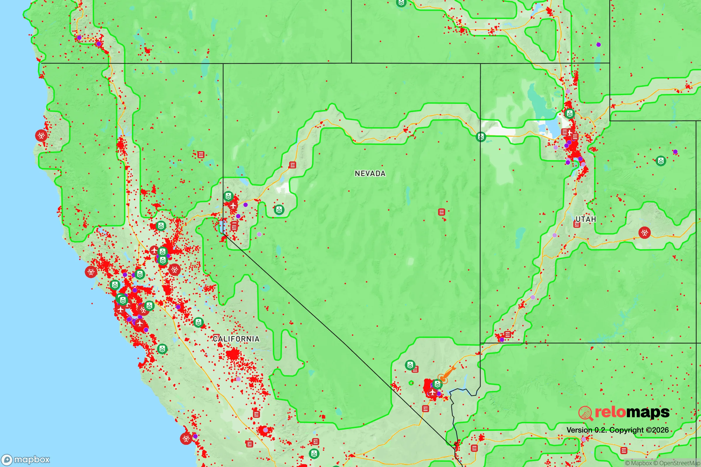
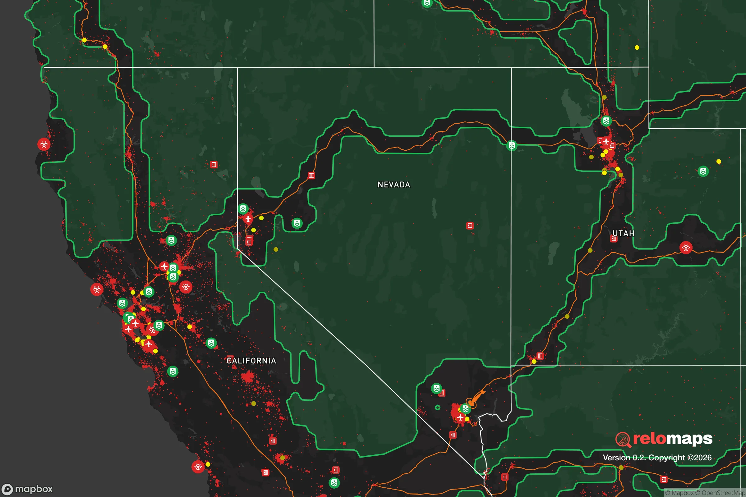
Important Note: For informational purposes only. This does not mean nothing bad ever happens in the green zones. Please use common sense. This is based on public data and modeled with AI. We tried to take a conservative approach but mistakes happen. We update this regularly as new information becomes available.
Solar Generator Recommendations
Backup power matters more here than in safer locations. We've picked three solar generators across budgets and capacity tiers — start with the budget unit if you only need a few essentials, or step up if you want to run a fridge and HVAC for days at a time.

Jackery Portable Power Station Explorer 300
Budget OptionPower on the Go: Weighing only 11 lbs, it's convenient to set up and store with book-sized foldable solar panels

BLUETTI Portable Power Station AC180
Designed for both indoor and outdoor scenarios, AC180 is highly capable as it has a robost capacity and continuous output power.

EF ECOFLOW DELTA Pro Ultra Power Station
Upgraded PickEcoFlow DELTA Pro Ultra is a whole-home energy system designed to grow with your family. Integrated with the Smart Home Panel 2, it scales to meet your evolving energy needs — keeping your home powered, intelligent, and secure through every stage of life.
We earn a commission, at no additional cost to you.
Strategic Assessment Analysis
Yerington, Nevada, sits in a strategic sweet spot that few relocators fully appreciate: far enough from the Las Vegas and Reno metropolitan areas to avoid their cascading failure risks, yet close enough to access their supply chains and medical infrastructure when things are stable. The town’s location in the Mason Valley, flanked by the Wassuk Range and the Pine Nut Mountains, gives it natural isolation without the logistical dead-end of a deep-rural outpost. For someone thinking in terms of decades, not just next year, Yerington offers a defensible position with genuine agricultural self-sufficiency—something increasingly rare in the Intermountain West.
Geographic position and natural advantages for long-term security
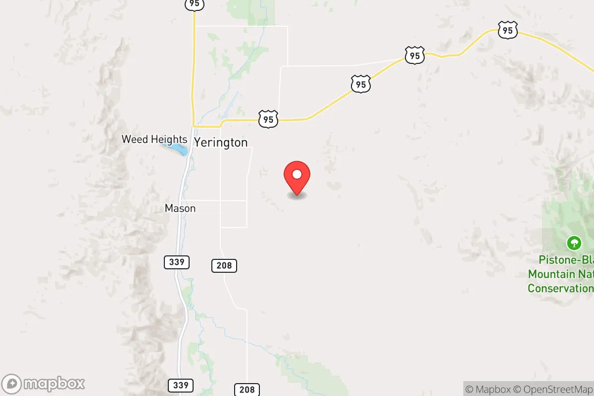
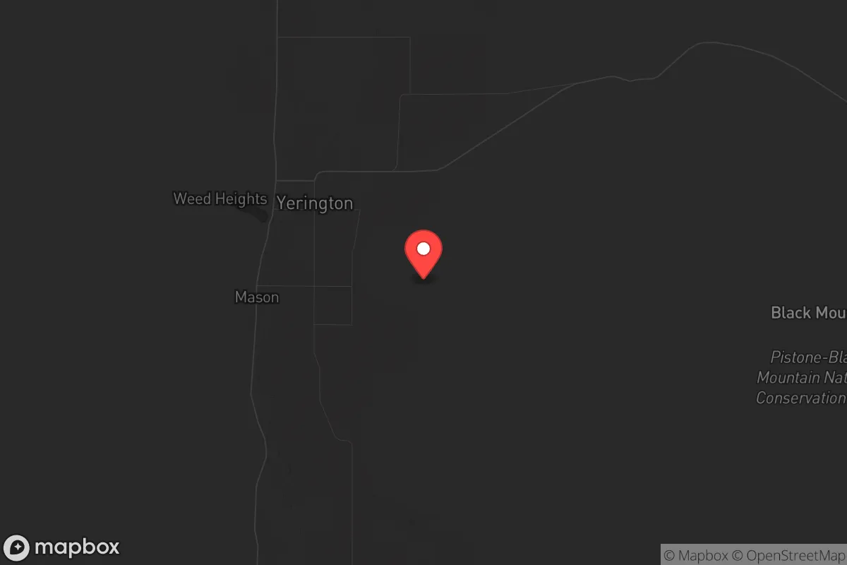
Yerington sits at roughly 4,400 feet elevation in Lyon County, about 90 miles southeast of Reno and 120 miles northeast of Carson City. That distance is critical: it places the town outside the likely blast radius and immediate fallout zones of any major metropolitan target, while still being within a half-day drive of Level I trauma centers and major freight hubs. The Mason Valley is a working agricultural basin fed by the Walker River, which means the area has a legitimate water surplus relative to most of Nevada. The surrounding mountains create a natural bowl that limits easy approach routes—there are essentially three paved roads into Yerington (US-95A, NV-208, and NV-339), all of which can be monitored or blocked with minimal effort. The valley floor is flat and open, which is a double-edged sword, but the adjacent foothills offer numerous retreat positions with line-of-sight coverage of the town. The climate is high desert: hot summers, cold winters, low humidity, and less than 10 inches of annual precipitation. That aridity is a challenge for off-grid water storage but a major advantage for preserving food, ammunition, and equipment long-term.
Risks, exposures, and proximity to fallout-relevant landmarks
No location is risk-free, and Yerington has specific exposures that a strategic relocator must weigh. The most obvious is the Nevada National Security Site (formerly the Nevada Test Site), located roughly 100 miles southwest as the crow flies. While the site has been inactive for nuclear testing since 1992, it remains a high-value government asset with ongoing subcritical experiments and hazardous material storage. In a major conflict scenario, that facility could become a target or a source of contamination. The Hawthorne Army Depot, about 70 miles south, stores a significant portion of the U.S. military’s conventional ammunition reserves—another potential target. The Walker River itself is a vulnerability: it’s the lifeblood of the valley’s agriculture, but it’s also a single point of failure. A drought cycle, upstream diversion, or deliberate contamination could cripple local food production. The town’s population is around 3,000, with Lyon County total around 60,000, so there’s no anonymity buffer—everyone will know who the newcomers are within a month. That’s a social risk if you’re trying to keep a low profile. On the positive side, Yerington has no major military bases, no nuclear power plants, no chemical refineries, and no major transportation corridors within 30 miles. It’s not on anyone’s target list for a first-strike scenario.
Practical resilience for a relocator: food, water, energy, and defensibility
Yerington’s practical resilience starts with water. The Walker River provides surface irrigation rights that are already allocated, but the local water table is accessible with a well drilled to 100-300 feet. Many properties in the valley come with existing agricultural wells, and the cost to drill a new one is reasonable compared to the Front Range or California. The growing season is short—about 120 frost-free days—but the valley produces alfalfa, hay, garlic, and some vegetables. For a relocator serious about food security, this is one of the few places in Nevada where you can realistically grow a meaningful portion of your own calories without massive greenhouse investment. The local power grid is served by NV Energy, but solar potential is excellent: Yerington averages over 300 sunny days per year, and net metering policies are still favorable. Battery storage is becoming more common among locals. Natural gas is available in town, but propane is the standard for rural properties—plan accordingly. Defensibility is mixed. The open valley floor offers long sightlines but limited cover. The better play is to secure a property on the valley’s edge, where you have a view of approach routes and can retreat into the mountains if needed. The local sheriff’s office is small—about 20 deputies for the entire county—so response times in a crisis will be measured in hours, not minutes. That means personal security is your responsibility. The community itself is conservative, rural, and largely self-reliant. Gun ownership is the norm, not the exception. Church attendance is high. The local economy is based on mining (the Yerington copper mine is currently in redevelopment), agriculture, and a small but growing lithium industry. That last point is worth watching: lithium processing brings jobs but also draws attention and infrastructure that could become a liability in a collapse scenario.
Overall, Yerington presents a strong strategic picture for someone who wants to be prepared without going full off-grid hermit. It’s not a bug-out location for a weekend warrior—it’s a place to build a life that can withstand shocks. The water, the agricultural base, the isolation from major targets, and the cultural alignment with self-reliance all point in the right direction. The trade-offs are real: limited medical access, a short growing season, and the social visibility of a small town. But for a conservative-leaning relocator who values preparedness over convenience, Yerington is one of the better options in the Great Basin. It’s not a fortress, but it’s a solid foundation—and in the current climate, that’s more than most places can offer.
* Values derived from national, state, county, city and local statistics and may differ in a specific area. Last updated: 2026-04-29T19:29:05.000Z
Narrative content on this page is AI-generated and may contain mistakes. Verify any details that matter before acting on them.
ReloMaps may earn a commission from affiliate links at no extra cost to you.