
Photo: Wikipedia
Strategic Assessment of Alamosa, CO
Workable tactical position. Some exposure to population density or targets, but generally defensible in a crisis.
What does the Strategic Assessment tell us?
Our Strategic Assessment grades tactical survivability of an area. Major population centers, military targets, fallout zones, natural disasters, and border exposure all drive risk — lower exposure means a more defensible position in a crisis.
This is heavily inspired by Joel Skousen's Strategic Relocation book. Highly recommended you checkout the book ($)What does this tell us?
Our Strategic Assessment grades tactical survivability of an area. Major population centers, military targets, fallout zones, natural disasters, and border exposure all drive risk — lower exposure means a more defensible position in a crisis.
This is heavily inspired by Joel Skousen's Strategic Relocation book. Highly recommended you checkout the book ($)Strategic Pillars

Key Distances
Regional Safe Places
Below is our recommended "safe zones" in Colorado and the surrounding area based on our strategic heuristics. For most people, it's unrealistic to live in a “safe zone” full-time due to work, family or other personal reasons. They tend to be more rural. However, many of these areas are perfect for second homes and retreat properties that double as a vacation home or even a short-term rental.


Important Note: For informational purposes only. This does not mean nothing bad ever happens in the green zones. Please use common sense. This is based on public data and modeled with AI. We tried to take a conservative approach but mistakes happen. We update this regularly as new information becomes available.
Solar Generator Recommendations
Backup power matters more here than in safer locations. We've picked three solar generators across budgets and capacity tiers — start with the budget unit if you only need a few essentials, or step up if you want to run a fridge and HVAC for days at a time.

Jackery Portable Power Station Explorer 300
Budget OptionPower on the Go: Weighing only 11 lbs, it's convenient to set up and store with book-sized foldable solar panels

BLUETTI Portable Power Station AC180
Designed for both indoor and outdoor scenarios, AC180 is highly capable as it has a robost capacity and continuous output power.

EF ECOFLOW DELTA Pro Ultra Power Station
Upgraded PickEcoFlow DELTA Pro Ultra is a whole-home energy system designed to grow with your family. Integrated with the Smart Home Panel 2, it scales to meet your evolving energy needs — keeping your home powered, intelligent, and secure through every stage of life.
We earn a commission, at no additional cost to you.
Strategic Assessment Analysis
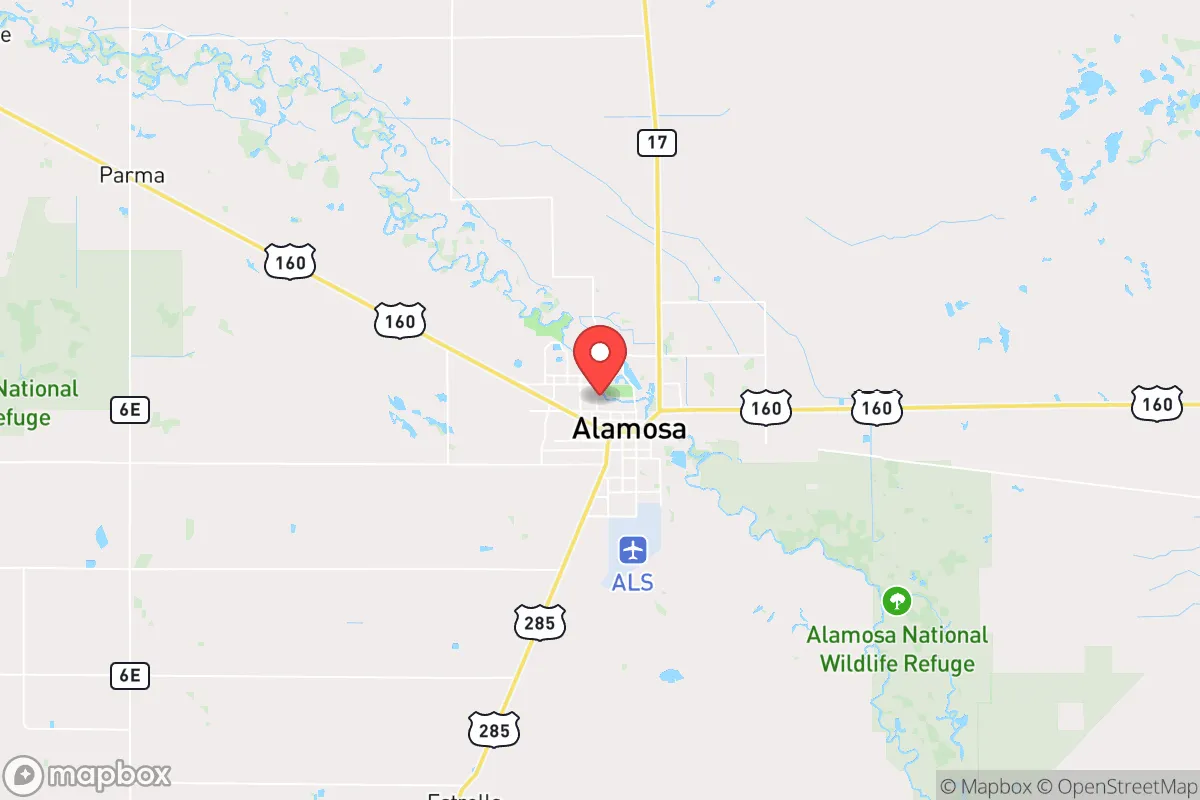
Alamosa, Colorado, offers a compelling strategic position for those prioritizing resilience and self-sufficiency, largely due to its isolation and high-altitude geography. Nestled in the San Luis Valley at 7,544 feet, this town of roughly 10,000 people sits over 200 miles from the Denver metro area and 150 miles from Albuquerque, placing it well outside the immediate fallout zones of major population centers. The valley’s agricultural base, abundant groundwater, and low population density create a buffer against the cascading failures that often follow urban-centric disasters, making it a viable relocation target for those seeking to weather civic unrest or supply chain disruptions.
Geographic isolation and natural defensive advantages
Alamosa’s primary strategic asset is its location within the San Luis Valley, a high-elevation basin ringed by the Sangre de Cristo and San Juan mountain ranges. This natural bowl provides a defensive perimeter: access is limited to a handful of mountain passes, including La Veta Pass (U.S. 160) and Wolf Creek Pass (U.S. 160 west), which are easily monitored and, in a worst-case scenario, could be temporarily blocked. The valley floor itself is flat and open, offering long sightlines that discourage surprise approaches. The area’s distance from major interstate corridors—I-25 is 70 miles east, I-70 is 100 miles north—means it avoids the refugee flows that would likely follow a major urban disaster. Alamosa’s airport (ALS) is a general aviation facility with a 8,500-foot runway, capable of handling small cargo aircraft if resupply becomes necessary, but it is not a target for strategic strikes. The surrounding Great Sand Dunes National Park and Rio Grande National Forest provide additional buffer zones and potential retreat areas, though the latter’s rugged terrain limits large-scale movement.
Risks, exposures, and proximity to fallout-relevant landmarks
No location is immune to risk, and Alamosa has specific vulnerabilities. The San Luis Valley sits atop the Rio Grande Rift, a seismically active zone; while major earthquakes are rare, the area experiences frequent minor tremors, and the valley’s unconsolidated sediments could amplify shaking. The primary concern for a prepper is the valley’s proximity to the San Luis Valley’s agricultural infrastructure—specifically, the large-scale potato and alfalfa operations that rely on irrigation from the Rio Grande and its tributaries. A prolonged drought or upstream contamination (e.g., from the closed Summitville mine site, which leaked acid mine drainage into the Alamosa River in the 1990s) could disrupt local food production. More critically, Alamosa lies roughly 120 miles south of the U.S. Air Force’s Schriever Space Force Base and 150 miles from the Cheyenne Mountain Complex, both potential targets in a conflict. While not in the immediate blast zone, prevailing winds from the north could carry fallout from a strike on those facilities, though the valley’s high altitude and mountain barriers would likely disperse contaminants. The town’s water supply comes from the confined Alamosa aquifer, which is deep and well-protected from surface contamination, but the municipal treatment plant is a single point of failure. For those on private wells, the risk is lower, but the aquifer’s recharge rate is slow, and over-extraction by agriculture is a long-term concern.
Practical resilience for a relocator: food, water, energy, and defensibility
For a relocator focused on self-sufficiency, Alamosa’s practical resilience is mixed but promising. The valley’s growing season is short—only 90 to 120 frost-free days—but the volcanic soils and abundant sunshine (over 300 days per year) support hardy crops like potatoes, quinoa, and beans. Local farmers’ markets and the Adams State University agricultural program provide knowledge networks for newcomers. Water rights are a critical issue: the valley is part of the Rio Grande Compact, and junior water rights holders face curtailment during droughts. A prepper should secure a property with senior water rights or a well that taps the deep aquifer (typically 200-400 feet), which is less vulnerable to surface contamination. Energy resilience is strong: the valley has high solar potential, and many rural properties already use off-grid solar arrays. Alamosa’s municipal utility offers net metering, and the area’s low humidity means solar panels remain efficient year-round. Natural gas is available in town, but rural properties rely on propane or wood—the latter is abundant from nearby national forests, though firewood cutting permits are required. Defensibility is excellent for a small group: the open valley floor makes approach detection easy, and the surrounding mountains offer numerous choke points. However, the town itself is not defensible—it’s a grid-layout with few natural barriers—so a relocator should prioritize a rural property on the valley’s edge, ideally with a view of the approaches from the passes. The local law enforcement presence is minimal (Alamosa County has about 20 deputies for 723 square miles), meaning community self-policing is the norm in remote areas. The nearest hospital, San Luis Valley Health, is a 50-bed facility with a Level IV trauma center—adequate for routine emergencies but not for mass casualty events. For serious injuries, evacuation to Denver or Colorado Springs is a 3-4 hour drive, a significant vulnerability.
Overall, Alamosa presents a viable but not perfect strategic relocation option for those with a conservative, prepper mindset. Its isolation, agricultural base, and defensible geography make it a strong candidate for weathering urban-centric disasters, civil unrest, or supply chain collapses. The trade-offs are real: a short growing season, water rights complexity, and distance from advanced medical care require careful planning and a willingness to invest in self-sufficiency infrastructure. For a single individual or family willing to put in the work—securing senior water rights, installing solar, building a root cellar, and establishing community ties with local ranchers and farmers—Alamosa offers a quiet, low-profile base far from the chaos of the Front Range. It is not a bug-out location for a weekend; it is a long-term homesteading play for those who see the writing on the wall and want a place where the neighbors are few, the views are wide, and the risks are manageable.
* Values derived from national, state, county, city and local statistics and may differ in a specific area. Last updated: 2026-05-11T22:08:49.000Z
Narrative content on this page is AI-generated and may contain mistakes. Verify any details that matter before acting on them.
ReloMaps may earn a commission from affiliate links at no extra cost to you.