
Photo: Wikipedia
Strategic Assessment of Alliance, NE
Deep buffer from population centers and strategic targets. Low natural disaster risk and minimal exposure to border or coastal threats.
What does the Strategic Assessment tell us?
Our Strategic Assessment grades tactical survivability of an area. Major population centers, military targets, fallout zones, natural disasters, and border exposure all drive risk — lower exposure means a more defensible position in a crisis.
This is heavily inspired by Joel Skousen's Strategic Relocation book. Highly recommended you checkout the book ($)What does this tell us?
Our Strategic Assessment grades tactical survivability of an area. Major population centers, military targets, fallout zones, natural disasters, and border exposure all drive risk — lower exposure means a more defensible position in a crisis.
This is heavily inspired by Joel Skousen's Strategic Relocation book. Highly recommended you checkout the book ($)Strategic Pillars

Key Distances
Regional Safe Places
Below is our recommended "safe zones" in Nebraska and the surrounding area based on our strategic heuristics. For most people, it's unrealistic to live in a “safe zone” full-time due to work, family or other personal reasons. They tend to be more rural. However, many of these areas are perfect for second homes and retreat properties that double as a vacation home or even a short-term rental.
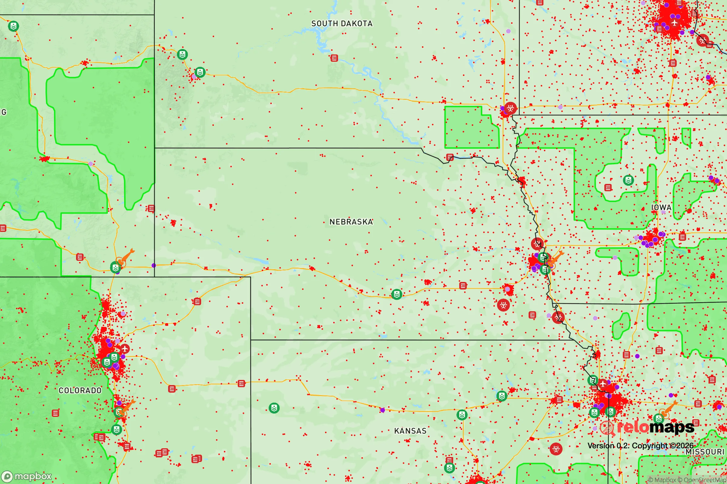
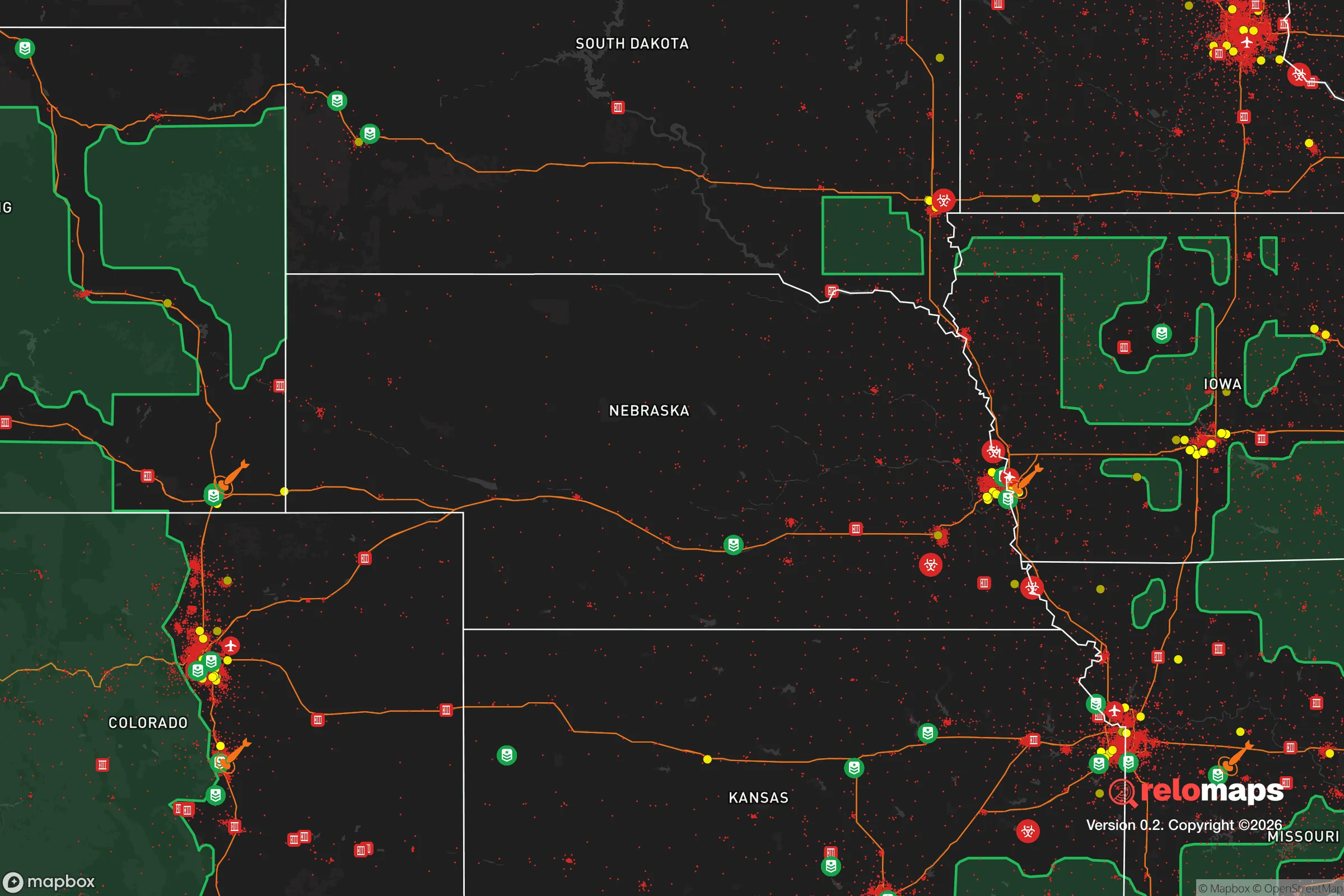
Important Note: For informational purposes only. This does not mean nothing bad ever happens in the green zones. Please use common sense. This is based on public data and modeled with AI. We tried to take a conservative approach but mistakes happen. We update this regularly as new information becomes available.
Solar Generator Recommendations
Backup power matters more here than in safer locations. We've picked three solar generators across budgets and capacity tiers — start with the budget unit if you only need a few essentials, or step up if you want to run a fridge and HVAC for days at a time.

Jackery Portable Power Station Explorer 300
Budget OptionPower on the Go: Weighing only 11 lbs, it's convenient to set up and store with book-sized foldable solar panels

BLUETTI Portable Power Station AC180
Designed for both indoor and outdoor scenarios, AC180 is highly capable as it has a robost capacity and continuous output power.

EF ECOFLOW DELTA Pro Ultra Power Station
Upgraded PickEcoFlow DELTA Pro Ultra is a whole-home energy system designed to grow with your family. Integrated with the Smart Home Panel 2, it scales to meet your evolving energy needs — keeping your home powered, intelligent, and secure through every stage of life.
We earn a commission, at no additional cost to you.
Strategic Assessment Analysis
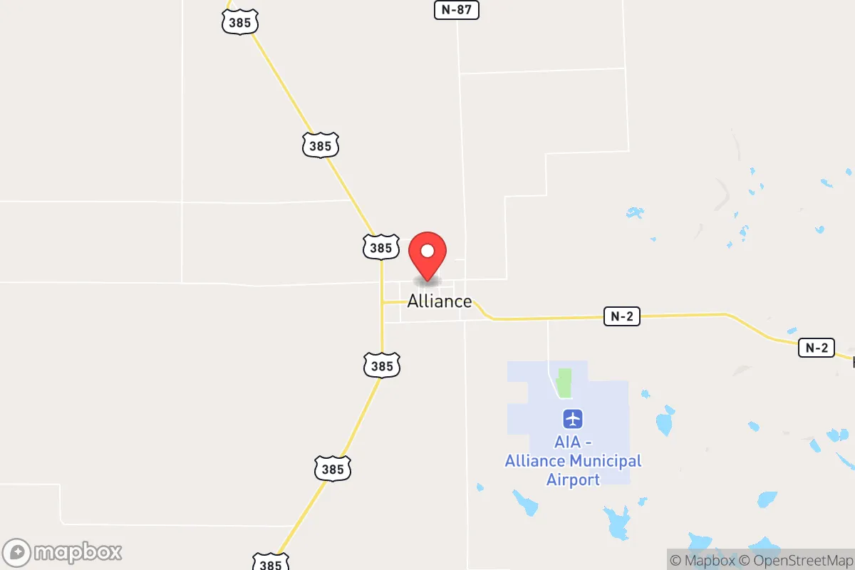
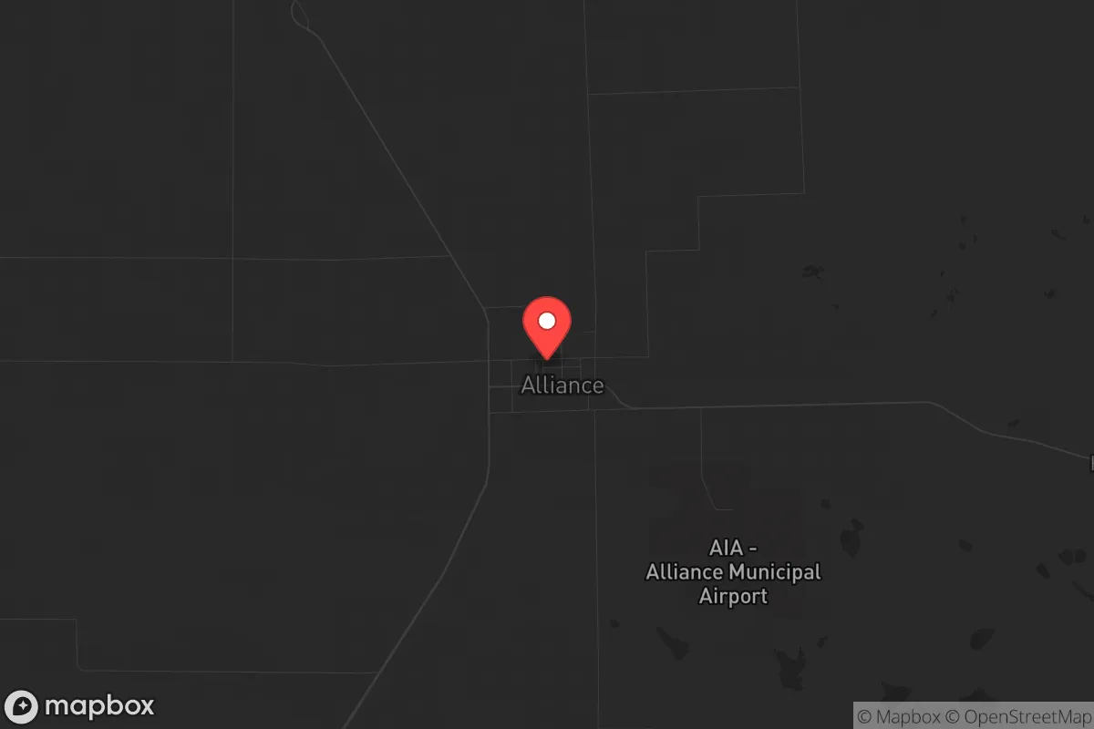
Alliance, Nebraska, sits in the far western part of the state, roughly 50 miles from the Wyoming border, and offers a strategic combination of geographic isolation, agricultural self-sufficiency, and low population density that makes it a serious candidate for those prioritizing long-term resilience. With a population hovering around 8,000, the town is small enough to avoid the chaos of urban collapse yet large enough to maintain essential services like a hospital, grocery stores, and a regional airport. Its location along the Burlington Northern Santa Fe rail line and U.S. Highway 385 provides a logistical backbone for supply movement without the congestion of interstate corridors. For a relocator thinking about civic unrest, mass casualty events, or systemic disruptions, Alliance presents a quiet, defensible base with access to the High Plains’ natural resources.
Geographic position and natural advantages for long-term security
Alliance sits in the Sandhills region, a vast area of grass-stabilized dunes that is one of the most sparsely populated regions in the continental United States. The nearest major population center is Scottsbluff, about 70 miles west, and Denver is roughly 250 miles southwest—far enough to buffer against urban unrest or fallout from a major event. The area’s elevation, around 4,000 feet, provides a dry climate that reduces the risk of flooding, mold, and many vector-borne diseases. The Ogallala Aquifer lies beneath much of western Nebraska, giving Alliance a reliable groundwater source that is less vulnerable to surface contamination than rivers or reservoirs in more populated regions. The surrounding ranchland and dryland farming operations mean that food production is a local reality, not just a theoretical option. For a prepper, the ability to source beef, grain, and vegetables within a 50-mile radius is a tangible advantage that few suburban or exurban locations can match.
Risks, exposures, and proximity to fallout-relevant landmarks
No location is without vulnerabilities, and Alliance has several that a strategic relocator must weigh. The town is roughly 100 miles from the U.S. Strategic Command (STRATCOM) headquarters at Offutt Air Force Base near Omaha, and about 150 miles from the Minuteman III missile fields in western Nebraska and eastern Wyoming. While these are not immediate fallout zones, they are high-value targets in a nuclear exchange scenario, and prevailing winds from the west could carry fallout across the region. Alliance is also within 200 miles of the Rocky Flats Plant site near Denver, a former nuclear weapons production facility that remains a contamination concern. The area’s flat, open terrain offers little natural cover from aerial surveillance or blast effects, and the lack of major highways means evacuation routes are limited to two-lane roads that could become clogged. Additionally, the town’s economic reliance on agriculture and the railroad makes it vulnerable to supply chain disruptions—if diesel or fertilizer shipments stop, local farming operations grind to a halt within weeks.
Practical resilience for a relocator: food, water, energy, and defensibility
For someone serious about self-reliance, Alliance offers a mix of strengths and gaps. Water is the strongest asset: the Ogallala Aquifer provides abundant, clean groundwater, and most homes in the area have private wells or access to municipal systems with low contamination risk. Food security is also solid—the region produces corn, wheat, and hay, and cattle ranching is the dominant industry. A relocator with a few acres can raise livestock and grow vegetables with relative ease, though the short growing season (roughly 130 frost-free days) limits crop variety. Energy is a mixed bag. The area has strong wind resources, and small-scale wind turbines are feasible, but grid power is still the primary source for most residents. Solar works well given the 260+ sunny days per year, but winter snow and dust can reduce panel efficiency. Natural gas is available in town, but rural properties rely on propane or heating oil. Defensibility is moderate: the flat terrain makes it hard to hide, but the low population density means fewer threats from looters or organized groups. The local sheriff’s office and volunteer fire department are responsive but stretched thin—a serious incident would require self-reliance for at least 72 hours, likely longer. The town’s gun culture is strong, with multiple firearms dealers and a local shooting range, which aligns with a prepper mindset for personal security.
The overall strategic picture for Alliance is one of trade-offs. It offers genuine advantages in water, food, and isolation that are hard to find in more populated parts of the country, and its distance from major cities and military targets reduces the likelihood of being caught in the initial wave of a crisis. However, the flat terrain, limited evacuation routes, and proximity to strategic assets like STRATCOM and missile fields mean that a relocator must plan for both natural and man-made disasters with a clear-eyed understanding of the risks. For a conservative-leaning individual or family who values self-sufficiency, community cohesion, and a slower pace of life, Alliance is a viable base—but it is not a fortress. The key is to arrive with a plan: secure a well, stockpile fuel and ammunition, build relationships with local ranchers and farmers, and accept that the same isolation that protects you also limits your options if things go sideways. In a world where urban centers are increasingly fragile, Alliance offers a quiet, defensible corner of the High Plains that rewards preparation and patience.
* Values derived from national, state, county, city and local statistics and may differ in a specific area. Last updated: 2026-05-03T20:28:40.000Z
Narrative content on this page is AI-generated and may contain mistakes. Verify any details that matter before acting on them.
ReloMaps may earn a commission from affiliate links at no extra cost to you.