

Photo: Dylan Hunter via Unsplash
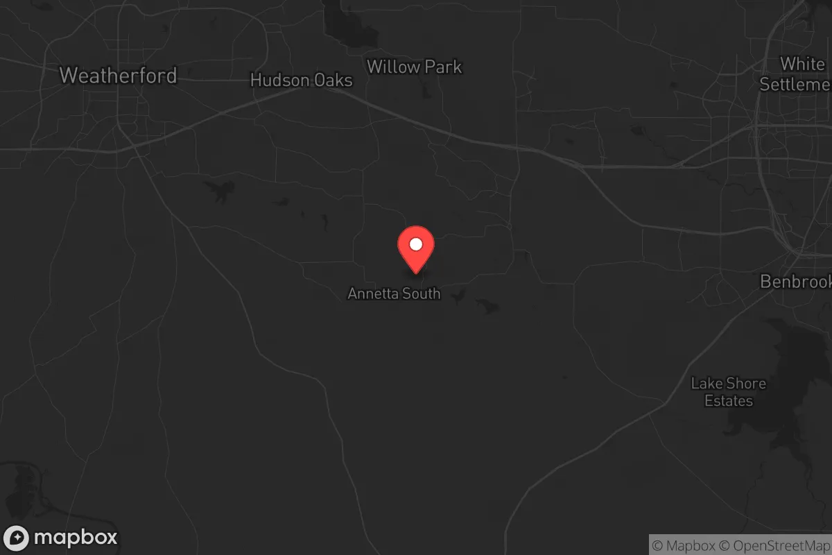
Strategic Assessment of Annetta South, TX
Meaningful friction. Expect exposure to either population pressure, blast zones, or natural disaster risk. Consider buying a retreat property.
What does the Strategic Assessment tell us?
Our Strategic Assessment grades tactical survivability of an area. Major population centers, military targets, fallout zones, natural disasters, and border exposure all drive risk — lower exposure means a more defensible position in a crisis.
This is heavily inspired by Joel Skousen's Strategic Relocation book. Highly recommended you checkout the book ($)What does this tell us?
Our Strategic Assessment grades tactical survivability of an area. Major population centers, military targets, fallout zones, natural disasters, and border exposure all drive risk — lower exposure means a more defensible position in a crisis.
This is heavily inspired by Joel Skousen's Strategic Relocation book. Highly recommended you checkout the book ($)Strategic Pillars

Key Distances
Regional Safe Places
Below is our recommended "safe zones" in Texas and the surrounding area based on our strategic heuristics. For most people, it's unrealistic to live in a “safe zone” full-time due to work, family or other personal reasons. They tend to be more rural. However, many of these areas are perfect for second homes and retreat properties that double as a vacation home or even a short-term rental.


Important Note: For informational purposes only. This does not mean nothing bad ever happens in the green zones. Please use common sense. This is based on public data and modeled with AI. We tried to take a conservative approach but mistakes happen. We update this regularly as new information becomes available.
Solar Generator Recommendations
Backup power matters more here than in safer locations. We've picked three solar generators across budgets and capacity tiers — start with the budget unit if you only need a few essentials, or step up if you want to run a fridge and HVAC for days at a time.

Jackery Portable Power Station Explorer 300
Budget OptionPower on the Go: Weighing only 11 lbs, it's convenient to set up and store with book-sized foldable solar panels

BLUETTI Portable Power Station AC180
Designed for both indoor and outdoor scenarios, AC180 is highly capable as it has a robost capacity and continuous output power.

EF ECOFLOW DELTA Pro Ultra Power Station
Upgraded PickEcoFlow DELTA Pro Ultra is a whole-home energy system designed to grow with your family. Integrated with the Smart Home Panel 2, it scales to meet your evolving energy needs — keeping your home powered, intelligent, and secure through every stage of life.
We earn a commission, at no additional cost to you.
Strategic Assessment Analysis
Annetta South, Texas, offers a strategic paradox for the prepper-minded relocator: it sits close enough to the Dallas-Fort Worth metroplex to access its resources, yet far enough into Parker County’s rural fabric to provide genuine buffer from urban chaos. The town’s resilience stems from its low population density—roughly 500 residents spread over a square mile—and its position along the edge of the Barnett Shale region, which means natural gas infrastructure is abundant. For someone concerned about civic unrest, mass casualty events, or supply chain collapse, this location provides a rare combination of seclusion and logistical access that many more remote towns lack.
Geographic position and natural advantages for long-term security
Annetta South sits roughly 30 miles west of downtown Fort Worth, placing it outside the immediate blast radius of any major urban target while still within a day’s drive of critical medical and industrial hubs. The area is part of the Cross Timbers ecoregion, characterized by rolling hills, post oak and juniper woodlands, and limestone-based soils that support decent well water yields. The Brazos River flows about 10 miles to the south, offering a secondary water source if municipal supplies are compromised. The terrain itself provides natural defensibility: the wooded hills and winding county roads create choke points that would slow any organized movement, whether from looters or government convoys. Parker County’s average annual rainfall of 34 inches supports rain catchment systems, and the growing season of 230 days allows for substantial food production on even a few acres. For a relocator prioritizing self-sufficiency, the land here is more forgiving than the high plains to the west or the piney woods to the east.
Risks, exposures, and proximity to fallout-relevant landmarks
The most significant vulnerability for Annetta South is its proximity to the Dallas-Fort Worth metroplex, a primary target for any large-scale conflict or terrorist event. DFW International Airport is 40 miles east, and the city of Fort Worth hosts major defense contractors like Lockheed Martin (home of the F-35 assembly line) and Bell Textron. These are high-value targets that could draw conventional or asymmetric attacks. Additionally, the Barnett Shale natural gas fields mean there are numerous wellheads, pipelines, and compressor stations within a 10-mile radius. A major pipeline rupture or intentional sabotage could create localized contamination or fire hazards. The area also sits within the 50-mile radius of the Comanche Peak Nuclear Power Plant in Glen Rose, about 35 miles southwest. While a meltdown scenario is low-probability, the prevailing winds from the south-southwest mean fallout could reach Annetta South within hours. On the plus side, the town is far enough from major interstate highways (I-20 runs 8 miles south, I-30 about 15 miles north) that refugee flows from a city evacuation would likely bypass it, funneling instead along those corridors toward Weatherford or Mineral Wells.
Practical resilience for a relocator: food, water, energy, and defensibility
For a single individual or family looking to establish a resilient homestead, Annetta South offers a workable baseline. Water is the first concern: most properties in the area rely on private wells, and the Trinity Aquifer yields moderate volumes at depths of 200-400 feet. A solar-powered pump with a storage tank of 1,000 gallons or more is a practical investment. Rainwater catchment from a 2,000-square-foot roof can yield over 40,000 gallons annually, enough for a family of four with careful use. Food production is viable: the soil is sandy loam over limestone, requiring amendment but capable of producing vegetables, fruit trees (peach, pear, fig), and small grains. Parker County has a strong agricultural extension office and a culture of livestock keeping—chickens, goats, and even cattle are common. Local ordinances in Annetta South are generally lenient; there are no zoning restrictions that prohibit backyard gardens or small animal husbandry, though HOA covenants in some subdivisions may apply. Energy independence is achievable: the region averages 220 sunny days per year, making solar a solid primary source. Natural gas generators are a common backup, given the local infrastructure. Battery storage is advisable, as grid outages during winter storms (like the 2021 Uri event) have proven prolonged. Defensibility is moderate: the town’s layout—scattered homes on 1-5 acre lots with wooded buffers—makes it hard to surveil or approach unnoticed. However, the lack of a natural perimeter (no river or mountain barrier) means a determined group could approach from multiple directions. A well-placed fence, motion-activated lighting, and a neighborhood watch network are practical countermeasures. The local sheriff’s office in Parker County is well-funded and responsive, but response times in a crisis could stretch to 30 minutes or more for outlying properties.
The overall strategic picture for Annetta South is one of calculated trade-offs. It is not a remote bunker location—you will have neighbors, and you will be within earshot of I-20 traffic. But for a relocator who wants to maintain a professional career or access urban healthcare while building a resilient lifestyle, it offers a rare sweet spot. The conservative culture of Parker County is a practical asset: gun ownership is the norm, church networks provide mutual aid, and local government is skeptical of overreach. The biggest risk is complacency—the area feels safe, and it is easy to forget that 40 miles east lies one of the most targeted urban centers in the country. If you prepare for that reality—secure water, stored food, off-grid power, and a plan for evacuation or shelter-in-place—Annetta South can serve as a solid base for weathering whatever comes. If you ignore that proximity, it becomes just another suburb with a longer commute.
* Values derived from national, state, county, city and local statistics and may differ in a specific area. Last updated: 2026-04-28T18:20:24.000Z
Narrative content on this page is AI-generated and may contain mistakes. Verify any details that matter before acting on them.
ReloMaps may earn a commission from affiliate links at no extra cost to you.