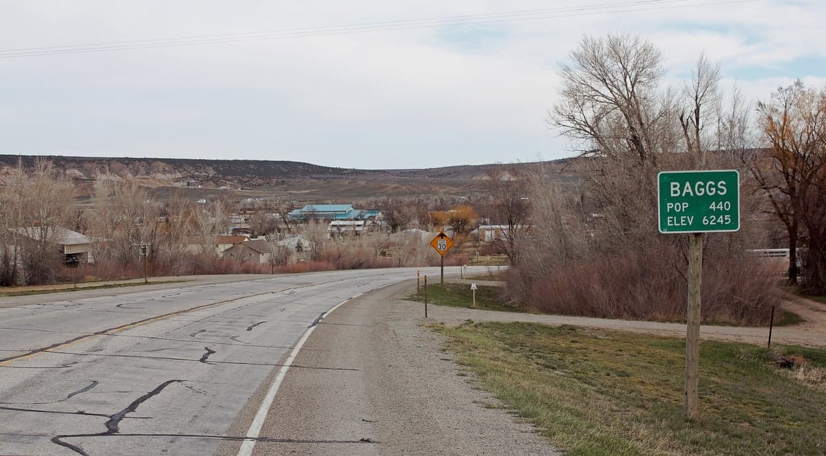
Photo: Wikipedia
Strategic Assessment of Baggs, WY
Strong survivability profile. Good buffer from population centers, with manageable environmental and tactical risks.
What does the Strategic Assessment tell us?
Our Strategic Assessment grades tactical survivability of an area. Major population centers, military targets, fallout zones, natural disasters, and border exposure all drive risk — lower exposure means a more defensible position in a crisis.
This is heavily inspired by Joel Skousen's Strategic Relocation book. Highly recommended you checkout the book ($)What does this tell us?
Our Strategic Assessment grades tactical survivability of an area. Major population centers, military targets, fallout zones, natural disasters, and border exposure all drive risk — lower exposure means a more defensible position in a crisis.
This is heavily inspired by Joel Skousen's Strategic Relocation book. Highly recommended you checkout the book ($)Strategic Pillars

Key Distances
Regional Safe Places
Below is our recommended "safe zones" in Wyoming and the surrounding area based on our strategic heuristics. For most people, it's unrealistic to live in a “safe zone” full-time due to work, family or other personal reasons. They tend to be more rural. However, many of these areas are perfect for second homes and retreat properties that double as a vacation home or even a short-term rental.
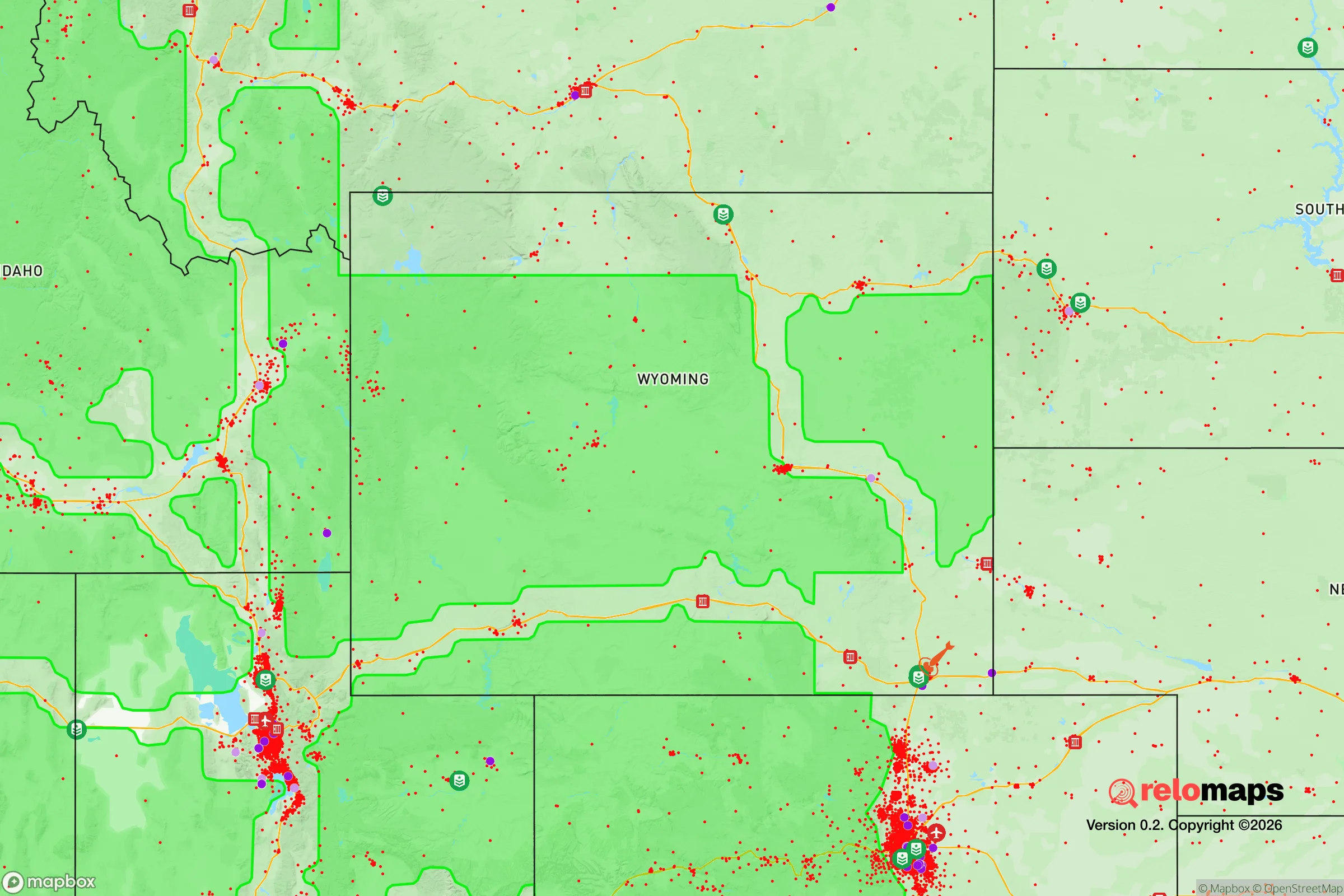
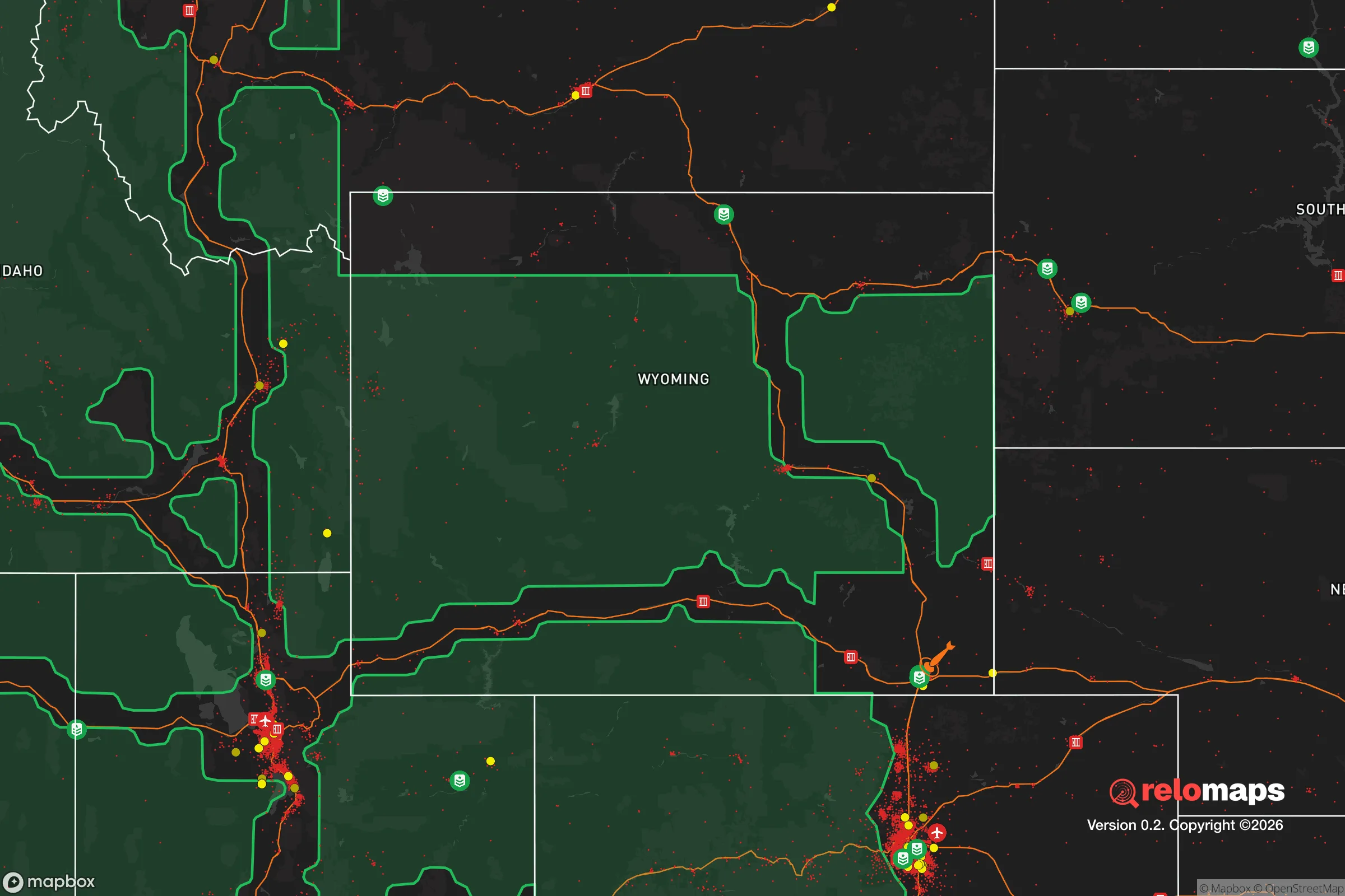
Important Note: For informational purposes only. This does not mean nothing bad ever happens in the green zones. Please use common sense. This is based on public data and modeled with AI. We tried to take a conservative approach but mistakes happen. We update this regularly as new information becomes available.
Solar Generator Recommendations
Backup power matters more here than in safer locations. We've picked three solar generators across budgets and capacity tiers — start with the budget unit if you only need a few essentials, or step up if you want to run a fridge and HVAC for days at a time.

Jackery Portable Power Station Explorer 300
Budget OptionPower on the Go: Weighing only 11 lbs, it's convenient to set up and store with book-sized foldable solar panels

BLUETTI Portable Power Station AC180
Designed for both indoor and outdoor scenarios, AC180 is highly capable as it has a robost capacity and continuous output power.

EF ECOFLOW DELTA Pro Ultra Power Station
Upgraded PickEcoFlow DELTA Pro Ultra is a whole-home energy system designed to grow with your family. Integrated with the Smart Home Panel 2, it scales to meet your evolving energy needs — keeping your home powered, intelligent, and secure through every stage of life.
We earn a commission, at no additional cost to you.
Strategic Assessment Analysis
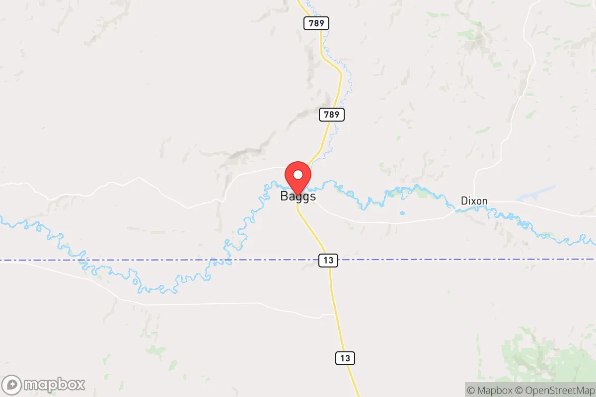
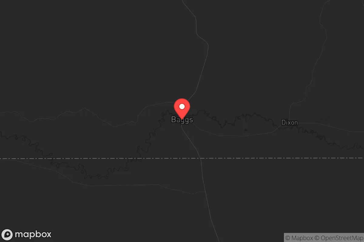
Baggs, Wyoming, sits as a strategic outlier in the modern prepper’s map—a low-population, high-altitude pocket in the Little Snake River Valley that offers genuine geographic isolation without being completely cut off from supply lines. With fewer than 500 residents and the nearest significant population center (Rawlins) over 70 miles away, this town provides a rare combination of natural defensibility, water access, and distance from the kind of cascading failures that would cripple urban corridors in a national emergency. For a relocator thinking in terms of decades, not months, Baggs represents a location where resilience is built into the landscape itself, not bolted on after the fact.
Geographic position and natural advantages for long-term survival
Baggs sits at roughly 6,200 feet elevation in the far south-central part of Wyoming, just north of the Colorado border. The town is cradled by the Little Snake River, which provides a reliable surface water source—a non-negotiable asset in any grid-down scenario. The surrounding landscape is a mix of sagebrush steppe, piñon-juniper woodlands, and the eastern flanks of the Sierra Madre Range. This terrain offers multiple advantages: it’s rugged enough to discourage casual foot traffic, open enough for line-of-sight observation, and high enough to avoid the worst of low-elevation flooding or heat-related agricultural stress. The area’s low population density—Carbon County has roughly 14,000 people spread over 7,900 square miles—means that even in a mass evacuation event, the pressure on local resources would be minimal compared to the Front Range or the Wasatch Front. For a relocator, the key takeaway is that Baggs is positioned far enough from major interstate corridors (I-80 runs 70 miles north, I-70 about 90 miles south) to avoid the refugee flows that would follow any major disaster in Denver, Salt Lake City, or Cheyenne. The town is also within a day’s drive of the Wyoming Range and the Medicine Bow-Routt National Forests, offering additional fallback options if local conditions deteriorate.
Risks, exposures, and proximity to fallout-relevant landmarks
No location is without vulnerabilities, and Baggs has a few that a serious prepper must weigh. The most immediate concern is its proximity to the Colorado Front Range—Denver is roughly 200 miles southeast, but the I-25 corridor is a known chokepoint for any mass movement of people. In a scenario involving a major earthquake along the Wasatch Fault or a coordinated attack on the Front Range’s energy infrastructure, Baggs could see secondary effects from displaced populations, though the distance and terrain would filter out all but the most determined. More directly, the town lies about 120 miles from the Rocky Flats National Wildlife Refuge (former nuclear weapons plant) and roughly 150 miles from the Fort Collins-Loveland area, which hosts significant defense and aerospace contractors. While these distances provide a buffer, they are not absolute—prevailing westerly winds could carry fallout from a dirty bomb or nuclear incident at those sites, though the dispersion over such distance would reduce concentrations significantly. The area also sits in a seismically quiet zone, with no major fault lines nearby, and is far from any active volcanic centers. Flood risk is low due to the elevation and arid climate, though the Little Snake River can rise during spring snowmelt. Wildfire is the most realistic natural hazard—the surrounding sagebrush and juniper can carry fire quickly in dry years, so defensible space and a reliable water source for firefighting are essential. For the conservative relocator, the calculus here is favorable: the risks are manageable with preparation, and the area’s isolation from major military, nuclear, and population targets is a significant net positive.
Practical resilience for a relocator: food, water, energy, and defensibility
Water is Baggs’ strongest card. The Little Snake River flows year-round, and the shallow groundwater table in the valley floor means wells are viable for most properties. A prepper should plan for a hand-pump or solar-powered well system as a backup to any electric pump, and rainwater catchment is feasible given the area’s 10-12 inches of annual precipitation—supplemental, not primary. For food, the growing season is short (roughly 90-100 frost-free days) and the soil is alkaline, but cold-hardy crops like potatoes, carrots, kale, and certain grains can be grown with irrigation. The area supports cattle and sheep grazing, and hunting for mule deer, pronghorn, and elk is legal with proper tags. Small-scale poultry and rabbits are practical for protein. Energy independence is achievable: solar irradiance in this region is excellent (5.5-6.0 peak sun hours per day in summer), and wind is consistent enough for small turbines. Wood heating is viable from nearby national forest lands, though permits are required for cutting. Defensibility is strong—the town has only a few paved roads in and out (Wyoming Highway 789 to the north, Carbon County Road 5 to the south), and the surrounding terrain provides natural chokepoints. A small, organized community could monitor and control access with minimal effort. The nearest law enforcement is the Carbon County Sheriff’s Office in Rawlins, 70 miles away, so self-reliance in security is a given. For a single individual or family, the practical takeaway is that Baggs offers the raw ingredients for a resilient lifestyle, but it demands upfront investment in infrastructure—wells, solar, food storage, and a reliable vehicle capable of navigating snow and rough roads.
The overall strategic picture for Baggs is one of calculated trade-offs. It lacks the immediate convenience of a suburban prepper compound near a major city, but that is precisely the point. In a world where the risks of civil unrest, supply chain collapse, and mass casualty events are rising, the town’s isolation becomes its greatest asset. The conservative relocator who values self-sufficiency, community cohesion, and distance from the chaos of urban centers will find Baggs a viable long-term option—provided they are willing to put in the work to build the infrastructure that the area lacks. It is not a place for those seeking a turnkey solution, but for those who understand that resilience is earned, not bought, it offers a foundation that few other locations in the lower 48 can match.
* Values derived from national, state, county, city and local statistics and may differ in a specific area. Last updated: 2026-05-16T09:59:00.000Z
Narrative content on this page is AI-generated and may contain mistakes. Verify any details that matter before acting on them.
ReloMaps may earn a commission from affiliate links at no extra cost to you.