Photo: Wikipedia
Quality of Life in Bakersfield, CA
A high quality of life with strong walkability, manageable living costs, healthy neighborhood signals, and solid amenity access.
What does Quality of Life tell us?
Quality of Life blends cost of living, nearby amenities, socioeconomic signals, and neighborhood character. City-level scores represent the whole municipality; individual neighborhoods can differ.
What does this tell us?
Quality of Life blends cost of living, nearby amenities, socioeconomic signals, and neighborhood character. City-level scores represent the whole municipality; individual neighborhoods can differ.
Cost of Living
20% above national average
The Real Cost of Living in Bakersfield, CA for 2026
| Tier | Individual | Family (4) |
|---|---|---|
| Survival | $22k | $41k |
| Comfortable | $67k | $99k |
| Luxury | $137k+ | $212k+ |
| Elite (Top 5%) | $161k+ | $250k+ |
78%
The Area Signal
A metric tracking the socioeconomic signals of the area.


Hobbies
Explore the areaGroceries
5 within 10 miles
Gas
0 within 10 miles
Hospital
3 within 20 miles
Airport
SAN — San Luis Obispo County Regional
Post Office
USPS — Bakersfield, CA
Critical Amenities
Quality-of-Life Analysis
Bakersfield presents a mixed quality-of-life profile defined by its status as a major agricultural and energy hub in the southern Central Valley. The city's median household income of roughly $67,000 trails the California average by about $15,000, and its cost of living index of 120 (20% above the U.S. average) reflects a population that is largely working-class, with significant employment in farming, oil extraction, and logistics. While not an affluent community by state standards, Bakersfield offers a more attainable version of California living for those who prioritize space and affordability over coastal proximity.
Cost of living and housing affordability compared to nearby areas
Bakersfield's cost of living is a major draw, sitting well below the California average of roughly 150. The median home value of $347,300 is less than half the state median of around $750,000, and the median rent of $1,371 is similarly affordable relative to cities like Los Angeles ($2,200+) or San Francisco ($3,000+). This affordability gap is stark: a home in Bakersfield costs about what a down payment would be in coastal markets. The average commute of 24 minutes is notably shorter than the state average of 30 minutes, reflecting the city's less congested road network and the prevalence of local employment in agriculture, oil fields, and distribution centers. However, property taxes are effectively higher than in many other states due to California's Proposition 13 limits, and utility costs run above the national average due to summer air conditioning demands in the hot, dry climate.
Schools, amenities, and what daily life feels like
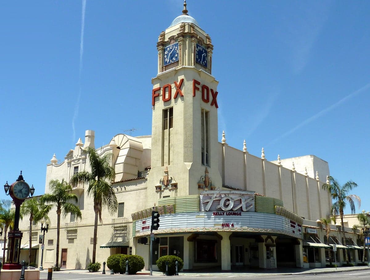
Daily life in Bakersfield is defined by a slower pace and strong community ties, with the Kern River Parkway offering over 30 miles of trails for walking and cycling. The city's public school system, Kern High School District, is one of the largest in the state, but overall academic performance lags behind state averages — only about 35% of students meet math proficiency standards compared to 40% statewide. For families, private and charter options like Stockdale Christian School or the Bakersfield City School District's magnet programs are common alternatives. Amenities are practical rather than cosmopolitan: the Fox Theater hosts concerts, the Kern County Museum covers local history, and the Buck Owens Crystal Palace anchors the city's strong country music heritage. Dining leans toward chain restaurants and Mexican cuisine, with fewer independent fine-dining options than in larger metros. The climate is a defining factor — summer highs regularly exceed 100°F from June through September, making outdoor activity primarily a morning or evening pursuit.
Bakersfield is best suited for individuals and families who prioritize housing affordability and a slower, more grounded lifestyle over coastal amenities or cutting-edge urban culture. It works well for workers in agriculture, energy, logistics, and education who want to own a home on a single income, or for retirees seeking lower costs without leaving California entirely. Those who thrive here tend to value community, tolerate extreme heat, and prefer a no-frills environment where the trade-off for lower housing costs is less cultural diversity and fewer entertainment options. Remote workers with coastal salaries can find exceptional value, but the city's limited public transit and car-dependent layout mean a vehicle is essential.
Crime in Bakersfield, CA
WARNING: The crime statistics are unreliable for this jurisdiction. Local authorities have either not reported or under reported their data to the FBI. This could be due to bad intentions, incompetence or technical issues. Regardless, we suggest skepticism.
Significantly higher crime rates than 81% of comparable U.S. locations.
Violent CrimeViolent Crime Analysis
Property CrimeProperty Crime Analysis
Crime Analysis
Bakersfield, California, faces a serious public safety challenge, with crime rates significantly exceeding both state and national averages. The city's violent crime rate stands at 495.7 incidents per 100,000 residents, and its property crime rate is 2,232.6 per 100,000, placing it among the more dangerous metro areas in the state. These figures reflect a broader trend in Kern County, where progressive criminal justice policies at the county and state level have contributed to a permissive environment for offenders, raising concerns for residents and potential movers.
Crime in context
To understand Bakersfield's safety landscape, it is essential to compare its rates to broader benchmarks. The city's violent crime rate is roughly 30% higher than the California state average and nearly double the national average. Property crime is similarly elevated, at about 40% above the state average and 60% above the national average. These disparities are not accidental. California's progressive justice reforms—including Proposition 47, which reclassified many nonviolent felonies as misdemeanors, and early release programs championed by liberal district attorneys—have reduced penalties for theft and drug offenses. In Kern County, the influence of these policies has been compounded by a local judiciary that often prioritizes rehabilitation over incarceration, leading to higher recidivism and more criminals cycling back onto Bakersfield streets.
What residents experience
For those living in Bakersfield, the high crime rates translate into tangible daily risks. Property crime is the most pervasive issue, with vehicle theft, burglary, and shoplifting being common occurrences. Residents frequently report finding their cars broken into or stolen, particularly in commercial districts and apartment complexes. Violent crime, while less frequent, is more alarming: aggravated assaults and robberies are concentrated in certain neighborhoods, and the city has seen periodic spikes in gang-related violence. The Bakersfield Police Department has struggled to keep pace, with staffing levels that lag behind population growth. Many residents invest in security systems, steering wheel locks, and neighborhood watch programs as a matter of routine. The sense of insecurity is heightened by the knowledge that offenders often face minimal consequences, a direct result of the progressive legal environment that critics argue prioritizes the rights of criminals over the safety of law-abiding citizens.
Neighborhood-level safety varies considerably within Bakersfield. Areas like the Northwest (near Rosedale Highway) and the Southwest (around Stockdale Highway) generally report lower crime rates, with more affluent, suburban-style developments and better-funded police patrols. In contrast, downtown Bakersfield and the Eastside (east of Highway 99) experience higher concentrations of both property and violent crime, often linked to poverty and gang activity. The Oildale neighborhood, just north of downtown, has a reputation for higher crime and drug-related issues. Prospective residents should research specific zip codes and consult local crime maps, as the difference between a safe block and a high-risk one can be just a few streets. Overall, Bakersfield's crime problem is a serious consideration, driven in large part by a justice system that many believe has become too lenient on offenders.
* Values derived from national, state, county, city and local statistics and may differ in a specific area. Last updated: 2026-04-19T20:55:11.000Z
Narrative content on this page is AI-generated and may contain mistakes. Verify any details that matter before acting on them.
ReloMaps may earn a commission from affiliate links at no extra cost to you.