Photo: Wikipedia
Strategic Assessment of Bakersfield, CA
Multiple tactical vulnerabilities. Population density, target proximity, or disaster risk are likely compounding. A retreat property and exit planning is required.
What does the Strategic Assessment tell us?
Our Strategic Assessment grades tactical survivability of an area. Major population centers, military targets, fallout zones, natural disasters, and border exposure all drive risk — lower exposure means a more defensible position in a crisis.
This is heavily inspired by Joel Skousen's Strategic Relocation book. Highly recommended you checkout the book ($)What does this tell us?
Our Strategic Assessment grades tactical survivability of an area. Major population centers, military targets, fallout zones, natural disasters, and border exposure all drive risk — lower exposure means a more defensible position in a crisis.
This is heavily inspired by Joel Skousen's Strategic Relocation book. Highly recommended you checkout the book ($)Strategic Pillars

Key Distances
Regional Safe Places
Below is our recommended "safe zones" in California and the surrounding area based on our strategic heuristics. For most people, it's unrealistic to live in a “safe zone” full-time due to work, family or other personal reasons. They tend to be more rural. However, many of these areas are perfect for second homes and retreat properties that double as a vacation home or even a short-term rental.


Important Note: For informational purposes only. This does not mean nothing bad ever happens in the green zones. Please use common sense. This is based on public data and modeled with AI. We tried to take a conservative approach but mistakes happen. We update this regularly as new information becomes available.
Solar Generator Recommendations
Backup power matters more here than in safer locations. We've picked three solar generators across budgets and capacity tiers — start with the budget unit if you only need a few essentials, or step up if you want to run a fridge and HVAC for days at a time.

Jackery Portable Power Station Explorer 300
Budget OptionPower on the Go: Weighing only 11 lbs, it's convenient to set up and store with book-sized foldable solar panels

BLUETTI Portable Power Station AC180
Designed for both indoor and outdoor scenarios, AC180 is highly capable as it has a robost capacity and continuous output power.

EF ECOFLOW DELTA Pro Ultra Power Station
Upgraded PickEcoFlow DELTA Pro Ultra is a whole-home energy system designed to grow with your family. Integrated with the Smart Home Panel 2, it scales to meet your evolving energy needs — keeping your home powered, intelligent, and secure through every stage of life.
We earn a commission, at no additional cost to you.
Strategic Assessment Analysis
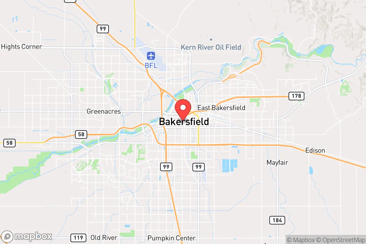
Bakersfield offers a surprisingly strong strategic position for those prioritizing resilience, self-sufficiency, and distance from the most obvious collapse vectors. Tucked at the southern end of the San Joaquin Valley, it sits far enough from California's major coastal population centers—Los Angeles is about 110 miles south, San Francisco about 280 miles north—to avoid the immediate chaos of a major urban event, yet close enough to leverage those regions' resources if needed. The city's economy is rooted in agriculture, oil, and logistics, giving it a working-class, independent character that aligns well with a prepper mindset. For a relocator concerned with civic unrest, mass casualty events, or natural disasters, Bakersfield presents a mixed but ultimately favorable picture: real environmental risks, but strong practical foundations for long-term survival.
Geographic position and natural advantages for long-term survival
Bakersfield's location is its primary strategic asset. It sits in the southern Central Valley, a vast agricultural basin that produces a significant portion of the nation's food—think almonds, grapes, citrus, and dairy. In a prolonged disruption of supply chains, being near the source of calories is a major advantage. The city is also adjacent to the Kern River and sits atop the Kern County oil fields, one of the most productive oil regions in the lower 48 states. This means local access to both water and energy, two resources that become critical when national grids or pipelines falter. The surrounding terrain is flat and open to the west and south, but the Sierra Nevada foothills rise to the east, offering potential retreat areas with elevation, timber, and water catchment. The Tehachapi Mountains to the south provide a natural barrier between Bakersfield and the Los Angeles basin, slowing any northward movement of unrest from that direction. For a relocator, this geographic buffer is worth a lot—it buys time.
Risks, exposures, and proximity to fallout-relevant landmarks
No location is without vulnerabilities, and Bakersfield has several that demand attention. The most immediate is earthquake risk: the city sits near the San Andreas Fault, roughly 30 miles to the west. A major rupture could cause significant ground shaking, liquefaction in low-lying areas, and disruption of roads, pipelines, and power lines. The 1952 Kern County earthquake (magnitude 7.5) caused widespread damage, and a repeat is a matter of when, not if. Flooding is another concern—the Kern River can surge dramatically during heavy snowmelt or rain, and parts of the city lie in floodplains. Air quality is poor year-round due to agricultural dust and trapped pollution, which could complicate respiratory health in a prolonged grid-down scenario. On the human-caused risk side, Bakersfield is within 100 miles of the Diablo Canyon nuclear power plant (near San Luis Obispo) and the San Onofre nuclear plant (now decommissioned but still a waste storage site). A major incident at either would put Bakersfield in a downwind plume zone depending on weather patterns. The city also hosts a major rail hub and interstate highways (I-5 and CA-99) that could become chokepoints or targets during civil unrest. For a prepper, these risks are manageable with planning—but they're real and should factor into any relocation decision.
Practical resilience for a relocator: food, water, energy, and defensibility
Where Bakersfield shines is in the practical, day-to-day resilience that matters most when things go sideways. Food security is exceptional: Kern County is one of the top agricultural producers in the country, and local farmers' markets, CSAs, and bulk suppliers are abundant. A relocator with a few acres can grow a significant portion of their own food, and the growing season is long (nearly year-round). Water access is solid—the Kern River and groundwater basins provide reliable sources, though drought years can tighten allocations. Well drilling is common in rural areas, and rainwater catchment is feasible. Energy is a standout: the county is a major oil and gas producer, and solar potential is high (over 300 sunny days per year). A home with solar panels and battery storage can achieve near-total energy independence. Defensibility is mixed: the city itself is sprawling and flat, making perimeter defense difficult. But the surrounding rural areas—especially east toward Lake Isabella and the Sierra foothills—offer properties with natural chokepoints, elevation, and visibility. For a relocator, the smart play is to buy land or a home on the eastern edge of the county, where you can keep a low profile, store supplies, and have escape routes into the mountains. The local culture is independent and gun-friendly, with a strong hunting and outdoor tradition. That means neighbors are more likely to be assets than liabilities in a crisis.
The overall strategic picture for Bakersfield is one of calculated trade-offs. You get proximity to food, water, and energy production—the three pillars of long-term survival—but you also accept real seismic and flood risks, plus the possibility of fallout from distant nuclear sites. The city's distance from major coastal population centers is a net positive, but the valley's flat terrain and major highways mean it's not a fortress. For a conservative-leaning relocator who values self-reliance, a working-class ethos, and the ability to grow or store your own resources, Bakersfield is a strong candidate—provided you choose your specific location carefully, prepare for the known hazards, and build a network of like-minded neighbors. It's not a bug-out paradise, but it's a solid, defensible base for riding out the storms ahead.
* Values derived from national, state, county, city and local statistics and may differ in a specific area. Last updated: 2026-04-19T20:55:11.000Z
Narrative content on this page is AI-generated and may contain mistakes. Verify any details that matter before acting on them.
ReloMaps may earn a commission from affiliate links at no extra cost to you.