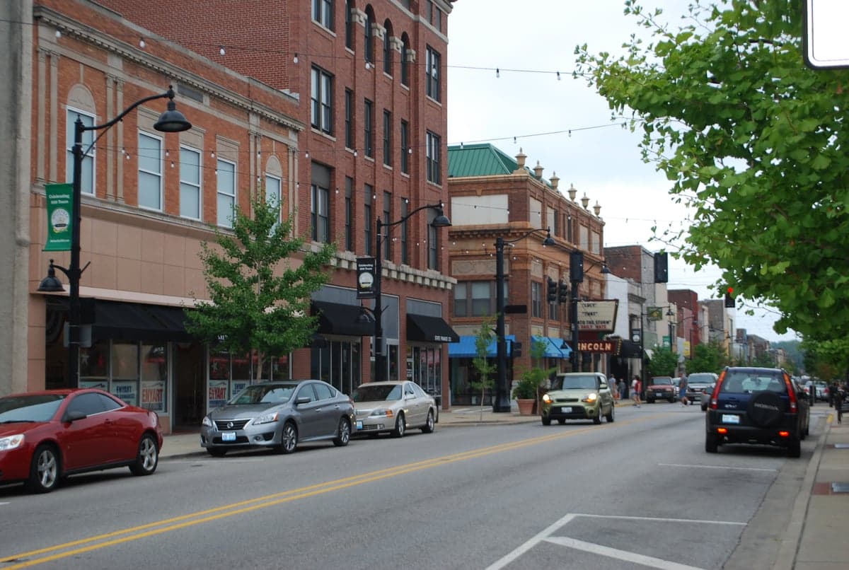
Photo: Wikipedia
Strategic Assessment of Belleville, IL
Meaningful friction. Expect exposure to either population pressure, blast zones, or natural disaster risk. Consider buying a retreat property.
What does the Strategic Assessment tell us?
Our Strategic Assessment grades tactical survivability of an area. Major population centers, military targets, fallout zones, natural disasters, and border exposure all drive risk — lower exposure means a more defensible position in a crisis.
This is heavily inspired by Joel Skousen's Strategic Relocation book. Highly recommended you checkout the book ($)What does this tell us?
Our Strategic Assessment grades tactical survivability of an area. Major population centers, military targets, fallout zones, natural disasters, and border exposure all drive risk — lower exposure means a more defensible position in a crisis.
This is heavily inspired by Joel Skousen's Strategic Relocation book. Highly recommended you checkout the book ($)Strategic Pillars

Key Distances
Regional Safe Places
Below is our recommended "safe zones" in Illinois and the surrounding area based on our strategic heuristics. For most people, it's unrealistic to live in a “safe zone” full-time due to work, family or other personal reasons. They tend to be more rural. However, many of these areas are perfect for second homes and retreat properties that double as a vacation home or even a short-term rental.
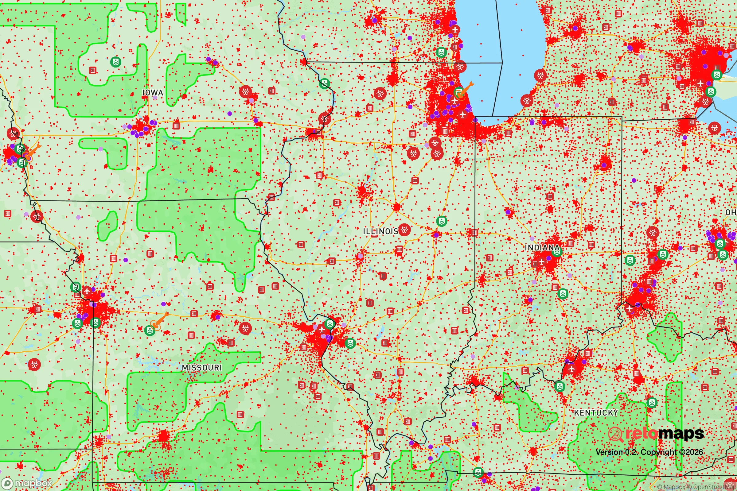
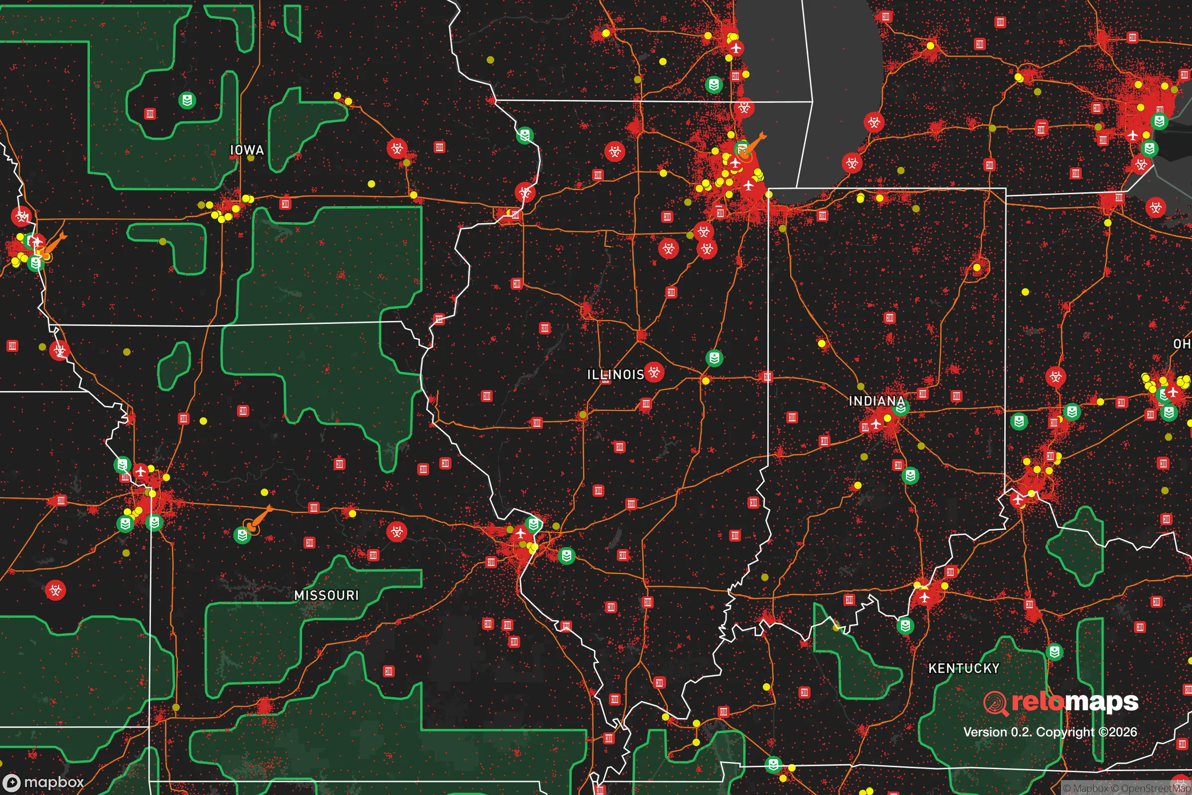
Important Note: For informational purposes only. This does not mean nothing bad ever happens in the green zones. Please use common sense. This is based on public data and modeled with AI. We tried to take a conservative approach but mistakes happen. We update this regularly as new information becomes available.
Solar Generator Recommendations
Backup power matters more here than in safer locations. We've picked three solar generators across budgets and capacity tiers — start with the budget unit if you only need a few essentials, or step up if you want to run a fridge and HVAC for days at a time.

Jackery Portable Power Station Explorer 300
Budget OptionPower on the Go: Weighing only 11 lbs, it's convenient to set up and store with book-sized foldable solar panels

BLUETTI Portable Power Station AC180
Designed for both indoor and outdoor scenarios, AC180 is highly capable as it has a robost capacity and continuous output power.

EF ECOFLOW DELTA Pro Ultra Power Station
Upgraded PickEcoFlow DELTA Pro Ultra is a whole-home energy system designed to grow with your family. Integrated with the Smart Home Panel 2, it scales to meet your evolving energy needs — keeping your home powered, intelligent, and secure through every stage of life.
We earn a commission, at no additional cost to you.
Strategic Assessment Analysis
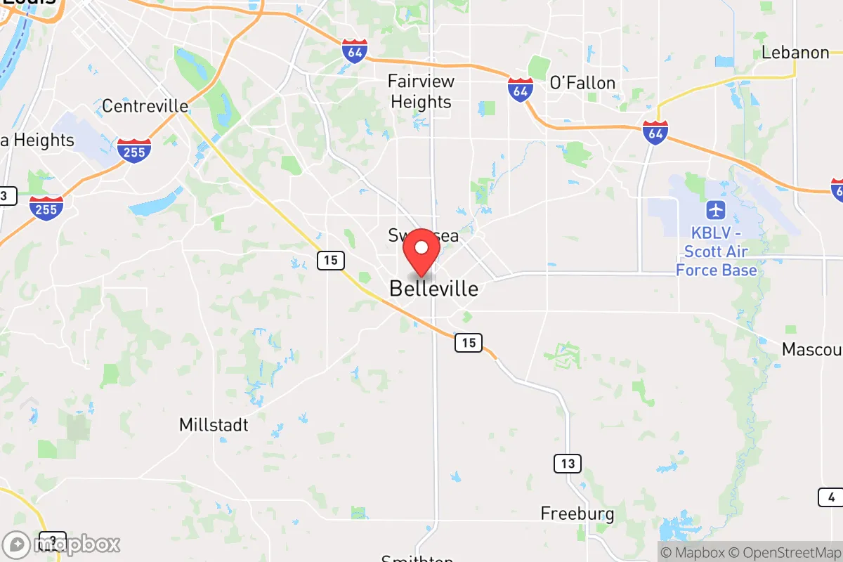
Belleville, Illinois, sits in a precarious but potentially advantageous position for those prioritizing resilience and self-sufficiency. Located about 15 miles southeast of St. Louis, it offers a buffer from the immediate chaos of a major metropolitan area while still providing access to its resources—a double-edged sword in any strategic relocation calculus. For the prepper or survivalist, the key question is whether this proximity to a major urban center and its associated risks can be offset by the area's natural advantages, infrastructure, and community character. The answer, as with most things in preparedness, is nuanced: Belleville presents a viable option for those who understand its specific exposures and are willing to mitigate them.
Geographic position and natural advantages for long-term survival
Belleville's location in the American Bottom floodplain, near the Mississippi River, provides both a blessing and a curse. The region's fertile soil, historically a draw for agriculture, means that local food production is a realistic possibility for those with land or access to community gardens. The surrounding St. Clair County is dotted with smaller towns and rural pockets—like Freeburg, Mascoutah, and Smithton—that offer more acreage and lower population density than the city core. This creates a layered defense: a relocator could live in a semi-rural fringe while still commuting to Belleville for work or supplies. The area's position also places it within a day's drive of multiple biomes—the Ozarks to the south, the Shawnee National Forest to the southeast, and the Great Plains to the west—offering escape routes if conditions deteriorate. However, the flat, open terrain of much of the region provides limited natural cover, making defensibility a challenge without deliberate fortification. The Mississippi River itself is a double-edged asset: it provides a water source and a natural barrier to the west, but its floodplains are prone to inundation, and any bridge or ferry crossing becomes a chokepoint in a crisis.
Risks, exposures, and proximity to fallout-relevant landmarks
The most significant strategic liability for Belleville is its proximity to St. Louis, a major urban center with all the attendant risks: civil unrest, infrastructure collapse, and potential targeting in a conflict. St. Louis is a hub for rail, barge, and interstate traffic (I-55, I-64, I-70), making it a logical chokepoint for supply chains and a likely flashpoint for unrest. The city has a history of civil disturbances, and any large-scale event—whether economic collapse, pandemic, or social breakdown—could send waves of refugees or looters across the Mississippi into Illinois. Belleville itself is home to Scott Air Force Base, a major military installation that is a clear strategic asset but also a potential target. In a war scenario or major terrorist event, the base could be a primary objective, drawing fire or becoming a focal point for military activity that could disrupt civilian life. Additionally, the region is within the New Madrid Seismic Zone, a known earthquake risk. A major quake could devastate the Mississippi River bridges and levees, isolating Belleville from St. Louis and potentially causing catastrophic flooding. The area also has a history of tornadoes, with the 2017 EF-3 tornado that struck the nearby town of Washington serving as a reminder of the region's severe weather exposure. For the prepper, these risks mean that any survival plan must account for both man-made and natural threats, with a strong emphasis on redundancy in transportation and supply routes.
Practical resilience for a relocator: food, water, energy, and defensibility
For a single individual or family looking to establish a resilient foothold, Belleville offers a mixed bag. The local water supply comes from the Mississippi River, treated by Illinois American Water, but a major earthquake or infrastructure failure could disrupt this for weeks. A well on private property is a strong hedge, though groundwater quality varies in the floodplain. The area's agricultural base means that local farmers' markets and CSAs are viable, but reliance on grocery store supply chains is a vulnerability. Energy-wise, the grid is served by Ameren Illinois, with natural gas and coal as primary sources. Solar is feasible, though the region's cloud cover and flat terrain mean lower efficiency than in the Southwest. Wood heating is a practical backup, given the surrounding forests. Defensibility is the weak point: Belleville's suburban layout with cul-de-sacs and open yards offers little natural cover. A relocator should prioritize a property with a basement (for tornado and civil unrest shelter), a perimeter fence, and a location on a dead-end road or cul-de-sac to limit approach vectors. The local gun culture is strong—Illinois has restrictive firearm laws, but St. Clair County is more permissive than Cook County—and a well-stocked armory is a given for any serious prepper. Community-wise, the area has a mix of conservative-leaning rural towns and more liberal suburbs, so finding like-minded neighbors is possible but requires deliberate effort. The presence of Scott Air Force Base also means a transient military population, which can be both a security asset (trained individuals) and a liability (potential for rapid departure in a crisis).
Overall, Belleville represents a strategic compromise for the survivalist: close enough to a major city to access resources and infrastructure, but far enough to avoid the worst of the initial chaos. Its agricultural potential and multiple escape routes are genuine advantages, but the risks from St. Louis, the New Madrid fault, and Scott Air Force Base are non-trivial. For a relocator willing to invest in a well, solar panels, and a defensible property in the rural outskirts, it could serve as a viable base of operations. However, those seeking true isolation and minimal exposure should look further south or west, into the Ozarks or the Plains. Belleville is a middle-ground option—not a fortress, but not a death trap either. It demands active preparation, not passive hope.
* Values derived from national, state, county, city and local statistics and may differ in a specific area. Last updated: 2026-04-23T08:55:30.000Z
Narrative content on this page is AI-generated and may contain mistakes. Verify any details that matter before acting on them.
ReloMaps may earn a commission from affiliate links at no extra cost to you.