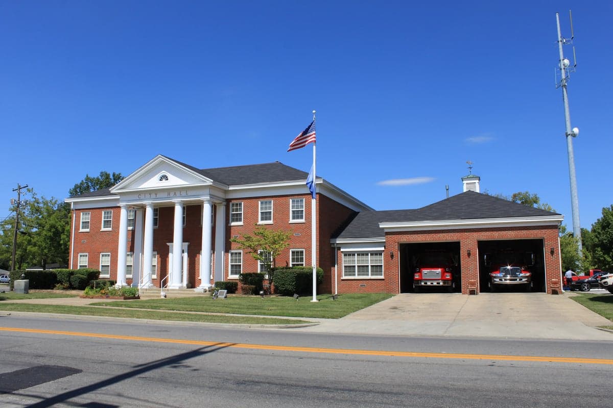
Photo: Wikipedia
Strategic Assessment of Berea, KY
Meaningful friction. Expect exposure to either population pressure, blast zones, or natural disaster risk. Consider buying a retreat property.
What does the Strategic Assessment tell us?
Our Strategic Assessment grades tactical survivability of an area. Major population centers, military targets, fallout zones, natural disasters, and border exposure all drive risk — lower exposure means a more defensible position in a crisis.
This is heavily inspired by Joel Skousen's Strategic Relocation book. Highly recommended you checkout the book ($)What does this tell us?
Our Strategic Assessment grades tactical survivability of an area. Major population centers, military targets, fallout zones, natural disasters, and border exposure all drive risk — lower exposure means a more defensible position in a crisis.
This is heavily inspired by Joel Skousen's Strategic Relocation book. Highly recommended you checkout the book ($)Strategic Pillars

Key Distances
Regional Safe Places
Below is our recommended "safe zones" in Kentucky and the surrounding area based on our strategic heuristics. For most people, it's unrealistic to live in a “safe zone” full-time due to work, family or other personal reasons. They tend to be more rural. However, many of these areas are perfect for second homes and retreat properties that double as a vacation home or even a short-term rental.


Important Note: For informational purposes only. This does not mean nothing bad ever happens in the green zones. Please use common sense. This is based on public data and modeled with AI. We tried to take a conservative approach but mistakes happen. We update this regularly as new information becomes available.
Solar Generator Recommendations
Backup power matters more here than in safer locations. We've picked three solar generators across budgets and capacity tiers — start with the budget unit if you only need a few essentials, or step up if you want to run a fridge and HVAC for days at a time.

Jackery Portable Power Station Explorer 300
Budget OptionPower on the Go: Weighing only 11 lbs, it's convenient to set up and store with book-sized foldable solar panels

BLUETTI Portable Power Station AC180
Designed for both indoor and outdoor scenarios, AC180 is highly capable as it has a robost capacity and continuous output power.

EF ECOFLOW DELTA Pro Ultra Power Station
Upgraded PickEcoFlow DELTA Pro Ultra is a whole-home energy system designed to grow with your family. Integrated with the Smart Home Panel 2, it scales to meet your evolving energy needs — keeping your home powered, intelligent, and secure through every stage of life.
We earn a commission, at no additional cost to you.
Strategic Assessment Analysis
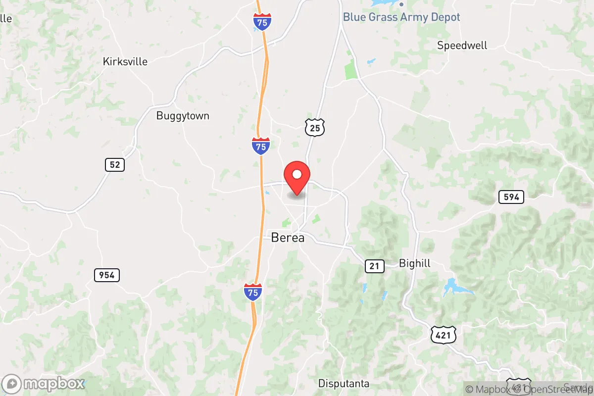
Berea, Kentucky, sits in a sweet spot for those thinking seriously about resilience: close enough to supply lines and infrastructure, far enough from the blast zones and crowd densities that make a major city a liability in a crisis. Nestled at the edge of the Appalachian foothills, this small town of roughly 15,000 offers a mix of rural buffer, local manufacturing, and a surprisingly self-sufficient character that appeals to the prepper mindset. For a single individual or a family looking to hedge against civic unrest, supply chain disruptions, or larger-scale disasters, Berea presents a defensible, resource-rich base that doesn't require going completely off-grid.
Geographic position and natural buffers: why Berea's location works for preparedness
Berea's location at the intersection of I-75 and the Kentucky River palisades gives it a dual advantage: it's connected but not congested. The town sits about 40 miles south of Lexington and 110 miles southeast of Louisville, placing it outside the immediate fallout zone of any major metropolitan target. In a scenario involving civil unrest or a mass casualty event, those 40 miles of rural highway and secondary roads offer a critical buffer. The surrounding Madison County is hilly and wooded, with the Berea College Forest and the Pinnacles providing natural terrain that slows movement and offers cover. The Kentucky River runs just west of town, a reliable water source that doesn't depend on municipal treatment plants. For a relocator, this means you're not trapped in a basin or a floodplain—Berea sits on a ridge, so drainage is good, and the elevation (roughly 1,000 feet) gives you line-of-sight advantages for observation. The area's karst topography (limestone caves and springs) also offers natural shelter options, though you'll want to scout those personally.
Risks, exposures, and proximity to fallout-relevant landmarks
No location is perfect, and Berea has its vulnerabilities. The most obvious is I-75 itself: a major north-south artery that, in a crisis, could become a chokepoint or a vector for displaced populations. During a mass evacuation from Lexington or Knoxville, Berea would see heavy traffic, and the exits at Berea and Mt. Vernon could become contested zones. The Blue Grass Army Depot in Richmond (about 20 miles north) stores chemical weapons and conventional munitions—a legitimate concern if you're thinking about a worst-case scenario involving sabotage or accident. That depot is a high-value target in any conflict scenario, and while the risk is low in peacetime, it's a factor a strategic relocator should weigh. Additionally, the nearby East Kentucky Power Cooperative plant in Clark County is a potential grid-failure point. On the plus side, Berea is far from any nuclear power plant (the nearest is in Tennessee, over 150 miles away) and outside the 50-mile evacuation zone for any major dam failure. The area's biggest natural risk is severe thunderstorms and occasional tornadoes—Madison County is in the Ohio Valley severe weather belt—but the hilly terrain reduces the likelihood of a direct hit compared to flatter areas to the west.
Practical resilience for a relocator: food, water, energy, and defensibility
For a prepper or survivalist, Berea offers several concrete advantages. Water is the first win: the Kentucky River is perennial and accessible at several public access points, and the area's limestone aquifers mean many homes have private wells. Even if municipal water fails, a hand pump or a simple filtration system can keep you supplied. Food production is viable: Madison County has a strong agricultural base, with cattle, poultry, and row crops (corn, soybeans, hay) within a 15-minute drive. The Berea Farmers Market operates year-round, and local farms like Elmwood Stock Farm and Marksbury Farm offer direct-to-consumer meat and produce. For long-term storage, the area has several feed-and-seed stores and a Tractor Supply that stocks bulk grains and supplies. Energy resilience is mixed: the grid is served by Kentucky Utilities, which has a decent reliability record, but ice storms in 2009 and 2022 caused multi-day outages. Solar is viable—the region gets about 200 sunny days per year—and local installers like Solar Energy Solutions operate in the area. Wood heat is a major plus: the Berea College Forest and Daniel Boone National Forest (just east) provide abundant firewood, and most homes have fireplaces or wood stoves. Defensibility is strong: Berea's layout is compact, with a historic downtown grid and residential areas that funnel into a few main roads. The surrounding hills create natural chokepoints, and the Berea College campus (with its own police force and emergency generators) could serve as a community rally point. For a single individual, a small homestead on the outskirts (say, along Brushy Fork Road or off Old Paint Lick Road) offers seclusion without isolation—you're 10 minutes from town but invisible from the main road.
The overall strategic picture for Berea is one of calculated balance. It's not a remote bunker location—you're still within a day's drive of 60% of the U.S. population, which is both a risk and a resource. The town's economic anchor, Berea College, provides a stable, educated population and a culture of self-reliance (the college's student labor program and sustainability initiatives are a net positive). The local government is small and responsive, with a police force that knows the community. For a conservative-leaning relocator who values independence, local control, and the ability to weather a crisis without relying on federal assistance, Berea checks most boxes. The key is to arrive before the crisis, build relationships with neighbors, and secure your own water and energy systems. If you do that, this little town at the edge of the Appalachians can be a solid base for whatever comes next.
* Values derived from national, state, county, city and local statistics and may differ in a specific area. Last updated: 2026-04-21T09:24:13.000Z
Narrative content on this page is AI-generated and may contain mistakes. Verify any details that matter before acting on them.
ReloMaps may earn a commission from affiliate links at no extra cost to you.