
Photo: Wikipedia
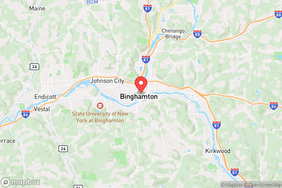
Strategic Assessment of Binghamton, NY
Meaningful friction. Expect exposure to either population pressure, blast zones, or natural disaster risk. Consider buying a retreat property.
What does the Strategic Assessment tell us?
Our Strategic Assessment grades tactical survivability of an area. Major population centers, military targets, fallout zones, natural disasters, and border exposure all drive risk — lower exposure means a more defensible position in a crisis.
This is heavily inspired by Joel Skousen's Strategic Relocation book. Highly recommended you checkout the book ($)What does this tell us?
Our Strategic Assessment grades tactical survivability of an area. Major population centers, military targets, fallout zones, natural disasters, and border exposure all drive risk — lower exposure means a more defensible position in a crisis.
This is heavily inspired by Joel Skousen's Strategic Relocation book. Highly recommended you checkout the book ($)Strategic Pillars

Key Distances
Regional Safe Places
Below is our recommended "safe zones" in New York and the surrounding area based on our strategic heuristics. For most people, it's unrealistic to live in a “safe zone” full-time due to work, family or other personal reasons. They tend to be more rural. However, many of these areas are perfect for second homes and retreat properties that double as a vacation home or even a short-term rental.


Important Note: For informational purposes only. This does not mean nothing bad ever happens in the green zones. Please use common sense. This is based on public data and modeled with AI. We tried to take a conservative approach but mistakes happen. We update this regularly as new information becomes available.
Solar Generator Recommendations
Backup power matters more here than in safer locations. We've picked three solar generators across budgets and capacity tiers — start with the budget unit if you only need a few essentials, or step up if you want to run a fridge and HVAC for days at a time.

Jackery Portable Power Station Explorer 300
Budget OptionPower on the Go: Weighing only 11 lbs, it's convenient to set up and store with book-sized foldable solar panels

BLUETTI Portable Power Station AC180
Designed for both indoor and outdoor scenarios, AC180 is highly capable as it has a robost capacity and continuous output power.

EF ECOFLOW DELTA Pro Ultra Power Station
Upgraded PickEcoFlow DELTA Pro Ultra is a whole-home energy system designed to grow with your family. Integrated with the Smart Home Panel 2, it scales to meet your evolving energy needs — keeping your home powered, intelligent, and secure through every stage of life.
We earn a commission, at no additional cost to you.
Strategic Assessment Analysis
Binghamton, New York, occupies a surprisingly strategic position for those prioritizing resilience and self-sufficiency, though it is not without significant trade-offs. Nestled in the Southern Tier at the confluence of the Susquehanna and Chenango Rivers, this small city of roughly 44,000 offers a blend of geographic isolation from major metropolitan chaos and access to critical infrastructure that a savvy relocator should understand. For a conservative-leaning individual or family looking to weather civic unrest, economic volatility, or large-scale disasters, Binghamton presents a mixed bag: a quiet, affordable, and defensible location that sits uncomfortably close to certain high-value targets and natural floodplains.
Geographic position and natural advantages for long-term stability
Binghamton’s primary strategic asset is its location in a valley surrounded by the rolling hills of the Appalachian Plateau. This terrain provides natural chokepoints and defensible positions, making large-scale incursions or chaotic mob movements difficult. The city is roughly 70 miles from Scranton, Pennsylvania, and 150 miles from New York City—close enough to monitor urban trends but far enough to avoid the immediate fallout of a major event. The surrounding area is dotted with small towns like Endicott, Johnson City, and Vestal, which offer additional buffer zones and potential resupply points. The region’s low population density (Broome County has about 190,000 residents) means less competition for resources in a crisis, and the local economy is anchored by stable employers like Binghamton University and Lockheed Martin, which provide skilled labor and technical expertise without the chaos of a major metro. The Susquehanna River and its tributaries offer a reliable water source, though this comes with a major caveat we’ll cover shortly.
Risks, exposures, and proximity to fallout-relevant landmarks
Here’s where the analysis gets sobering. Binghamton’s location is not a fortress. The city lies within 50 miles of the New York-Pennsylvania border, which is a corridor for major transportation routes like Interstate 81 and 86. In a national emergency, these highways could become clogged with refugees or military convoys, turning the area into a bottleneck. More concerning is the proximity to critical infrastructure: the Nine Mile Point Nuclear Generating Station is about 90 miles northwest near Oswego, and the Indian Point Energy Center (though decommissioned) is within 150 miles. While not immediate blast zones, prevailing winds could carry fallout from a nuclear incident or attack into the Southern Tier. Additionally, the region is home to several large-scale data centers and defense contractors (like BAE Systems in nearby Endicott), which could be secondary targets in a cyber or kinetic conflict. For the prepper, the biggest day-to-day risk is flooding: the Susquehanna has a history of devastating floods, including the 2011 record crest that inundated downtown. Any serious plan must account for flood-proofing or elevation above the 100-year floodplain.
Practical resilience for a relocator: food, water, energy, and defensibility
On the practical side, Binghamton offers several advantages for the self-reliant. The region has a strong agricultural base—farms and orchards dot the surrounding hills, and the local farmers’ markets (like the Binghamton Farmers Market) provide fresh produce and meat. For long-term food security, the soil is fertile, and the growing season (roughly 150 days) allows for substantial gardening. Water is abundant from the rivers and numerous small creeks, but filtration and treatment are non-negotiable due to agricultural runoff and potential contamination. Energy-wise, the area is served by New York State Electric & Gas (NYSEG), but grid reliability is a concern during winter storms. Solar is viable, though the valley’s frequent cloud cover reduces efficiency; a backup generator with a propane or diesel supply is a wise investment. Defensibility is decent: the hilly terrain and limited road access make it easy to secure a rural property outside city limits. The local gun culture is strong—New York’s restrictive laws notwithstanding—and there are several shooting ranges and outdoor sportsmen’s clubs. However, the city itself is not defensible; its dense downtown and aging infrastructure would be a liability in a breakdown scenario. The smart play is to buy land in the surrounding townships (like Chenango or Colesville) where zoning is lax and neighbors are sparse.
The overall strategic picture for a conservative relocator
So where does that leave the strategic relocator? Binghamton is not a prepper’s paradise—it lacks the extreme isolation of Montana or the arid self-sufficiency of the Southwest. But for someone who needs to stay within a day’s drive of the Northeast corridor for work or family, it’s a solid middle-ground option. The low cost of living (median home price around $150,000) allows for significant investment in supplies, land, and infrastructure. The local political climate is mixed—Broome County leans purple, with a conservative rural base that respects property rights and self-reliance, though the city itself is more progressive. For a conservative family, the key is to avoid the city core and focus on the outlying hills, where you can build a resilient homestead with good water, defensible terrain, and a community of like-minded individuals. The risks—flooding, proximity to potential targets, and New York’s regulatory environment—are real but manageable with proper planning. Binghamton won’t save you from a nuclear exchange or a complete societal collapse, but for weathering the storms of the next decade—economic, political, or environmental—it offers a quiet, affordable, and strategically sound base of operations. Just keep your bug-out bag ready and your flood insurance paid up.
* Values derived from national, state, county, city and local statistics and may differ in a specific area. Last updated: 2026-05-01T00:47:30.000Z
Narrative content on this page is AI-generated and may contain mistakes. Verify any details that matter before acting on them.
ReloMaps may earn a commission from affiliate links at no extra cost to you.