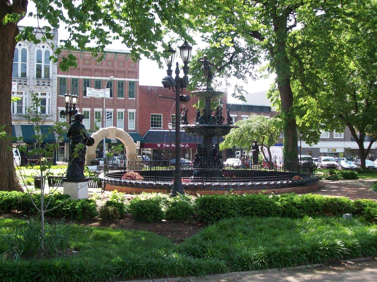
Photo: Wikipedia
Strategic Assessment of Bowling Green, KY
Workable tactical position. Some exposure to population density or targets, but generally defensible in a crisis.
What does the Strategic Assessment tell us?
Our Strategic Assessment grades tactical survivability of an area. Major population centers, military targets, fallout zones, natural disasters, and border exposure all drive risk — lower exposure means a more defensible position in a crisis.
This is heavily inspired by Joel Skousen's Strategic Relocation book. Highly recommended you checkout the book ($)What does this tell us?
Our Strategic Assessment grades tactical survivability of an area. Major population centers, military targets, fallout zones, natural disasters, and border exposure all drive risk — lower exposure means a more defensible position in a crisis.
This is heavily inspired by Joel Skousen's Strategic Relocation book. Highly recommended you checkout the book ($)Strategic Pillars

Key Distances
Regional Safe Places
Below is our recommended "safe zones" in Kentucky and the surrounding area based on our strategic heuristics. For most people, it's unrealistic to live in a “safe zone” full-time due to work, family or other personal reasons. They tend to be more rural. However, many of these areas are perfect for second homes and retreat properties that double as a vacation home or even a short-term rental.


Important Note: For informational purposes only. This does not mean nothing bad ever happens in the green zones. Please use common sense. This is based on public data and modeled with AI. We tried to take a conservative approach but mistakes happen. We update this regularly as new information becomes available.
Solar Generator Recommendations
Backup power matters more here than in safer locations. We've picked three solar generators across budgets and capacity tiers — start with the budget unit if you only need a few essentials, or step up if you want to run a fridge and HVAC for days at a time.

Jackery Portable Power Station Explorer 300
Budget OptionPower on the Go: Weighing only 11 lbs, it's convenient to set up and store with book-sized foldable solar panels

BLUETTI Portable Power Station AC180
Designed for both indoor and outdoor scenarios, AC180 is highly capable as it has a robost capacity and continuous output power.

EF ECOFLOW DELTA Pro Ultra Power Station
Upgraded PickEcoFlow DELTA Pro Ultra is a whole-home energy system designed to grow with your family. Integrated with the Smart Home Panel 2, it scales to meet your evolving energy needs — keeping your home powered, intelligent, and secure through every stage of life.
We earn a commission, at no additional cost to you.
Strategic Assessment Analysis
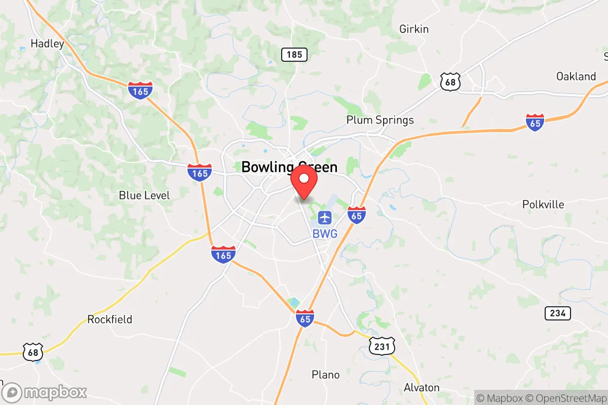
Bowling Green, Kentucky, sits in a strategic sweet spot that resilience-minded relocators should take seriously: far enough from major metropolitan chaos to offer genuine buffer, yet close enough to critical infrastructure and supply lines to avoid isolation. The city’s position along Interstate 65 places it roughly 65 miles north of Nashville and 110 miles south of Louisville, giving you a practical distance from the immediate fallout zones of either city while still allowing access to their medical and logistical resources if needed. Warren County’s population of roughly 135,000 provides enough local economy and community density to sustain essential services without the vulnerability of a dense urban core. For someone thinking in terms of civic unrest, supply chain disruptions, or large-scale disasters, Bowling Green offers a balance of proximity and separation that few midsized American cities can match.
Geographic position and natural advantages for long-term stability
Bowling Green’s geography is its first line of defense. The city sits in the Pennyroyal Plateau region, characterized by rolling hills, limestone bedrock, and abundant groundwater — a combination that supports both agriculture and reliable well water. The Barren River runs through the area, providing a surface water source that, while not massive, is sufficient for small-scale irrigation and emergency supply. The region’s karst topography means numerous springs and aquifers, which historically have kept the area resilient during droughts that plague other parts of the country. The climate is temperate, with four distinct seasons but no extreme weather patterns that would force mass evacuation — tornado risk exists but is lower than in the Deep South or Plains states. The surrounding farmland is some of the most productive in Kentucky, with soybeans, corn, and tobacco as staples, meaning local food production is a realistic option rather than a theoretical one. The lack of major military installations, nuclear power plants, or high-value industrial targets within a 50-mile radius reduces the likelihood of being caught in a primary strike or secondary fallout plume during a major conflict or terrorist event. For a relocator prioritizing long-term stability, the natural advantages here are quiet but real.
Risks, exposures, and proximity to fallout-relevant landmarks
No location is immune, and Bowling Green has its own set of vulnerabilities that a prepper must account for. The most significant risk is the city’s position along I-65, a major north-south evacuation and supply corridor. In the event of a Nashville-area disaster — whether natural, terrorist, or civil unrest — this highway could become a chokepoint for refugees fleeing north, potentially overwhelming local resources and law enforcement. The city itself has a small but active industrial base, including a General Motors Corvette assembly plant and a Fruit of the Loom distribution center, which could become targets for sabotage or labor-related unrest. The nearby Mammoth Cave National Park, while a natural asset, also draws significant tourist traffic that could complicate evacuation scenarios. More concerning is the proximity to the Tennessee Valley Authority’s nuclear facilities: the Browns Ferry Nuclear Plant in Alabama is about 150 miles south, and the Sequoyah Nuclear Plant near Chattanooga is roughly 160 miles southeast. While these distances provide some buffer, prevailing wind patterns in the region can carry fallout from a catastrophic failure into south-central Kentucky. The city’s reliance on a single major interstate for both supply and evacuation is a structural weakness — secondary routes like US 231 and KY 185 exist but are not designed for mass throughput. For the strategic relocator, these risks are manageable with proper planning, but they cannot be ignored.
Practical resilience for a relocator: food, water, energy, and defensibility
Bowling Green’s practical resilience comes down to four pillars: food, water, energy, and defensibility. On food, the surrounding agricultural base is strong — Warren County has over 1,200 farms, many of which are small family operations that could be tapped for local sourcing in a crisis. The city’s farmers’ markets and co-ops are active, and the presence of Kentucky’s agricultural extension services means local knowledge on gardening, livestock, and food preservation is accessible. Water is the stronger asset: the Bowling Green municipal water supply draws from the Barren River and several deep wells, but the real advantage is the abundance of private wells and springs in the rural areas just outside city limits. A property with a tested well and a hand pump is a realistic goal here, not a fantasy. Energy infrastructure is more mixed. The city is served by the Tennessee Valley Authority grid, which is reliable but centralized — a major grid failure would affect the entire region. However, the prevalence of natural gas in the area and the growing number of solar installations on rural properties offer off-grid options. Bowling Green’s topography — rolling hills, wooded areas, and river valleys — provides natural defensibility for a well-chosen property. The city itself is not easily fortified, but the surrounding countryside offers numerous choke points and concealment opportunities for those willing to live 15–20 minutes outside the urban core. Law enforcement presence is adequate but not overwhelming; the Warren County Sheriff’s Office and Bowling Green Police Department maintain a visible presence, but in a widespread crisis, self-reliance would be the primary expectation.
The overall strategic picture for Bowling Green is one of cautious optimism for the resilience-minded relocator. It offers a genuine buffer from the most likely flashpoints of civil unrest and large-scale disaster while still providing access to the economic and medical infrastructure that makes daily life sustainable. The risks — primarily the I-65 corridor and the distant but real nuclear threat — are manageable with proper planning, property selection, and community building. For a conservative-leaning individual or family looking to plant roots in a place that values self-sufficiency, local governance, and traditional community structures, Bowling Green represents a solid, if not spectacular, option. It is not a bunker, but it is a base — and in the current strategic environment, a defensible base with good water and local food is worth more than a dozen urban safe rooms. The key is to act before the window closes, as the area is already seeing increased interest from those with the same calculus.
* Values derived from national, state, county, city and local statistics and may differ in a specific area. Last updated: 2026-04-21T09:51:58.000Z
Narrative content on this page is AI-generated and may contain mistakes. Verify any details that matter before acting on them.
ReloMaps may earn a commission from affiliate links at no extra cost to you.