Photo: Wikipedia
Strategic Assessment of Brewer, ME
Meaningful friction. Expect exposure to either population pressure, blast zones, or natural disaster risk. Consider buying a retreat property.
What does the Strategic Assessment tell us?
Our Strategic Assessment grades tactical survivability of an area. Major population centers, military targets, fallout zones, natural disasters, and border exposure all drive risk — lower exposure means a more defensible position in a crisis.
This is heavily inspired by Joel Skousen's Strategic Relocation book. Highly recommended you checkout the book ($)What does this tell us?
Our Strategic Assessment grades tactical survivability of an area. Major population centers, military targets, fallout zones, natural disasters, and border exposure all drive risk — lower exposure means a more defensible position in a crisis.
This is heavily inspired by Joel Skousen's Strategic Relocation book. Highly recommended you checkout the book ($)Strategic Pillars

Key Distances
Regional Safe Places
Below is our recommended "safe zones" in Maine and the surrounding area based on our strategic heuristics. For most people, it's unrealistic to live in a “safe zone” full-time due to work, family or other personal reasons. They tend to be more rural. However, many of these areas are perfect for second homes and retreat properties that double as a vacation home or even a short-term rental.


Important Note: For informational purposes only. This does not mean nothing bad ever happens in the green zones. Please use common sense. This is based on public data and modeled with AI. We tried to take a conservative approach but mistakes happen. We update this regularly as new information becomes available.
Solar Generator Recommendations
Backup power matters more here than in safer locations. We've picked three solar generators across budgets and capacity tiers — start with the budget unit if you only need a few essentials, or step up if you want to run a fridge and HVAC for days at a time.

Jackery Portable Power Station Explorer 300
Budget OptionPower on the Go: Weighing only 11 lbs, it's convenient to set up and store with book-sized foldable solar panels

BLUETTI Portable Power Station AC180
Designed for both indoor and outdoor scenarios, AC180 is highly capable as it has a robost capacity and continuous output power.

EF ECOFLOW DELTA Pro Ultra Power Station
Upgraded PickEcoFlow DELTA Pro Ultra is a whole-home energy system designed to grow with your family. Integrated with the Smart Home Panel 2, it scales to meet your evolving energy needs — keeping your home powered, intelligent, and secure through every stage of life.
We earn a commission, at no additional cost to you.
Strategic Assessment Analysis
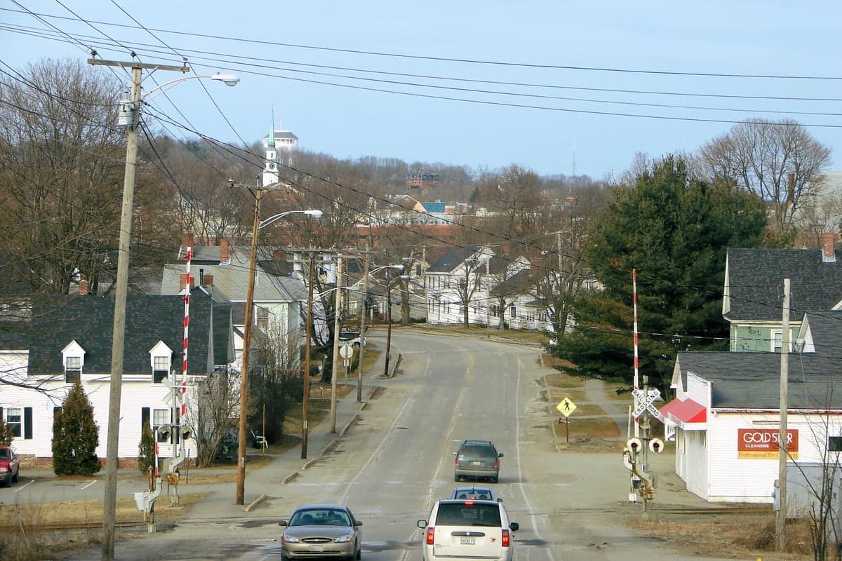
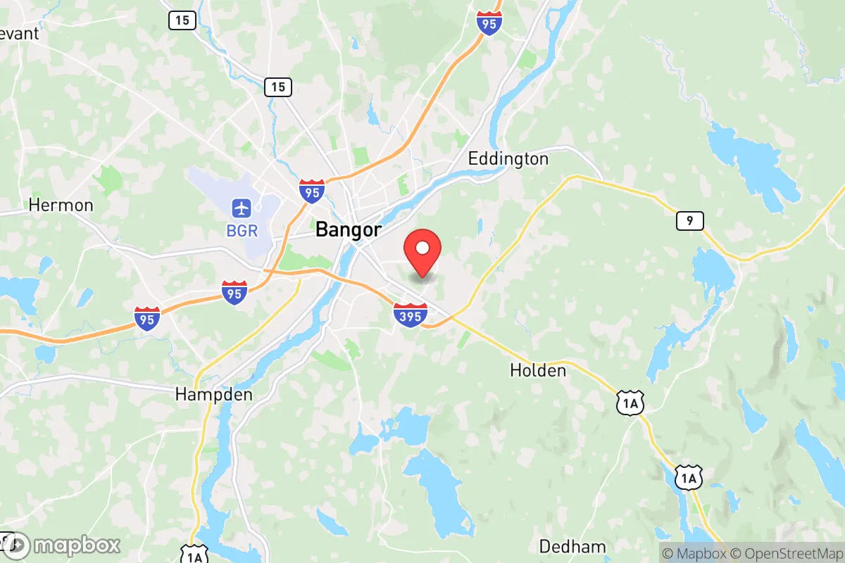
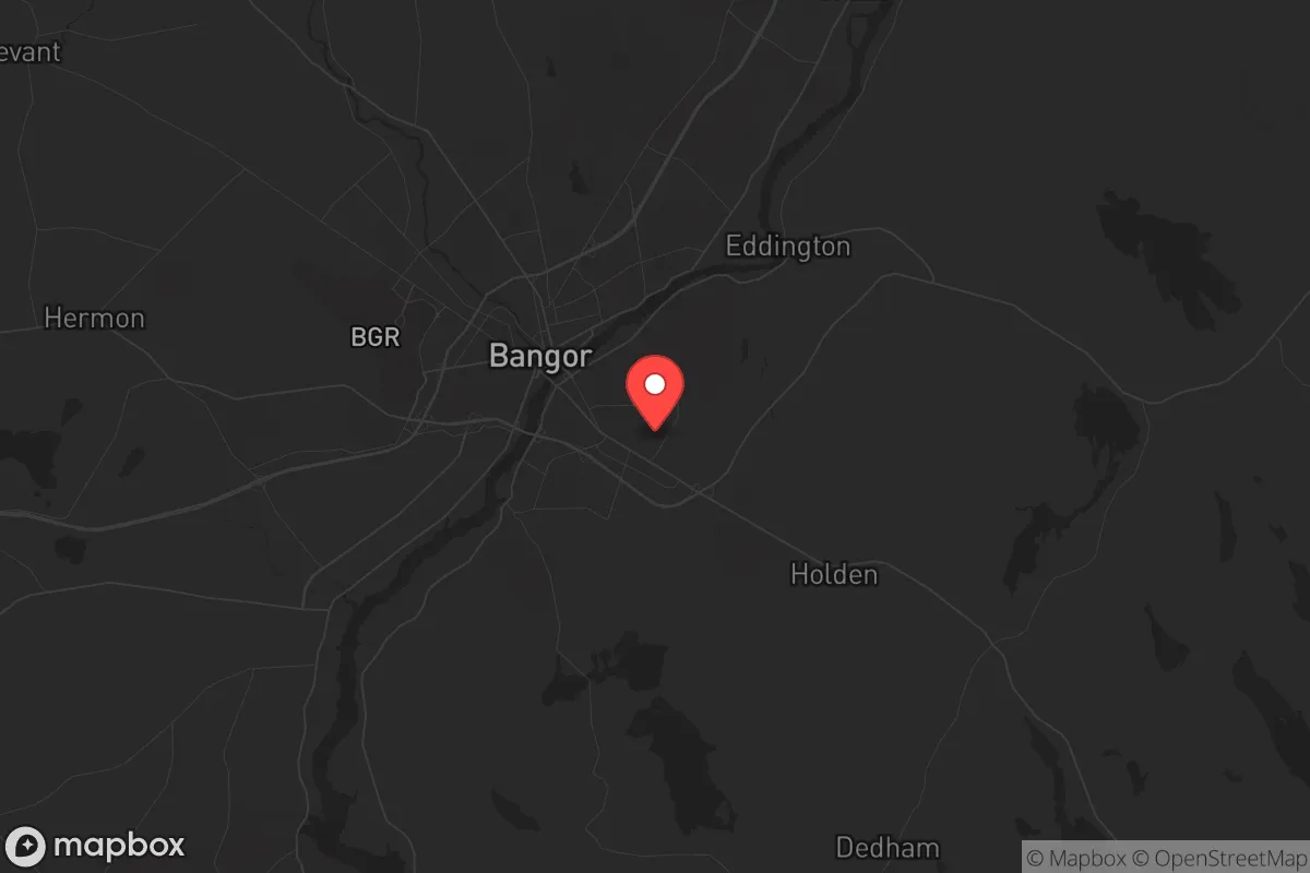
Brewer, Maine, offers a compelling strategic position for those prioritizing resilience and self-sufficiency, sitting just across the Penobscot River from Bangor but maintaining a distinctly lower profile. This small city of roughly 9,500 people provides a buffer from the denser population centers while still granting access to essential infrastructure. For a relocator with a prepper mindset, Brewer’s key advantage is its location at the edge of Maine’s vast, sparsely populated interior, offering both a defensible retreat and a logistical link to the coast.
Geographic position and natural advantages for long-term security
Brewer sits at the confluence of the Penobscot River and the Souadabscook Stream, providing abundant freshwater resources and a natural barrier against easy approach from the east. The city is roughly 30 miles inland from the Atlantic coast at Penobscot Bay, placing it outside the immediate blast radius of any coastal port target while still allowing access to maritime resources if needed. The surrounding landscape is a mix of working forests, small farms, and low-density residential areas, with the Maine Highlands to the north offering thousands of square miles of remote terrain for retreat or foraging. The area’s cold winters and deep snowpack act as a natural deterrent to unprepared transient populations, and the local economy is rooted in forestry, healthcare, and education—sectors that tend to remain functional during disruptions. Brewer’s position along Interstate 395 and Route 1A provides a direct route to the Canadian border at Houlton (about 90 miles northeast), a potential secondary egress point if domestic conditions deteriorate.
Risks, exposures, and proximity to fallout-relevant landmarks
The most significant strategic liability is Brewer’s proximity to Bangor, a city of roughly 32,000 that hosts Bangor International Airport (BGR), a joint-use civilian and military airfield. BGR is a regular refueling stop for military aircraft, including C-5 Galaxies and KC-135 tankers, making it a potential target in a conflict scenario. The airport is about 5 miles from downtown Brewer, placing the city within a plausible fallout zone if the airfield were struck. Additionally, the Penobscot River bridges connecting Brewer to Bangor are chokepoints that could become contested or blocked during civil unrest, limiting mobility. The Maine Army National Guard’s Bangor Armory and the nearby Naval Computer and Telecommunications Station in Cutler (about 100 miles east) add to the region’s military footprint. On the positive side, Brewer is far from major metropolitan areas—Boston is 240 miles south, and Portland is 130 miles south—reducing the risk of spillover from urban unrest. There are no nuclear power plants within 100 miles; the nearest is Seabrook Station in New Hampshire, over 160 miles away. The area’s primary natural risk is winter storms and occasional ice jams on the Penobscot, which can cause localized flooding but are predictable and manageable with proper preparation.
Practical resilience for a relocator: food, water, energy, and defensibility
Brewer’s practical resilience hinges on its access to freshwater and arable land. The Penobscot River is a reliable year-round water source, though treatment would be necessary after a disruption. The city’s water utility draws from groundwater wells, which are less vulnerable to surface contamination than reservoir systems. For food security, the surrounding Penobscot County has a strong agricultural base, with dozens of small farms producing dairy, vegetables, and maple syrup within a 20-mile radius. The Brewer Farmers Market operates seasonally, and local food co-ops in Bangor provide bulk purchasing options. For energy, Maine’s grid is relatively isolated from the rest of New England, which can be a double-edged sword: it’s less likely to be targeted, but also less redundant. Solar potential is moderate due to winter cloud cover, but wood heat is a practical and widely used alternative—Maine is the most forested state in the nation, and firewood is cheap and abundant. Defensibility is moderate: Brewer’s residential neighborhoods are spread out with natural tree cover, but the city’s layout along the river means there are only a few road bridges into Bangor, which could be monitored or blocked. Single-family homes on the city’s outskirts, particularly along the Souadabscook Stream or near the Brewer Lake area, offer better standoff distance and multiple egress routes via logging roads. The local police department is small (about 20 officers), so in a prolonged crisis, residents would need to rely on mutual aid networks and personal preparedness rather than expecting rapid official response.
Overall, Brewer presents a balanced strategic picture for the conservative prepper: it’s close enough to Bangor’s hospitals, hardware stores, and supply chains to be practical for daily life, but far enough from high-value targets to avoid being a primary fallout zone. The city’s small size, river access, and proximity to Maine’s vast interior make it a viable base for a self-reliant lifestyle, provided the relocator accounts for the winter heating demand and the potential for bridge closures during unrest. For a single individual or family willing to invest in wood heat, water filtration, and a vehicle capable of navigating unplowed roads, Brewer offers a defensible foothold in a region that remains one of the least densely populated in the eastern United States. The trade-off is accepting that you’re living in a cold, remote area with limited economic opportunity—but for those prioritizing security over convenience, that’s precisely the point.
* Values derived from national, state, county, city and local statistics and may differ in a specific area. Last updated: 2026-05-01T10:44:49.000Z
Narrative content on this page is AI-generated and may contain mistakes. Verify any details that matter before acting on them.
ReloMaps may earn a commission from affiliate links at no extra cost to you.