
Photo: Wikipedia
Strategic Assessment of Bridgeport, TX
Meaningful friction. Expect exposure to either population pressure, blast zones, or natural disaster risk. Consider buying a retreat property.
What does the Strategic Assessment tell us?
Our Strategic Assessment grades tactical survivability of an area. Major population centers, military targets, fallout zones, natural disasters, and border exposure all drive risk — lower exposure means a more defensible position in a crisis.
This is heavily inspired by Joel Skousen's Strategic Relocation book. Highly recommended you checkout the book ($)What does this tell us?
Our Strategic Assessment grades tactical survivability of an area. Major population centers, military targets, fallout zones, natural disasters, and border exposure all drive risk — lower exposure means a more defensible position in a crisis.
This is heavily inspired by Joel Skousen's Strategic Relocation book. Highly recommended you checkout the book ($)Strategic Pillars

Key Distances
Regional Safe Places
Below is our recommended "safe zones" in Texas and the surrounding area based on our strategic heuristics. For most people, it's unrealistic to live in a “safe zone” full-time due to work, family or other personal reasons. They tend to be more rural. However, many of these areas are perfect for second homes and retreat properties that double as a vacation home or even a short-term rental.


Important Note: For informational purposes only. This does not mean nothing bad ever happens in the green zones. Please use common sense. This is based on public data and modeled with AI. We tried to take a conservative approach but mistakes happen. We update this regularly as new information becomes available.
Solar Generator Recommendations
Backup power matters more here than in safer locations. We've picked three solar generators across budgets and capacity tiers — start with the budget unit if you only need a few essentials, or step up if you want to run a fridge and HVAC for days at a time.

Jackery Portable Power Station Explorer 300
Budget OptionPower on the Go: Weighing only 11 lbs, it's convenient to set up and store with book-sized foldable solar panels

BLUETTI Portable Power Station AC180
Designed for both indoor and outdoor scenarios, AC180 is highly capable as it has a robost capacity and continuous output power.

EF ECOFLOW DELTA Pro Ultra Power Station
Upgraded PickEcoFlow DELTA Pro Ultra is a whole-home energy system designed to grow with your family. Integrated with the Smart Home Panel 2, it scales to meet your evolving energy needs — keeping your home powered, intelligent, and secure through every stage of life.
We earn a commission, at no additional cost to you.
Strategic Assessment Analysis
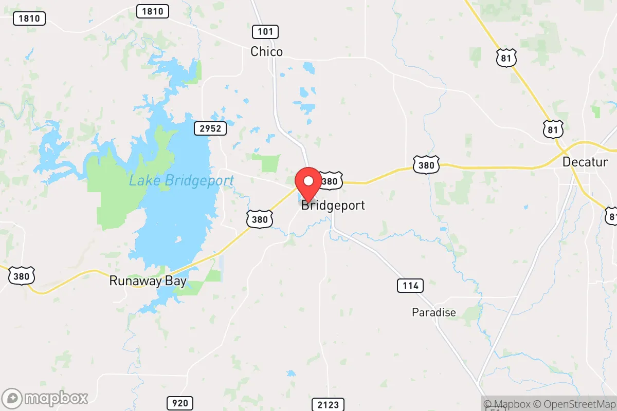
Bridgeport, Texas, offers a compelling mix of strategic depth and practical resilience for those prioritizing self-reliance and distance from major metropolitan vulnerabilities. Located in Wise County, roughly 45 miles northwest of Fort Worth, this town of roughly 6,000 residents sits far enough from the Dallas-Fort Worth metroplex to avoid its immediate fallout risks—both literal and societal—while remaining close enough for occasional supply runs or medical access. The area’s position along U.S. Highway 380 and State Highway 114 provides solid logistical connectivity without making it a natural chokepoint for population movement during a crisis. For the prepper or survivalist, Bridgeport’s relative obscurity and low population density are its primary strategic assets, offering a buffer against the cascading failures that often accompany urban collapse.
Geographic position and natural advantages for long-term survival
Bridgeport sits on the northern edge of the Barnett Shale formation, which historically provided natural gas wealth, but the real advantage here is water and terrain. The town is anchored by Bridgeport Lake, a 2,100-acre reservoir that serves as a reliable freshwater source for the immediate area. In a grid-down scenario, this lake is a critical asset—it’s large enough to sustain fishing and small-scale irrigation but small enough to avoid the kind of large-scale refugee draw that would plague a major reservoir like Lake Lewisville. The surrounding terrain is a mix of rolling hills, limestone bluffs, and post oak savanna, offering natural defensibility and cover. The LBJ National Grasslands lie just to the east, providing over 20,000 acres of public land that could serve as a buffer zone or foraging area, though it’s worth noting that public lands attract attention during crises. The area’s elevation, around 800 feet, keeps it above most flood risks while still benefiting from decent rainfall averages of roughly 35 inches per year, supporting rain catchment and small-scale agriculture. For a relocator, the key takeaway is that Bridgeport’s geography offers a rare combination of accessible water, defensible terrain, and low population density—all within a two-hour drive of major medical and supply hubs, but far enough to avoid their immediate collapse dynamics.
Risks, exposures, and proximity to fallout-relevant landmarks
No location is without vulnerabilities, and Bridgeport has several that demand attention. The most immediate concern is proximity to the Dallas-Fort Worth metroplex, which sits roughly 45 miles to the southeast. While this distance provides a buffer against direct fallout from a nuclear event or major industrial accident, it does not eliminate the risk of secondary effects—refugee flows, supply chain disruptions, and electromagnetic pulse (EMP) propagation. The DFW area is a prime target for any strategic strike scenario, and Bridgeport lies within the outer range of potential fallout patterns depending on wind direction. Additionally, the Barnett Shale natural gas infrastructure is scattered throughout Wise County, including compressor stations and pipelines. While these are not high-value military targets, a major pipeline rupture or industrial accident could create localized hazards. The town itself sits near the Lake Bridgeport Dam, which, if compromised, could cause downstream flooding but is unlikely to be a direct target. More pressing for the prepper is the U.S. 380 corridor, which runs east-west through town. In a mass evacuation scenario from the metroplex, this road could become a chokepoint for fleeing populations, making Bridgeport a potential waypoint for desperate individuals. The town’s small police force and limited emergency services would be quickly overwhelmed in such a scenario. For the strategic relocator, the calculus is clear: Bridgeport’s risks are manageable with proper planning—maintaining a low profile, stockpiling supplies, and having a secondary retreat location further west—but they are not negligible.
Practical resilience for a relocator: food, water, energy, and defensibility
For the individual or family looking to establish a resilient homestead, Bridgeport offers a workable baseline. Water security is the strongest pillar: Bridgeport Lake provides a year-round surface water source, and the area’s groundwater is generally accessible via shallow wells, though permits and testing are required. Rainwater catchment is viable given the annual rainfall, and many rural properties already have cisterns or pond systems. Food production is feasible but requires effort. The growing season runs roughly March through October, with sandy loam soils that drain well but need amendment for heavy vegetable production. Local livestock—cattle, goats, and poultry—are common, and the Wise County Extension Office offers resources for small-scale farming. For those without land, the local farmers’ market and nearby farms provide some buffer, but long-term food security demands personal production. Energy independence is mixed. The area has good solar exposure, with roughly 230 sunny days per year, making photovoltaic systems viable. Natural gas is abundant historically, but new connections are expensive, and propane delivery is the more common off-grid solution. Wood heating is practical given the surrounding forests, but be aware that Wise County has burn bans during dry periods. Defensibility is where Bridgeport shines for the prepared relocator. The terrain offers natural chokepoints—creeks, ridges, and limited road access in the more rural pockets. Properties along Farm-to-Market roads like FM 2123 or FM 1658 provide standoff distance from main thoroughfares. The local gun culture is strong, with several shooting ranges and a sheriff’s office that is generally supportive of Second Amendment rights. For the prepper, the key is to buy land with a good well, southern solar exposure, and a driveway that isn’t visible from the road. Bridgeport’s real estate market, while rising, still offers acreage under $10,000 per acre in many areas, making it accessible for those with moderate capital.
The overall strategic picture for Bridgeport is one of cautious optimism for the survival-minded relocator. It is not a bug-out location—it’s too close to the metroplex for that—but it functions well as a primary residence with strong resilience characteristics. The town’s small size, conservative culture, and access to water and defensible terrain make it a solid choice for those who want to be prepared without going completely off-grid. The main trade-off is proximity to DFW: you get logistical convenience in good times, but you inherit the risk of being on the evacuation path in bad times. For the single individual or family willing to invest in a well, solar, and a good perimeter, Bridgeport offers a realistic balance of accessibility and security. The smart play is to treat it as a base of operations, not a final redoubt—have a plan to go deeper into rural Texas if the situation deteriorates, but know that for most scenarios short of a full societal collapse, Bridgeport will hold its own.
* Values derived from national, state, county, city and local statistics and may differ in a specific area. Last updated: 2026-05-08T21:12:31.000Z
Narrative content on this page is AI-generated and may contain mistakes. Verify any details that matter before acting on them.
ReloMaps may earn a commission from affiliate links at no extra cost to you.