Photo: Wikipedia
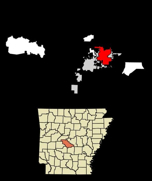
Strategic Assessment of Bryant, AR
Workable tactical position. Some exposure to population density or targets, but generally defensible in a crisis.
What does the Strategic Assessment tell us?
Our Strategic Assessment grades tactical survivability of an area. Major population centers, military targets, fallout zones, natural disasters, and border exposure all drive risk — lower exposure means a more defensible position in a crisis.
This is heavily inspired by Joel Skousen's Strategic Relocation book. Highly recommended you checkout the book ($)What does this tell us?
Our Strategic Assessment grades tactical survivability of an area. Major population centers, military targets, fallout zones, natural disasters, and border exposure all drive risk — lower exposure means a more defensible position in a crisis.
This is heavily inspired by Joel Skousen's Strategic Relocation book. Highly recommended you checkout the book ($)Strategic Pillars

Key Distances
Regional Safe Places
Below is our recommended "safe zones" in Arkansas and the surrounding area based on our strategic heuristics. For most people, it's unrealistic to live in a “safe zone” full-time due to work, family or other personal reasons. They tend to be more rural. However, many of these areas are perfect for second homes and retreat properties that double as a vacation home or even a short-term rental.


Important Note: For informational purposes only. This does not mean nothing bad ever happens in the green zones. Please use common sense. This is based on public data and modeled with AI. We tried to take a conservative approach but mistakes happen. We update this regularly as new information becomes available.
Solar Generator Recommendations
Backup power matters more here than in safer locations. We've picked three solar generators across budgets and capacity tiers — start with the budget unit if you only need a few essentials, or step up if you want to run a fridge and HVAC for days at a time.

Jackery Portable Power Station Explorer 300
Budget OptionPower on the Go: Weighing only 11 lbs, it's convenient to set up and store with book-sized foldable solar panels

BLUETTI Portable Power Station AC180
Designed for both indoor and outdoor scenarios, AC180 is highly capable as it has a robost capacity and continuous output power.

EF ECOFLOW DELTA Pro Ultra Power Station
Upgraded PickEcoFlow DELTA Pro Ultra is a whole-home energy system designed to grow with your family. Integrated with the Smart Home Panel 2, it scales to meet your evolving energy needs — keeping your home powered, intelligent, and secure through every stage of life.
We earn a commission, at no additional cost to you.
Strategic Assessment Analysis
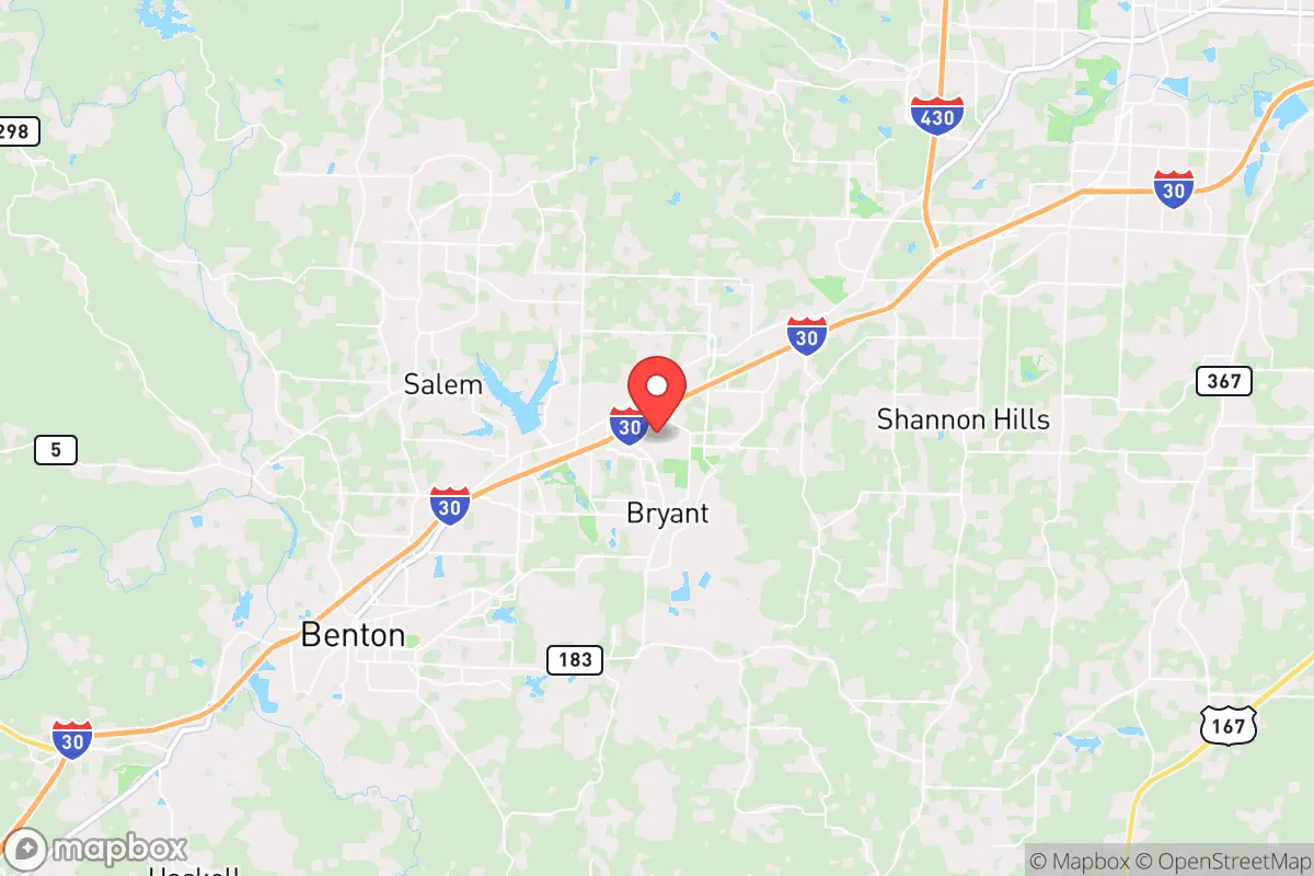
Bryant, Arkansas, sits in a sweet spot that few preppers fully appreciate: close enough to a major metro to access resources, yet far enough to avoid the worst of urban collapse. Located just southwest of Little Rock along Interstate 30, this Saline County town of roughly 22,000 offers a blend of suburban convenience and rural buffer that makes it a viable base for those thinking seriously about long-term resilience. The area’s growth has been steady—up about 15% since 2020—driven by families and professionals looking for lower crime, better schools, and a slower pace without total isolation. For a conservative-leaning relocator weighing civic unrest, supply chain disruptions, or natural disasters, Bryant presents a defensible middle ground, but it’s not without trade-offs that demand honest assessment.
Geographic position and natural advantages for long-term security
Bryant’s location is its strongest card. It sits on the southern edge of the Ouachita foothills, with the Arkansas River about 15 miles north and the Saline River winding through the county. This gives residents access to reliable freshwater sources—critical for any extended grid-down scenario. The terrain is gently rolling, with enough tree cover to provide natural concealment and windbreaks, but not so rugged that it impedes travel or farming. The climate is humid subtropical, meaning a long growing season (roughly 210 frost-free days) for food production, though summers are hot and humid. Bryant is roughly 20 miles from Little Rock’s urban core, which is close enough for supply runs or medical access in normal times, but far enough that a major riot or infrastructure failure in the city would likely stay contained. The area is not in a hurricane zone, not in a major floodplain (though low-lying spots near the Saline can flood), and not on a known fault line. Tornadoes are the primary natural threat—Saline County averages about 3-4 tornado warnings per year—but the topography doesn’t funnel storms like the Plains do. For a prepper, the key takeaway is that Bryant offers a defensible perimeter with multiple egress routes: I-30 east/west, Highway 67 north, and a network of county roads that can bypass choke points if the interstate gets clogged.
Risks, exposures, and proximity to fallout-relevant landmarks
No strategic assessment is honest without naming the liabilities. Bryant’s biggest exposure is its proximity to Little Rock, a city of roughly 200,000 that has seen its share of civil unrest—most notably the 2020 protests that turned violent downtown. Little Rock is also home to the Clinton Presidential Center, a federal courthouse, and multiple National Guard facilities, all of which could become targets in a widespread destabilization event. If a mass casualty event or coordinated attack hit the capital, Bryant would likely see a surge of evacuees, potentially overwhelming local resources. The interstate corridor (I-30) is a double-edged sword: it’s your lifeline for resupply, but it’s also a funnel for refugees and looters. On the industrial side, there are no nuclear plants within 50 miles, but there are chemical facilities along the Arkansas River—particularly fertilizer and fuel storage—that could pose secondary hazards if targeted or neglected. The Saline River itself is a minor concern for flooding, but the bigger risk is that a major dam failure upstream (e.g., at Lake Maumelle or Lake Ouachita) could disrupt water supply and cause localized flooding. Bryant is not in a primary fallout zone for any major military or nuclear target, but it’s within 100 miles of Little Rock Air Force Base (Jacksonville), which could be a first-strike target in a conflict. That’s a sobering reality, but one that applies to most of central Arkansas. For a relocator, the calculus is simple: Bryant is far enough from high-value targets to avoid direct blast effects, but close enough to feel the ripple effects of a regional crisis.
Practical resilience for a relocator: food, water, energy, and defensibility
For someone serious about self-sufficiency, Bryant’s practical infrastructure is a mixed bag. The water situation is decent: the city draws from the Saline River and local wells, with a treatment plant that can handle about 8 million gallons per day. In a grid-down scenario, residents with private wells (common in outlying subdivisions) have a major advantage, but those on city water would lose pressure within hours of a pump failure. Rainwater catchment is legal and practical—annual rainfall averages 50 inches—so a 1,000-gallon cistern is a smart investment. Food production is viable: the soil is mostly clay-loam, which requires amendment but can support gardens, fruit trees (apples, pears, peaches), and small livestock. The growing season runs April through October, and local ordinances in unincorporated parts of Saline County are lenient on chickens and goats, though Bryant’s city limits have stricter rules. For energy, the grid is served by Entergy Arkansas, which has a mixed reliability record—outages during ice storms and thunderstorms are common, lasting 2-6 hours on average. Solar is a strong option here, with about 210 sunny days per year, and net metering is available, though the state’s regulatory climate is friendly to fossil fuels. Defensibility is where Bryant shines: the town is laid out in a grid with multiple entry points, but the surrounding rural areas offer natural chokepoints (bridges over the Saline, narrow two-lane roads). A well-placed group could secure a neighborhood or a farmstead with relative ease, especially if you’re on the outskirts. The local law enforcement presence is solid—Saline County Sheriff’s Office has about 60 deputies—but in a widespread collapse, they’d be stretched thin. The nearest Level 1 trauma center is in Little Rock (UAMS), about 25 minutes away, which is a vulnerability if the interstate is blocked. Stockpiling medical supplies and learning basic trauma care is non-negotiable here.
The overall strategic picture for Bryant is one of cautious optimism for a conservative prepper. It’s not a remote bunker—it’s a working-class suburb with good bones for resilience. The community is predominantly conservative, with a strong church presence and a culture of neighborly self-reliance that’s increasingly rare. The downsides—proximity to Little Rock, reliance on a single interstate, and moderate tornado risk—are manageable with planning. For a single individual or a family looking to ride out the next decade of instability, Bryant offers a realistic balance of access and security. It’s not a bug-out location; it’s a live-in location where you can build a life that’s prepared for the worst while still enjoying the present. The key is to treat it as a base, not a fortress—invest in water storage, solar backup, and a garden, and keep a low profile. If the country holds together, you’re in a growing, affordable town with good schools and low crime. If it doesn’t, you’re positioned to hold your ground or bug out to the Ouachitas or Ozarks within a few hours. That’s the kind of flexibility that makes Bryant worth a serious look.
* Values derived from national, state, county, city and local statistics and may differ in a specific area. Last updated: 2026-04-30T07:21:29.000Z
Narrative content on this page is AI-generated and may contain mistakes. Verify any details that matter before acting on them.
ReloMaps may earn a commission from affiliate links at no extra cost to you.