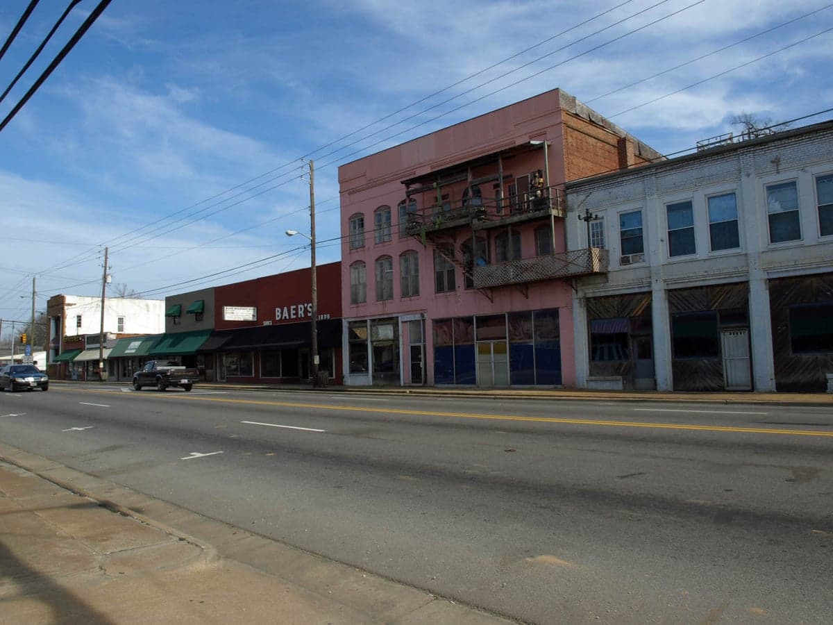
Photo: Wikipedia
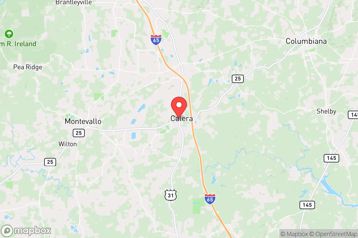
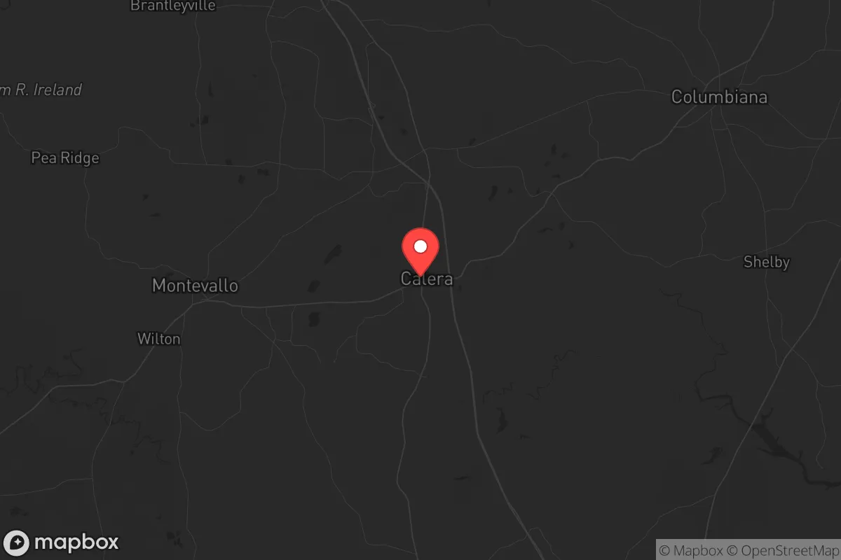
Strategic Assessment of Calera, AL
Workable tactical position. Some exposure to population density or targets, but generally defensible in a crisis.
What does the Strategic Assessment tell us?
Our Strategic Assessment grades tactical survivability of an area. Major population centers, military targets, fallout zones, natural disasters, and border exposure all drive risk — lower exposure means a more defensible position in a crisis.
This is heavily inspired by Joel Skousen's Strategic Relocation book. Highly recommended you checkout the book ($)What does this tell us?
Our Strategic Assessment grades tactical survivability of an area. Major population centers, military targets, fallout zones, natural disasters, and border exposure all drive risk — lower exposure means a more defensible position in a crisis.
This is heavily inspired by Joel Skousen's Strategic Relocation book. Highly recommended you checkout the book ($)Strategic Pillars

Key Distances
Regional Safe Places
Below is our recommended "safe zones" in Alabama and the surrounding area based on our strategic heuristics. For most people, it's unrealistic to live in a “safe zone” full-time due to work, family or other personal reasons. They tend to be more rural. However, many of these areas are perfect for second homes and retreat properties that double as a vacation home or even a short-term rental.
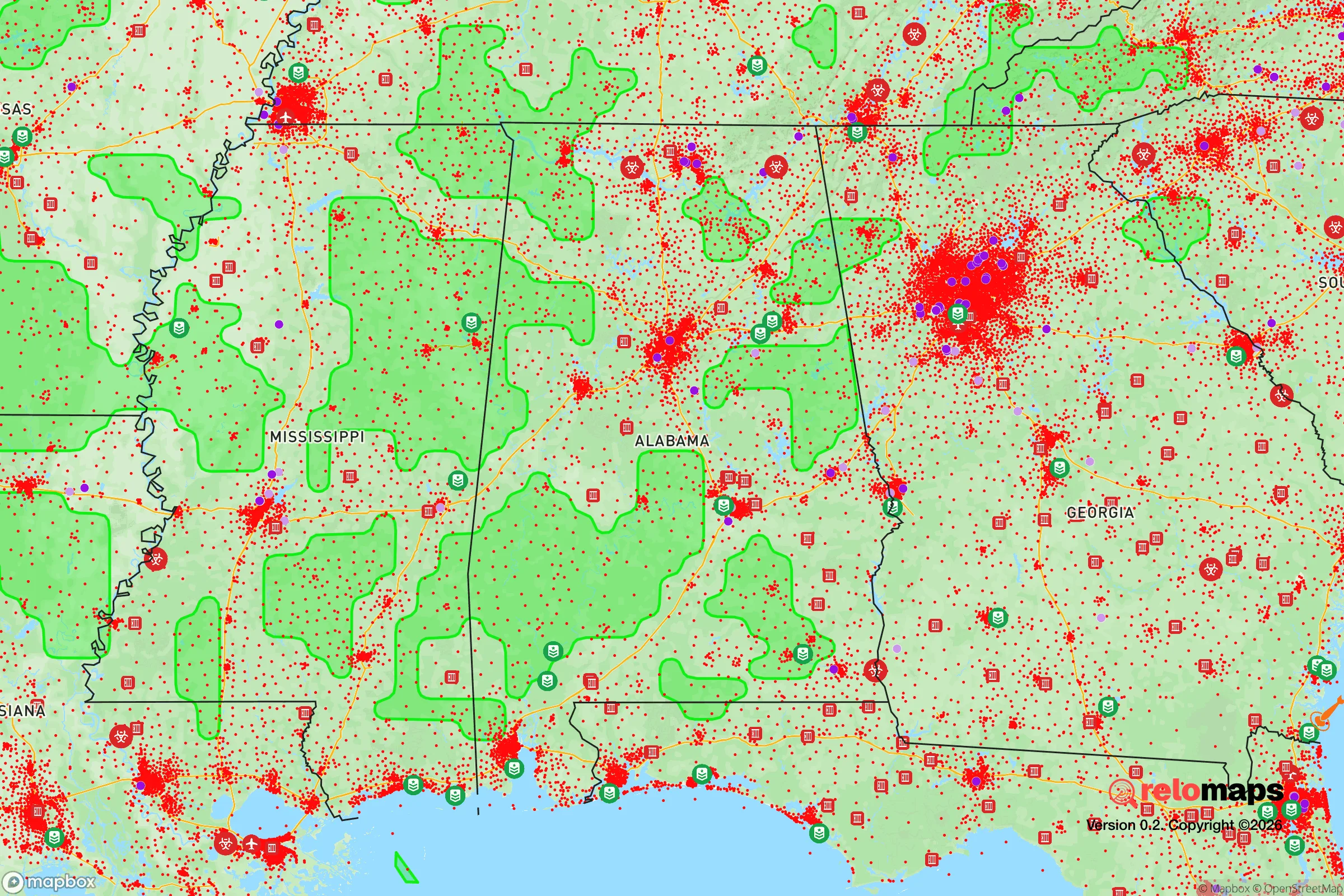
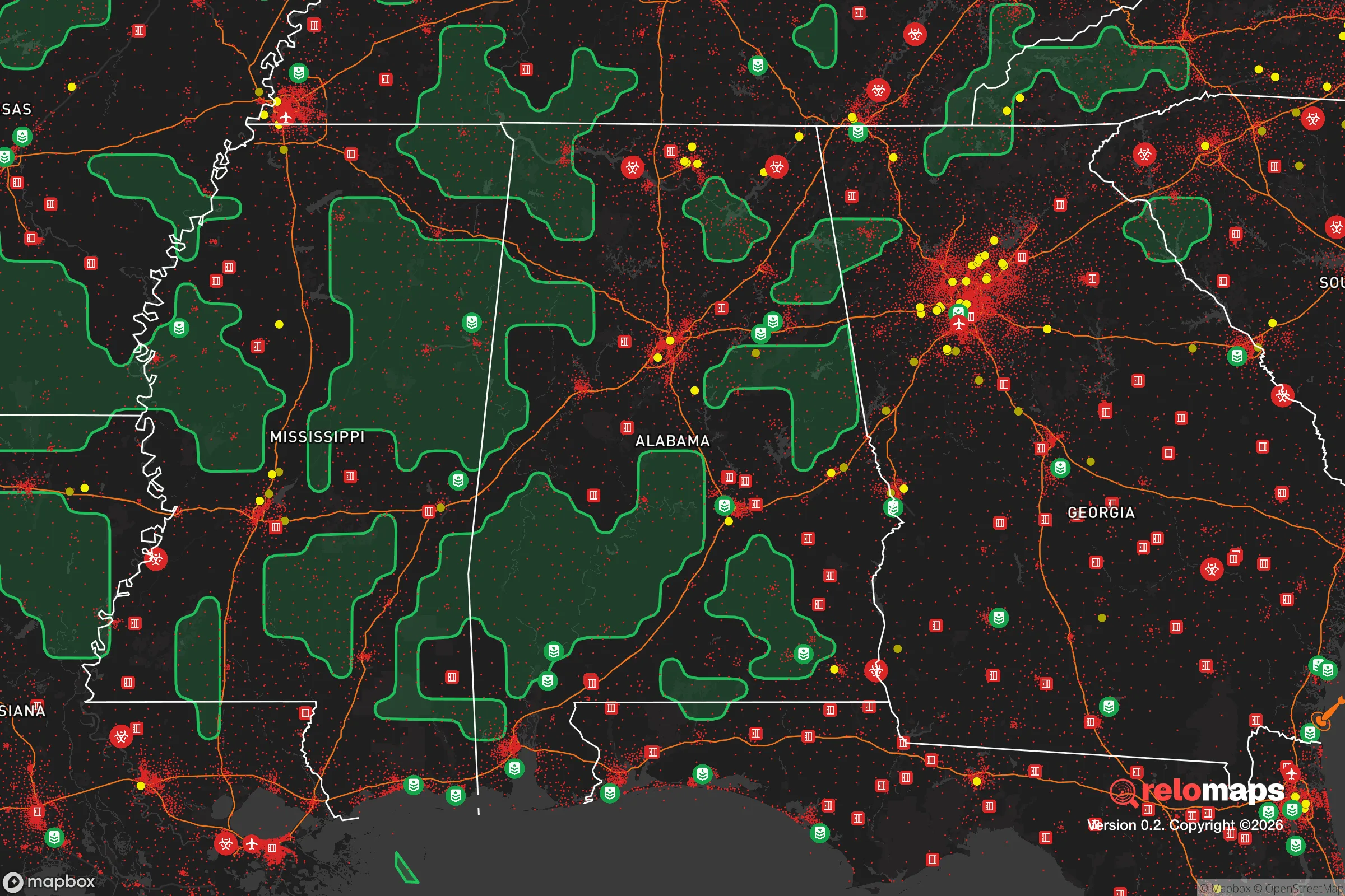
Important Note: For informational purposes only. This does not mean nothing bad ever happens in the green zones. Please use common sense. This is based on public data and modeled with AI. We tried to take a conservative approach but mistakes happen. We update this regularly as new information becomes available.
Solar Generator Recommendations
Backup power matters more here than in safer locations. We've picked three solar generators across budgets and capacity tiers — start with the budget unit if you only need a few essentials, or step up if you want to run a fridge and HVAC for days at a time.

Jackery Portable Power Station Explorer 300
Budget OptionPower on the Go: Weighing only 11 lbs, it's convenient to set up and store with book-sized foldable solar panels

BLUETTI Portable Power Station AC180
Designed for both indoor and outdoor scenarios, AC180 is highly capable as it has a robost capacity and continuous output power.

EF ECOFLOW DELTA Pro Ultra Power Station
Upgraded PickEcoFlow DELTA Pro Ultra is a whole-home energy system designed to grow with your family. Integrated with the Smart Home Panel 2, it scales to meet your evolving energy needs — keeping your home powered, intelligent, and secure through every stage of life.
We earn a commission, at no additional cost to you.
Strategic Assessment Analysis
Calera, Alabama, sits in a sweet spot that few relocators fully appreciate until they dig into the map: close enough to Birmingham and Montgomery for supply runs and medical access, but far enough from either to avoid the worst of urban collapse scenarios. Its position along the I-65 corridor gives it logistical reach, while the surrounding Shelby and Chilton County terrain offers a mix of farmland, forest, and modest elevation that supports a self-sufficient lifestyle. For someone thinking in terms of decades, not just the next election cycle, Calera presents a defensible, resource-rich anchor point in the Deep South.
Geographic position and natural advantages for long-term security
Calera’s location at the intersection of Shelby and Chilton counties places it in a transitional zone between the Piedmont foothills and the Black Belt prairie. This isn’t flat, flood-prone delta land—it’s rolling hills with decent drainage, which matters when you’re thinking about water management and garden viability. The area sits roughly 30 miles south of Birmingham and 50 miles north of Montgomery, meaning you’re outside the immediate blast radius or fallout plume of any major target, yet still within a two-hour drive of two state capitals and their associated infrastructure. The Cahaba River runs nearby, providing a reliable surface water source that isn’t heavily industrialized upstream. Soils in the region range from sandy loam to clay, which is workable for food production once amended. The growing season stretches from April to October, giving you a solid 200+ days for crops. For a prepper, that’s a tangible advantage over northern or high-desert locations.
Risks, exposures, and proximity to fallout-relevant landmarks
No location is risk-free, and Calera has its share of exposure points. The I-65 corridor is a double-edged sword: it’s your supply line, but it’s also a primary evacuation route for Birmingham and Montgomery in a crisis. If civil unrest hits those cities, expect heavy traffic and potential roadblocks on I-65 and US-31. The nearby Birmingham metropolitan area (population roughly 1.1 million) is a significant concentration of people who may become desperate in a grid-down scenario. Additionally, the University of Alabama at Birmingham (UAB) is a Level I trauma center and research hub—valuable in normal times, but a potential target for looting or violence during a breakdown. The Birmingham-Shuttlesworth International Airport is a secondary target for any adversary looking to disrupt regional logistics. On the industrial side, the Mercedes-Benz plant in Vance (about 20 miles west) and the Honda plant in Lincoln (about 30 miles east) are both large manufacturing facilities that could become focal points for civil unrest or targeted disruption. Calera itself has a minor industrial base—a few distribution centers and a cement plant—but nothing that would make it a primary target. The real risk is being caught between two major urban areas during a mass evacuation or riot event. Your best hedge is to have a secondary retreat further south or east, and to avoid relying solely on I-65 for egress.
Practical resilience for a relocator: food, water, energy, and defensibility
Water is the first concern for any long-term setup, and Calera’s access to the Cahaba River and several smaller creeks (like Buck Creek and Shoal Creek) gives you options. Municipal water comes from the Cahaba River via the Birmingham Water Works system, but that’s vulnerable to contamination or service interruption. A well is the gold standard here—most lots in the rural parts of Shelby and Chilton counties can hit good water at 150-300 feet. Rainwater catchment is also viable, given the area averages about 54 inches of precipitation per year. For food, the local growing conditions support corn, beans, squash, tomatoes, peppers, and leafy greens. Livestock—chickens, goats, and even a small cattle operation—are feasible on 5-10 acres. The local soil pH tends to be acidic (5.5-6.5), so you’ll need to lime for most vegetables, but that’s a known fix. Energy-wise, grid reliability in Shelby County is decent, but Chilton County sees more outages during storms. Solar is a strong play here—you get about 4.5 peak sun hours per day, enough for a modest off-grid setup. Natural gas is available in town, but propane tanks are the standard for rural properties. Defensibility is where Calera shines. The terrain is gently rolling, with enough tree cover to break lines of sight from the road. Many properties sit on dead-end roads or have long driveways, giving you natural standoff. The local law enforcement presence is solid—Shelby County Sheriff’s Office has a good reputation for response times—but in a prolonged crisis, you’re on your own. The community is largely conservative, with a strong church presence and a culture of mutual aid among rural landowners. That’s a soft asset that can’t be bought.
The overall strategic picture for Calera is one of balanced risk and reward. It’s not a remote mountain fortress, and it’s not a self-sufficient homestead in the middle of nowhere. What it offers is a defensible, resource-rich base within striking distance of urban infrastructure, but far enough away to avoid the worst of the fallout—literal and figurative. The key is to treat Calera as a hub, not a final destination. Build your primary residence there, establish your garden and water systems, and maintain a secondary bug-out location further into the Alabama countryside (say, the Talladega National Forest area or the Coosa River valley). If you’re a single individual or a family looking to plant roots in a place that gives you options without isolating you from civilization, Calera is a strong candidate. Just don’t expect to ride out every scenario from your living room—preparation here means having a plan for both staying and leaving.
* Values derived from national, state, county, city and local statistics and may differ in a specific area. Last updated: 2026-04-19T18:45:38.000Z
Narrative content on this page is AI-generated and may contain mistakes. Verify any details that matter before acting on them.
ReloMaps may earn a commission from affiliate links at no extra cost to you.