
Photo: Wikipedia
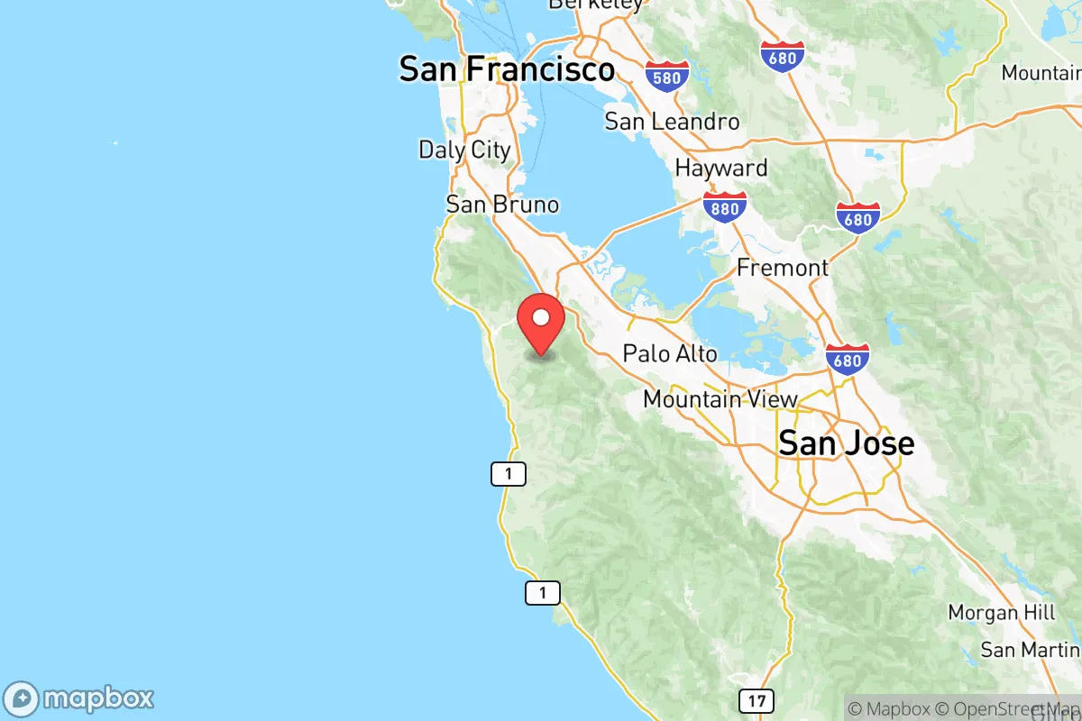
Strategic Assessment of San Mateo County
Multiple tactical vulnerabilities. Population density, target proximity, or disaster risk are likely compounding. A retreat property and exit planning is required.
What does the Strategic Assessment tell us?
Our Strategic Assessment grades tactical survivability of an area. Major population centers, military targets, fallout zones, natural disasters, and border exposure all drive risk — lower exposure means a more defensible position in a crisis.
This is heavily inspired by Joel Skousen's Strategic Relocation book. Highly recommended you checkout the book ($)What does this tell us?
Our Strategic Assessment grades tactical survivability of an area. Major population centers, military targets, fallout zones, natural disasters, and border exposure all drive risk — lower exposure means a more defensible position in a crisis.
This is heavily inspired by Joel Skousen's Strategic Relocation book. Highly recommended you checkout the book ($)Strategic Pillars

Key Distances
Strategic Assessment Analysis
San Mateo County presents a complex strategic picture for the conservative prepper or survivalist. Its location on the San Francisco Peninsula offers some natural advantages, but its proximity to major urban centers, critical infrastructure, and high-value targets creates significant vulnerabilities that must be weighed carefully. For a relocator prioritizing long-term resilience, this area is a mixed bag—offering defensible terrain and access to resources, but sitting squarely in the shadow of one of the nation's most politically and economically volatile regions.
Geographic position and natural advantages for long-term survival
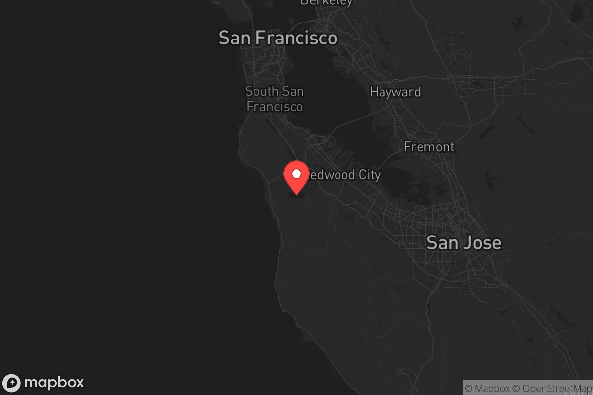
San Mateo County stretches along the western edge of the San Francisco Bay, from the city of South San Francisco down to the Santa Cruz County line near Pescadero. Its geography is defined by the Santa Cruz Mountains, which run north-south through the county, creating a natural barrier between the densely populated Bay Area and the Pacific coast. This mountainous spine offers defensible terrain—rugged, forested, and with limited road access—ideal for a retreat or bug-out location. The county's coastal areas, including Half Moon Bay and Pacifica, provide access to the ocean for fishing and desalination potential, though the fog and salt spray complicate long-term agriculture. The interior valleys, like those around Woodside and Portola Valley, are more sheltered and have historically supported small-scale farming. The county's water supply is relatively robust, drawing from the Hetch Hetchy system via the San Francisco Public Utilities Commission, but this infrastructure is a single point of failure—a major earthquake or sabotage could cut off water to the entire peninsula. For a relocator, the key natural advantage is the combination of elevation, forest cover, and coastal access, which provides multiple options for self-sufficiency if you can secure a property away from the main highways.
Risks, exposures, and proximity to fallout-relevant landmarks
This is where the strategic picture gets grim. San Mateo County is sandwiched between two of the most politically and economically significant targets on the West Coast: San Francisco to the north and San Jose to the south. Both are major population centers with high-value infrastructure—tech headquarters, government buildings, and transportation hubs—that would be primary targets in any large-scale conflict or civil unrest. The county itself hosts several critical assets: the San Francisco International Airport (SFO) sits in the northern part of the county, a likely target for both conventional and unconventional attacks. The Crystal Springs Reservoir, which stores much of the region's drinking water, is a vulnerable point—a single breach could flood the low-lying areas and cut off water to millions. Additionally, the county's coastline is exposed to tsunami risks from seismic activity along the San Andreas Fault, which runs directly through the county. The fault line is a constant threat—a major quake could collapse bridges, isolate communities, and trigger landslides that block escape routes. For the prepper, the proximity to these targets means that any major event—whether a terrorist attack, civil unrest, or natural disaster—would likely draw chaos into the county as people flee the cities. The Dumbarton Bridge and San Mateo Bridge are chokepoints that would become impassable in a crisis, trapping residents on the peninsula.
Practical resilience for a relocator: food, water, energy, and defensibility
For a relocator looking to set up a sustainable operation, San Mateo County offers some practical advantages but also serious limitations. Food production is possible in the coastal valleys and inland areas, but the climate is cool and foggy, limiting crop diversity. The county has a handful of small farms and farmers' markets, but most food is imported via the region's fragile supply chains. Water is the biggest concern—while the Hetch Hetchy system is reliable in normal times, it's a single point of failure. A well on your property is ideal, but groundwater in the county is limited and often contaminated by saltwater intrusion near the coast. Rainwater catchment is viable in the wet season (November to March), but storage capacity is critical. Energy is another weak point—the county's power grid is aging and vulnerable to wildfires and earthquakes. Solar panels with battery storage are a must, but the frequent fog and marine layer reduce solar efficiency. Defensibility is the strongest card the county holds. The mountainous terrain, limited road access, and dense forests make it possible to secure a property against casual intrusion. The key is to avoid the main corridors—Highway 101 and Interstate 280—and focus on the rural areas like La Honda or Loma Mar, where neighbors are few and far between. However, the county's population density (over 1,500 people per square mile in urban areas) means that any collapse would bring desperate people from the cities into the hills. You'd need a solid perimeter, a reliable water source, and a plan for self-defense.
The overall strategic picture for San Mateo County is one of high risk with moderate reward. Its natural defenses and coastal access are real assets, but they're outweighed by the proximity to major targets and the fragility of its infrastructure. For a conservative relocator seeking long-term stability, this area is best viewed as a temporary staging ground or a bug-out location for those with existing ties to the region. The smart play is to secure a property in the mountains, stockpile supplies, and maintain a low profile—but be ready to move inland if the situation deteriorates. The county's political climate leans heavily left, which could create friction for those with traditional values, but the rural areas are more independent-minded. In short, San Mateo County is a defensible outpost on the edge of a volatile region—not a safe haven, but a place where a prepared individual could ride out a storm if they plan carefully and keep their options open.
* Values derived from national, state, county, city and local statistics and may differ in a specific area. Last updated: 2026-05-11T22:27:20.000Z
Narrative content on this page is AI-generated and may contain mistakes. Verify any details that matter before acting on them.
ReloMaps may earn a commission from affiliate links at no extra cost to you.