Photo: Wikipedia
Strategic Assessment of Canby, OR
Multiple tactical vulnerabilities. Population density, target proximity, or disaster risk are likely compounding. A retreat property and exit planning is required.
What does the Strategic Assessment tell us?
Our Strategic Assessment grades tactical survivability of an area. Major population centers, military targets, fallout zones, natural disasters, and border exposure all drive risk — lower exposure means a more defensible position in a crisis.
This is heavily inspired by Joel Skousen's Strategic Relocation book. Highly recommended you checkout the book ($)What does this tell us?
Our Strategic Assessment grades tactical survivability of an area. Major population centers, military targets, fallout zones, natural disasters, and border exposure all drive risk — lower exposure means a more defensible position in a crisis.
This is heavily inspired by Joel Skousen's Strategic Relocation book. Highly recommended you checkout the book ($)Strategic Pillars

Key Distances
Regional Safe Places
Below is our recommended "safe zones" in Oregon and the surrounding area based on our strategic heuristics. For most people, it's unrealistic to live in a “safe zone” full-time due to work, family or other personal reasons. They tend to be more rural. However, many of these areas are perfect for second homes and retreat properties that double as a vacation home or even a short-term rental.


Important Note: For informational purposes only. This does not mean nothing bad ever happens in the green zones. Please use common sense. This is based on public data and modeled with AI. We tried to take a conservative approach but mistakes happen. We update this regularly as new information becomes available.
Solar Generator Recommendations
Backup power matters more here than in safer locations. We've picked three solar generators across budgets and capacity tiers — start with the budget unit if you only need a few essentials, or step up if you want to run a fridge and HVAC for days at a time.

Jackery Portable Power Station Explorer 300
Budget OptionPower on the Go: Weighing only 11 lbs, it's convenient to set up and store with book-sized foldable solar panels

BLUETTI Portable Power Station AC180
Designed for both indoor and outdoor scenarios, AC180 is highly capable as it has a robost capacity and continuous output power.

EF ECOFLOW DELTA Pro Ultra Power Station
Upgraded PickEcoFlow DELTA Pro Ultra is a whole-home energy system designed to grow with your family. Integrated with the Smart Home Panel 2, it scales to meet your evolving energy needs — keeping your home powered, intelligent, and secure through every stage of life.
We earn a commission, at no additional cost to you.
Strategic Assessment Analysis
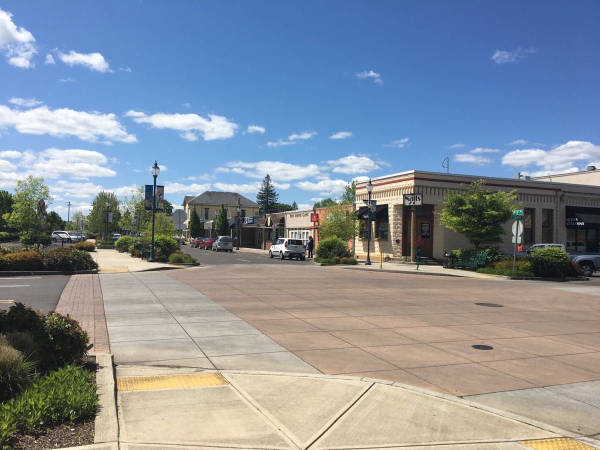
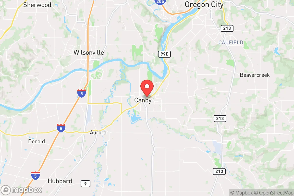
Canby, Oregon, occupies a strategic middle ground that resilience-minded relocators should evaluate carefully: close enough to Portland’s resources to be useful, far enough to avoid the worst of a metropolitan collapse. Sitting along the Willamette River in Clackamas County, this city of roughly 18,000 offers a blend of agricultural self-sufficiency and access to major transport corridors, but it also sits within the fallout shadow of several high-value targets. For a conservative-leaning individual or family preparing for civic unrest, mass casualty events, or natural disasters, Canby presents both genuine advantages and sobering liabilities that demand a clear-eyed assessment.
Geographic position and natural advantages for long-term stability
Canby’s location at the intersection of Oregon 99E and the Willamette River gives it a dual advantage: it is a natural transportation node and sits on one of the most fertile river valleys in the Pacific Northwest. The surrounding agricultural land—hops, berries, hazelnuts, and row crops—means that even if supply chains fracture, local food production remains viable. The city is roughly 25 miles south of Portland, placing it outside the immediate blast radius of any downtown Portland or military-adjacent target, yet close enough that a relocator can still access medical facilities, hardware suppliers, and bulk goods from the metro area during stable periods. The Willamette River itself provides a reliable water source, though treatment and pumping infrastructure would be vulnerable in a grid-down scenario. The terrain is mostly flat to gently rolling, which simplifies gardening, livestock, and alternative energy setups compared to steeper foothill towns. Canby’s elevation (roughly 150 feet) keeps it above the worst of Willamette Valley flooding, though the river’s floodplain does extend into parts of the city—any property purchase should verify FEMA flood zone status before committing.
Risks, exposures, and proximity to fallout-relevant landmarks
The most significant strategic drawback of Canby is its proximity to Portland and the I-5 corridor. In a mass casualty event or widespread civil unrest, Portland’s population of over 650,000 would likely attempt to flee south along 99E and I-5, and Canby sits directly in that path. The city’s two main bridges over the Willamette—the 99E bridge and the railroad bridge—are chokepoints that could become impassable or contested. Additionally, the nearby Oregon City hydroelectric dam and the Willamette Falls are critical infrastructure that, if damaged or targeted, could disrupt power and water for the entire region. Canby is also within 30 miles of the Portland International Airport, a major logistics hub that would be a high-priority target in any conflict scenario. On the natural disaster front, the Cascadia Subduction Zone earthquake poses a real threat: a major quake would likely liquefy soils along the river, damage bridges, and sever road access to Portland and Salem for weeks or months. The city’s reliance on a single major north-south road (99E) and a single rail line means that evacuation or resupply options are limited. For a prepper, these factors mean that Canby is not a bug-out location—it is a location that requires active preparation for isolation and potential refugee flow.
Practical resilience for a relocator: food, water, energy, and defensibility
Canby’s agricultural base is its strongest resilience asset. The surrounding farmland produces a wide variety of crops, and the city itself has a working agricultural supply chain—feed stores, farm equipment dealers, and seed suppliers are present. A relocator with a few acres or even a large suburban lot can establish substantial food production. The Willamette River provides a raw water source, but treatment requires either a well (most properties outside city limits have them) or a robust filtration system. City water comes from the Clackamas River via a treatment plant that would be vulnerable to power loss and earthquake damage. For energy, Canby has good solar exposure by Pacific Northwest standards, though winter cloud cover is a factor. Natural gas is available in much of the city, but a grid-down scenario would require backup generation or a wood-burning heat source—firewood is plentiful in the surrounding foothills. Defensibility is mixed: the city’s layout is spread out with many cul-de-sacs and rural roads, which can slow an approaching threat, but the flat terrain offers little natural cover. A rural property on the outskirts, with a long driveway and clear sightlines, is far more defensible than a house in a subdivision near 99E. The local law enforcement presence is modest—Clackamas County Sheriff’s Office covers the area—and in a prolonged crisis, residents would need to rely on mutual aid networks rather than expecting rapid official response.
The overall strategic picture for Canby is one of calculated trade-offs. It offers genuine agricultural self-sufficiency, a moderate distance from Portland’s core, and a riverine water source, but it sits on a major evacuation route, is vulnerable to earthquake-induced isolation, and lacks the natural defensibility of a mountain or hilltop location. For a conservative relocator who is willing to invest in well water, solar backup, and a rural property outside the floodplain, Canby can serve as a viable long-term base—provided they also build strong local relationships and have a secondary bug-out plan for the first 72 hours of a major event. It is not a fortress, but it is a place where preparation and community can make the difference between surviving and thriving.
* Values derived from national, state, county, city and local statistics and may differ in a specific area. Last updated: 2026-05-19T08:57:48.000Z
Narrative content on this page is AI-generated and may contain mistakes. Verify any details that matter before acting on them.
ReloMaps may earn a commission from affiliate links at no extra cost to you.