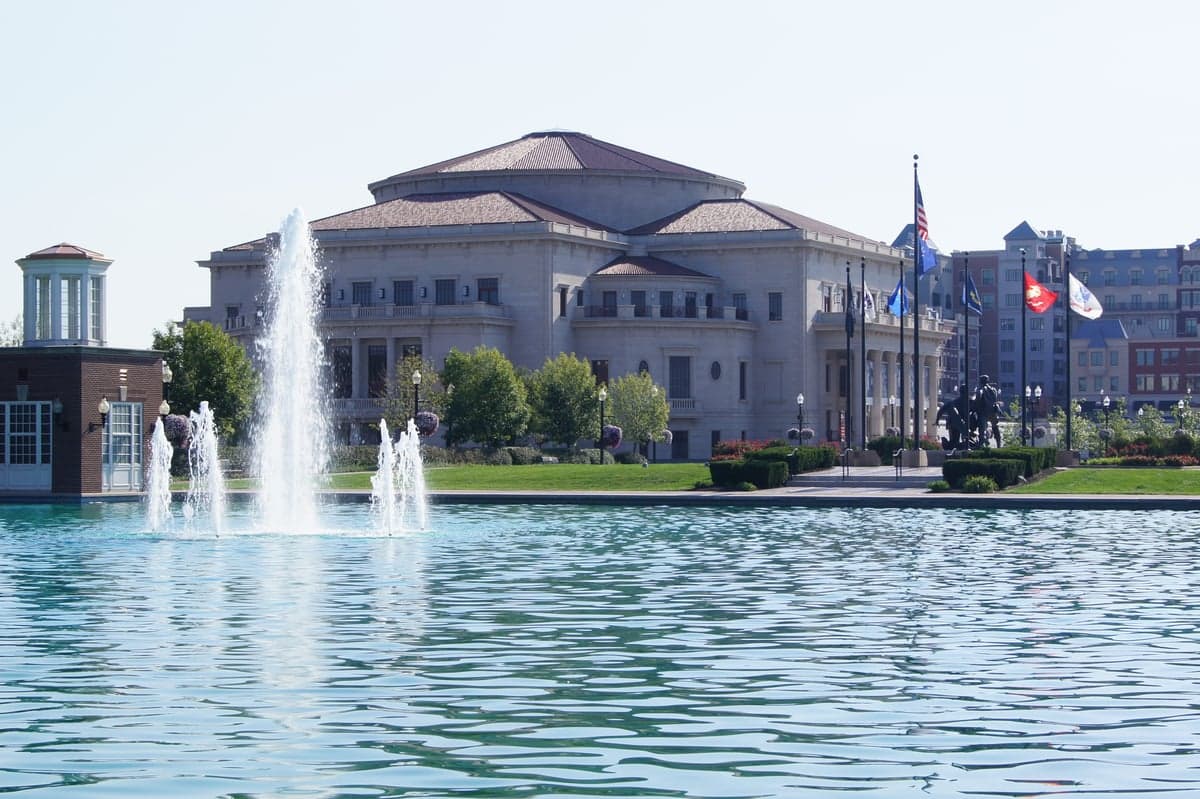
Photo: Wikipedia
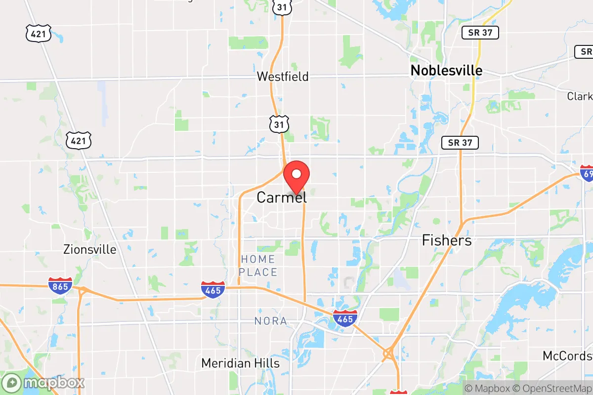
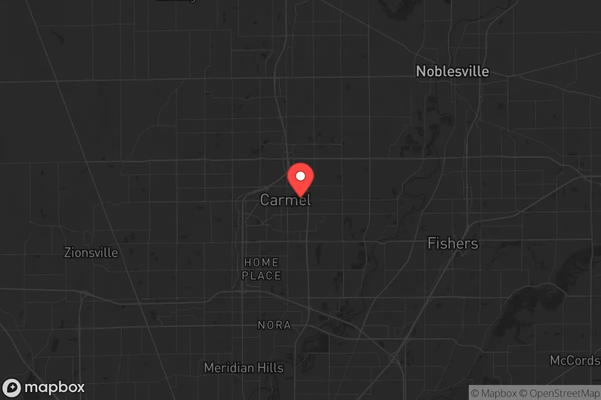
Strategic Assessment of Carmel, IN
Multiple tactical vulnerabilities. Population density, target proximity, or disaster risk are likely compounding. A retreat property and exit planning is required.
What does the Strategic Assessment tell us?
Our Strategic Assessment grades tactical survivability of an area. Major population centers, military targets, fallout zones, natural disasters, and border exposure all drive risk — lower exposure means a more defensible position in a crisis.
This is heavily inspired by Joel Skousen's Strategic Relocation book. Highly recommended you checkout the book ($)What does this tell us?
Our Strategic Assessment grades tactical survivability of an area. Major population centers, military targets, fallout zones, natural disasters, and border exposure all drive risk — lower exposure means a more defensible position in a crisis.
This is heavily inspired by Joel Skousen's Strategic Relocation book. Highly recommended you checkout the book ($)Strategic Pillars

Key Distances
Regional Safe Places
Below is our recommended "safe zones" in Indiana and the surrounding area based on our strategic heuristics. For most people, it's unrealistic to live in a “safe zone” full-time due to work, family or other personal reasons. They tend to be more rural. However, many of these areas are perfect for second homes and retreat properties that double as a vacation home or even a short-term rental.

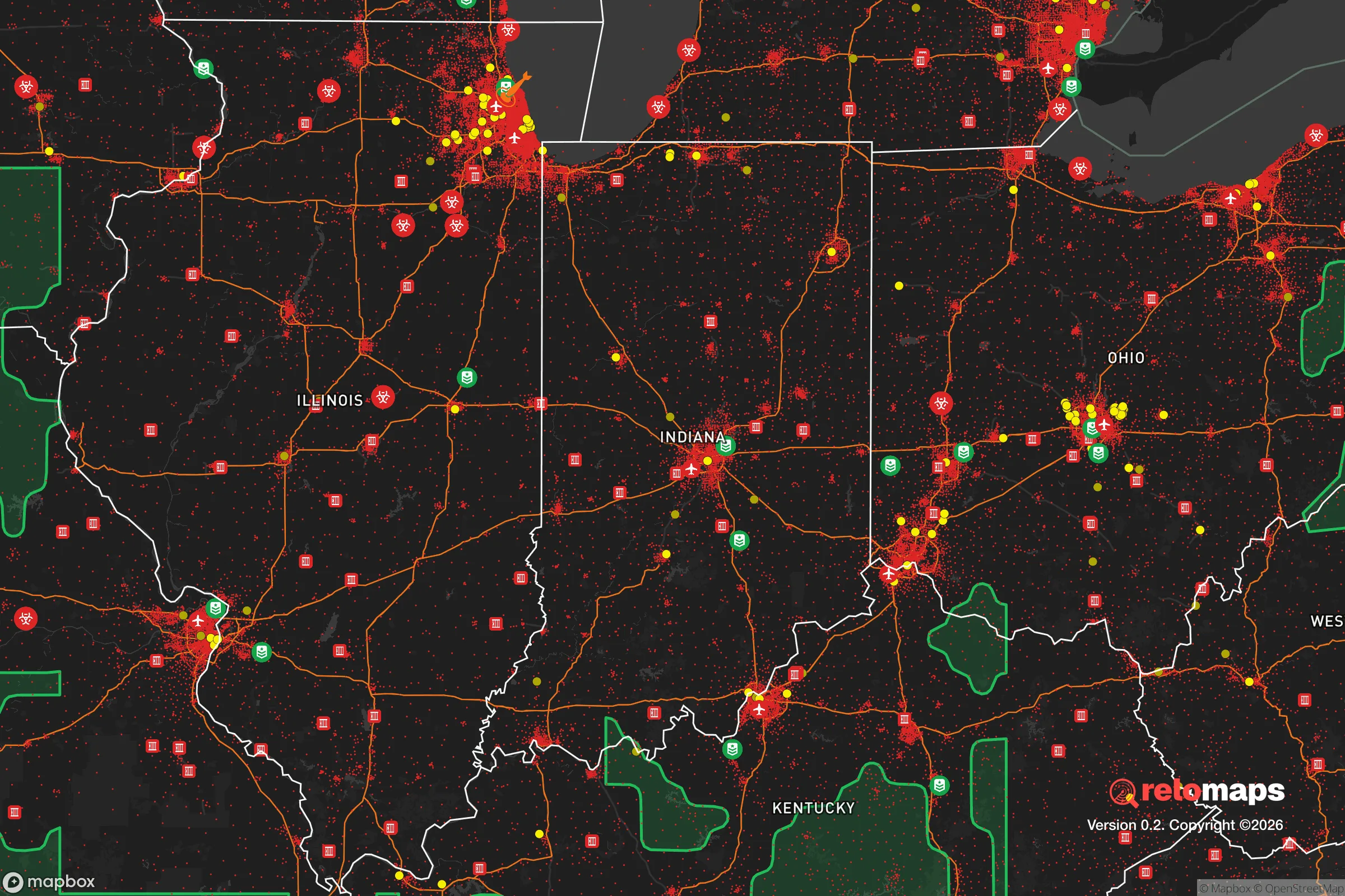
Important Note: For informational purposes only. This does not mean nothing bad ever happens in the green zones. Please use common sense. This is based on public data and modeled with AI. We tried to take a conservative approach but mistakes happen. We update this regularly as new information becomes available.
Solar Generator Recommendations
Backup power matters more here than in safer locations. We've picked three solar generators across budgets and capacity tiers — start with the budget unit if you only need a few essentials, or step up if you want to run a fridge and HVAC for days at a time.

Jackery Portable Power Station Explorer 300
Budget OptionPower on the Go: Weighing only 11 lbs, it's convenient to set up and store with book-sized foldable solar panels

BLUETTI Portable Power Station AC180
Designed for both indoor and outdoor scenarios, AC180 is highly capable as it has a robost capacity and continuous output power.

EF ECOFLOW DELTA Pro Ultra Power Station
Upgraded PickEcoFlow DELTA Pro Ultra is a whole-home energy system designed to grow with your family. Integrated with the Smart Home Panel 2, it scales to meet your evolving energy needs — keeping your home powered, intelligent, and secure through every stage of life.
We earn a commission, at no additional cost to you.
Strategic Assessment Analysis
Carmel, Indiana, presents a mixed bag for the strategic relocator. Its core resilience lies in its high-income, low-crime environment and robust local governance, but its proximity to Indianapolis and lack of natural barriers introduce significant vulnerabilities. For a prepper or survivalist, Carmel offers a strong baseline of stability and resources, but demands a clear-eyed understanding of its exposure to the cascading effects of a major urban collapse.
Geographic position and natural advantages for long-term stability
Carmel sits in Hamilton County, a region that has consistently ranked among the wealthiest and fastest-growing in the Midwest. Its location roughly 20 miles north of downtown Indianapolis places it in a suburban buffer zone—close enough to access the city's economic and logistical infrastructure, but far enough to avoid the immediate chaos of an urban crisis. The area is flat, with no significant natural barriers like mountains or large bodies of water that would funnel or restrict movement. This is a double-edged sword: it makes ingress and egress straightforward, but also means there are few chokepoints to control or defend. The White River runs through the western edge of the county, providing a modest water source, but it is not a major, defensible river system. The climate is temperate, with four distinct seasons, which supports basic subsistence gardening and livestock, though the growing season is only about 170 days. The soil in Hamilton County is fertile, part of the Indiana till plain, which historically made it prime farmland. For a relocator, this means that with proper planning, small-scale food production is viable, but the area is not a self-sufficient agricultural powerhouse. The lack of significant elevation changes also means that flooding is a manageable risk, primarily confined to the White River floodplain, and tornadoes are the primary natural threat, with an average of 2-3 touchdowns per year in the county.
Risks, exposures, and proximity to fallout-relevant landmarks
The most glaring vulnerability for Carmel is its proximity to Indianapolis, a major metropolitan area of over 2 million people. In the event of a mass casualty event, civil unrest, or a breakdown of supply chains, Carmel would be directly in the path of refugees and looters fleeing the city. Interstate 465, the Indianapolis beltway, is only a 15-minute drive south, and I-65 and I-69 provide high-speed corridors for both legitimate traffic and potential threats. The city is also within a 50-mile radius of several critical infrastructure targets: the Indianapolis International Airport, the FedEx hub at the Indianapolis International Airport (one of the largest in the world), and the Crane Naval Surface Warfare Center (about 100 miles southwest). While not a primary nuclear target, any major disruption to these facilities—whether from a terrorist attack, EMP, or natural disaster—would have immediate ripple effects on Carmel. The city's reliance on the grid is a major concern. Duke Energy provides electricity, and the local water utility draws from the White River and groundwater wells. A prolonged power outage or water contamination event would cripple the area, as most homes and businesses lack off-grid capabilities. The city's high population density (over 4,000 people per square mile) means that a biological event or a breakdown in law and order would spread rapidly. The Hamilton County Sheriff's Office is well-funded and professional, but it would be overwhelmed in a widespread crisis. The presence of the Carmel Police Department and a strong local government are assets, but they are not a substitute for a defensible perimeter.
Practical resilience for a relocator: food, water, energy, and defensibility
For a relocator serious about preparedness, Carmel requires a proactive, layered approach. Food security is achievable but not automatic. The city has a strong farmers' market and several local farms, but these are not sufficient to feed the population in a crisis. A prepper should plan for at least a 6-month supply of non-perishable food, and ideally establish a home garden or greenhouse. The local soil is good, but suburban HOA restrictions can be a barrier to visible food production. Water is the most critical vulnerability. The municipal supply is reliable day-to-day, but a single point of failure—a power outage at the treatment plant or a contamination event—would leave residents without potable water. A well is the gold standard, but many Carmel homes are on city water. Rainwater collection is legal in Indiana but may be restricted by local covenants. A minimum of 55 gallons of stored water per person is a baseline, with a plan for filtration and purification. Energy independence is a major challenge. Most homes are all-electric or natural gas. A whole-house generator with a propane tank is a wise investment, as is a solar panel system with battery storage. The flat terrain means that wind power is less viable, but small-scale solar is effective. Defensibility is the weakest link. Carmel is a sprawling suburb with open sightlines and multiple entry points. A single-family home on a standard lot offers limited defensive advantage. The best strategy is to choose a home on a cul-de-sac, near a green space or park that provides a buffer, and to invest in robust physical security: reinforced doors, window film, security cameras, and a well-stocked armory. The city's low crime rate is a comfort, but it also means that most residents are unprepared for a violent confrontation. A prepper in Carmel would be a minority, but not an outlier—there is a growing community of like-minded individuals in the broader Indianapolis area.
The overall strategic picture for Carmel is one of calculated risk. It offers a high quality of life, strong institutions, and a stable economic base, but it is not a bug-out location or a remote redoubt. It is a suburban fortress that requires constant maintenance and a clear plan for when the walls are tested. For a conservative-leaning individual or family who values community, education, and local governance, but who also understands that the world can turn on a dime, Carmel is a viable base of operations—provided you treat it as a forward operating base, not a final sanctuary. The key is to be the prepared minority in a sea of complacency. Stock deep, train hard, and keep your options open. The city will hold for a while, but the exit routes north toward Michigan or west toward the rural counties of Illinois should be memorized. Carmel is a good place to live, but it is not a place to die waiting for help that may never come.
* Values derived from national, state, county, city and local statistics and may differ in a specific area. Last updated: 2026-04-14T21:55:05.000Z
Narrative content on this page is AI-generated and may contain mistakes. Verify any details that matter before acting on them.
ReloMaps may earn a commission from affiliate links at no extra cost to you.