Photo: Wikipedia
Strategic Assessment of Cedar Rapids, IA
Meaningful friction. Expect exposure to either population pressure, blast zones, or natural disaster risk. Consider buying a retreat property.
What does the Strategic Assessment tell us?
Our Strategic Assessment grades tactical survivability of an area. Major population centers, military targets, fallout zones, natural disasters, and border exposure all drive risk — lower exposure means a more defensible position in a crisis.
This is heavily inspired by Joel Skousen's Strategic Relocation book. Highly recommended you checkout the book ($)What does this tell us?
Our Strategic Assessment grades tactical survivability of an area. Major population centers, military targets, fallout zones, natural disasters, and border exposure all drive risk — lower exposure means a more defensible position in a crisis.
This is heavily inspired by Joel Skousen's Strategic Relocation book. Highly recommended you checkout the book ($)Strategic Pillars

Key Distances
Regional Safe Places
Below is our recommended "safe zones" in Iowa and the surrounding area based on our strategic heuristics. For most people, it's unrealistic to live in a “safe zone” full-time due to work, family or other personal reasons. They tend to be more rural. However, many of these areas are perfect for second homes and retreat properties that double as a vacation home or even a short-term rental.


Important Note: For informational purposes only. This does not mean nothing bad ever happens in the green zones. Please use common sense. This is based on public data and modeled with AI. We tried to take a conservative approach but mistakes happen. We update this regularly as new information becomes available.
Solar Generator Recommendations
Backup power matters more here than in safer locations. We've picked three solar generators across budgets and capacity tiers — start with the budget unit if you only need a few essentials, or step up if you want to run a fridge and HVAC for days at a time.

Jackery Portable Power Station Explorer 300
Budget OptionPower on the Go: Weighing only 11 lbs, it's convenient to set up and store with book-sized foldable solar panels

BLUETTI Portable Power Station AC180
Designed for both indoor and outdoor scenarios, AC180 is highly capable as it has a robost capacity and continuous output power.

EF ECOFLOW DELTA Pro Ultra Power Station
Upgraded PickEcoFlow DELTA Pro Ultra is a whole-home energy system designed to grow with your family. Integrated with the Smart Home Panel 2, it scales to meet your evolving energy needs — keeping your home powered, intelligent, and secure through every stage of life.
We earn a commission, at no additional cost to you.
Strategic Assessment Analysis
Cedar Rapids, Iowa, presents a surprisingly strong case for the strategic relocator, particularly for those prioritizing resilience, community stability, and a buffer from the chaos of coastal and urban centers. While not a remote mountain redoubt, this city of roughly 135,000 offers a blend of industrial self-sufficiency, agricultural abundance, and a Midwestern cultural temperament that leans heavily toward self-reliance and neighborly mutual aid. Its location in the heart of the Corn Belt, far from the immediate fallout zones of major strategic targets, makes it a viable hub for those looking to establish a sustainable, defensible position without complete isolation.
Geographic Position and Natural Advantages for Long-Term Stability
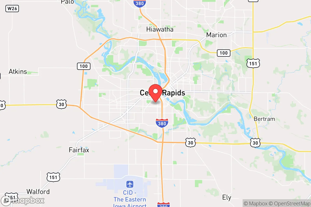
Cedar Rapids sits in Linn County, roughly 200 miles from Chicago and 100 miles from Des Moines, placing it outside the primary blast and immediate fallout zones of any major metropolitan target. The city is situated along the Cedar River, a significant water source that, while historically prone to flooding, provides a critical resource for long-term survival. The surrounding landscape is flat, fertile farmland, which is a double-edged sword: it offers unparalleled agricultural potential but limited natural defensive terrain. The region's climate is continental, with cold winters and hot, humid summers, which means a relocator must be prepared for seasonal extremes. The area's primary natural advantage is its deep, rich topsoil and abundant freshwater aquifer, making it one of the most productive agricultural regions in the world. For a prepper, this means local food production is not just possible but historically proven, and the local economy is deeply tied to food processing and agricultural machinery, which would remain functional in a crisis.
Risk Exposures, Fallout Proximity, and Strategic Vulnerabilities
The most significant risk for Cedar Rapids is its proximity to the Duane Arnold Energy Center, a decommissioned nuclear power plant located just northwest of the city near Palo. While the plant is permanently shut down, the spent fuel pools remain on-site, presenting a potential radiological hazard in the event of a targeted attack or major natural disaster. This is a non-negotiable concern for any serious prepper. Additionally, the city is within a few hundred miles of several major strategic targets: Offutt Air Force Base near Omaha (about 250 miles west), the nuclear weapons complex at Kansas City, and the major transportation hubs of Chicago. A ground burst at any of these locations could produce fallout that reaches Cedar Rapids within 12-24 hours, depending on wind patterns. The city's own industrial base—including major grain processing, metal fabrication, and chemical plants—could become secondary hazards if damaged. The 2016 flood demonstrated the city's vulnerability to natural disasters, with the Cedar River cresting at over 22 feet, causing billions in damage and displacing thousands. For a relocator, this means any property must be carefully evaluated for flood risk, and a robust plan for water purification and evacuation is essential.
Practical Resilience: Food, Water, Energy, and Defensibility
From a practical standpoint, Cedar Rapids offers several key advantages for a self-sufficient lifestyle. The city is surrounded by some of the most productive farmland in the world, and local farmers' markets, co-ops, and bulk food suppliers are abundant. The area is also a hub for renewable energy, with significant wind and solar installations in the surrounding counties. The local power grid is relatively stable, but a prepper should assume grid-down scenarios and invest in solar, battery storage, and a backup generator. Water is plentiful from the Cedar River and the underlying Jordan Aquifer, but filtration and storage are mandatory given agricultural runoff and potential contamination. The city's defensibility is moderate: the flat terrain offers little natural cover, but the city's layout—with a dense urban core surrounded by suburban and rural areas—allows for a layered defense strategy. The local population is predominantly conservative, with a strong work ethic and a culture of self-reliance. Gun ownership is common, and the state has permissive concealed carry laws. For a single individual or family, the key is to establish a home base in a rural or semi-rural area within a 20-30 minute drive of the city, where you can access supplies and community while maintaining a low profile and a defensible position.
The overall strategic picture for Cedar Rapids is one of calculated risk versus reward. It is not a bug-out location for a total collapse scenario—it is too close to infrastructure and population centers for that. However, for the relocator looking for a place to build a resilient life in a community that shares your values, it is a strong contender. The city's industrial base means it will be a node of activity in any crisis, for better or worse. The key is to be prepared: stockpile supplies, build a community of like-minded individuals, and have a plan for both natural disasters and man-made events. If you can accept the nuclear proximity risk and the flood history, Cedar Rapids offers a solid foundation for a prepared, self-sufficient life in the American heartland.
* Values derived from national, state, county, city and local statistics and may differ in a specific area. Last updated: 2026-04-30T03:30:48.000Z
Narrative content on this page is AI-generated and may contain mistakes. Verify any details that matter before acting on them.
ReloMaps may earn a commission from affiliate links at no extra cost to you.