
Photo: Wikipedia
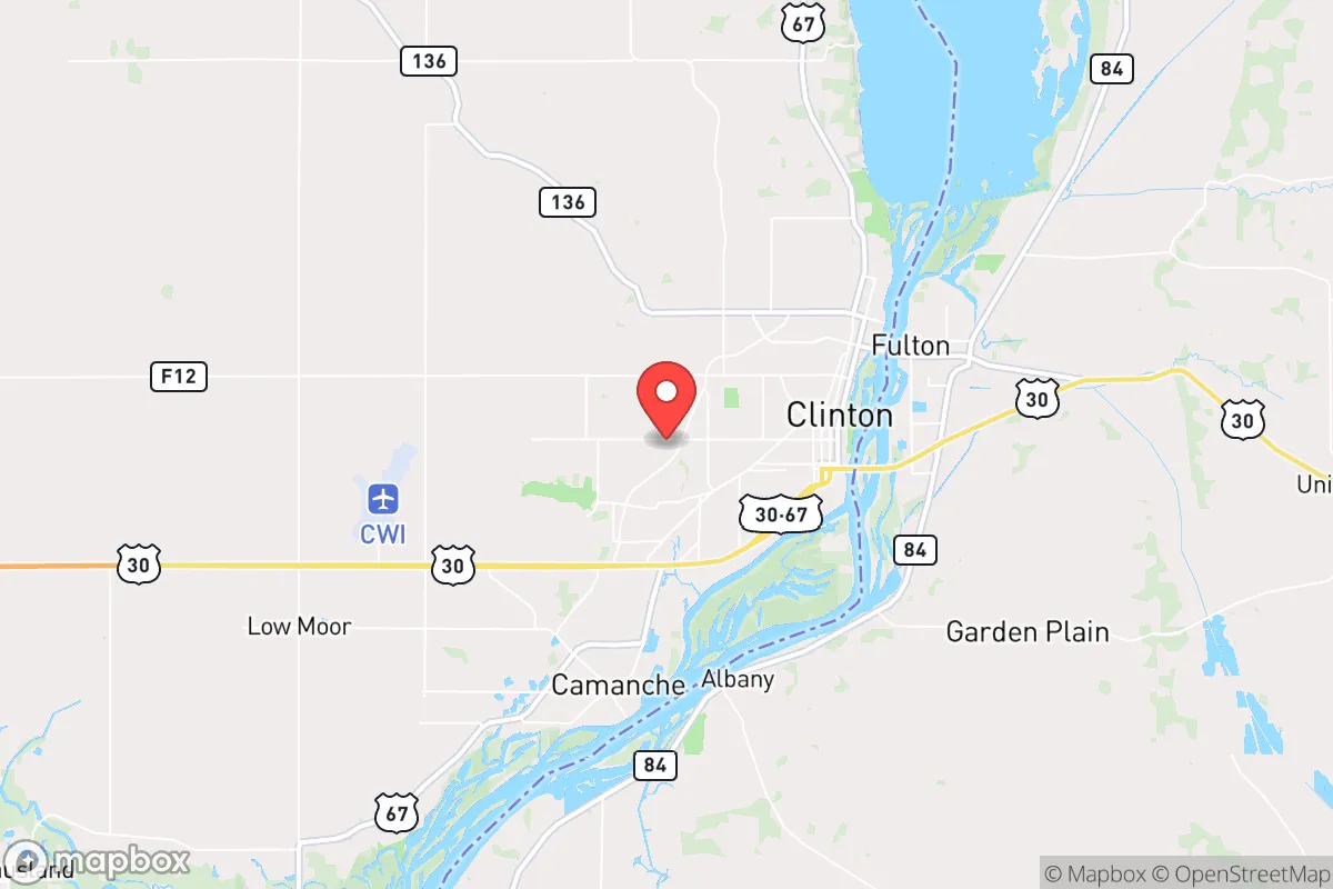
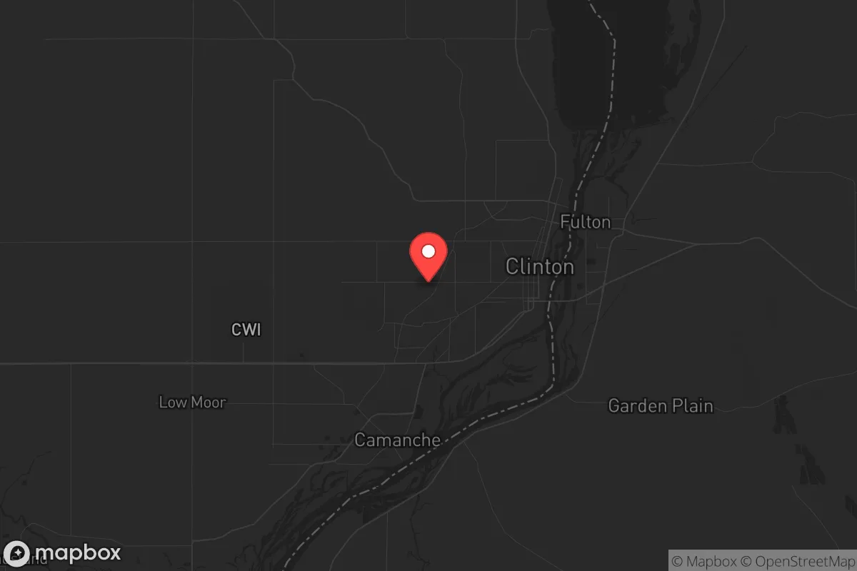
Strategic Assessment of Clinton, IA
Meaningful friction. Expect exposure to either population pressure, blast zones, or natural disaster risk. Consider buying a retreat property.
What does the Strategic Assessment tell us?
Our Strategic Assessment grades tactical survivability of an area. Major population centers, military targets, fallout zones, natural disasters, and border exposure all drive risk — lower exposure means a more defensible position in a crisis.
This is heavily inspired by Joel Skousen's Strategic Relocation book. Highly recommended you checkout the book ($)What does this tell us?
Our Strategic Assessment grades tactical survivability of an area. Major population centers, military targets, fallout zones, natural disasters, and border exposure all drive risk — lower exposure means a more defensible position in a crisis.
This is heavily inspired by Joel Skousen's Strategic Relocation book. Highly recommended you checkout the book ($)Strategic Pillars

Key Distances
Regional Safe Places
Below is our recommended "safe zones" in Iowa and the surrounding area based on our strategic heuristics. For most people, it's unrealistic to live in a “safe zone” full-time due to work, family or other personal reasons. They tend to be more rural. However, many of these areas are perfect for second homes and retreat properties that double as a vacation home or even a short-term rental.


Important Note: For informational purposes only. This does not mean nothing bad ever happens in the green zones. Please use common sense. This is based on public data and modeled with AI. We tried to take a conservative approach but mistakes happen. We update this regularly as new information becomes available.
Solar Generator Recommendations
Backup power matters more here than in safer locations. We've picked three solar generators across budgets and capacity tiers — start with the budget unit if you only need a few essentials, or step up if you want to run a fridge and HVAC for days at a time.

Jackery Portable Power Station Explorer 300
Budget OptionPower on the Go: Weighing only 11 lbs, it's convenient to set up and store with book-sized foldable solar panels

BLUETTI Portable Power Station AC180
Designed for both indoor and outdoor scenarios, AC180 is highly capable as it has a robost capacity and continuous output power.

EF ECOFLOW DELTA Pro Ultra Power Station
Upgraded PickEcoFlow DELTA Pro Ultra is a whole-home energy system designed to grow with your family. Integrated with the Smart Home Panel 2, it scales to meet your evolving energy needs — keeping your home powered, intelligent, and secure through every stage of life.
We earn a commission, at no additional cost to you.
Strategic Assessment Analysis
Clinton, Iowa, sits on the Mississippi River about 140 miles west of Chicago and 90 miles northeast of Des Moines, offering a strategic buffer from the immediate blast zones of major metropolitan targets while still providing access to critical supply chains. For a relocator with a prepper mindset, the town’s population of roughly 24,000 provides a low-profile, semi-rural environment that avoids the chaos of urban collapse without requiring total isolation. The area’s industrial history—anchored by the Clinton Corn Processing plant and a rail hub—gives it a functional backbone for local production and transport, but its proximity to the Quad Cities (40 miles south) and the nuclear plant at Cordova, Illinois (just 20 miles east across the river) introduces real risks that demand careful consideration.
Geographic position and natural advantages for long-term security
Clinton’s location on the Mississippi River is a double-edged sword. On the plus side, the river provides a reliable water source, a natural transportation corridor for barges carrying grain and fuel, and a defensible eastern boundary. The surrounding terrain is mostly flat agricultural land with scattered woodlots, which limits natural cover but offers good visibility and open lines of sight for anyone setting up perimeter security. The area sits in USDA hardiness zone 5b, with cold winters that can stress unprepared newcomers but also reduce the viability of certain pests and diseases. The Mississippi River Valley also offers fertile soil for small-scale farming, and the region’s history of self-sufficient farming communities means local knowledge of food preservation and animal husbandry is still accessible through older residents and county extension offices. For a relocator, the ability to tap into existing rural networks—like the Clinton County Farm Bureau or local livestock auctions—is a practical advantage that urban refugees often overlook.
Risks, exposures, and proximity to fallout-relevant landmarks
The most significant risk for Clinton is its proximity to the Quad Cities Nuclear Generating Station in Cordova, Illinois, just across the river. A catastrophic failure or a targeted strike on that facility would place Clinton directly in the potential fallout plume, depending on wind direction. The plant is a boiling water reactor, and while security is tight, any major event—whether from sabotage, grid failure, or a coordinated attack—could force a rapid evacuation or shelter-in-place scenario. Additionally, Clinton lies within 100 miles of the Chicago metropolitan area, a likely target for civil unrest or infrastructure attacks. The I-80 corridor, which runs just south of town, is a major east-west artery that could become a chokepoint for fleeing populations or military movements. The town itself has a rail line running through its core, which is both an asset for supply movement and a vulnerability if rail transport is disrupted or targeted. Flooding from the Mississippi is a recurring natural hazard—the 2019 floods caused significant damage—so any long-term property should be elevated or located on higher ground west of the river. For a prepper, these factors mean that Clinton is not a bug-out location for a worst-case scenario; it’s a place to hunker down with a solid plan for river-level threats and a clear evacuation route west toward less populated areas like Cedar Rapids or the Driftless Region.
Practical resilience for a relocator: food, water, energy, and defensibility
Clinton’s practical resilience hinges on its industrial base and local resources. The Clinton Corn Processing plant produces ethanol, animal feed, and corn syrup, meaning there’s a steady supply of industrial-grade food inputs and fuel byproducts that could be repurposed in a crisis. The city’s water treatment plant draws from the Mississippi, which is a reliable source but requires filtration and chemical treatment for safe drinking—something any prepper should plan for with a high-capacity filter and iodine tablets. The local power grid is served by Alliant Energy, with natural gas and coal plants in the region, but a grid-down scenario would likely leave Clinton without power for extended periods due to its reliance on centralized infrastructure. Solar potential is moderate—about 4.5 peak sun hours per day—so a small off-grid solar setup with battery storage is feasible for a single family, but large-scale generation would be tough. Defensibility is mixed: the town’s layout is a typical Midwestern grid with a riverfront, which offers limited natural chokepoints. However, the surrounding rural areas have scattered farmsteads with good fields of fire and access to back roads that can be monitored. The local gun culture is strong—Iowa is a shall-issue state for permits, and Clinton County has a history of hunting and sport shooting—so finding like-minded neighbors for a community defense group is realistic. Food storage is straightforward: the area has multiple grocery stores, a Walmart, and local farms selling direct, but a prepper should stock at least three months of supplies given the potential for supply chain disruptions from Chicago or the Quad Cities.
Overall, Clinton offers a moderate strategic position for a conservative-leaning relocator focused on resilience. It’s not a remote mountain redoubt, but it’s far enough from major targets to avoid the immediate fallout of a Chicago-level event, while still providing access to river transport, industrial food production, and a rural support network. The biggest downsides are the nuclear plant risk and the floodplain exposure, both of which can be mitigated with proper site selection and a pre-planned evacuation route west. For a single individual or a family willing to invest in water filtration, off-grid power, and community building, Clinton is a viable option—just don’t expect it to be a fortress. It’s a working-class river town with real vulnerabilities, but also real assets for anyone serious about long-term preparedness in an unstable world.
* Values derived from national, state, county, city and local statistics and may differ in a specific area. Last updated: 2026-04-30T00:18:06.000Z
Narrative content on this page is AI-generated and may contain mistakes. Verify any details that matter before acting on them.
ReloMaps may earn a commission from affiliate links at no extra cost to you.