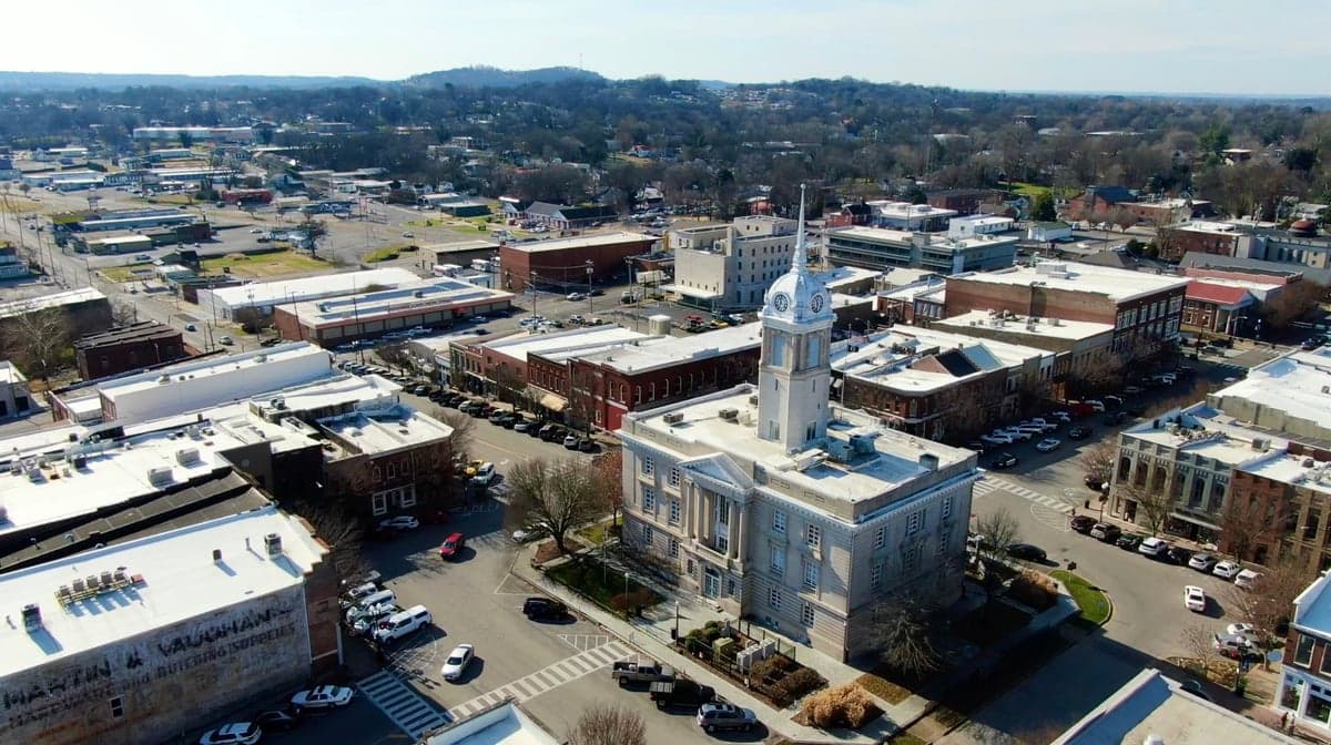
Photo: Wikipedia
Strategic Assessment of Columbia, TN
Meaningful friction. Expect exposure to either population pressure, blast zones, or natural disaster risk. Consider buying a retreat property.
What does the Strategic Assessment tell us?
Our Strategic Assessment grades tactical survivability of an area. Major population centers, military targets, fallout zones, natural disasters, and border exposure all drive risk — lower exposure means a more defensible position in a crisis.
This is heavily inspired by Joel Skousen's Strategic Relocation book. Highly recommended you checkout the book ($)What does this tell us?
Our Strategic Assessment grades tactical survivability of an area. Major population centers, military targets, fallout zones, natural disasters, and border exposure all drive risk — lower exposure means a more defensible position in a crisis.
This is heavily inspired by Joel Skousen's Strategic Relocation book. Highly recommended you checkout the book ($)Strategic Pillars

Key Distances
Regional Safe Places
Below is our recommended "safe zones" in Tennessee and the surrounding area based on our strategic heuristics. For most people, it's unrealistic to live in a “safe zone” full-time due to work, family or other personal reasons. They tend to be more rural. However, many of these areas are perfect for second homes and retreat properties that double as a vacation home or even a short-term rental.
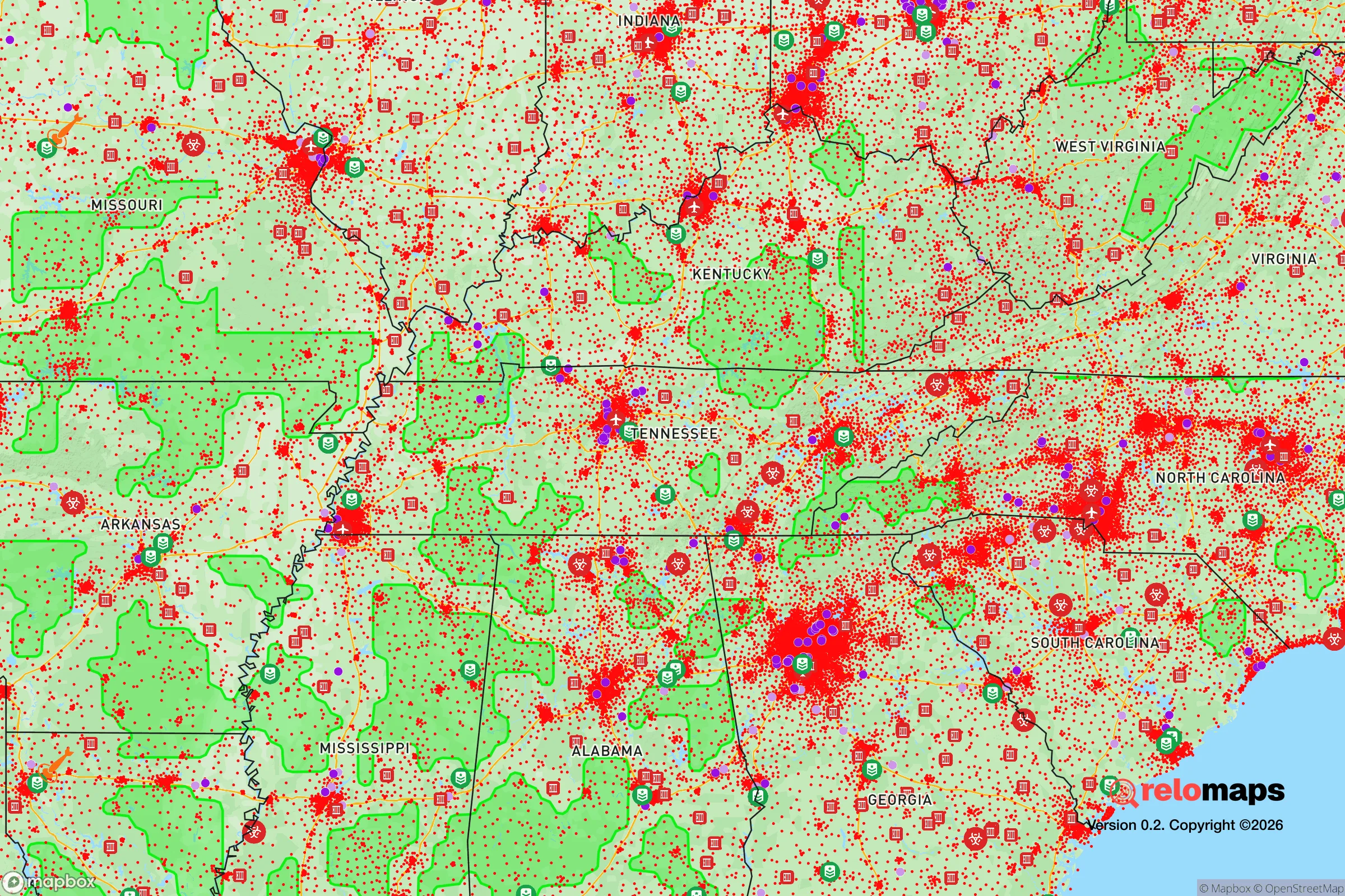
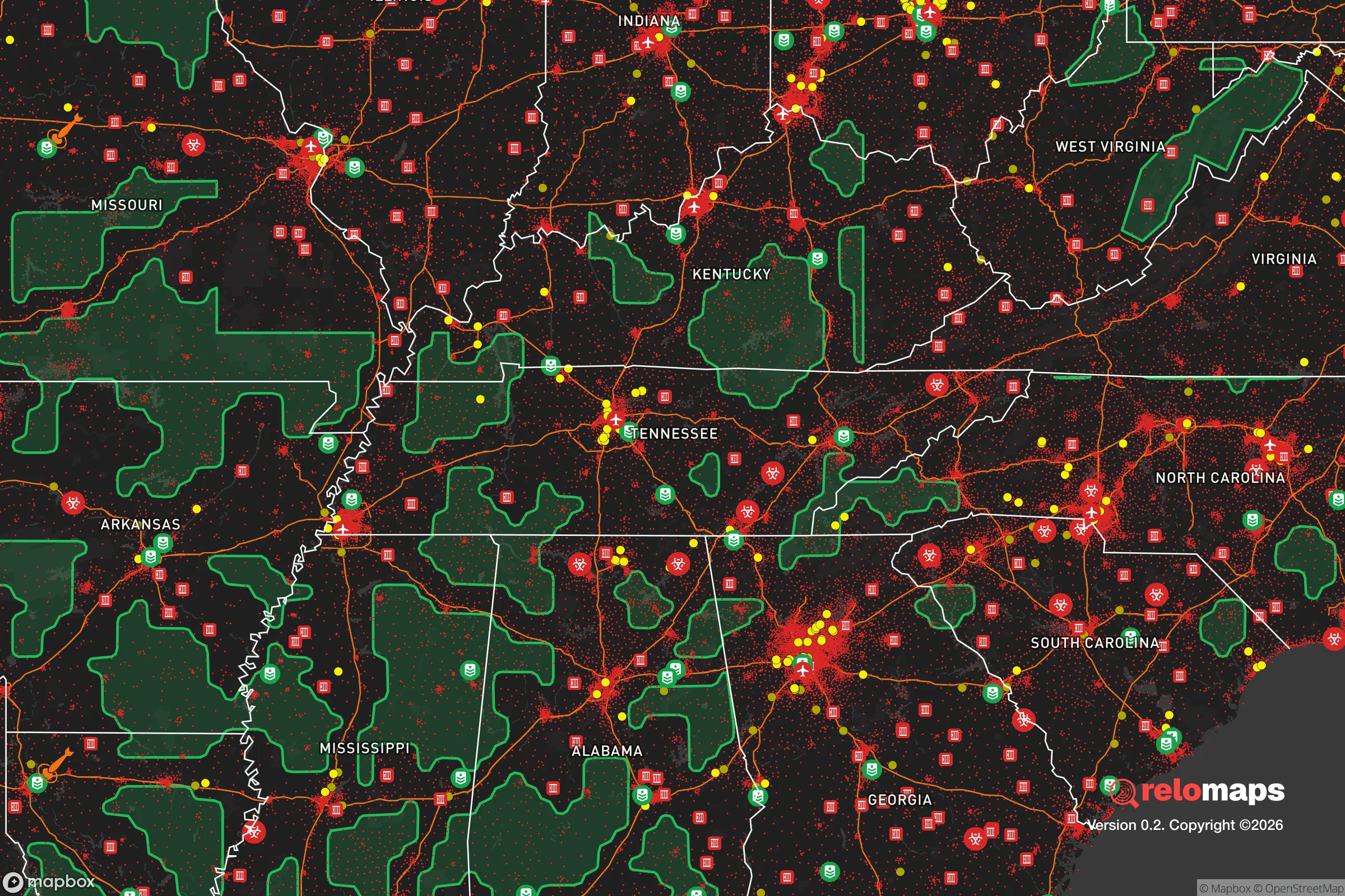
Important Note: For informational purposes only. This does not mean nothing bad ever happens in the green zones. Please use common sense. This is based on public data and modeled with AI. We tried to take a conservative approach but mistakes happen. We update this regularly as new information becomes available.
Solar Generator Recommendations
Backup power matters more here than in safer locations. We've picked three solar generators across budgets and capacity tiers — start with the budget unit if you only need a few essentials, or step up if you want to run a fridge and HVAC for days at a time.

Jackery Portable Power Station Explorer 300
Budget OptionPower on the Go: Weighing only 11 lbs, it's convenient to set up and store with book-sized foldable solar panels

BLUETTI Portable Power Station AC180
Designed for both indoor and outdoor scenarios, AC180 is highly capable as it has a robost capacity and continuous output power.

EF ECOFLOW DELTA Pro Ultra Power Station
Upgraded PickEcoFlow DELTA Pro Ultra is a whole-home energy system designed to grow with your family. Integrated with the Smart Home Panel 2, it scales to meet your evolving energy needs — keeping your home powered, intelligent, and secure through every stage of life.
We earn a commission, at no additional cost to you.
Strategic Assessment Analysis
Columbia, Tennessee, sits in a sweet spot that few relocation analysts fully appreciate: close enough to Nashville’s economic engine to sustain a growing tax base and job market, yet far enough south and west of the urban core to offer genuine strategic depth. For a conservative-minded relocator thinking about long-term resilience—civic unrest, supply-chain disruptions, or larger societal fractures—Columbia’s position along the Duck River and its status as the Maury County seat provide a rare combination of agricultural self-sufficiency, industrial diversity, and geographic buffer. The city’s population hovers around 45,000, with the county pushing 100,000, giving it enough scale to support hospitals, schools, and infrastructure without the vulnerability of a dense metro. This is not a bug-out cabin in the woods; it’s a functioning small city with the bones to absorb and sustain a household through a wide range of contingencies.
Geographic position and natural advantages for long-term security
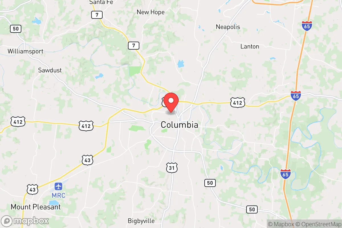
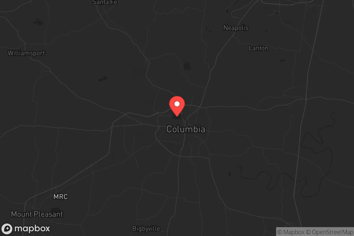
Columbia’s location at the intersection of U.S. Highway 412 and U.S. Highway 31—roughly 45 miles south of Nashville and 35 miles north of the Alabama line—places it on a secondary transportation corridor that avoids the chokepoints of I-65 and I-24. In a crisis scenario where major interstates become impassable due to congestion, checkpoints, or damage, these state highways offer alternate egress routes west toward the Tennessee River and east toward the Cumberland Plateau. The Duck River, which runs through the heart of Columbia, is the longest river entirely within Tennessee and provides a reliable freshwater source that is less likely to be contaminated by industrial runoff compared to the Cumberland or Tennessee rivers near larger cities. The surrounding Maury County terrain is rolling hills and limestone valleys—not mountainous, but with enough topographic variation to provide natural drainage, defensible ridgelines, and concealment from main roads. The area’s karst geology also means numerous springs and cave systems, which historically supported early settlements and could serve as emergency water sources or storage. For a prepper mindset, the key advantage is that Columbia is not a natural disaster hotspot: tornado risk is moderate (EF-2 or EF-3 events occur every few years, but not annually), flood risk is confined to low-lying areas near the river, and the region is seismically stable. No hurricane storm surge, no wildfire corridors, no earthquake faults—just predictable four-season weather that supports year-round gardening and livestock.
Risks, exposures, and proximity to fallout-relevant landmarks
The most significant strategic liability for Columbia is its proximity to Nashville’s metropolitan statistical area, which contains roughly 2 million people and multiple high-value targets. In a mass-casualty event or large-scale civil unrest, Nashville’s population would likely push south along the I-65 corridor, and Columbia sits directly in that path. The city is also within 60 miles of the Tennessee Valley Authority’s Sequoyah Nuclear Plant (near Chattanooga) and within 100 miles of the Browns Ferry Nuclear Plant in Alabama. While neither is an immediate fallout zone for Columbia under normal accident scenarios, a coordinated attack or catastrophic failure could produce a plume that affects Maury County depending on wind patterns. Additionally, the nearby Arnold Air Force Base (Tullahoma, about 40 miles southeast) and the U.S. Army’s Fort Campbell (about 70 miles northwest) are both potential targets in a conflict scenario. On the ground, Columbia’s own industrial base—including a General Motors plant (Spring Hill, 12 miles east) and several chemical and manufacturing facilities along the Duck River—could become secondary hazards if civil order collapses. The good news is that Columbia is not a primary target itself; it lacks the symbolic or logistical significance of Nashville, Memphis, or Oak Ridge. The risk is largely secondary: refugees, supply-chain interruption, and the potential for localized violence if law enforcement is overwhelmed. Maury County’s sheriff’s office and the Columbia Police Department are well-funded relative to rural counties, but a mass evacuation from Nashville would still strain resources for days or weeks.
Practical resilience for a relocator: food, water, energy, and defensibility
For a single individual or family looking to establish a resilient household, Columbia offers several concrete advantages that are hard to replicate in more remote areas. Food security is strong: Maury County has over 1,200 farms, and the local agricultural economy includes cattle, poultry, soybeans, corn, and hay. The Columbia Farmers Market operates year-round, and several u-pick orchards and CSAs operate within a 20-minute drive. In a prolonged disruption, a household with 1–2 acres could realistically produce a significant portion of its own calories, especially with the long growing season (April through October). Water access is excellent: the Duck River provides a surface water source that can be filtered or boiled, and the underlying aquifer (the Nashville Basin limestone) yields reliable well water at depths of 100–300 feet. Most residential lots in the county are on well and septic, which means no reliance on municipal water treatment plants that could fail or be targeted. Energy resilience is mixed: the local grid is served by Duck River Electric Membership Corporation, a cooperative that has historically been more reliable than investor-owned utilities, but it still depends on TVA’s regional generation. Solar potential is good—the area averages about 210 sunny days per year—and net metering is available for grid-tied systems. For off-grid capability, propane is widely available, and wood heating is feasible given the surrounding hardwood forests. Defensibility is where Columbia requires honest assessment: it is not a fortress. The city itself is spread out with multiple entry points, and the county’s rural areas are accessible via a network of two-lane roads. However, the terrain does offer natural chokepoints—bridges over the Duck River, narrow ridgeline roads, and limited east-west crossings—that could be monitored or controlled by a prepared community. The local gun culture is strong, with multiple shooting ranges and gun shops, and Maury County has a high rate of concealed-carry permits per capita. In a breakdown of civil order, a household that has built relationships with neighbors and invested in basic security measures (reinforced doors, perimeter lighting, a reliable vehicle with off-road capability) would be in a far better position than in a dense suburb or urban core.
The overall strategic picture for Columbia, Tennessee, is one of moderate-to-high resilience with manageable trade-offs. It is not a remote survivalist retreat—you will have neighbors, traffic, and the occasional Walmart run—but it offers a realistic balance of economic opportunity, agricultural capacity, and geographic buffer that most prepper-focused relocation guides overlook. The biggest threat is not natural disaster or direct attack, but the secondary effects of Nashville’s instability: refugees, resource competition, and potential civil unrest spilling south. A relocator who buys land with a good well, establishes a garden and rainwater catchment, and builds a network of like-minded locals will find Columbia to be a defensible, sustainable base for the long haul. For the conservative-minded individual who wants to stay engaged with the broader economy while maintaining the ability to weather a crisis, this is one of the better options in the mid-South. Just don’t expect to be invisible—prepare to be part of a community, because in a real emergency, that’s the only kind of security that holds.
* Values derived from national, state, county, city and local statistics and may differ in a specific area. Last updated: 2026-05-01T08:10:29.000Z
Narrative content on this page is AI-generated and may contain mistakes. Verify any details that matter before acting on them.
ReloMaps may earn a commission from affiliate links at no extra cost to you.