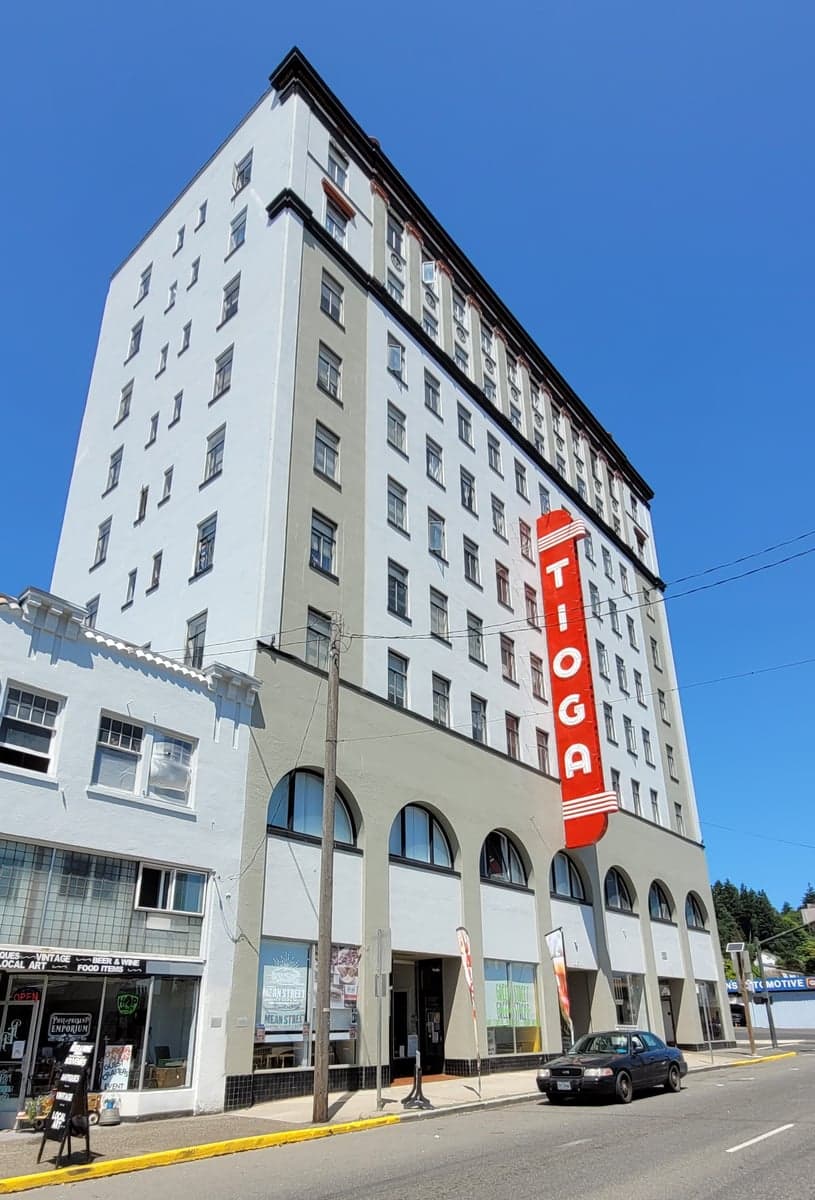
Photo: Wikipedia
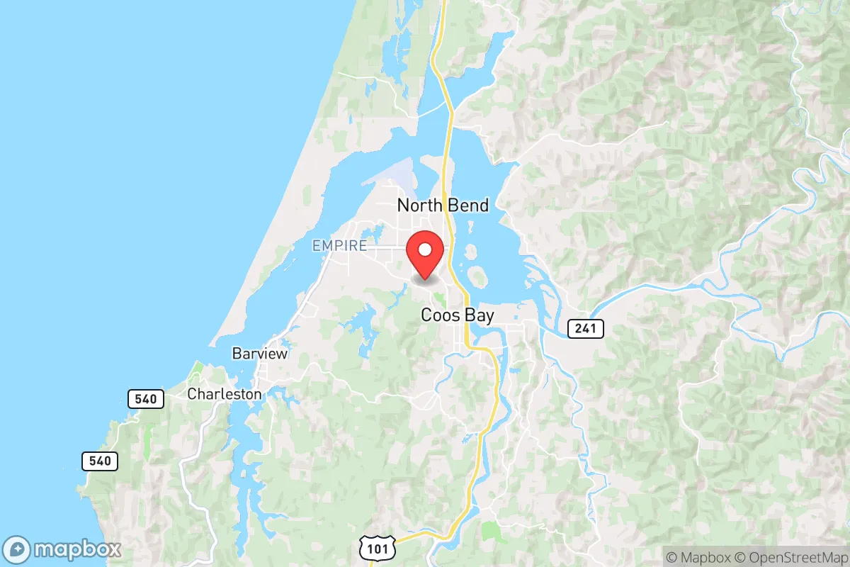
Strategic Assessment of Coos Bay, OR
Meaningful friction. Expect exposure to either population pressure, blast zones, or natural disaster risk. Consider buying a retreat property.
What does the Strategic Assessment tell us?
Our Strategic Assessment grades tactical survivability of an area. Major population centers, military targets, fallout zones, natural disasters, and border exposure all drive risk — lower exposure means a more defensible position in a crisis.
This is heavily inspired by Joel Skousen's Strategic Relocation book. Highly recommended you checkout the book ($)What does this tell us?
Our Strategic Assessment grades tactical survivability of an area. Major population centers, military targets, fallout zones, natural disasters, and border exposure all drive risk — lower exposure means a more defensible position in a crisis.
This is heavily inspired by Joel Skousen's Strategic Relocation book. Highly recommended you checkout the book ($)Strategic Pillars

Key Distances
Regional Safe Places
Below is our recommended "safe zones" in Oregon and the surrounding area based on our strategic heuristics. For most people, it's unrealistic to live in a “safe zone” full-time due to work, family or other personal reasons. They tend to be more rural. However, many of these areas are perfect for second homes and retreat properties that double as a vacation home or even a short-term rental.


Important Note: For informational purposes only. This does not mean nothing bad ever happens in the green zones. Please use common sense. This is based on public data and modeled with AI. We tried to take a conservative approach but mistakes happen. We update this regularly as new information becomes available.
Solar Generator Recommendations
Backup power matters more here than in safer locations. We've picked three solar generators across budgets and capacity tiers — start with the budget unit if you only need a few essentials, or step up if you want to run a fridge and HVAC for days at a time.

Jackery Portable Power Station Explorer 300
Budget OptionPower on the Go: Weighing only 11 lbs, it's convenient to set up and store with book-sized foldable solar panels

BLUETTI Portable Power Station AC180
Designed for both indoor and outdoor scenarios, AC180 is highly capable as it has a robost capacity and continuous output power.

EF ECOFLOW DELTA Pro Ultra Power Station
Upgraded PickEcoFlow DELTA Pro Ultra is a whole-home energy system designed to grow with your family. Integrated with the Smart Home Panel 2, it scales to meet your evolving energy needs — keeping your home powered, intelligent, and secure through every stage of life.
We earn a commission, at no additional cost to you.
Strategic Assessment Analysis
Coos Bay, Oregon, occupies a strategic position on the southern Oregon coast that offers a rare combination of natural defensibility, resource abundance, and relative isolation from major population centers. While the Pacific Northwest faces its own set of vulnerabilities—seismic threats, supply chain fragility, and political instability in Portland and Seattle—Coos Bay sits far enough from these hotspots to provide a genuine buffer, yet close enough to coastal shipping lanes and the region’s only deepwater port to maintain access to outside goods if needed. For a relocator thinking in terms of decades, not just years, this town of roughly 16,000 people represents a low-profile, high-resilience option that deserves serious consideration.
Geographic position and natural advantages for long-term security
Coos Bay’s defining asset is its location on a natural deepwater harbor—the largest between San Francisco and the Columbia River. This gives the area a logistical edge that most small coastal towns lack: the ability to receive bulk goods, fuel, and heavy equipment by sea even if road corridors are compromised. The surrounding terrain is a mix of coastal mountains, dense temperate rainforest, and the sprawling Oregon Dunes National Recreation Area to the south, which together create a natural barrier against overland movement from the Willamette Valley or inland population centers. The nearest major city, Eugene, is roughly 100 miles east over the Coast Range via Highway 126—a winding, two-lane road that is easily chokepointed. Portland is 180 miles north, and the I-5 corridor is over an hour inland. This distance from major urban areas means that in a scenario of civil unrest or mass casualty events, Coos Bay would likely see minimal spillover violence or refugee flow compared to towns closer to Portland or Salem. The climate is maritime—cool, wet winters and mild, dry summers—which supports year-round food production in protected microclimates and reduces the risk of wildfire relative to eastern Oregon or California. The area also sits atop significant freshwater aquifers, and the Coos River system provides reliable surface water even during drought years.
Risks, exposures, and proximity to fallout-relevant landmarks
No location is without vulnerabilities, and Coos Bay has several that a prepper-minded relocator must weigh. The most obvious is the Cascadia Subduction Zone earthquake and resulting tsunami threat. Coos Bay’s low-lying areas—including the downtown waterfront, the airport, and much of the bayfront industrial zone—sit at elevations of 10 to 20 feet, putting them directly in the inundation zone for a major Cascadia event. The Oregon Office of Emergency Management estimates a 37% probability of a magnitude 8.0+ quake in the next 50 years, and the tsunami wave could arrive within 15 to 20 minutes. This means that any property below 50 feet elevation or within a mile of the bay is a hard no for long-term survival planning. Higher ground exists—the hills around Empire, Eastside, and the bluffs above the bay offer safe zones—but buildable lots there are limited and expensive. Another risk is the area’s dependence on a single road corridor: Highway 101 runs north-south along the coast, and Highway 38 provides the only direct route inland to I-5 at Drain. Both are vulnerable to landslides, bridge failures, and earthquake damage. In a prolonged crisis, Coos Bay could become effectively isolated by road for weeks or months. On the positive side, the Port of Coos Bay is a designated strategic port under the U.S. Department of Transportation’s Marine Highway Program, meaning it has some federal priority for post-disaster recovery. There are no nuclear power plants within 150 miles (the closest is Trojan, decommissioned, near Portland), and no major military bases or chemical storage facilities in the immediate vicinity. The nearest fallout-relevant landmark is the Hanford Site in eastern Washington, roughly 300 miles away—far enough that prevailing westerly winds would carry any airborne contamination away from the coast.
Practical resilience for a relocator: food, water, energy, and defensibility
For someone serious about self-sufficiency, Coos Bay offers strong fundamentals. The region’s growing season runs from April through October, with average rainfall of 64 inches per year—enough to support intensive gardening, orchards, and small-scale livestock without irrigation. The coastal foggy, mild summers mean lower evaporation rates than inland areas, so water storage requirements are more manageable. The surrounding forests provide abundant firewood, building materials, and game (deer, elk, blacktail, and waterfowl), though hunting pressure is moderate. The commercial fishing fleet in Coos Bay is one of the largest on the Oregon coast, landing Dungeness crab, salmon, tuna, and groundfish. In a collapse scenario, access to protein from the sea is a major advantage that inland locations cannot match. Energy resilience is mixed: the local grid is served by the Bonneville Power Administration, which is hydro-dominated and relatively stable, but coastal transmission lines are vulnerable to storms and seismic damage. Solar potential is mediocre due to heavy cloud cover from November through February—expect only 2-3 peak sun hours per day in winter—so a serious off-grid setup would need wind or micro-hydro if a creek is available. Propane is widely available and can be stored in bulk. Defensibility is good by small-town standards: the population is spread across several distinct neighborhoods (Coos Bay proper, North Bend, Charleston, and the rural Eastside), and the terrain offers natural chokepoints at the bridges over the bay and the narrow coastal highway. The local culture leans independent and self-reliant, with a strong working-class ethos rooted in timber, fishing, and port operations. There is no significant homeless encampment problem downtown, unlike in Portland or Eugene, and property crime rates are moderate—roughly 30% below the Oregon average according to 2024 FBI data. The county sheriff’s office is well-regarded locally, and the Coos Bay Police Department maintains a visible presence.
The overall strategic picture for Coos Bay is one of calculated trade-offs. It offers genuine advantages in resource access, isolation from urban chaos, and a defensible geography that few coastal towns can match. But the seismic and tsunami risk is real and unavoidable—anyone relocating here must buy property above 50 feet elevation and have a plan for the first 72 hours after a major quake. The road vulnerability means that a prepper should stockpile at least three months of supplies, not the typical two-week emergency kit. For a conservative-leaning individual or family who values self-reliance, low population density, and proximity to the ocean’s bounty, Coos Bay is a strong candidate—provided you go in with eyes open about the ground shaking beneath your feet. It is not a bug-out location for a weekend; it is a long-term homesteading play in a region that will test your preparedness but reward it with genuine security if you plan accordingly.
* Values derived from national, state, county, city and local statistics and may differ in a specific area. Last updated: 2026-05-18T00:01:06.000Z
Narrative content on this page is AI-generated and may contain mistakes. Verify any details that matter before acting on them.
ReloMaps may earn a commission from affiliate links at no extra cost to you.