Photo: Wikipedia
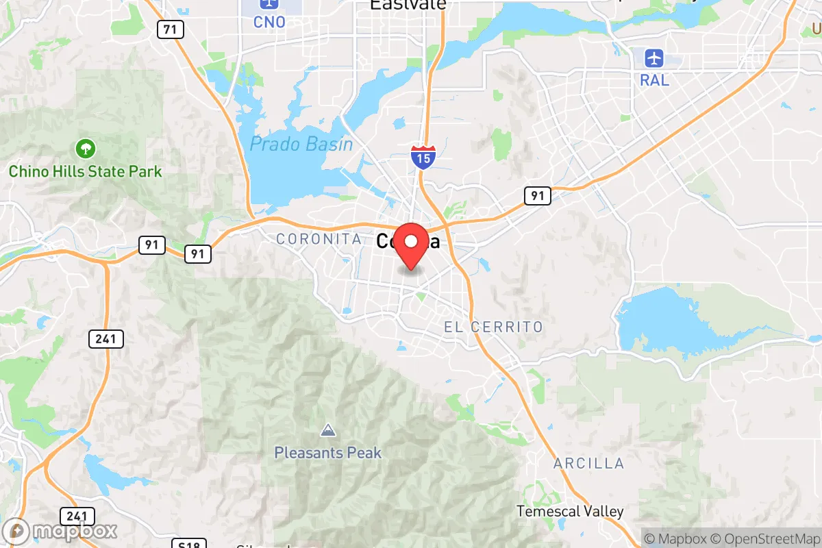
Strategic Assessment of Corona, CA
Multiple tactical vulnerabilities. Population density, target proximity, or disaster risk are likely compounding. A retreat property and exit planning is required.
What does the Strategic Assessment tell us?
Our Strategic Assessment grades tactical survivability of an area. Major population centers, military targets, fallout zones, natural disasters, and border exposure all drive risk — lower exposure means a more defensible position in a crisis.
This is heavily inspired by Joel Skousen's Strategic Relocation book. Highly recommended you checkout the book ($)What does this tell us?
Our Strategic Assessment grades tactical survivability of an area. Major population centers, military targets, fallout zones, natural disasters, and border exposure all drive risk — lower exposure means a more defensible position in a crisis.
This is heavily inspired by Joel Skousen's Strategic Relocation book. Highly recommended you checkout the book ($)Strategic Pillars

Key Distances
Regional Safe Places
Below is our recommended "safe zones" in California and the surrounding area based on our strategic heuristics. For most people, it's unrealistic to live in a “safe zone” full-time due to work, family or other personal reasons. They tend to be more rural. However, many of these areas are perfect for second homes and retreat properties that double as a vacation home or even a short-term rental.


Important Note: For informational purposes only. This does not mean nothing bad ever happens in the green zones. Please use common sense. This is based on public data and modeled with AI. We tried to take a conservative approach but mistakes happen. We update this regularly as new information becomes available.
Solar Generator Recommendations
Backup power matters more here than in safer locations. We've picked three solar generators across budgets and capacity tiers — start with the budget unit if you only need a few essentials, or step up if you want to run a fridge and HVAC for days at a time.

Jackery Portable Power Station Explorer 300
Budget OptionPower on the Go: Weighing only 11 lbs, it's convenient to set up and store with book-sized foldable solar panels

BLUETTI Portable Power Station AC180
Designed for both indoor and outdoor scenarios, AC180 is highly capable as it has a robost capacity and continuous output power.

EF ECOFLOW DELTA Pro Ultra Power Station
Upgraded PickEcoFlow DELTA Pro Ultra is a whole-home energy system designed to grow with your family. Integrated with the Smart Home Panel 2, it scales to meet your evolving energy needs — keeping your home powered, intelligent, and secure through every stage of life.
We earn a commission, at no additional cost to you.
Strategic Assessment Analysis
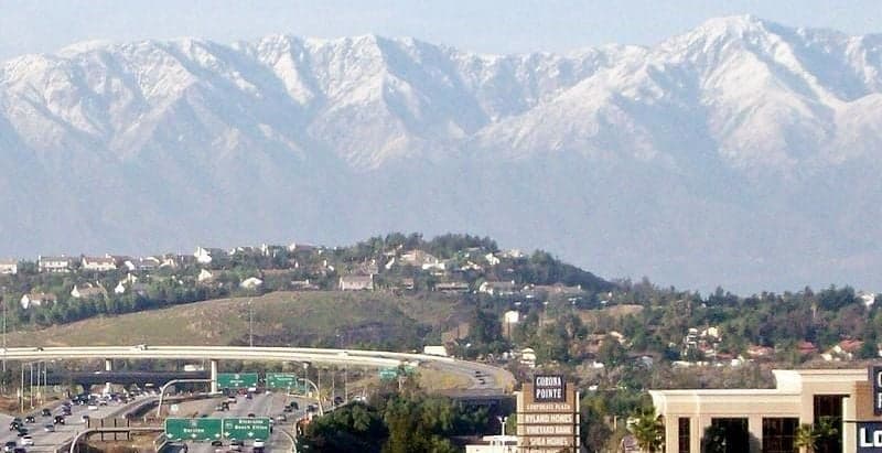
Corona, California, sits in a geographic sweet spot that offers a mix of strategic advantages and serious liabilities for the survival-minded relocator. Nestled at the junction of the 91 and 15 freeways, it’s close enough to major economic hubs to sustain a career but far enough from the immediate blast zones of Los Angeles and San Diego to offer a fighting chance in a crisis. The city’s position along the Santa Ana River and its proximity to the Cleveland National Forest provide natural resources and escape routes, but its location in a densely populated corridor of Southern California means you’re never truly isolated from the risks of civil unrest, supply chain collapse, or state-level policy failures. For a conservative-leaning individual or family looking to balance preparedness with modern employment, Corona demands a clear-eyed assessment of its resilience—and its vulnerabilities.
Geographic position and natural advantages for long-term survival
Corona’s geography is a double-edged sword, but the edges that cut in your favor are sharp. The city sits in the Temescal Valley, flanked by the Santa Ana Mountains to the west and the Chino Hills to the north, creating natural chokepoints that could be leveraged for defense or retreat. The Cleveland National Forest, a short drive to the south, offers over 460,000 acres of rugged terrain, water sources, and game—critical for a bug-out scenario or long-term foraging. The Santa Ana River, while often dry in summer, provides a riparian corridor that can be used for travel, water collection, and concealment. Corona’s elevation, ranging from 600 to 1,200 feet, gives it a slight thermal advantage over the coastal basins, meaning cooler nights and less oppressive heat during a grid-down event. The area’s Mediterranean climate—with mild, wet winters and dry summers—supports year-round gardening, especially if you’re willing to invest in drought-tolerant crops and rainwater catchment. For a prepper, these natural assets are non-negotiable: they offer a baseline for self-sufficiency that flat, arid suburbs simply cannot match.
Risks, exposures, and proximity to fallout-relevant landmarks
The sobering reality is that Corona sits within a 50-mile radius of multiple high-value targets that would make a major conflict or terrorist event catastrophic. March Air Reserve Base, just 10 miles to the east in Riverside, is a strategic airlift hub and a likely first-strike target in any conventional war. The Port of Los Angeles and Port of Long Beach, roughly 45 miles southwest, are the nation’s busiest cargo hubs—and prime targets for disruption, whether from state actors, EMP attacks, or domestic sabotage. The San Onofre Nuclear Generating Station, though decommissioned, still holds spent fuel in dry casks 40 miles down the coast; a direct hit or sabotage could render large swaths of Orange and Riverside counties uninhabitable for decades. Corona’s position along the 91 freeway, a major east-west artery, means it would be a chokepoint for mass evacuations from Los Angeles and Orange County—and a funnel for looters, refugees, and hostile actors moving inland. The city’s population of roughly 170,000, combined with the surrounding Inland Empire’s 4.5 million people, creates a density that would strain local resources within days of a major event. For the survivalist, these risks are not theoretical: they define the timeline and severity of any crisis you’d face here.
Practical resilience for a relocator: food, water, energy, and defensibility
Corona’s practical resilience is a mixed bag that requires active preparation, not passive reliance. The city’s water supply comes primarily from the State Water Project and the Colorado River Aqueduct—both vulnerable to earthquake damage, sabotage, or political mismanagement. The local groundwater basin, the Temescal Valley Aquifer, is over-allocated and subject to contamination from agricultural runoff and industrial sites. A serious prepper would need to invest in a deep well (if zoning allows) or a robust rainwater catchment system; the area averages 12 inches of rain per year, so storage capacity must be large. Food resilience is better: the surrounding agricultural areas—including the citrus groves of Riverside and the dairy operations in Chino—offer local sourcing, but these supply chains would collapse quickly in a crisis. Home gardening is viable, with a growing season that runs nearly year-round, but soil quality varies and requires amendment. Energy-wise, Corona is served by Southern California Edison, a grid that has proven fragile during wildfire seasons and heat waves. Solar panels with battery storage are a must, as is a backup generator for critical loads. Defensibility is the weakest link: Corona is a suburban sprawl with few natural barriers to entry. The city’s layout—winding hillside neighborhoods in the south, flat grid streets in the north—means that a determined group could move through most areas quickly. The best defensive positions are in the foothills near the Cleveland National Forest boundary, where limited access roads and steep terrain provide natural chokepoints. For a family, this means choosing a home with a clear line of sight, multiple exit routes, and a neighborhood that can be organized for mutual defense. Without that, Corona is just another suburb waiting to be overrun.
The overall strategic picture for Corona is one of calculated risk. It offers genuine advantages—proximity to wildlands, a moderate climate, and a location that’s far enough from the coast to avoid the worst of a port-city collapse. But it’s also embedded in a region that would be a focal point of chaos in any national emergency. For the conservative relocator who values self-reliance and community, Corona can work—but only if you treat it as a base to be hardened, not a sanctuary to be trusted. You’ll need to invest in water independence, energy backup, and a network of like-minded neighbors. You’ll need to know your escape routes into the forest and your rally points for defense. And you’ll need to accept that, in a worst-case scenario, the 91 freeway will become a river of desperation, and your job is to be on the right side of the current. Corona is not a bug-out location; it’s a prepper’s compromise—a place where you can build a life that’s ready for the worst, as long as you never forget that the worst is always closer than the map suggests.
* Values derived from national, state, county, city and local statistics and may differ in a specific area. Last updated: 2026-04-24T13:29:41.000Z
Narrative content on this page is AI-generated and may contain mistakes. Verify any details that matter before acting on them.
ReloMaps may earn a commission from affiliate links at no extra cost to you.