
Photo: Wikipedia
Strategic Assessment of Cumberland, MD
Meaningful friction. Expect exposure to either population pressure, blast zones, or natural disaster risk. Consider buying a retreat property.
What does the Strategic Assessment tell us?
Our Strategic Assessment grades tactical survivability of an area. Major population centers, military targets, fallout zones, natural disasters, and border exposure all drive risk — lower exposure means a more defensible position in a crisis.
This is heavily inspired by Joel Skousen's Strategic Relocation book. Highly recommended you checkout the book ($)What does this tell us?
Our Strategic Assessment grades tactical survivability of an area. Major population centers, military targets, fallout zones, natural disasters, and border exposure all drive risk — lower exposure means a more defensible position in a crisis.
This is heavily inspired by Joel Skousen's Strategic Relocation book. Highly recommended you checkout the book ($)Strategic Pillars

Key Distances
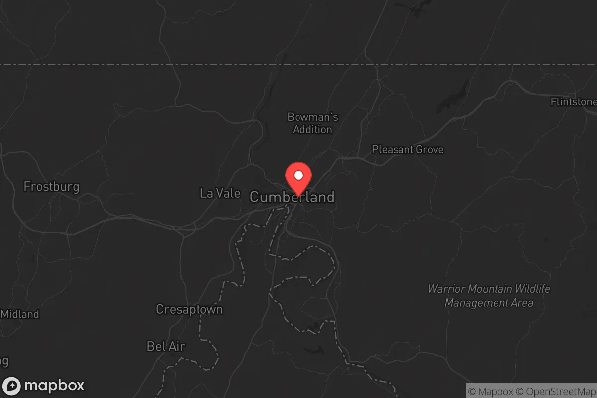
Regional Safe Places
Below is our recommended "safe zones" in Maryland and the surrounding area based on our strategic heuristics. For most people, it's unrealistic to live in a “safe zone” full-time due to work, family or other personal reasons. They tend to be more rural. However, many of these areas are perfect for second homes and retreat properties that double as a vacation home or even a short-term rental.


Important Note: For informational purposes only. This does not mean nothing bad ever happens in the green zones. Please use common sense. This is based on public data and modeled with AI. We tried to take a conservative approach but mistakes happen. We update this regularly as new information becomes available.
Solar Generator Recommendations
Backup power matters more here than in safer locations. We've picked three solar generators across budgets and capacity tiers — start with the budget unit if you only need a few essentials, or step up if you want to run a fridge and HVAC for days at a time.

Jackery Portable Power Station Explorer 300
Budget OptionPower on the Go: Weighing only 11 lbs, it's convenient to set up and store with book-sized foldable solar panels

BLUETTI Portable Power Station AC180
Designed for both indoor and outdoor scenarios, AC180 is highly capable as it has a robost capacity and continuous output power.

EF ECOFLOW DELTA Pro Ultra Power Station
Upgraded PickEcoFlow DELTA Pro Ultra is a whole-home energy system designed to grow with your family. Integrated with the Smart Home Panel 2, it scales to meet your evolving energy needs — keeping your home powered, intelligent, and secure through every stage of life.
We earn a commission, at no additional cost to you.
Strategic Assessment Analysis
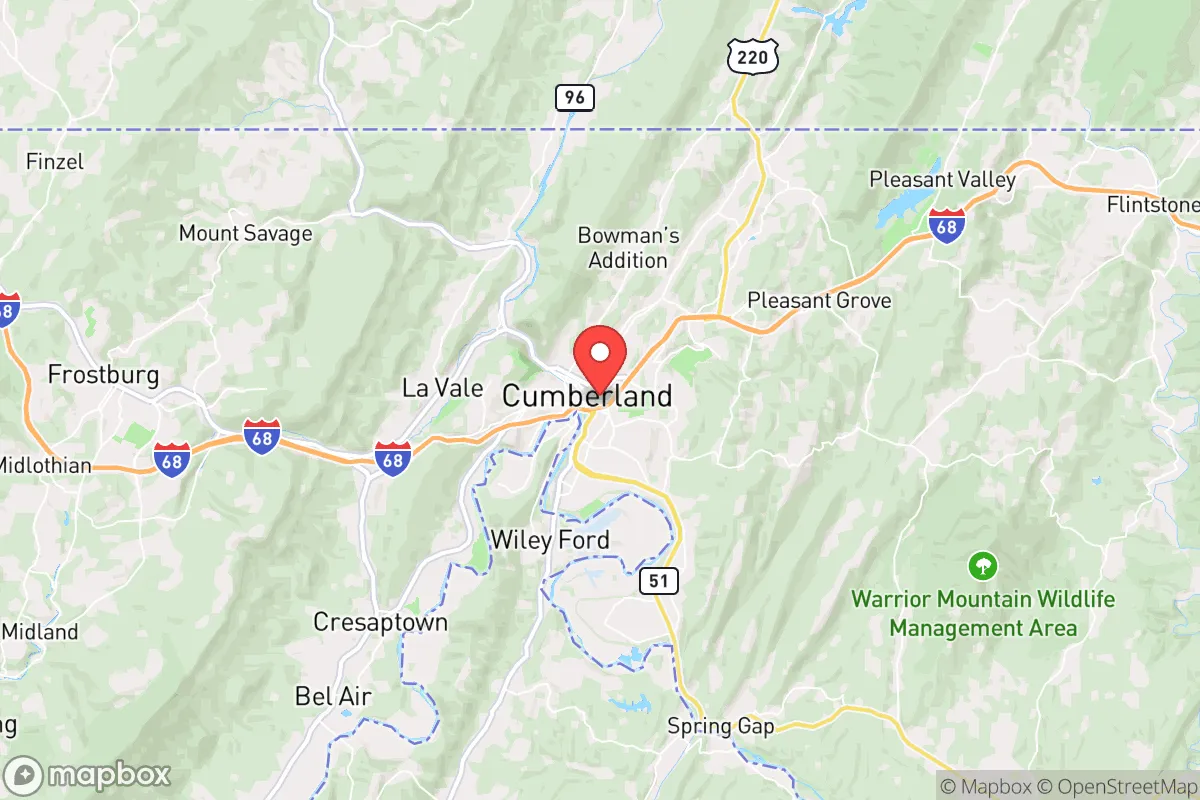
Cumberland, Maryland, occupies a strategic position that resilience-minded relocators should examine closely, offering a blend of geographic isolation and connective infrastructure that few mid-Atlantic towns can match. Nestled in the Appalachian Mountains at the intersection of I-68 and US-220, this former industrial hub of roughly 19,000 people sits roughly 130 miles west of Baltimore and 150 miles northwest of Washington, D.C.—close enough to monitor urban instability, yet far enough to avoid its immediate shockwaves. For those assessing long-term preparedness against civic unrest, mass casualty events, or natural disasters, Cumberland presents a compelling case as a secondary or primary relocation node, provided its specific vulnerabilities are understood and mitigated.
Geographic position and natural advantages for long-term security
Cumberland’s location in the Ridge-and-Valley Appalachians provides a natural defensive buffer that flatland communities simply cannot replicate. The town sits in a valley carved by the Potomac River, surrounded by ridges like Wills Mountain and Haystack Mountain that create chokepoints for any potential ground movement—whether that’s fleeing urban populations or organized threats. The area’s elevation, averaging around 620 feet, reduces flood risk compared to lower-lying river towns, though the Potomac itself can surge during heavy rain events. The surrounding Allegany County is heavily forested, with over 70% tree cover, offering ample cover, firewood, and game for those with land access. Critically, Cumberland is not near any major military installations, nuclear power plants, or strategic infrastructure that would make it a primary target during a conflict or terrorist event. The nearest nuclear facility, the Three Mile Island plant in Pennsylvania, is over 100 miles away, and the closest major military base, Fort Detrick in Frederick, is 70 miles east—far enough to avoid fallout from a localized event but close enough to feel secondary effects like refugee flow or supply chain disruption.
Risks, exposures, and proximity to fallout-relevant landmarks
While Cumberland’s isolation is an asset, it is not without exposure. The town lies within 50 miles of the Baltimore-Washington metropolitan area’s outer exurbs, meaning a major disaster in the capital corridor—whether a dirty bomb, cyberattack-induced grid collapse, or civil unrest—could send tens of thousands of evacuees funneling west along I-68 and US-40. These highways are the primary evacuation routes from the D.C. and Baltimore regions, and Cumberland sits at their western terminus before they descend into the Ohio River Valley. During a mass evacuation, the town could become a chokepoint for traffic, resource competition, and potential conflict. Additionally, the nearby CSX railroad line, which runs through the city center, carries hazardous materials including crude oil and chemicals; a derailment or sabotage event could contaminate the Potomac River watershed, which supplies local drinking water. The area also has a modest seismic risk—the Appalachian region experiences occasional minor earthquakes—and is prone to severe winter storms that can knock out power for days, a vulnerability that becomes critical during a grid-down scenario. For the prepper mindset, these risks are manageable with planning, but they underscore that no location is truly safe from cascading failures in a fragile national system.
Practical resilience for a relocator: food, water, energy, and defensibility
For a relocator focused on practical self-sufficiency, Cumberland offers a mixed but promising picture. The surrounding Allegany County has a strong agricultural base, with farms producing hay, corn, and livestock within a 20-mile radius. Local farmers’ markets operate seasonally, and the area has a growing network of small-scale homesteaders and permaculture practitioners—a community that can be tapped for knowledge sharing. Water availability is a strong point: the Potomac River and its tributaries provide abundant surface water, and the region’s average annual rainfall of 40 inches supports rainwater catchment systems. However, municipal water treatment relies on the Potomac, which is vulnerable to upstream contamination from the aforementioned rail line or industrial spills; a well on private property with a hand pump is a wise investment. Energy resilience is more challenging. The local grid is served by FirstEnergy and is susceptible to outages from storms and aging infrastructure. Solar potential is moderate—the area gets about 200 sunny days per year, below the national average—but micro-hydro from mountain streams or a backup propane generator can fill gaps. Defensibility is where Cumberland shines: the valley’s narrow access points, combined with the surrounding ridges, create natural perimeter security. A property on a ridge or in a hollow offers visual cover and limited approach routes. The local population skews older and more conservative, with a strong hunting and firearms culture—Allegany County has some of the highest per-capita gun ownership in Maryland—which can be a stabilizing factor in a crisis, though it also means outsiders should integrate respectfully rather than arrive with a confrontational mindset.
The overall strategic picture for Cumberland is one of calculated opportunity rather than guaranteed safety. It is not a bug-out location for a weekend warrior; it is a place where a serious relocator can build a resilient life with reasonable access to resources, a supportive community of like-minded individuals, and a geography that rewards preparation. The primary threat is not natural disaster but human-driven instability from the nearby urban corridor—a risk that can be mitigated by establishing a local network, stockpiling supplies before a crisis, and avoiding the main evacuation routes during a panic. For a conservative-leaning individual or family seeking a balance between isolation and access, Cumberland offers a solid foundation, provided the move is made with eyes open to its specific vulnerabilities and a commitment to becoming part of the local fabric rather than a transient observer.
* Values derived from national, state, county, city and local statistics and may differ in a specific area. Last updated: 2026-04-22T02:20:48.000Z
Narrative content on this page is AI-generated and may contain mistakes. Verify any details that matter before acting on them.
ReloMaps may earn a commission from affiliate links at no extra cost to you.