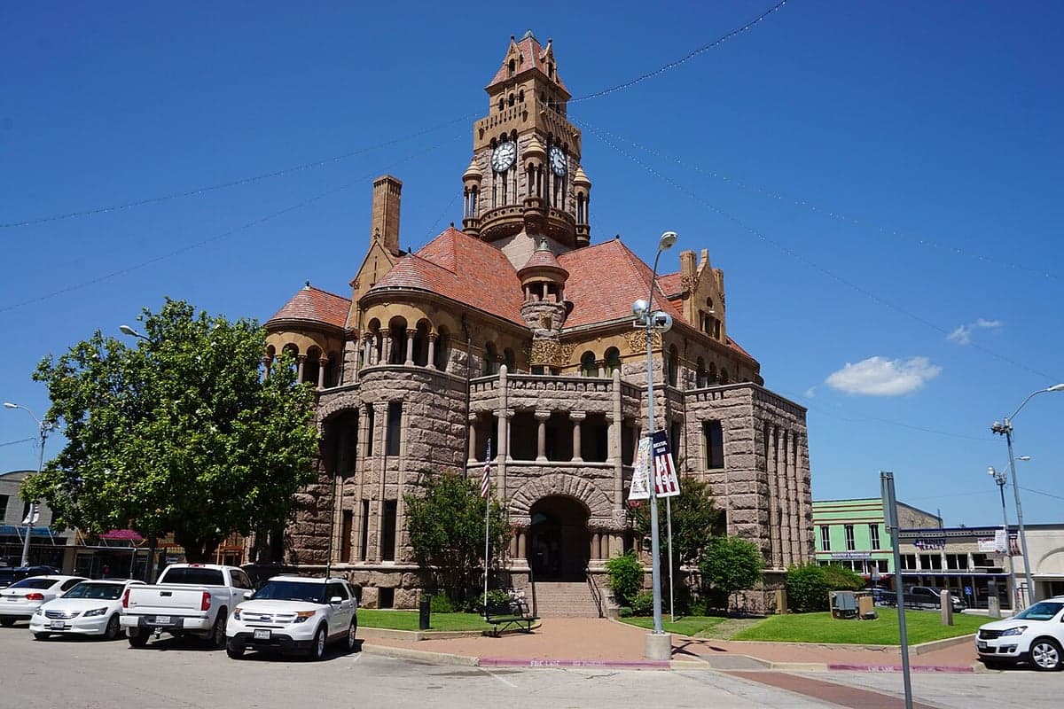
Photo: Wikipedia
Strategic Assessment of Decatur, TX
Meaningful friction. Expect exposure to either population pressure, blast zones, or natural disaster risk. Consider buying a retreat property.
What does the Strategic Assessment tell us?
Our Strategic Assessment grades tactical survivability of an area. Major population centers, military targets, fallout zones, natural disasters, and border exposure all drive risk — lower exposure means a more defensible position in a crisis.
This is heavily inspired by Joel Skousen's Strategic Relocation book. Highly recommended you checkout the book ($)What does this tell us?
Our Strategic Assessment grades tactical survivability of an area. Major population centers, military targets, fallout zones, natural disasters, and border exposure all drive risk — lower exposure means a more defensible position in a crisis.
This is heavily inspired by Joel Skousen's Strategic Relocation book. Highly recommended you checkout the book ($)Strategic Pillars

Key Distances
Regional Safe Places
Below is our recommended "safe zones" in Texas and the surrounding area based on our strategic heuristics. For most people, it's unrealistic to live in a “safe zone” full-time due to work, family or other personal reasons. They tend to be more rural. However, many of these areas are perfect for second homes and retreat properties that double as a vacation home or even a short-term rental.


Important Note: For informational purposes only. This does not mean nothing bad ever happens in the green zones. Please use common sense. This is based on public data and modeled with AI. We tried to take a conservative approach but mistakes happen. We update this regularly as new information becomes available.
Solar Generator Recommendations
Backup power matters more here than in safer locations. We've picked three solar generators across budgets and capacity tiers — start with the budget unit if you only need a few essentials, or step up if you want to run a fridge and HVAC for days at a time.

Jackery Portable Power Station Explorer 300
Budget OptionPower on the Go: Weighing only 11 lbs, it's convenient to set up and store with book-sized foldable solar panels

BLUETTI Portable Power Station AC180
Designed for both indoor and outdoor scenarios, AC180 is highly capable as it has a robost capacity and continuous output power.

EF ECOFLOW DELTA Pro Ultra Power Station
Upgraded PickEcoFlow DELTA Pro Ultra is a whole-home energy system designed to grow with your family. Integrated with the Smart Home Panel 2, it scales to meet your evolving energy needs — keeping your home powered, intelligent, and secure through every stage of life.
We earn a commission, at no additional cost to you.
Strategic Assessment Analysis
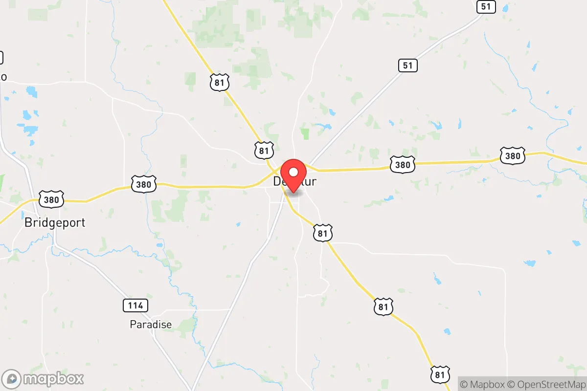
Decatur, Texas, offers a compelling mix of strategic depth and practical resilience for those looking to put distance between themselves and the fragility of major metroplexes, without vanishing into total isolation. Sitting roughly 40 miles northwest of Fort Worth, it places you far enough from the Dallas-Fort Worth (DFW) metroplex to avoid the worst of its collapse scenarios—whether from civil unrest, grid failure, or a mass casualty event—yet close enough to access critical supplies or medical evacuation routes if needed. The town’s position along U.S. 81/287 and its proximity to Interstate 35 give it a logistical backbone that most rural hamlets lack, but its real value lies in what’s not there: no major military bases, no nuclear plants within a dangerous radius, and no sprawling industrial targets that would make it a primary strike or fallout zone.
Geographic positioning and natural buffers from metroplex collapse
Decatur sits on the edge of the Cross Timbers region, a transition zone between the rolling plains and the more rugged terrain to the west. This isn’t mountainous country, but the area’s modest elevation changes and dense oak-juniper woodlands provide natural cover and line-of-sight breaks that open prairie lacks. The Wise County landscape offers multiple ingress and egress routes beyond the main highways—county roads and farm-to-market routes that can bypass chokepoints if I-35 or 287 become impassable due to civil unrest or a mass casualty event. The Trinity River basin lies to the east, but Decatur itself sits on higher ground, reducing flood risk compared to communities closer to the river. For a relocator with a prepper mindset, this means you’re not betting on a single road out; you’ve got a web of secondary paths that a determined person can learn in a weekend of scouting. The nearest major fallout-relevant landmark is the DFW metroplex itself, but prevailing winds from the south and southwest mean that any radiological or chemical plume from a city-center event would likely push northeast, away from Decatur. That’s a statistical edge, not a guarantee, but it’s one worth noting.
Risks, exposures, and proximity to fallout-relevant infrastructure
No location is immune, and Decatur has its own set of vulnerabilities that a serious strategic assessment must flag. The most obvious is the Eagle Mountain Lake and the Bridgeport Lake systems—both are within 20 miles and serve as water sources for the region, but they also represent potential targets for sabotage or contamination in a widespread disaster scenario. The Barnett Shale natural gas fields underlie much of Wise County, meaning there are numerous wellheads, pipelines, and compressor stations scattered across the rural landscape. A major pipeline rupture or intentional attack on gas infrastructure could create localized hazards, though these are diffuse compared to a single concentrated target like a refinery. More concerning is the proximity to the DFW metroplex’s outer ring of suburban sprawl; in a mass evacuation event, Decatur could become a choke point as panicked populations flee northwest along 287. The town’s population of roughly 7,000 would be overwhelmed by even a fraction of that flow. On the positive side, there are no nuclear power plants within a 100-mile radius—the closest is Comanche Peak near Glen Rose, about 70 miles south—and no major chemical weapons depots or military ammunition storage sites nearby. The risk profile is moderate, leaning low, provided you have a plan to secure your perimeter and avoid main roads during the first 72 hours of any major event.
Practical resilience for a relocator: food, water, energy, and defensibility
For the individual or family looking to establish a sustainable foothold, Decatur’s practical resilience hinges on three factors: water access, local food production, and energy independence. The area sits atop the Trinity Aquifer, and many rural properties outside city limits have private wells that can provide potable water even if municipal systems fail. Wise County’s agricultural base—cattle, hay, and some row crops—means that local food supply chains are shorter than in purely suburban zones; you can buy direct from ranchers or participate in the Decatur Farmers Market during growing season. For long-term storage, the dry climate (average annual rainfall around 35 inches) reduces mold and spoilage risks compared to humid regions. Energy-wise, the region has strong solar potential—over 200 sunny days per year—and wind patterns are consistent enough for small-scale turbines. Natural gas from the Barnett Shale is also available for heating or backup generation, though you’d need to secure your own supply contract or storage. Defensibility is where Decatur shines relative to open plains: the wooded terrain and irregular lot layouts in the surrounding unincorporated areas allow for natural perimeter control. A property with a long driveway, a creek or pond as a water source, and a view of the main approach can be hardened without looking like a fortress. The local sheriff’s office is responsive but small; in a prolonged crisis, you’re largely on your own, which is exactly the assumption a prepper should make.
The overall strategic picture for Decatur is one of balanced trade-offs. It’s not a remote bunker location—you’re still within a two-hour drive of 7 million people, and that proximity carries both risk and opportunity. The town’s conservative culture and rural governance structure mean fewer regulatory hurdles for things like rainwater catchment, solar panel installation, or firearm ownership compared to blue-state enclaves. The local economy is anchored by agriculture, oil and gas, and a growing logistics sector (Amazon has a distribution center in nearby Haslet), which provides employment stability even when national markets wobble. For the relocator who wants to be prepared for civic unrest, mass casualty events, or natural disasters, Decatur offers a realistic middle ground: close enough to civilization to matter, far enough to breathe, and with enough natural and infrastructural advantages to give you a fighting chance if things go sideways. The key is to buy your property now, before the next wave of metroplex refugees discovers what you already know.
* Values derived from national, state, county, city and local statistics and may differ in a specific area. Last updated: 2026-04-28T21:27:44.000Z
Narrative content on this page is AI-generated and may contain mistakes. Verify any details that matter before acting on them.
ReloMaps may earn a commission from affiliate links at no extra cost to you.