
Photo: Wikipedia
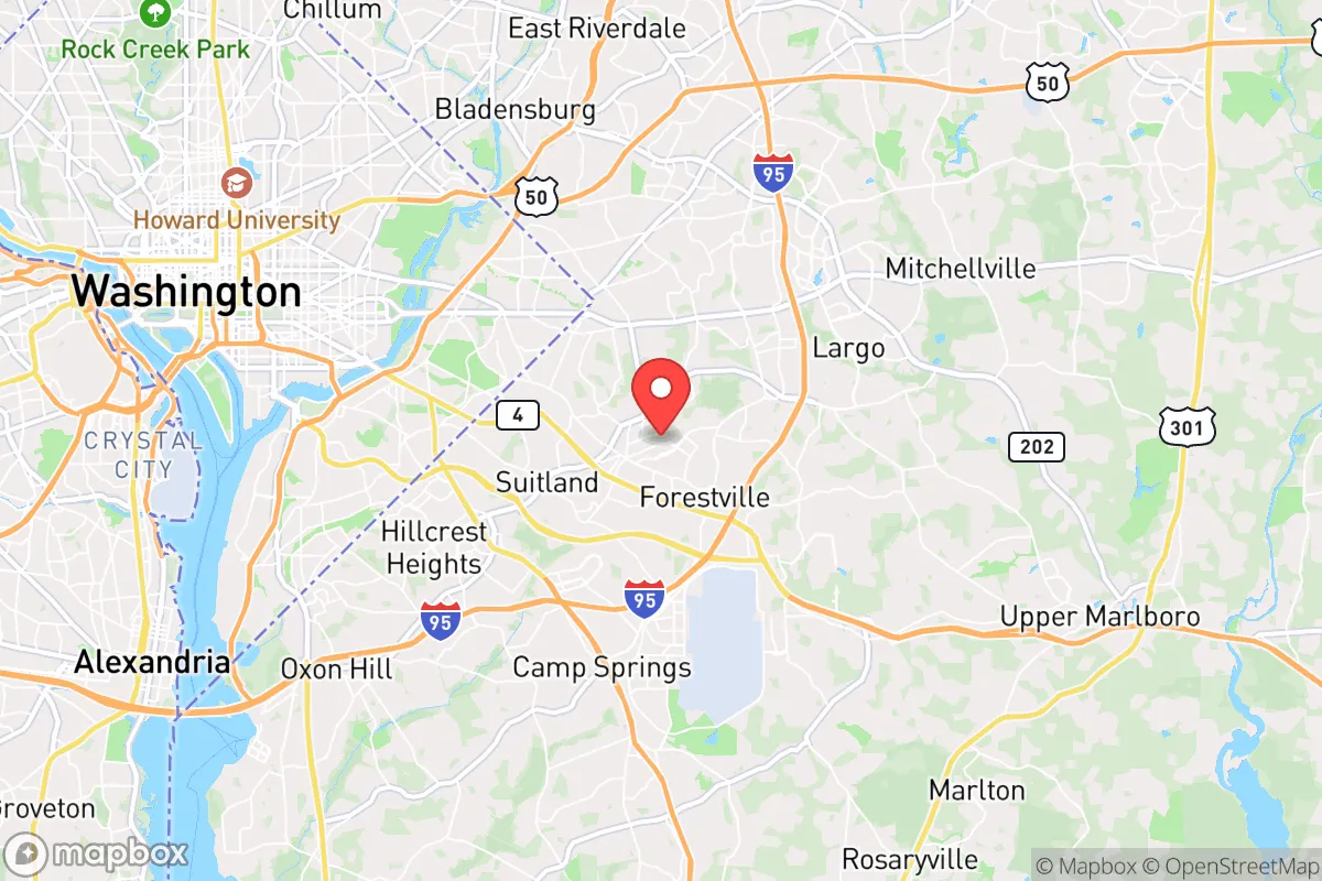
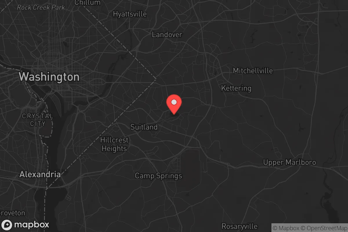
Strategic Assessment of District Heights, MD
Multiple tactical vulnerabilities. Population density, target proximity, or disaster risk are likely compounding. A retreat property and exit planning is required.
What does the Strategic Assessment tell us?
Our Strategic Assessment grades tactical survivability of an area. Major population centers, military targets, fallout zones, natural disasters, and border exposure all drive risk — lower exposure means a more defensible position in a crisis.
This is heavily inspired by Joel Skousen's Strategic Relocation book. Highly recommended you checkout the book ($)What does this tell us?
Our Strategic Assessment grades tactical survivability of an area. Major population centers, military targets, fallout zones, natural disasters, and border exposure all drive risk — lower exposure means a more defensible position in a crisis.
This is heavily inspired by Joel Skousen's Strategic Relocation book. Highly recommended you checkout the book ($)Strategic Pillars

Key Distances
Regional Safe Places
Below is our recommended "safe zones" in Maryland and the surrounding area based on our strategic heuristics. For most people, it's unrealistic to live in a “safe zone” full-time due to work, family or other personal reasons. They tend to be more rural. However, many of these areas are perfect for second homes and retreat properties that double as a vacation home or even a short-term rental.


Important Note: For informational purposes only. This does not mean nothing bad ever happens in the green zones. Please use common sense. This is based on public data and modeled with AI. We tried to take a conservative approach but mistakes happen. We update this regularly as new information becomes available.
Solar Generator Recommendations
Backup power matters more here than in safer locations. We've picked three solar generators across budgets and capacity tiers — start with the budget unit if you only need a few essentials, or step up if you want to run a fridge and HVAC for days at a time.

Jackery Portable Power Station Explorer 300
Budget OptionPower on the Go: Weighing only 11 lbs, it's convenient to set up and store with book-sized foldable solar panels

BLUETTI Portable Power Station AC180
Designed for both indoor and outdoor scenarios, AC180 is highly capable as it has a robost capacity and continuous output power.

EF ECOFLOW DELTA Pro Ultra Power Station
Upgraded PickEcoFlow DELTA Pro Ultra is a whole-home energy system designed to grow with your family. Integrated with the Smart Home Panel 2, it scales to meet your evolving energy needs — keeping your home powered, intelligent, and secure through every stage of life.
We earn a commission, at no additional cost to you.
Strategic Assessment Analysis
District Heights, Maryland, sits in a precarious strategic position that demands a hard-nosed assessment for anyone serious about resilience. Located just inside the Capital Beltway, roughly 10 miles southeast of the U.S. Capitol, this Prince George’s County suburb offers proximity to federal infrastructure but carries severe liabilities for a prepper or survivalist mindset. The area’s advantages—access to major highways, a dense suburban grid, and proximity to the Anacostia River watershed—are outweighed by its exposure to cascading risks from civil unrest, infrastructure fragility, and its location within a primary target zone for any large-scale disruption. For a conservative-leaning relocator prioritizing self-sufficiency and security, District Heights demands a clear-eyed evaluation of trade-offs, not romanticized notions of suburban safety.
Geographic position and natural advantages: a suburban buffer with critical flaws
District Heights occupies a flat, low-lying area of the Atlantic Coastal Plain, with elevations around 150 feet above sea level. Its position along the fall line—the geological transition between the Piedmont and the Coastal Plain—means the soil is predominantly clay-based, which complicates drainage and well-drilling. The area sits within the Anacostia River watershed, with several small tributaries like Beaverdam Creek and Watts Branch running through or near the district. These waterways provide a modest water source in a grid-down scenario, but they are heavily urbanized and carry pollution from decades of suburban runoff. The natural vegetation is mixed hardwood forest, but most of it has been cleared for housing developments, strip malls, and the sprawling infrastructure of the Washington metropolitan area. The climate is humid subtropical, with hot, humid summers and mild winters—average January lows hover around 28°F, and July highs reach 89°F. This climate supports year-round gardening, but the heavy clay soil requires significant amendment for food production. The area’s flat terrain offers no natural defensible high ground, and the dense suburban layout—grid streets, cul-de-sacs, and strip commercial corridors—creates chokepoints that would be difficult to secure in a crisis. The nearest significant natural barrier is the Patuxent River, about 15 miles east, but that’s a day’s walk through suburban sprawl. For a relocator, the geographic position is a net negative: too close to a primary target zone, too flat for defense, and too urbanized for meaningful self-sufficiency.
Risks, exposures, and proximity to fallout-relevant landmarks: a high-consequence location
The most glaring risk for District Heights is its proximity to Washington, D.C., and the cascade of threats that entails. The district lies within 10 miles of the Capitol, the White House, the Pentagon, and Joint Base Andrews—all primary targets for any state-level adversary or domestic terror event. In a nuclear exchange scenario, District Heights sits well within the thermal pulse and blast radius of a ground burst on the National Mall; a 10-kiloton device would produce lethal overpressure and firestorms across the entire Beltway. Even a conventional attack on the D.C. grid—an EMP, a cyberattack on the power infrastructure, or a coordinated bombing campaign—would leave District Heights without power, water, or communications for weeks, given its reliance on the regional grid and the Potomac water supply. The area is also vulnerable to civil unrest. Prince George’s County has a history of protest activity, and the 2020 George Floyd protests saw looting and arson in nearby communities like Largo and Camp Springs. District Heights’ location on the Beltway and near the Suitland Federal Center—a complex of government offices—makes it a likely flashpoint for any future unrest. The Suitland Parkway and Pennsylvania Avenue provide direct routes into D.C., meaning the area would be a transit corridor for both protesters and law enforcement. For a prepper, this is a high-exposure zone: the risks of being near a primary target, a federal facility, and a major protest corridor outweigh any convenience of suburban life. The only mitigating factor is the presence of multiple hospitals—MedStar Southern Maryland Hospital Center is just 3 miles west—but in a mass casualty event, those facilities would be overwhelmed within hours.
Practical resilience for a relocator: food, water, energy, and defensibility
For a relocator focused on practical resilience, District Heights presents significant challenges. Water is the most critical issue. The municipal water supply comes from the Washington Aqueduct, which draws from the Potomac River—a single point of failure that would be compromised in any major event. Private wells are rare in this dense suburb, and the clay soil makes drilling expensive and yields uncertain. Rainwater collection is feasible—the area averages 43 inches of precipitation annually—but roof space on typical suburban homes is limited, and local regulations may restrict cisterns. Food production is possible but difficult. The growing season runs from April to October, but the heavy clay soil requires raised beds or extensive tilling. Community gardens exist, like the one at the District Heights Municipal Center, but they are small and would be contested in a crisis. Foraging is minimal; the urbanized landscape offers little wild edibles beyond dandelions and blackberries along fence lines. Energy resilience is poor. The grid is above-ground and vulnerable to storms, sabotage, and EMP. Solar panels are viable—the area gets about 4.5 peak sun hours per day—but most homes are shaded by mature trees, and homeowner association restrictions may limit installations. Backup generators are common in the area, but fuel supply would be cut off within days of a major disruption. Defensibility is the weakest point. District Heights is a dense, interconnected suburb with no natural barriers, multiple ingress points, and a population density of over 5,000 people per square mile. In a grid-down scenario, the area would be a sieve—people from D.C. would flood outward along the Beltway and Suitland Parkway, and the local population would be competing for the same limited resources. The best defensive strategy would be to fortify a single home with reinforced doors, window bars, and a perimeter fence, but that only delays the inevitable if a mob arrives. For a relocator, the practical takeaway is clear: District Heights is not a location for long-term self-sufficiency. It’s a place to live if you have a job in D.C. and a bug-out plan to somewhere more defensible, like the Shenandoah Valley or the Allegheny Mountains.
The overall strategic picture for District Heights is one of calculated risk for the short-term commuter, but a hard pass for the serious prepper. Its proximity to D.C. offers employment and infrastructure access, but those same factors make it a high-consequence location for any large-scale disruption. The area’s flat terrain, dense population, and reliance on fragile regional systems mean that resilience is a matter of luck, not preparation. For a conservative-leaning relocator who values self-sufficiency, security, and distance from urban chaos, District Heights is a stepping stone at best—a place to build capital and connections before moving to a more defensible position. The smart play is to treat it as a temporary base, not a permanent home, and to have a fully stocked bug-out vehicle ready at all times. If you’re looking for a place to ride out the storm, look further east toward the Eastern Shore or west into the mountains. District Heights is where the storm begins, not where you want to be when it hits.
* Values derived from national, state, county, city and local statistics and may differ in a specific area. Last updated: 2026-04-22T01:14:30.000Z
Narrative content on this page is AI-generated and may contain mistakes. Verify any details that matter before acting on them.
ReloMaps may earn a commission from affiliate links at no extra cost to you.