
Photo: Wikipedia
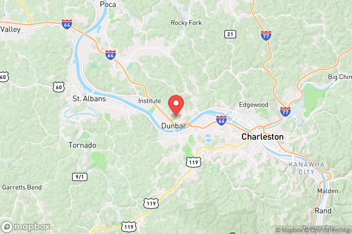
Strategic Assessment of Dunbar, WV
Meaningful friction. Expect exposure to either population pressure, blast zones, or natural disaster risk. Consider buying a retreat property.
What does the Strategic Assessment tell us?
Our Strategic Assessment grades tactical survivability of an area. Major population centers, military targets, fallout zones, natural disasters, and border exposure all drive risk — lower exposure means a more defensible position in a crisis.
This is heavily inspired by Joel Skousen's Strategic Relocation book. Highly recommended you checkout the book ($)What does this tell us?
Our Strategic Assessment grades tactical survivability of an area. Major population centers, military targets, fallout zones, natural disasters, and border exposure all drive risk — lower exposure means a more defensible position in a crisis.
This is heavily inspired by Joel Skousen's Strategic Relocation book. Highly recommended you checkout the book ($)Strategic Pillars

Key Distances
Regional Safe Places
Below is our recommended "safe zones" in West Virginia and the surrounding area based on our strategic heuristics. For most people, it's unrealistic to live in a “safe zone” full-time due to work, family or other personal reasons. They tend to be more rural. However, many of these areas are perfect for second homes and retreat properties that double as a vacation home or even a short-term rental.


Important Note: For informational purposes only. This does not mean nothing bad ever happens in the green zones. Please use common sense. This is based on public data and modeled with AI. We tried to take a conservative approach but mistakes happen. We update this regularly as new information becomes available.
Solar Generator Recommendations
Backup power matters more here than in safer locations. We've picked three solar generators across budgets and capacity tiers — start with the budget unit if you only need a few essentials, or step up if you want to run a fridge and HVAC for days at a time.

Jackery Portable Power Station Explorer 300
Budget OptionPower on the Go: Weighing only 11 lbs, it's convenient to set up and store with book-sized foldable solar panels

BLUETTI Portable Power Station AC180
Designed for both indoor and outdoor scenarios, AC180 is highly capable as it has a robost capacity and continuous output power.

EF ECOFLOW DELTA Pro Ultra Power Station
Upgraded PickEcoFlow DELTA Pro Ultra is a whole-home energy system designed to grow with your family. Integrated with the Smart Home Panel 2, it scales to meet your evolving energy needs — keeping your home powered, intelligent, and secure through every stage of life.
We earn a commission, at no additional cost to you.
Strategic Assessment Analysis
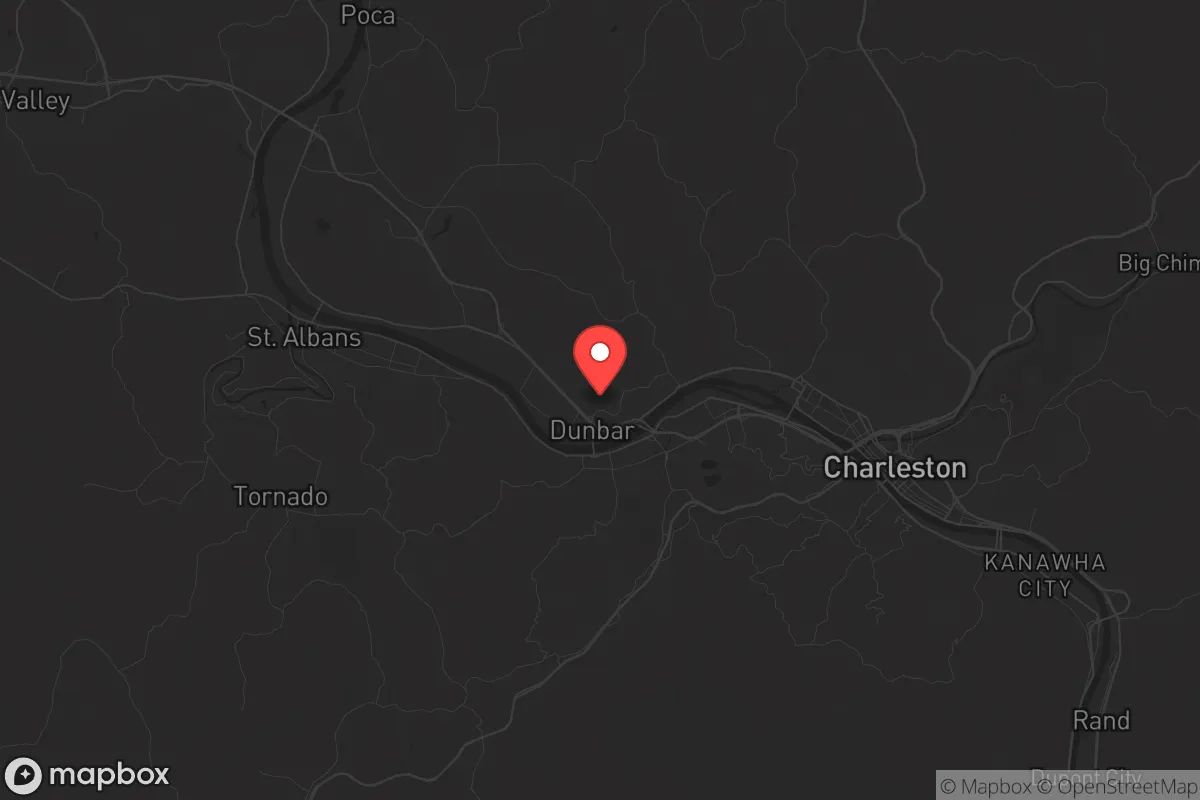
Dunbar, West Virginia, sits in a strategic pocket of the Kanawha Valley that offers a blend of quiet resilience and overlooked advantages for those serious about long-term preparedness. While it’s not a remote mountain redoubt, its position along the Kanawha River and just west of Charleston provides a buffer zone that many preppers find useful—close enough to monitor regional events, far enough to avoid the worst of urban collapse scenarios. The town’s industrial roots, combined with a shrinking population, mean infrastructure is underutilized, which can work in a relocator’s favor if you know how to leverage it.
Geographic position and natural advantages for long-term security
Dunbar’s geography is its first line of defense. The Kanawha River runs along its southern edge, offering a reliable water source and a natural barrier that complicates casual movement from the south. To the north and east, the rolling hills of the Appalachian foothills provide elevation advantages—good for line-of-sight observation and radio communications, bad for anyone trying to approach unseen. The town sits at roughly 600 feet elevation, with higher ridges within a 15-minute drive that offer defensible positions if things go sideways. The surrounding Kanawha State Forest, just 10 miles southeast, gives you over 9,000 acres of public land for foraging, hunting, and temporary retreat if needed. Unlike flatter, more exposed areas, this terrain forces any potential threat to funnel through predictable chokepoints—bridges over the river and a handful of two-lane roads. For a prepper, that’s a tactical gift. The local climate is temperate, with average annual rainfall around 44 inches, meaning water catchment is viable year-round, and the growing season runs roughly April through October, long enough for serious gardening.
Risks, exposures, and proximity to fallout-relevant landmarks
No analysis is honest without naming the liabilities. Dunbar’s biggest exposure is its proximity to Charleston—just 8 miles east. Charleston is a regional hub with a population of about 47,000 in the city proper and over 200,000 in the metro area. In a mass casualty event, civil unrest, or grid-down scenario, that population will push outward. Dunbar sits directly on the evacuation route via US-60 and I-64, meaning you’ll see refugee flow before most. The Kanawha River also hosts barge traffic carrying industrial chemicals—the valley has a history of chemical spills, including the 2014 Elk River spill that contaminated water for 300,000 people. Dunbar’s water intake is downstream of Charleston, so any upstream contamination hits you first. On the fallout front, the nearest nuclear facility is the Beaver Valley Power Station in Pennsylvania, about 200 miles northeast—outside the lethal fallout zone for most scenarios, but within the range for low-level contamination depending on wind patterns. More immediate: the Yeager Airport (just 5 miles east) and the CSX rail line running through town are potential targets for sabotage or accidents. The good news is that Dunbar itself has no major military bases, refineries, or government centers that would make it a primary target. The bad news is that its location on a major river and interstate means it’s a transit corridor, not a dead end. For a relocator, this means you need a bug-out plan that heads deeper into the hills—toward Boone or Fayette County—within the first 24 hours of a major event.
Practical resilience for a relocator: food, water, energy, and defensibility
Let’s get practical. Dunbar’s water supply comes from the Kanawha River, treated by the West Virginia American Water plant. In a grid-down event, that plant stops. You need a backup plan. The river itself is accessible from multiple public access points, but it’s also the most obvious source—expect competition. Better options: the numerous small creeks and springs in the surrounding hills, like those in Kanawha State Forest or along Coal River to the south. A good topo map and a weekend of scouting will pay off. For food, the local soil is acidic but workable—raised beds with compost will produce tomatoes, beans, squash, and greens. The area has a strong hunting culture; deer, turkey, and small game are abundant in the state forest and private woodlands. Fishing in the Kanawha is decent for catfish and bass, but heavy metal contamination from decades of industrial runoff means you shouldn’t rely on it long-term without testing. Energy resilience is mixed. Dunbar is served by Appalachian Power, which has a mixed reliability record—outages from storms and equipment failures happen a few times a year. Solar is viable; the area gets about 4.5 peak sun hours per day, enough for a modest off-grid setup. But the tree cover is dense, so you’ll need to clear a south-facing roof or ground mount. Natural gas is available in most of the town, which is a plus for heating and cooking if the grid stays up. Defensibility at the neighborhood level is where Dunbar shines for the prepared relocator. The housing stock includes older brick homes and ranch-style houses on quarter-acre lots, many with basements. A basement with a reinforced door, a wood stove, and a water filtration system gives you a hardened shelter that’s hard to breach. The street layout is a mix of grid and cul-de-sac, which means you can control access points with minimal effort. Neighbors tend to be older, long-term residents—good for community stability, but not necessarily prepper-minded. You’ll likely be the one with the plan, so keep a low profile until trust is earned.
The overall strategic picture for Dunbar is one of calculated trade-offs. It’s not a remote bunker location, and it’s not a self-sufficient homestead paradise. What it offers is a defensible, resource-rich base within striking distance of both urban infrastructure and wilderness retreat. For a single individual or a family willing to invest in water independence, a solar backup, and a solid bug-out route into the hills, Dunbar provides a realistic platform for weathering the next decade’s uncertainties. The key is to treat it as a forward operating base, not a final destination—use its access to supplies and information during the calm, and have your escape plan locked and loaded for when the calm breaks. If you’re looking for a place that’s off the radar but not off the map, this valley town deserves a hard look.
* Values derived from national, state, county, city and local statistics and may differ in a specific area. Last updated: 2026-05-01T17:05:52.000Z
Narrative content on this page is AI-generated and may contain mistakes. Verify any details that matter before acting on them.
ReloMaps may earn a commission from affiliate links at no extra cost to you.