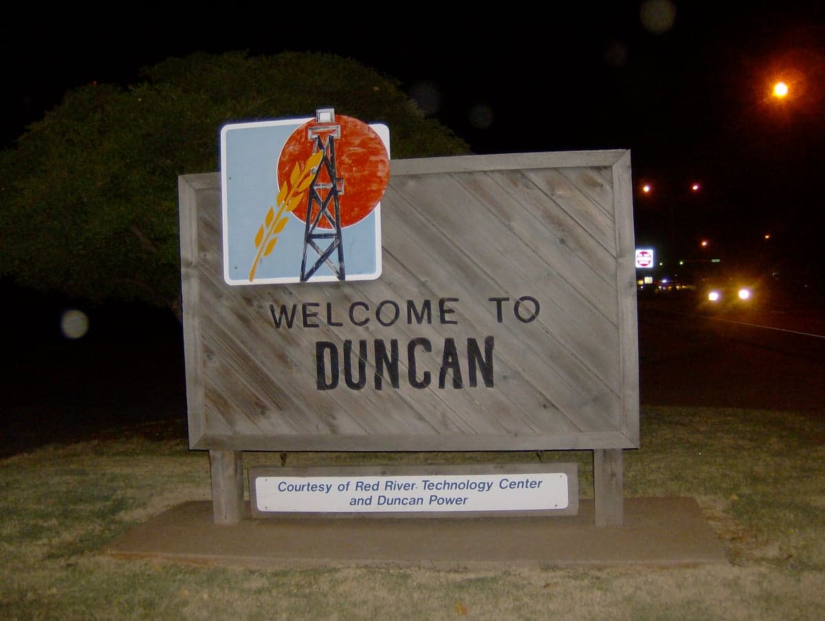

Photo: Wikipedia
Strategic Assessment of Duncan, OK
Workable tactical position. Some exposure to population density or targets, but generally defensible in a crisis.
What does the Strategic Assessment tell us?
Our Strategic Assessment grades tactical survivability of an area. Major population centers, military targets, fallout zones, natural disasters, and border exposure all drive risk — lower exposure means a more defensible position in a crisis.
This is heavily inspired by Joel Skousen's Strategic Relocation book. Highly recommended you checkout the book ($)What does this tell us?
Our Strategic Assessment grades tactical survivability of an area. Major population centers, military targets, fallout zones, natural disasters, and border exposure all drive risk — lower exposure means a more defensible position in a crisis.
This is heavily inspired by Joel Skousen's Strategic Relocation book. Highly recommended you checkout the book ($)Strategic Pillars

Key Distances
Regional Safe Places
Below is our recommended "safe zones" in Oklahoma and the surrounding area based on our strategic heuristics. For most people, it's unrealistic to live in a “safe zone” full-time due to work, family or other personal reasons. They tend to be more rural. However, many of these areas are perfect for second homes and retreat properties that double as a vacation home or even a short-term rental.
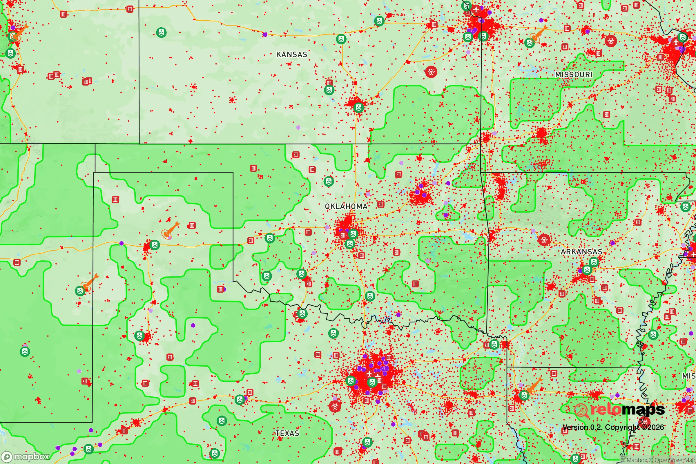
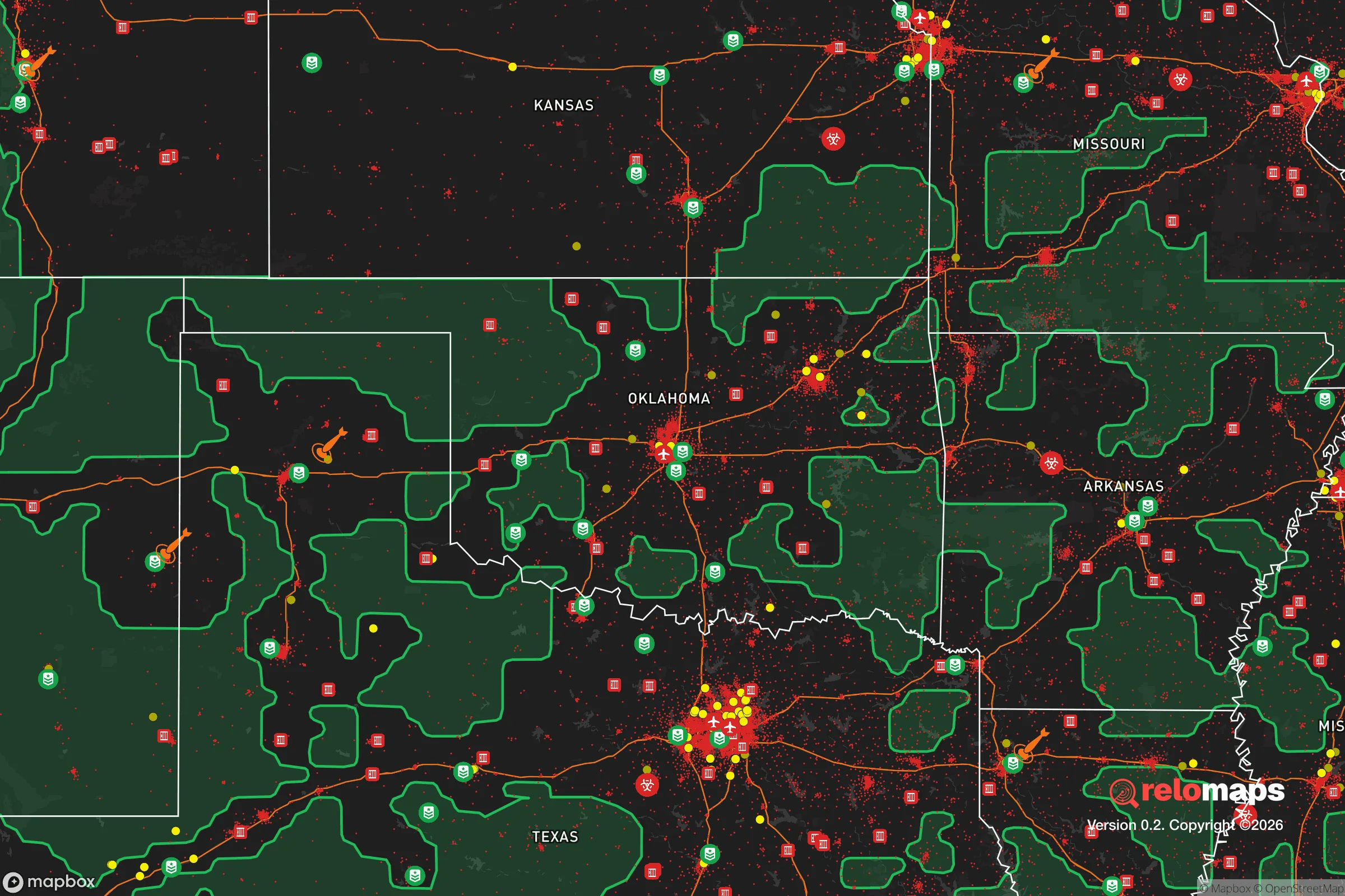
Important Note: For informational purposes only. This does not mean nothing bad ever happens in the green zones. Please use common sense. This is based on public data and modeled with AI. We tried to take a conservative approach but mistakes happen. We update this regularly as new information becomes available.
Solar Generator Recommendations
Backup power matters more here than in safer locations. We've picked three solar generators across budgets and capacity tiers — start with the budget unit if you only need a few essentials, or step up if you want to run a fridge and HVAC for days at a time.

Jackery Portable Power Station Explorer 300
Budget OptionPower on the Go: Weighing only 11 lbs, it's convenient to set up and store with book-sized foldable solar panels

BLUETTI Portable Power Station AC180
Designed for both indoor and outdoor scenarios, AC180 is highly capable as it has a robost capacity and continuous output power.

EF ECOFLOW DELTA Pro Ultra Power Station
Upgraded PickEcoFlow DELTA Pro Ultra is a whole-home energy system designed to grow with your family. Integrated with the Smart Home Panel 2, it scales to meet your evolving energy needs — keeping your home powered, intelligent, and secure through every stage of life.
We earn a commission, at no additional cost to you.
Strategic Assessment Analysis
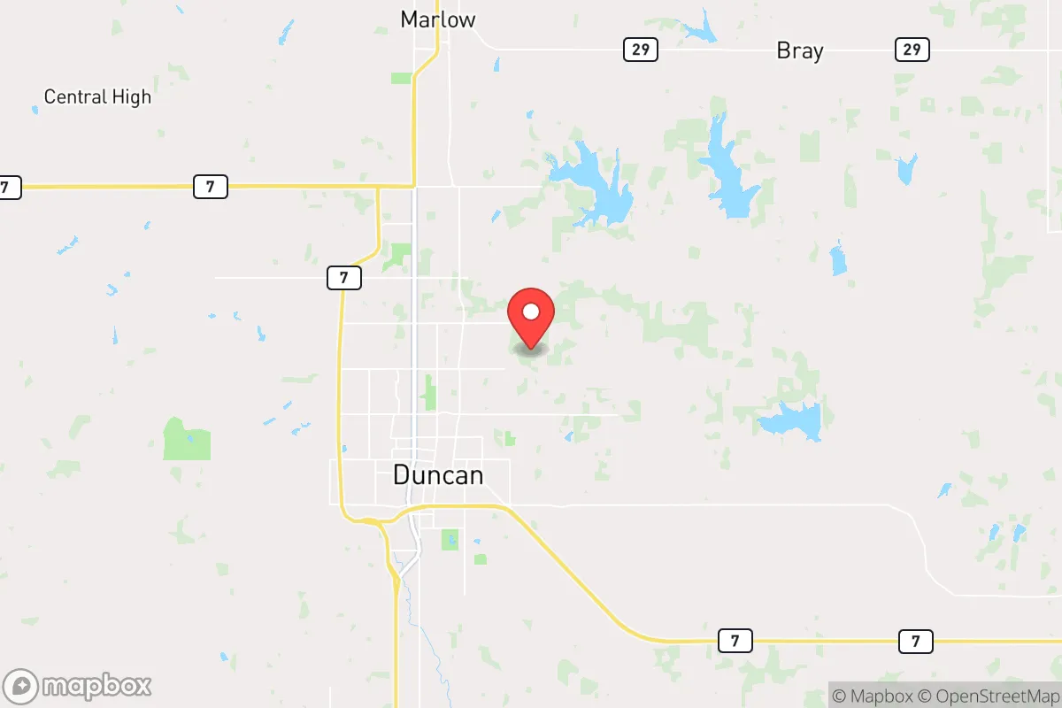
Duncan, Oklahoma, offers a strategic balance of isolation and accessibility that appeals to those prioritizing long-term preparedness and community stability. Situated roughly 80 miles south of Oklahoma City and 30 miles north of the Red River border with Texas, this town of about 22,000 residents sits far enough from major metropolitan centers to reduce exposure to cascading urban collapse, yet close enough to supply routes and regional resources. The area’s historical resilience—rooted in oil booms and agricultural self-sufficiency—provides a practical foundation for relocators who view self-reliance as a core value. For conservative-minded individuals and families assessing risk in an increasingly unstable national landscape, Duncan presents a defensible, low-profile option worth serious consideration.
Geographic position and natural advantages for long-term security
Duncan’s location in Stephens County places it within the Southern Plains region, a zone characterized by relatively low population density and a climate that supports year-round subsistence agriculture. The area sits atop the Anadarko Basin, a geological formation that has historically yielded substantial oil and natural gas reserves—meaning local energy production is not just theoretical but a proven economic driver. The surrounding terrain is gently rolling prairie with scattered woodlands, offering natural cover and defensible positions without the extreme isolation that complicates supply runs. Duncan is roughly 100 miles from the nearest major military installation (Fort Sill in Lawton), which is close enough to benefit from regional stability but far enough to avoid being a primary target in a conflict scenario. The absence of major interstate highways running directly through town reduces the risk of mass evacuation traffic or refugee flows during a crisis, while still providing access to I-44 and US-81 for resupply. The area’s water resources include the Clear Creek and Wildhorse Creek watersheds, plus Lake Duncan and Humphreys Lake within a 15-minute drive, offering multiple redundant water sources for off-grid living.
Risks, exposures, and proximity to fallout-relevant landmarks
No strategic assessment is complete without acknowledging vulnerabilities, and Duncan has several that demand attention. The most significant risk is proximity to the Cushing oil storage hub, roughly 70 miles northeast, which is one of the largest crude oil storage facilities in North America and a high-value target for both state actors and domestic disruption. A major incident there could disrupt fuel supplies across the region, though Duncan’s distance and prevailing wind patterns (generally south to north) reduce direct fallout exposure. The town also sits within 150 miles of Tinker Air Force Base near Oklahoma City, a major logistics and maintenance hub for the US military, which could become a focal point in a conflict scenario. On the natural disaster front, Stephens County falls within Tornado Alley, with an average of 5-7 tornado warnings per year—this is a manageable risk with proper sheltering but not negligible. Duncan’s industrial base includes oilfield services and a chemical plant (the former Halliburton facility), which could pose localized contamination risks if damaged during a severe weather event. The town’s location on the edge of the Chickasaw Nation also means jurisdictional complexities in a breakdown scenario, though tribal relations in the area have historically been cooperative rather than adversarial.
Practical resilience for a relocator: food, water, energy, and defensibility
For a family or individual serious about preparedness, Duncan offers several concrete advantages. The local climate supports a 200-day growing season, with fertile loam soils that are well-suited for vegetable gardens, fruit trees, and small livestock operations. Stephens County has a strong agricultural tradition, with numerous working ranches and farms within a 20-mile radius, meaning local food production knowledge is accessible and seed stock is available. Water security is above average: the Garber-Wellington Aquifer underlies much of the region, and private wells are common in rural areas just outside city limits. For those purchasing property, a well-equipped home with solar panels and battery storage is feasible, as the area receives an average of 235 sunny days per year. The local energy grid is served by Public Service Company of Oklahoma, but natural gas extraction in the region means propane and natural gas supplies are more reliable than in many parts of the country. Duncan’s layout is compact and defensible, with the downtown core surrounded by residential neighborhoods that create natural chokepoints—a feature that matters if civil unrest reaches smaller towns. The local police force is professional but small (about 40 officers), so community-based security networks would be essential in a prolonged crisis. The Duncan Regional Hospital provides basic emergency care, but serious trauma cases require evacuation to Lawton or Oklahoma City, which is a vulnerability worth planning around with a stocked medical kit and training.
The overall strategic picture for Duncan, Oklahoma, is one of moderate risk with high practical resilience. It avoids the extreme exposure of suburban sprawl near major cities while retaining enough economic activity and infrastructure to support a self-sufficient lifestyle. The town’s conservative cultural fabric—evident in its strong church presence, gun ownership rates, and local governance—aligns with the values of relocators seeking a community that will pull together rather than fracture under pressure. Duncan is not a bug-out location for the ultra-wealthy; it is a working-class town where preparedness is a tradition, not a trend. For those willing to invest in a home with defensible space, establish relationships with local farmers and tradespeople, and accept the trade-offs of rural life (limited entertainment, slower internet, fewer medical specialists), this area offers a solid foundation for weathering the uncertainties ahead. The key is to move before the next crisis forces a rush—Duncan’s housing market remains affordable, with median home prices around $150,000, but that window may close as more people recognize the value of being far enough from the chaos but close enough to survive it.
* Values derived from national, state, county, city and local statistics and may differ in a specific area. Last updated: 2026-04-25T13:51:25.000Z
Narrative content on this page is AI-generated and may contain mistakes. Verify any details that matter before acting on them.
ReloMaps may earn a commission from affiliate links at no extra cost to you.