Photo: Wikipedia
Strategic Assessment of Easton, MD
Meaningful friction. Expect exposure to either population pressure, blast zones, or natural disaster risk. Consider buying a retreat property.
What does the Strategic Assessment tell us?
Our Strategic Assessment grades tactical survivability of an area. Major population centers, military targets, fallout zones, natural disasters, and border exposure all drive risk — lower exposure means a more defensible position in a crisis.
This is heavily inspired by Joel Skousen's Strategic Relocation book. Highly recommended you checkout the book ($)What does this tell us?
Our Strategic Assessment grades tactical survivability of an area. Major population centers, military targets, fallout zones, natural disasters, and border exposure all drive risk — lower exposure means a more defensible position in a crisis.
This is heavily inspired by Joel Skousen's Strategic Relocation book. Highly recommended you checkout the book ($)Strategic Pillars

Key Distances
Regional Safe Places
Below is our recommended "safe zones" in Maryland and the surrounding area based on our strategic heuristics. For most people, it's unrealistic to live in a “safe zone” full-time due to work, family or other personal reasons. They tend to be more rural. However, many of these areas are perfect for second homes and retreat properties that double as a vacation home or even a short-term rental.


Important Note: For informational purposes only. This does not mean nothing bad ever happens in the green zones. Please use common sense. This is based on public data and modeled with AI. We tried to take a conservative approach but mistakes happen. We update this regularly as new information becomes available.
Solar Generator Recommendations
Backup power matters more here than in safer locations. We've picked three solar generators across budgets and capacity tiers — start with the budget unit if you only need a few essentials, or step up if you want to run a fridge and HVAC for days at a time.

Jackery Portable Power Station Explorer 300
Budget OptionPower on the Go: Weighing only 11 lbs, it's convenient to set up and store with book-sized foldable solar panels

BLUETTI Portable Power Station AC180
Designed for both indoor and outdoor scenarios, AC180 is highly capable as it has a robost capacity and continuous output power.

EF ECOFLOW DELTA Pro Ultra Power Station
Upgraded PickEcoFlow DELTA Pro Ultra is a whole-home energy system designed to grow with your family. Integrated with the Smart Home Panel 2, it scales to meet your evolving energy needs — keeping your home powered, intelligent, and secure through every stage of life.
We earn a commission, at no additional cost to you.
Strategic Assessment Analysis
Easton, Maryland, presents a mixed strategic picture for the conservative prepper. Its location on the Delmarva Peninsula offers genuine geographic isolation from the worst of a cascading national crisis, but that same geography creates a vulnerability that could turn the area into a trap. The town’s resilience hinges on its position as a regional hub for the Eastern Shore, but its proximity to the Chesapeake Bay Bridge and the Baltimore-Washington corridor introduces risks that a serious relocator must weigh carefully. For a single individual or family looking to ride out civic unrest or a mass casualty event, Easton offers a buffer zone—but it is not a fortress.
Geographic position and natural advantages for long-term security
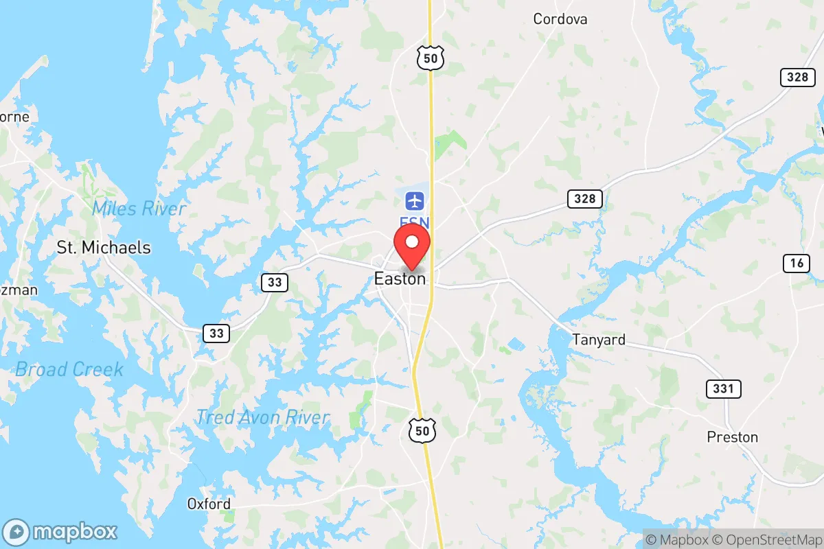
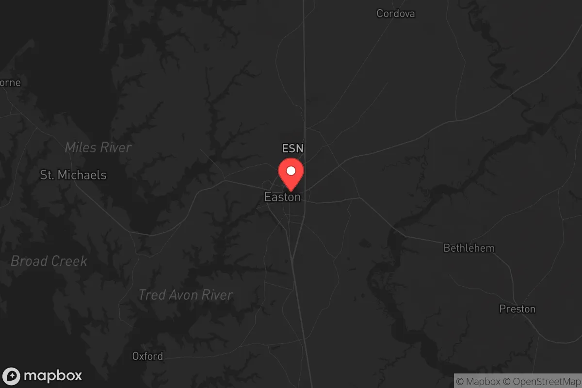
Easton sits at the heart of Talbot County, roughly 70 miles from Baltimore and 80 miles from Washington, D.C. That distance, combined with the natural barrier of the Chesapeake Bay, provides a meaningful first layer of defense against the chaos that would likely engulf the I-95 corridor during a major event. The Delmarva Peninsula is a dead-end from a strategic mobility standpoint—only two bridges (the Bay Bridge and the Chesapeake Bay Bridge-Tunnel) connect it to the mainland. In a collapse scenario, those chokepoints would be overwhelmed within hours, effectively sealing off the peninsula from the worst of the urban exodus. For a prepper, that is both a blessing and a curse. The blessing: Easton is unlikely to see the same flood of refugees as a town on I-81 or I-95. The curse: if you need to leave the peninsula for any reason—medical evacuation, resupply, or relocation—you are at the mercy of those same bridges. The area’s natural advantages include a temperate climate, ample rainfall, and fertile soil. The Eastern Shore is prime agricultural land, and Easton sits within a network of small farms, tidal creeks, and forested tracts that could support subsistence living. The town itself is built on a grid, with a historic core that is walkable but not defensible in any military sense. The real value here is the surrounding rural buffer—not the town proper.
Risks, exposures, and proximity to fallout-relevant landmarks
The most significant risk for Easton is its proximity to the Baltimore-Washington metropolitan area, which holds a concentration of high-value targets in any major conflict or terrorist event. The Pentagon, the White House, Fort Meade, and the NSA are all within a 90-minute drive under normal conditions. In a nuclear exchange or a coordinated attack on government infrastructure, fallout patterns would depend on wind direction, but the prevailing westerlies mean that Easton is downwind of the D.C. area. A dirty bomb or a limited nuclear strike on the capital could deposit radioactive material across the Chesapeake and onto the Eastern Shore within hours. The Bay Bridge itself is a critical infrastructure node—a single well-placed explosive device could sever the peninsula’s only road link to the mainland, trapping residents and complicating any evacuation or resupply. Additionally, the region’s vulnerability to sea-level rise and storm surge is not theoretical. Hurricane Isabel in 2003 pushed a 6-foot storm surge into Easton’s low-lying areas, and climate models suggest that Category 2 or 3 storms will become more frequent. For a prepper, this means that a major hurricane could simultaneously knock out power, flood roads, and contaminate freshwater sources, all while the bridges are closed or damaged. The town’s reliance on the Bay for tourism and commerce also means that a prolonged economic disruption—like a pandemic or a currency collapse—would hit Easton harder than a more diversified inland community.
Practical resilience for a relocator: food, water, energy, and defensibility
Easton’s practical resilience is a mixed bag. On the positive side, the town has a robust local food system. The Talbot County Farmers Market operates year-round, and the surrounding area is dotted with CSAs, u-pick operations, and small-scale livestock farms. A relocator with the means to buy a few acres outside of town could achieve a high degree of food self-sufficiency within two growing seasons. The water situation is more concerning. Easton draws its municipal water from the Choptank River and a series of groundwater wells, but the system is vulnerable to both saltwater intrusion and contamination from upstream agricultural runoff. A prepper would be wise to invest in a deep well on private property, ideally one that taps into the Aquia aquifer, which is less susceptible to surface contamination. Energy resilience is a weak point. The Eastern Shore is served by Delmarva Power, and the grid is notoriously fragile during storms. Outages lasting 3-5 days are common after a hurricane or nor’easter. Solar with battery backup is a viable option here—the region gets enough sun to make a 5-7 kW system practical for a single-family home—but natural gas is not widely available outside of town, so propane or wood heat is the backup of choice. Defensibility is the hardest variable. Easton itself is not defensible; it is a small town with multiple entry points and a police force of about 30 officers. In a widespread collapse, the town would be vulnerable to looting and roaming gangs. The smarter play is to secure a rural property within a 15-minute drive of Easton—close enough to access medical care and supplies, but far enough to control your perimeter. The area’s network of tidal creeks and rivers also offers a secondary escape route by boat, which is a unique advantage for those willing to invest in a shallow-draft vessel.
The overall strategic picture for Easton is one of calculated trade-offs. It offers genuine geographic isolation from the worst of the urban collapse, but that isolation comes with a single-point-of-failure chokepoint at the Bay Bridge. The agricultural base is strong, but the water and energy infrastructure are fragile. For a conservative relocator who values community, low crime, and a slower pace of life, Easton is a solid choice—provided you are not looking for a bug-out location that can be held indefinitely. This is a place to live and build, not a place to hide. If you are willing to invest in off-grid systems, secure a rural property, and accept that you are trading easy escape for a buffer zone, Easton can work. But if you are looking for a location that is both remote and self-sufficient, you may want to look further inland, toward the Shenandoah Valley or the Appalachian foothills. Easton is a hedge, not a guarantee.
* Values derived from national, state, county, city and local statistics and may differ in a specific area. Last updated: 2026-04-22T01:12:56.000Z
Narrative content on this page is AI-generated and may contain mistakes. Verify any details that matter before acting on them.
ReloMaps may earn a commission from affiliate links at no extra cost to you.