Photo: Wikipedia
Strategic Assessment of Easton, PA
Multiple tactical vulnerabilities. Population density, target proximity, or disaster risk are likely compounding. A retreat property and exit planning is required.
What does the Strategic Assessment tell us?
Our Strategic Assessment grades tactical survivability of an area. Major population centers, military targets, fallout zones, natural disasters, and border exposure all drive risk — lower exposure means a more defensible position in a crisis.
This is heavily inspired by Joel Skousen's Strategic Relocation book. Highly recommended you checkout the book ($)What does this tell us?
Our Strategic Assessment grades tactical survivability of an area. Major population centers, military targets, fallout zones, natural disasters, and border exposure all drive risk — lower exposure means a more defensible position in a crisis.
This is heavily inspired by Joel Skousen's Strategic Relocation book. Highly recommended you checkout the book ($)Strategic Pillars

Key Distances
Regional Safe Places
Below is our recommended "safe zones" in Pennsylvania and the surrounding area based on our strategic heuristics. For most people, it's unrealistic to live in a “safe zone” full-time due to work, family or other personal reasons. They tend to be more rural. However, many of these areas are perfect for second homes and retreat properties that double as a vacation home or even a short-term rental.


Important Note: For informational purposes only. This does not mean nothing bad ever happens in the green zones. Please use common sense. This is based on public data and modeled with AI. We tried to take a conservative approach but mistakes happen. We update this regularly as new information becomes available.
Solar Generator Recommendations
Backup power matters more here than in safer locations. We've picked three solar generators across budgets and capacity tiers — start with the budget unit if you only need a few essentials, or step up if you want to run a fridge and HVAC for days at a time.

Jackery Portable Power Station Explorer 300
Budget OptionPower on the Go: Weighing only 11 lbs, it's convenient to set up and store with book-sized foldable solar panels

BLUETTI Portable Power Station AC180
Designed for both indoor and outdoor scenarios, AC180 is highly capable as it has a robost capacity and continuous output power.

EF ECOFLOW DELTA Pro Ultra Power Station
Upgraded PickEcoFlow DELTA Pro Ultra is a whole-home energy system designed to grow with your family. Integrated with the Smart Home Panel 2, it scales to meet your evolving energy needs — keeping your home powered, intelligent, and secure through every stage of life.
We earn a commission, at no additional cost to you.
Strategic Assessment Analysis
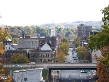
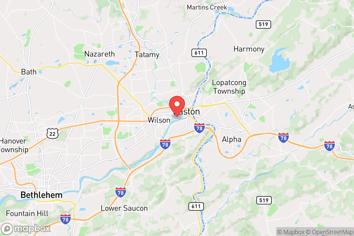
Easton, Pennsylvania, occupies a strategic position that offers a mixed bag for the conservative prepper: it sits at the confluence of the Delaware and Lehigh Rivers, providing a reliable water source and historical trade route, but its proximity to the I-78 corridor and the New York City-Philadelphia megalopolis means it’s squarely in the path of any mass evacuation or civil unrest cascade. The city itself, with a population around 28,000, is small enough to avoid the worst of urban collapse but large enough to have a functional tax base and infrastructure. For a relocator weighing resilience against exposure, Easton’s geographic advantages are real, but they come tethered to liabilities that demand a clear-eyed assessment.
Geographic position and natural advantages for long-term survival
Easton’s location at the junction of the Delaware and Lehigh Rivers is its single strongest asset. These waterways provide a perennial source of fresh water, which is the first thing to secure in any prolonged disruption—municipal supplies can fail, but a river doesn’t stop flowing. The surrounding Lehigh Valley is part of the Appalachian Ridge and Valley region, meaning the terrain offers natural chokepoints and defensible high ground within a 15- to 30-minute drive west into the Pocono foothills. The area’s agricultural history is still visible: Northampton County has over 400 farms, and the nearby Lehigh Valley is one of the few regions in the Northeast with significant remaining farmland, which translates to local food production capacity that won’t vanish overnight if supply chains break. The climate is temperate four-season, with reliable rainfall averaging 45 inches per year, so gardening and rainwater catchment are viable. For a relocator who wants to be within striking distance of resources but not inside a blast radius, Easton’s position—roughly 70 miles from both New York City and Philadelphia—puts it outside the immediate fallout zone of a major urban event while still close enough to monitor and, if necessary, interdict supply lines.
Risks, exposures, and proximity to fallout-relevant landmarks
The same geography that gives Easton its advantages also creates its most serious vulnerabilities. The city sits directly on Interstate 78, a major east-west artery that connects the Port of New York and New Jersey to the interior. In any mass evacuation scenario—whether from a natural disaster, a terrorist attack, or a cascading grid failure—I-78 becomes a parking lot and a funnel for desperate populations moving west. Easton itself would be a chokepoint, meaning the city could be overrun by refugees or become a target for looting parties. The Lehigh Valley International Airport (ABE) is just 10 miles west, and while it’s not a major military installation, it’s a regional hub that could become a staging ground for FEMA or National Guard operations, drawing unwanted attention. More concerning is the proximity to the Philadelphia Naval Shipyard (about 60 miles south) and the New York City metro area’s dense concentration of chemical plants, refineries, and nuclear power plants—specifically the Limerick Generating Station (45 miles southwest) and the Indian Point decommissioned site (still holding spent fuel, about 90 miles northeast). A major incident at any of these could send fallout or hazardous material plumes into the Lehigh Valley depending on wind patterns. Easton also sits in a floodplain; the Delaware River has a history of severe flooding, most notably in 1955, 2005, and 2011, which can knock out bridges and isolate neighborhoods. For the prepper, the risk calculus here is that Easton is a good place to stage from, but a poor place to stay during a regional crisis—you’ll want a bug-out location further into the Poconos or south toward the Maryland border.
Practical resilience for a relocator: food, water, energy, and defensibility
On the practical side, Easton offers a mix of strengths and weaknesses for a relocator building a resilient lifestyle. Water is abundant—the Delaware River is a massive, unfiltered source, but it requires treatment (boiling, filtration, or chemical purification) because it carries agricultural runoff and upstream sewage. The city’s municipal water comes from the Delaware, so if the grid goes down, so does the tap. A well-drilled property in the surrounding townships (Forks, Palmer, Williams) is a far better bet. Food security is viable: the Easton Farmers’ Market is the oldest continuous open-air market in the country, and the Lehigh Valley has a strong network of CSAs, butchers, and bulk food co-ops. For long-term storage, the area has several Mennonite and Amish communities within a 30-minute drive that produce grains, eggs, and dairy outside the industrial system. Energy resilience is a mixed picture. The grid in the Lehigh Valley is served by PPL Electric, which has a decent reliability record but is vulnerable to ice storms and summer thunderstorms. Solar potential is moderate—the region gets about 200 sunny days per year, less than the Southwest but enough for a well-sized off-grid system with battery backup. Natural gas is widely available in the city and suburbs, which is a plus for heating and cooking if the grid holds. Defensibility is where Easton falls short for a lone relocator. The city itself is dense, with row homes and narrow streets that make it hard to secure a perimeter. The surrounding suburbs are more spread out, but they’re also bedroom communities with little natural cover. The best defensive posture is to buy land in the rural townships north or west of the city—places like Mount Bethel or Bangor—where you have tree cover, elevation, and distance from the I-78 corridor. In Easton proper, you’re relying on community resilience and mutual aid, which is a gamble if social order fractures.
The overall strategic picture for Easton is that it’s a solid secondary position—a place to establish a foothold with good access to water, farmland, and regional trade routes, but not a final redoubt. For the conservative prepper who wants to be close enough to urban resources (medical centers, hardware stores, fuel depots) but far enough to avoid the initial shockwave of a collapse, Easton works as a base of operations. The key is to treat it as a staging ground: secure a property with a well, solar panels, and a garden, but have a bug-out plan for the Poconos or the Appalachian highlands if the I-78 corridor becomes a liability. The area’s political leanings are mixed—Northampton County went blue in 2020 and 2024, but the rural townships lean red—so you’ll find a mix of like-minded neighbors and urban transplants. The bottom line: Easton gives you the resources to ride out a moderate disruption, but if the country tips into serious unrest, you’ll want to be further into the hills before the bridges get locked down.
* Values derived from national, state, county, city and local statistics and may differ in a specific area. Last updated: 2026-05-01T02:56:48.000Z
Narrative content on this page is AI-generated and may contain mistakes. Verify any details that matter before acting on them.
ReloMaps may earn a commission from affiliate links at no extra cost to you.