Photo: Wikipedia
Strategic Assessment of El Dorado, KS
Meaningful friction. Expect exposure to either population pressure, blast zones, or natural disaster risk. Consider buying a retreat property.
What does the Strategic Assessment tell us?
Our Strategic Assessment grades tactical survivability of an area. Major population centers, military targets, fallout zones, natural disasters, and border exposure all drive risk — lower exposure means a more defensible position in a crisis.
This is heavily inspired by Joel Skousen's Strategic Relocation book. Highly recommended you checkout the book ($)What does this tell us?
Our Strategic Assessment grades tactical survivability of an area. Major population centers, military targets, fallout zones, natural disasters, and border exposure all drive risk — lower exposure means a more defensible position in a crisis.
This is heavily inspired by Joel Skousen's Strategic Relocation book. Highly recommended you checkout the book ($)Strategic Pillars

Key Distances
Regional Safe Places
Below is our recommended "safe zones" in Kansas and the surrounding area based on our strategic heuristics. For most people, it's unrealistic to live in a “safe zone” full-time due to work, family or other personal reasons. They tend to be more rural. However, many of these areas are perfect for second homes and retreat properties that double as a vacation home or even a short-term rental.
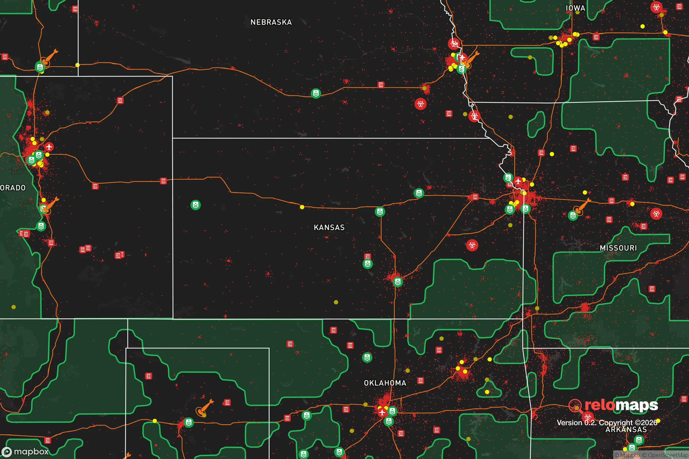
Important Note: For informational purposes only. This does not mean nothing bad ever happens in the green zones. Please use common sense. This is based on public data and modeled with AI. We tried to take a conservative approach but mistakes happen. We update this regularly as new information becomes available.
Solar Generator Recommendations
Backup power matters more here than in safer locations. We've picked three solar generators across budgets and capacity tiers — start with the budget unit if you only need a few essentials, or step up if you want to run a fridge and HVAC for days at a time.

Jackery Portable Power Station Explorer 300
Budget OptionPower on the Go: Weighing only 11 lbs, it's convenient to set up and store with book-sized foldable solar panels

BLUETTI Portable Power Station AC180
Designed for both indoor and outdoor scenarios, AC180 is highly capable as it has a robost capacity and continuous output power.

EF ECOFLOW DELTA Pro Ultra Power Station
Upgraded PickEcoFlow DELTA Pro Ultra is a whole-home energy system designed to grow with your family. Integrated with the Smart Home Panel 2, it scales to meet your evolving energy needs — keeping your home powered, intelligent, and secure through every stage of life.
We earn a commission, at no additional cost to you.
Strategic Assessment Analysis
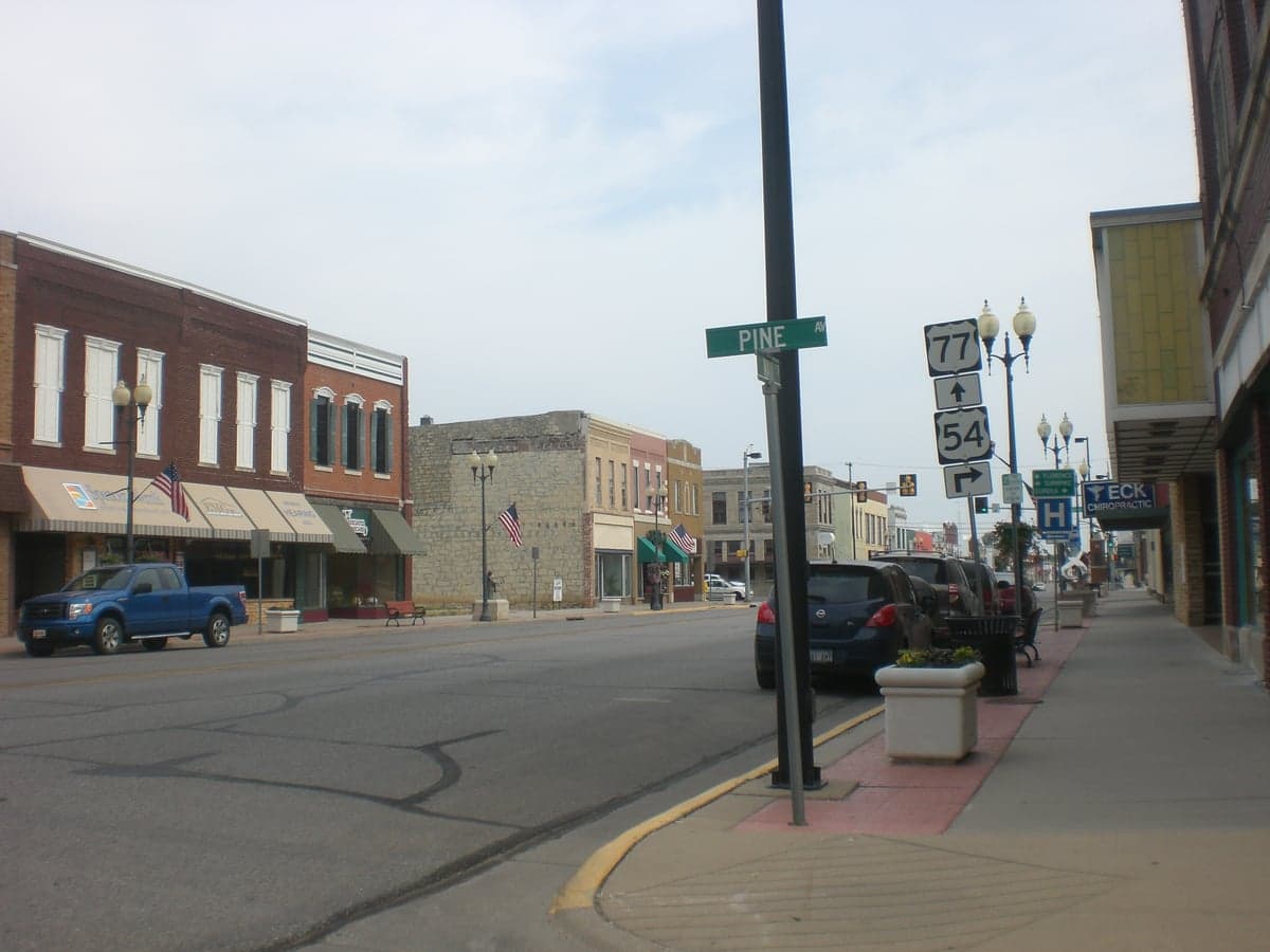
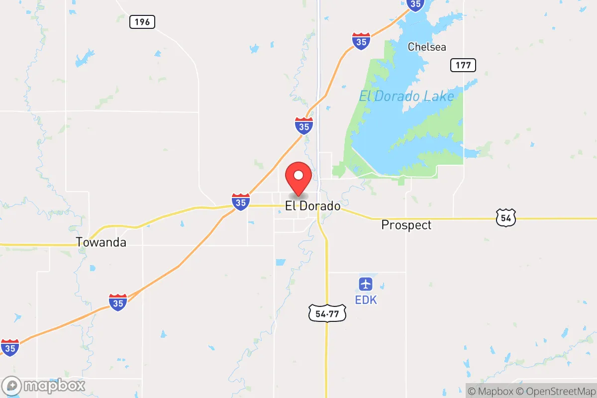
El Dorado, Kansas, sits in a sweet spot that few relocation analysts talk about openly: close enough to Wichita for supply runs and medical access, but far enough out that you aren't staring down the barrel of a major metro's collapse when things go sideways. The town itself has held steady through economic shifts, thanks to a diversified base of oil, agriculture, and a state prison that keeps local employment anchored. For someone thinking in terms of decades, not election cycles, El Dorado offers a blend of geographic insulation and practical infrastructure that makes it worth a hard look.
Geographic position and natural advantages for what it offers a prepper
El Dorado sits in Butler County, roughly 30 miles east-northeast of Wichita. That distance is critical. You are outside the blast radius of any plausible Wichita-targeting event, yet close enough to reach the city's hospitals, big-box retailers, and airport within 40 minutes. The land here is rolling Flint Hills prairie—thin soil, but excellent drainage and few floodplains. The El Dorado Lake, a 8,000-acre U.S. Army Corps of Engineers reservoir, sits right on the town's eastern edge. That's not just recreation; it's a multi-year water supply that doesn't depend on the Ogallala Aquifer, which is depleting fast depleting out west. The lake is fed by the Walnut River, a perennial stream that gives you a secondary water source if the reservoir's pumps ever stop. For a prepper, having a surface water reserve that isn't tied to a single well or municipal line is a major plus. The surrounding countryside is open enough to provide long sightlines, but with enough tree lines and creek bottoms to offer cover if you need to move discreetly.
Ris>Risks, exposures, and proximity to fallout-relevant landmarks
No place is risk-free, and El Dorado has its share. The biggest concern is the El Dorado Correctional Facility, a medium-security prison, located just north of town. In a grid-down or civil unrest scenario, a prison with hundreds of inmates and limited staff could become a liability. The facility is not a maximum-security unit, but it's still a concentration of people who have little to lose. On the industrial side, the area has a history of oil and gas extraction—there are active wells and storage tanks scattered around the county. A well fire or pipeline rupture is a localized hazard, not a regional one, but it's worth knowing where the nearest tank battery is relative to your property. The larger risk is Wichita itself. If a major event—EMP, economic collapse, pandemic—takes out the city, you will see a wave of refugees heading east on US-54 and K-254. El Dorado is the first decent-sized town on those routes. That means you need a plan for traffic, for strangers passing through, and for the possibility that local law enforcement gets overwhelmed. McConnell Air Force Base, just south of Wichita's southwest side, is a potential target in a conventional conflict. Fallout from a strike there would likely drift east-northeast, which puts El Dorado in a moderate risk zone. You'd want a basement or interior shelter with at least 48 hours of supplies for that scenario.
Practical resilience for a relocator: food, water, energy, and defensibility
El Dorado's practical resilience is where the rubber meets the road. Water is the strongest card. El Dorado Lake holds roughly 100,000 acre-feet of water at conservation pool. Even in a multi-year drought, that's enough to supply the town and surrounding rural areas for years. The city's water treatment plant pulls directly from the lake, and there are numerous private wells in the county that tap into the shallow alluvial aquifer along the Walnut River. If you buy land with a well, you are largely independent. Food is more complicated. Butler County is agricultural, but the dominant crops are wheat, soybeans, and corn—commodity crops, not garden vegetables. You can buy bulk grain locally, but fresh produce requires either a serious garden or a relationship with a farmer who runs a CSA. The local farmers' market in El Dorado runs May through October, but it's small-scale food production is not the norm. For long-term food security, you would want to establish your own garden and possibly a small orchard. The growing season is about 180 days, with average last frost around mid-April. Energy is a mixed bag. The grid is served by Westar Energy (Evergy), which has been reliable but is increasingly tied to intermittent renewables. Natural gas is available in town, but rural properties rely on propane or electric. Solar works well here—the area averages 215 sunny days per year, and there are no major shading issues on the open prairie. Wind is also viable; average speeds are around 12 mph, enough for a small turbine. Defensibility is where El Dorado shines compared to a suburban subdivision. The town itself is compact, with a grid layout that gives you multiple egress routes. The rural areas offer even more options: you can buy a 10- or 20-acre parcel with a creek, a well, and a gravel road that sees maybe one car a day. Neighbors are far enough apart that you can establish a perimeter without being obvious. The local sheriff's office is responsive but small—about 20 deputies for the entire county. In a crisis, you are your own first responder.
The overall strategic picture for El Dorado is one of moderate risk and high reward for a relocator who thinks in terms of decades. You are not in a fortress, but you are in a position that gives you time and options. The lake secures your water. The distance from Wichita buys you a buffer. The open terrain gives you visibility and room to maneuver. The downsides—the prison, the refugee flows, the moderate fallout risk—are manageable with planning. For someone who wants to be part of a functioning small town with a hospital, a grocery store, and a school, but who also wants the ability to pull back to a rural property and ride out a rough patch, El Dorado is a solid choice. It is not a bug-out location for a weekend; it is a place to build a life that can withstand the next 20 years.
* Values derived from national, state, county, city and local statistics and may differ in a specific area. Last updated: 2026-05-14T23:36:43.000Z
Narrative content on this page is AI-generated and may contain mistakes. Verify any details that matter before acting on them.
ReloMaps may earn a commission from affiliate links at no extra cost to you.