Photo: Wikipedia
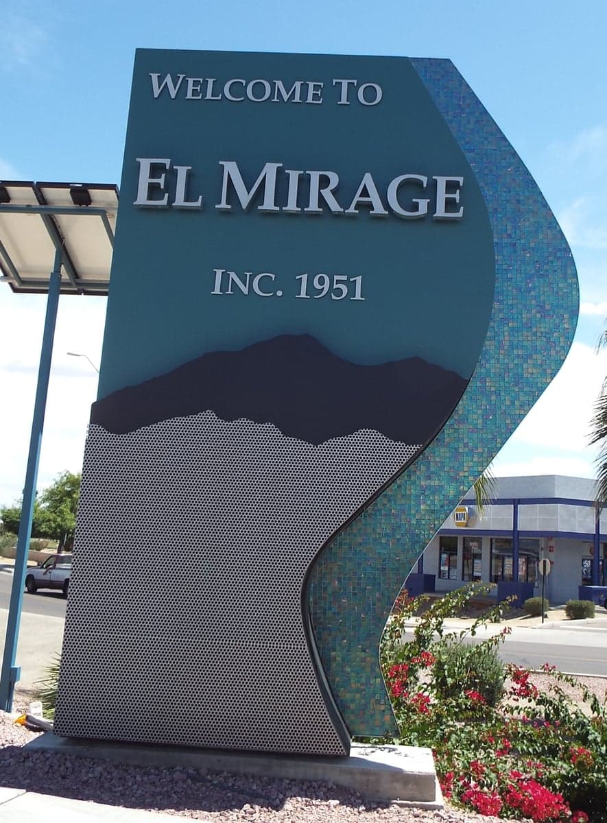
Strategic Assessment of El Mirage, AZ
Multiple tactical vulnerabilities. Population density, target proximity, or disaster risk are likely compounding. A retreat property and exit planning is required.
What does the Strategic Assessment tell us?
Our Strategic Assessment grades tactical survivability of an area. Major population centers, military targets, fallout zones, natural disasters, and border exposure all drive risk — lower exposure means a more defensible position in a crisis.
This is heavily inspired by Joel Skousen's Strategic Relocation book. Highly recommended you checkout the book ($)What does this tell us?
Our Strategic Assessment grades tactical survivability of an area. Major population centers, military targets, fallout zones, natural disasters, and border exposure all drive risk — lower exposure means a more defensible position in a crisis.
This is heavily inspired by Joel Skousen's Strategic Relocation book. Highly recommended you checkout the book ($)Strategic Pillars

Key Distances
Regional Safe Places
Below is our recommended "safe zones" in Arizona and the surrounding area based on our strategic heuristics. For most people, it's unrealistic to live in a “safe zone” full-time due to work, family or other personal reasons. They tend to be more rural. However, many of these areas are perfect for second homes and retreat properties that double as a vacation home or even a short-term rental.
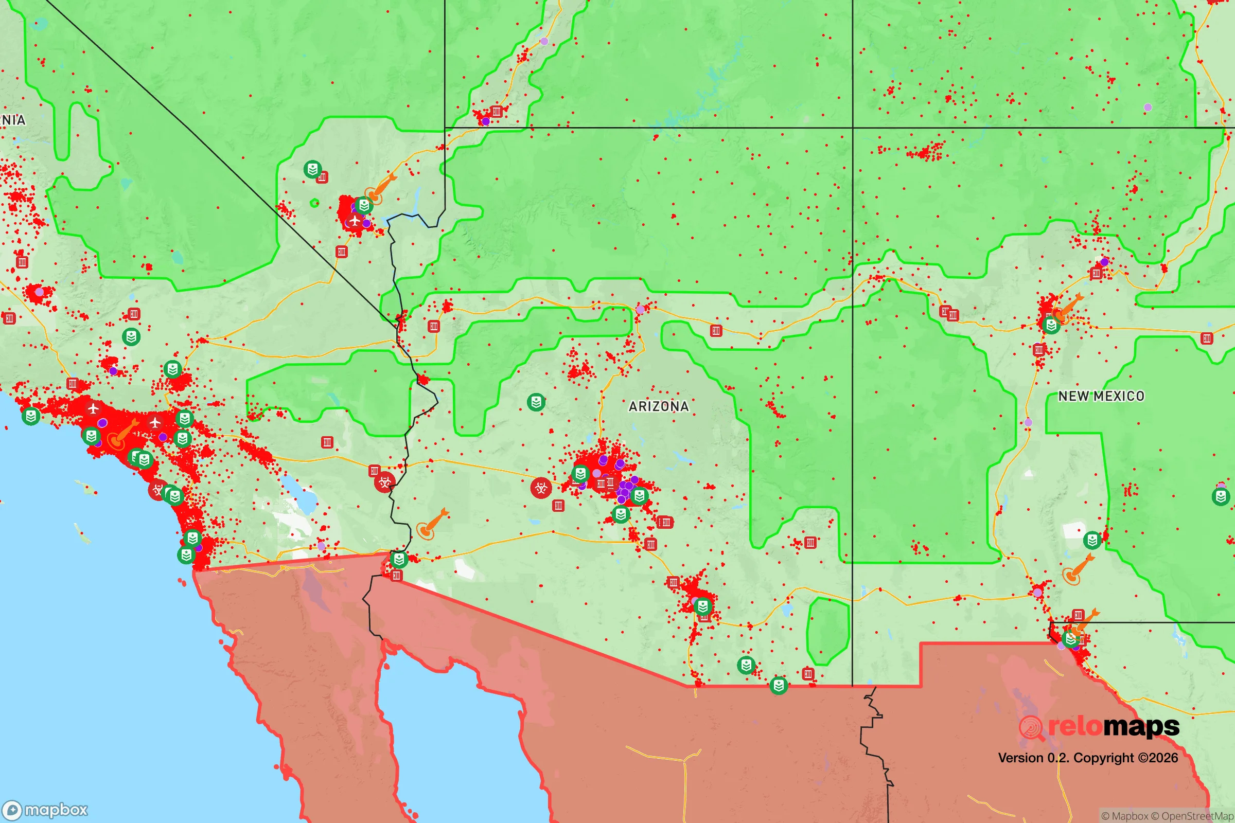
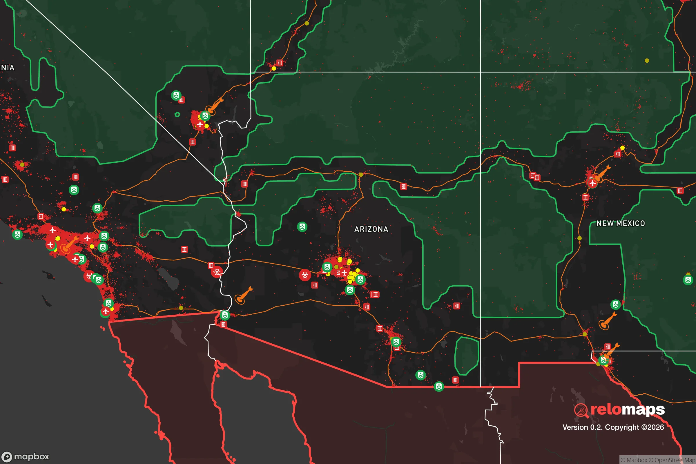
Important Note: For informational purposes only. This does not mean nothing bad ever happens in the green zones. Please use common sense. This is based on public data and modeled with AI. We tried to take a conservative approach but mistakes happen. We update this regularly as new information becomes available.
Solar Generator Recommendations
Backup power matters more here than in safer locations. We've picked three solar generators across budgets and capacity tiers — start with the budget unit if you only need a few essentials, or step up if you want to run a fridge and HVAC for days at a time.

Jackery Portable Power Station Explorer 300
Budget OptionPower on the Go: Weighing only 11 lbs, it's convenient to set up and store with book-sized foldable solar panels

BLUETTI Portable Power Station AC180
Designed for both indoor and outdoor scenarios, AC180 is highly capable as it has a robost capacity and continuous output power.

EF ECOFLOW DELTA Pro Ultra Power Station
Upgraded PickEcoFlow DELTA Pro Ultra is a whole-home energy system designed to grow with your family. Integrated with the Smart Home Panel 2, it scales to meet your evolving energy needs — keeping your home powered, intelligent, and secure through every stage of life.
We earn a commission, at no additional cost to you.
Strategic Assessment Analysis
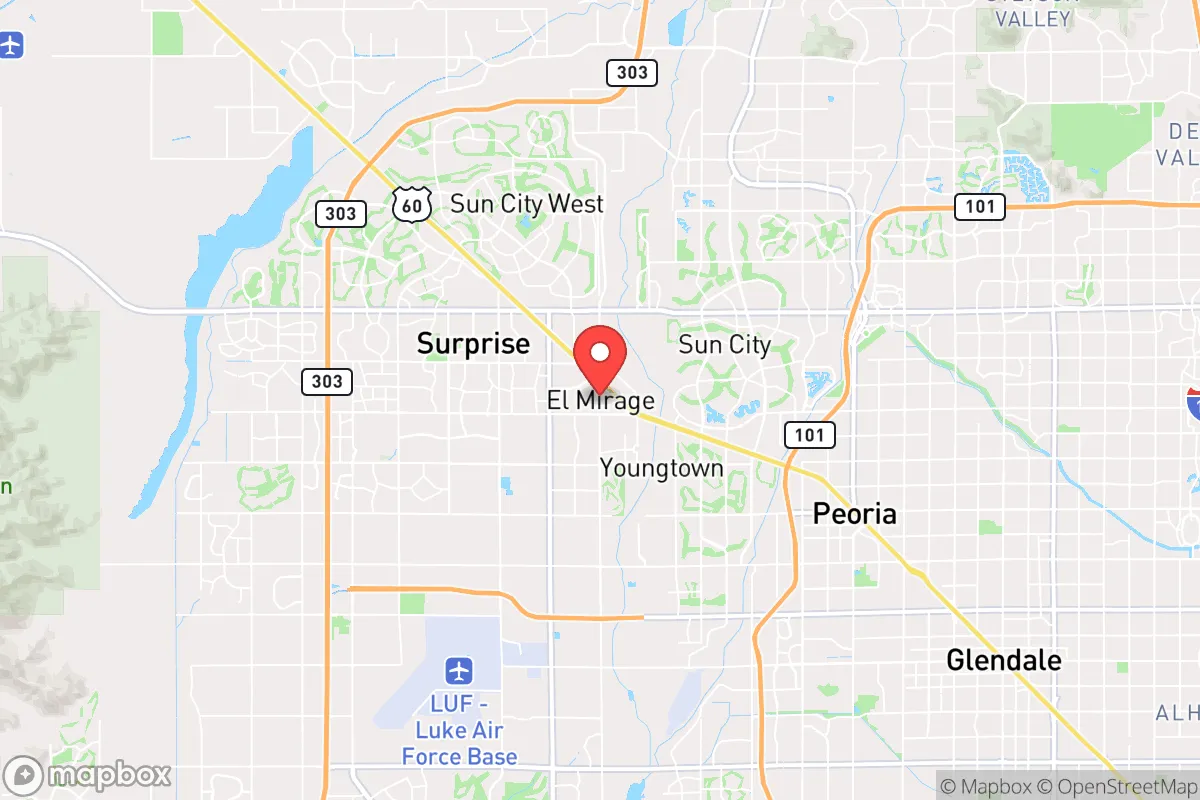
El Mirage, Arizona, sits in a precarious but potentially strategic pocket of the West Valley, roughly 20 miles northwest of downtown Phoenix. Its location offers a mixed bag for the prepper-minded relocator: close enough to tap into the region’s infrastructure and job base, yet far enough from the urban core to avoid the worst of a sudden collapse. The city’s resilience hinges on its position along the rapidly developing US 60 corridor and its proximity to the White Tank Mountains, which provide a natural buffer against the densest population centers. For someone weighing the risks of civic unrest, supply chain disruptions, or mass casualty events, El Mirage presents a calculated trade-off—not a fortress, but a viable foothold in a state that values self-reliance.
Geographic position and natural advantages for long-term stability
El Mirage’s geography is defined by its place in the Sonoran Desert, which offers both harsh realities and strategic benefits. The city sits on relatively flat terrain at an elevation of about 1,100 feet, with the White Tank Mountains rising to the west. These mountains act as a natural barrier, limiting direct overland access from the more populous areas of the West Valley like Surprise and Peoria. To the north, the Agua Fria River—usually dry—provides a minor topographic feature that could slow movement in a crisis. The city’s position also places it within a 30-minute drive of Luke Air Force Base, a major military installation that could become a focal point for security or, conversely, a target. For the prepper, the key advantage is the ability to retreat westward into the White Tank Mountains or further into the undeveloped lands near the Hassayampa River, where water sources and isolation increase. The region’s low humidity and abundant sunshine also make solar power a reliable option for off-grid energy, a critical factor for long-term sustainability.
Risks, exposures, and proximity to fallout-relevant landmarks
The most significant vulnerability for El Mirage is its proximity to Phoenix’s urban core and the associated risks of civil unrest, infrastructure failure, and potential targeting. The city lies within the blast and fallout radius of several high-value targets: Luke Air Force Base to the north, the Palo Verde Nuclear Generating Station about 40 miles west, and the major transportation hubs along I-10 and US 60. In a mass casualty event or nuclear exchange, El Mirage would face fallout from multiple directions, though the prevailing westerly winds might push contamination toward the east. The city’s population of roughly 40,000 is small enough to avoid the worst of urban chaos, but its growth rate—among the fastest in Arizona—means that infrastructure is already strained. Water supply is a critical concern: El Mirage relies on the Central Arizona Project canal, which is vulnerable to sabotage or disruption. The city’s location in a floodplain near the Agua Fria River also poses a risk of flash flooding during monsoon storms, which could compound a disaster scenario. For the conservative prepper, these exposures mean that El Mirage is not a bug-out location but a staging area—close enough to resources, but requiring a solid plan for evacuation or hardening.
Practical resilience for a relocator: food, water, energy, and defensibility
For someone looking to establish a resilient household in El Mirage, the practical challenges are real but manageable with preparation. Water is the most immediate concern: the city’s municipal supply comes from the CAP canal and local groundwater, but a prolonged outage would leave residents dependent on stored water or private wells. The average household should plan for at least two weeks of stored water, with a backup filtration system for the Agua Fria or Hassayampa rivers—both of which are seasonal and unreliable. Food security is easier: the region’s agricultural history means that local farms and farmers’ markets are still accessible, and the climate supports year-round gardening with shade structures and drip irrigation. Energy independence is achievable through solar panels, which are common in the area, and battery storage systems that can handle the summer AC load. Defensibility is a mixed bag: El Mirage’s suburban layout—with cul-de-sacs, walled communities, and a grid of major roads—offers some natural chokepoints, but the flat terrain and lack of natural cover make it hard to secure a large perimeter. A relocator should prioritize a home on the western edge of town, closer to the White Tank Mountains, where escape routes into the backcountry are more accessible. The city’s police force is small, and response times in a crisis would be slow, so self-defense capability and a neighborhood watch network are essential.
The overall strategic picture for El Mirage is one of cautious opportunity. It is not a remote survivalist paradise—it is a working-class suburb with real vulnerabilities to urban collapse, infrastructure failure, and fallout. But for the conservative relocator who values proximity to a major job market and the ability to build a resilient household without complete isolation, it offers a viable middle ground. The key is to treat El Mirage as a base of operations, not a final destination: store supplies, develop a retreat plan into the White Tank Mountains or further west, and build relationships with like-minded neighbors. The city’s growth and development will continue to erode its strategic advantages over time, so the window for securing a foothold here is narrowing. For those willing to put in the work, El Mirage can be a solid anchor in an increasingly uncertain Southwest.
* Values derived from national, state, county, city and local statistics and may differ in a specific area. Last updated: 2026-04-20T11:24:45.000Z
Narrative content on this page is AI-generated and may contain mistakes. Verify any details that matter before acting on them.
ReloMaps may earn a commission from affiliate links at no extra cost to you.