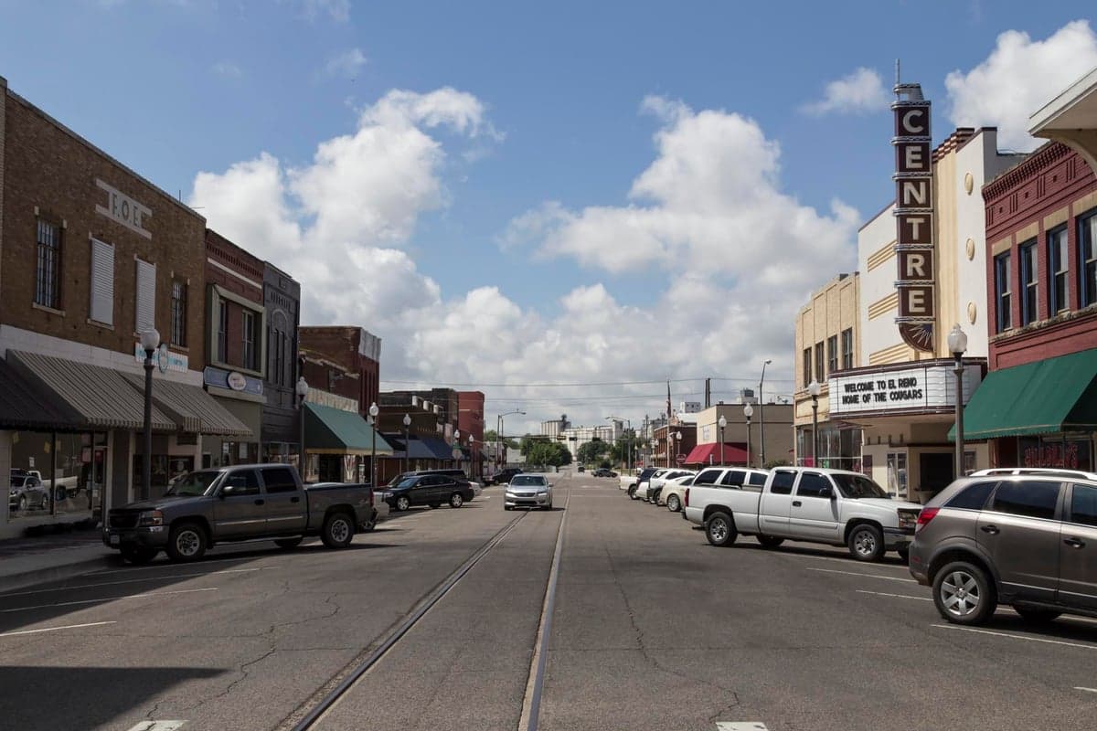

Photo: Wikipedia
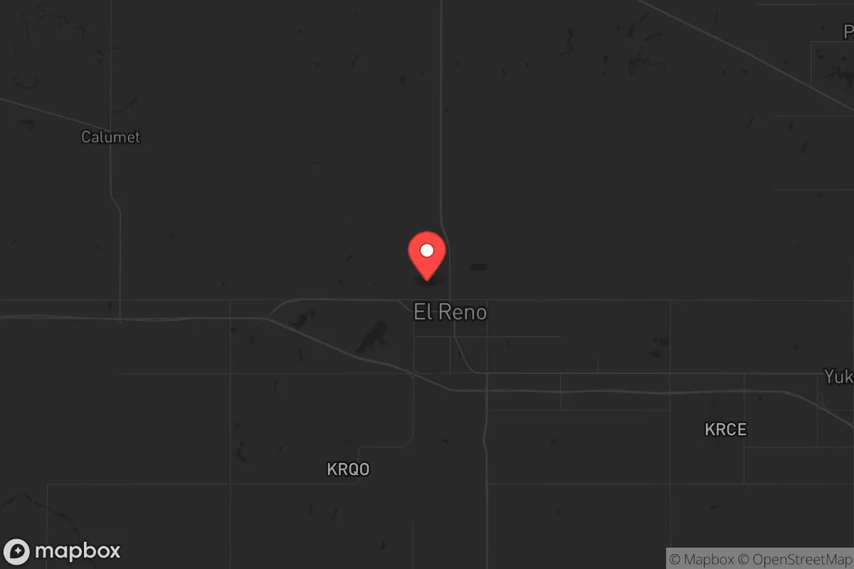
Strategic Assessment of El Reno, OK
Meaningful friction. Expect exposure to either population pressure, blast zones, or natural disaster risk. Consider buying a retreat property.
What does the Strategic Assessment tell us?
Our Strategic Assessment grades tactical survivability of an area. Major population centers, military targets, fallout zones, natural disasters, and border exposure all drive risk — lower exposure means a more defensible position in a crisis.
This is heavily inspired by Joel Skousen's Strategic Relocation book. Highly recommended you checkout the book ($)What does this tell us?
Our Strategic Assessment grades tactical survivability of an area. Major population centers, military targets, fallout zones, natural disasters, and border exposure all drive risk — lower exposure means a more defensible position in a crisis.
This is heavily inspired by Joel Skousen's Strategic Relocation book. Highly recommended you checkout the book ($)Strategic Pillars

Key Distances
Regional Safe Places
Below is our recommended "safe zones" in Oklahoma and the surrounding area based on our strategic heuristics. For most people, it's unrealistic to live in a “safe zone” full-time due to work, family or other personal reasons. They tend to be more rural. However, many of these areas are perfect for second homes and retreat properties that double as a vacation home or even a short-term rental.
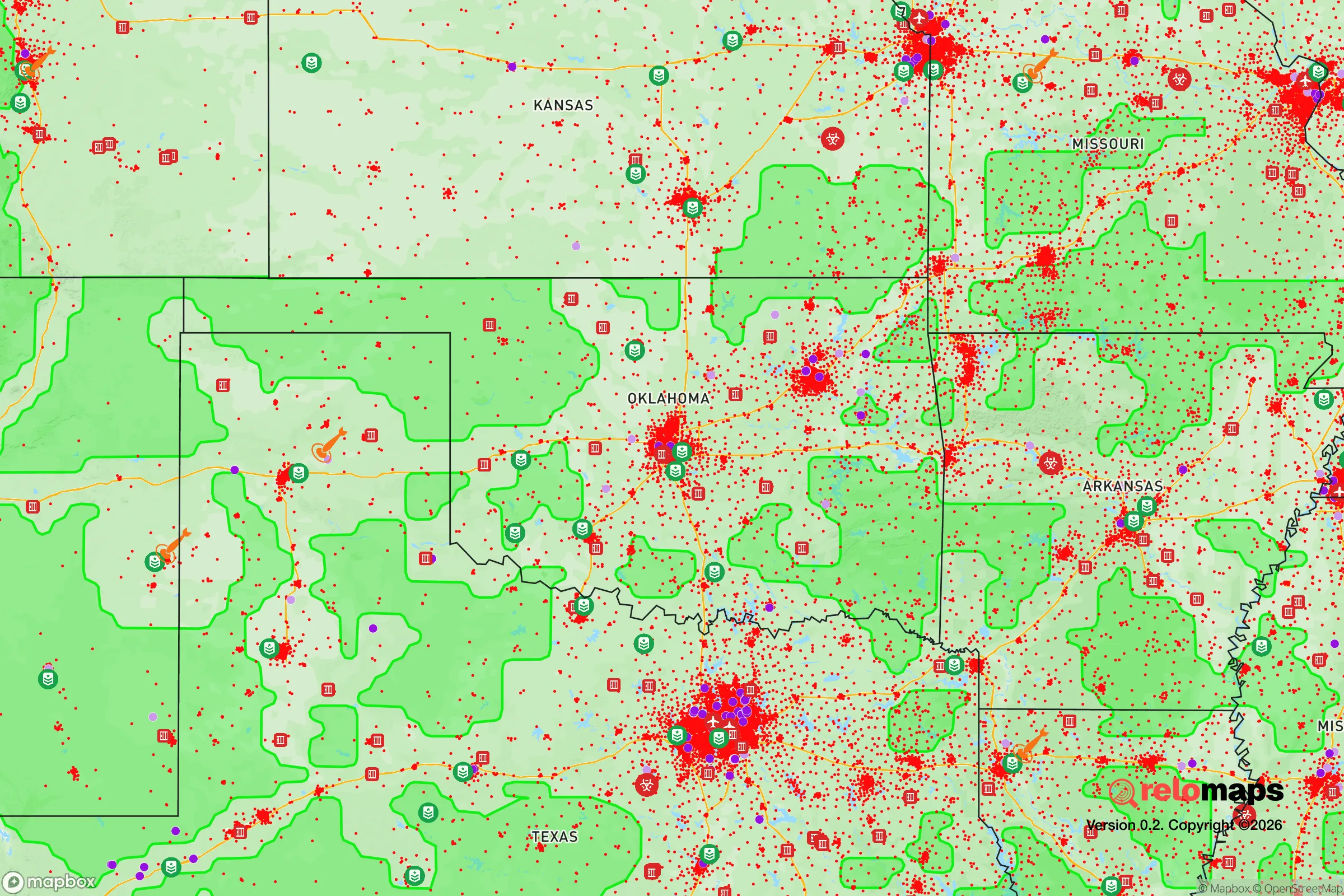
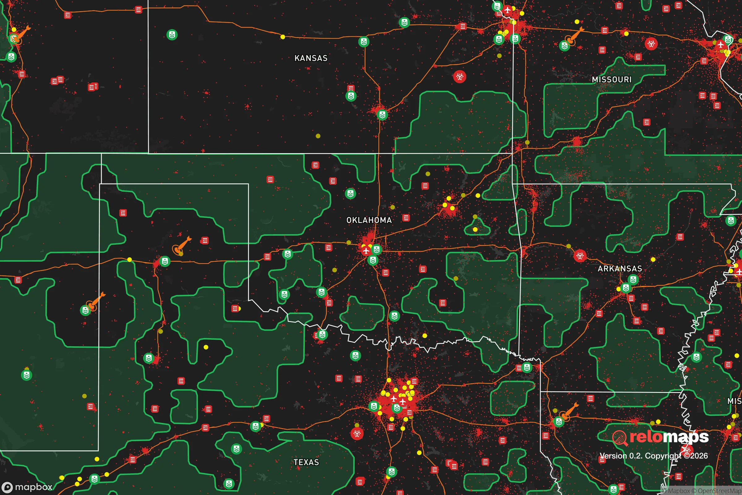
Important Note: For informational purposes only. This does not mean nothing bad ever happens in the green zones. Please use common sense. This is based on public data and modeled with AI. We tried to take a conservative approach but mistakes happen. We update this regularly as new information becomes available.
Solar Generator Recommendations
Backup power matters more here than in safer locations. We've picked three solar generators across budgets and capacity tiers — start with the budget unit if you only need a few essentials, or step up if you want to run a fridge and HVAC for days at a time.

Jackery Portable Power Station Explorer 300
Budget OptionPower on the Go: Weighing only 11 lbs, it's convenient to set up and store with book-sized foldable solar panels

BLUETTI Portable Power Station AC180
Designed for both indoor and outdoor scenarios, AC180 is highly capable as it has a robost capacity and continuous output power.

EF ECOFLOW DELTA Pro Ultra Power Station
Upgraded PickEcoFlow DELTA Pro Ultra is a whole-home energy system designed to grow with your family. Integrated with the Smart Home Panel 2, it scales to meet your evolving energy needs — keeping your home powered, intelligent, and secure through every stage of life.
We earn a commission, at no additional cost to you.
Strategic Assessment Analysis
El Reno, Oklahoma, sits in a strategic sweet spot that resilience-minded relocators should take seriously: close enough to Oklahoma City for supply runs and medical access, but far enough out that you aren't breathing the same air when things go sideways. The town's position along the historic Chisholm Trail and its modern role as a transportation hub—I-40, I-35, and the Union Pacific rail corridor all converge here—means it's wired into the national grid in a way that most small towns aren't. That same connectivity, however, makes it a potential chokepoint during disruptions. For a conservative-leaning individual or family looking to balance access with distance, El Reno offers a workable middle ground, provided you understand both its natural advantages and its exposure to the kinds of events that make prepping a necessity rather than a hobby.
Geographic position and natural advantages for long-term stability
El Reno sits on the Canadian River valley floor, which gives it a reliable groundwater table and decent soil for small-scale agriculture—two assets that become critical when supply chains falter. The surrounding Canadian County is flat, open prairie with scattered tree lines along creeks, offering good visibility and limited natural cover for anyone approaching your property. That's a double-edged sword: you can see trouble coming, but so can it see you. The area's elevation is modest, around 1,300 feet, which means you're not dealing with extreme cold or snowpack that could isolate you for weeks. Winters are cold but manageable; summers are hot and dry, which makes water storage and fire mitigation non-negotiable. The lack of major mountain ranges or dense forests means overland travel is straightforward, but it also means you're exposed to the full force of Great Plains weather—tornadoes, straight-line winds, and hailstorms are annual realities. For a relocator, the natural advantage here is predictability: you know what the climate will do, and you can build for it. The land is affordable, with acreage still available under $5,000 per acre within 20 minutes of town, which makes it feasible to establish a defensible homestead without taking on crippling debt.
Risks, exposures, and proximity to fallout-relevant landmarks
Let's be direct: El Reno is 30 miles from Oklahoma City's urban core, and that proximity carries real risk in a scenario involving civil unrest, EMP, or a major terrorist event. Oklahoma City is a regional transportation and energy hub—it hosts the Tinker Air Force Base, the Will Rogers World Airport, and major interstate junctions. In a national crisis, those assets become targets or chokepoints. El Reno itself sits near the Union Pacific's main freight line and the I-40/I-35 interchange, which means any disruption to those arteries will ripple through the local economy and potentially draw displaced populations westward. The town also lies within 50 miles of the Cimarron River corridor, which has been discussed in prepper circles as a potential fallout zone if a nuclear event targeted the central plains. More concretely, the nearby Fort Reno military installation—now a historic site and agricultural research station—was once a strategic asset; today it's mostly benign, but its history as a POW camp and military depot means it's on federal maps. For the survivalist, the key takeaway is that El Reno is not a bug-out location—it's a semi-rural buffer zone. You can't rely on it being untouched if Oklahoma City goes hot. Your plan needs to account for the possibility of evacuees, looters, or military checkpoints on the highways. The positive side: the town's small size (about 20,000 people) and its agricultural base mean it's less likely to be a primary target than the metro area, and the local population is largely self-reliant, rural-minded folks who aren't going to panic at the first power outage.
Practical resilience for a relocator: food, water, energy, and defensibility
If you're serious about self-sufficiency, El Reno's practical assets are worth weighing. The Canadian River alluvial aquifer provides decent well water at depths of 100-200 feet, though you'll want to test for salt and mineral content—some areas have high total dissolved solids. Rainwater catchment is viable, with annual precipitation around 33 inches, but you'll need storage capacity for the dry summer months. The local soil, while not prime farmland, supports wheat, alfalfa, and sorghum, and there's a strong tradition of small-scale cattle and poultry operations. The Canadian County Extension Office offers soil testing and agricultural workshops, which is a resource most preppers overlook. For energy, the area has good solar exposure—over 260 sunny days per year—and wind is consistent enough that a small turbine could supplement a solar array. Natural gas is available in town, but rural properties rely on propane or electric. Defensibility is where El Reno gets mixed marks: the flat terrain means you can't hide, but it also means you can establish a clear perimeter. A property with a good well, a berm or earthwork barrier, and a clear line of sight to the nearest road is achievable on a modest budget. The local sheriff's office is responsive but small; in a prolonged crisis, you are your own first responder. Gun culture is strong here, and the county has a shall-issue concealed carry permit system, so you won't be the only armed household on your block. That's a social asset—neighbors who are prepared and willing to cooperate—but it also means you should establish relationships early, before the crisis hits. The town has a single grocery store (a Homeland) and a Walmart, but both are vulnerable to supply chain disruptions; your plan should assume you'll need to produce or barter for a significant portion of your food within 90 days.
The overall strategic picture for El Reno is one of calculated trade-offs. It offers affordable land, a conservative and self-reliant community, and proximity to a major city without being swallowed by it. The risks are real: tornadoes, proximity to a high-value target zone, and the flat terrain that makes concealment difficult. But for a relocator who wants to be within a day's drive of medical care, fuel, and supplies while maintaining a working homestead, El Reno is a viable option. The key is to treat it as a base of operations, not a fortress. Build your water storage, establish a garden and livestock rotation, get to know your neighbors at the feed store and the gun range, and keep a vehicle gassed up with a route out of town that avoids the interstates. If you do that, El Reno can work as a long-term resilience play—but only if you go in with eyes open, not looking for a perfect sanctuary, but for a place where the odds are tilted in your favor.
* Values derived from national, state, county, city and local statistics and may differ in a specific area. Last updated: 2026-04-25T13:51:37.000Z
Narrative content on this page is AI-generated and may contain mistakes. Verify any details that matter before acting on them.
ReloMaps may earn a commission from affiliate links at no extra cost to you.