
Photo: Wikipedia
Strategic Assessment of Elkins, WV
Meaningful friction. Expect exposure to either population pressure, blast zones, or natural disaster risk. Consider buying a retreat property.
What does the Strategic Assessment tell us?
Our Strategic Assessment grades tactical survivability of an area. Major population centers, military targets, fallout zones, natural disasters, and border exposure all drive risk — lower exposure means a more defensible position in a crisis.
This is heavily inspired by Joel Skousen's Strategic Relocation book. Highly recommended you checkout the book ($)What does this tell us?
Our Strategic Assessment grades tactical survivability of an area. Major population centers, military targets, fallout zones, natural disasters, and border exposure all drive risk — lower exposure means a more defensible position in a crisis.
This is heavily inspired by Joel Skousen's Strategic Relocation book. Highly recommended you checkout the book ($)Strategic Pillars

Key Distances
Regional Safe Places
Below is our recommended "safe zones" in West Virginia and the surrounding area based on our strategic heuristics. For most people, it's unrealistic to live in a “safe zone” full-time due to work, family or other personal reasons. They tend to be more rural. However, many of these areas are perfect for second homes and retreat properties that double as a vacation home or even a short-term rental.


Important Note: For informational purposes only. This does not mean nothing bad ever happens in the green zones. Please use common sense. This is based on public data and modeled with AI. We tried to take a conservative approach but mistakes happen. We update this regularly as new information becomes available.
Solar Generator Recommendations
Backup power matters more here than in safer locations. We've picked three solar generators across budgets and capacity tiers — start with the budget unit if you only need a few essentials, or step up if you want to run a fridge and HVAC for days at a time.

Jackery Portable Power Station Explorer 300
Budget OptionPower on the Go: Weighing only 11 lbs, it's convenient to set up and store with book-sized foldable solar panels

BLUETTI Portable Power Station AC180
Designed for both indoor and outdoor scenarios, AC180 is highly capable as it has a robost capacity and continuous output power.

EF ECOFLOW DELTA Pro Ultra Power Station
Upgraded PickEcoFlow DELTA Pro Ultra is a whole-home energy system designed to grow with your family. Integrated with the Smart Home Panel 2, it scales to meet your evolving energy needs — keeping your home powered, intelligent, and secure through every stage of life.
We earn a commission, at no additional cost to you.
Strategic Assessment Analysis
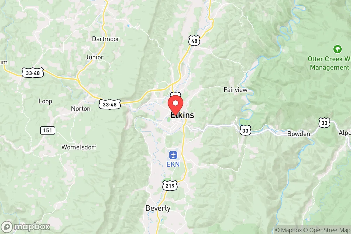
Elkins, West Virginia, sits in a geographic sweet spot that offers genuine strategic depth for those thinking long-term about resilience, but it’s not without trade-offs. Nestled in the Tygart Valley of Randolph County, this town of roughly 7,000 people is far enough from major population centers to avoid the worst of cascading collapse scenarios, yet close enough to regional infrastructure to make relocation practical. The surrounding Monongahela National Forest and the Allegheny Mountains create a natural buffer that few other locations in the eastern United States can match, giving a relocator a real shot at weathering the kind of civic and environmental shocks that are becoming harder to ignore.
Geographic position and natural advantages for long-term security
Elkins’ location is its strongest card. It sits at the intersection of US-33 and US-219, roughly 120 miles east of Charleston and 140 miles south of Pittsburgh—close enough to access medical and supply hubs in a stable period, but far enough that a major urban collapse wouldn’t immediately wash over the area. The town is surrounded by the Monongahela National Forest, which covers nearly 920,000 acres of rugged, sparsely populated terrain. This isn’t flat farmland; it’s steep, wooded hills and narrow valleys that naturally channel movement and make large-scale incursions difficult. The Tygart Valley River runs through town, providing a reliable surface water source, and the region’s annual rainfall of around 45 inches means groundwater recharge is consistent. For a prepper, the combination of defensible terrain, abundant water, and low population density (Randolph County has about 29 people per square mile) is a solid foundation. The area also sits in a zone with relatively low seismic and hurricane risk, though winter storms and occasional flooding from heavy rain are real concerns that require preparation.
Risks, exposures, and proximity to fallout-relevant landmarks
No location is a fortress, and Elkins has vulnerabilities that need to be weighed honestly. The most obvious is its proximity to the Davis-Besse Nuclear Power Station in Ohio, about 180 miles northwest, and the Beaver Valley Power Station in Pennsylvania, roughly 150 miles north. While those distances are outside the immediate lethal fallout zone for a major accident or attack, prevailing winds from the west and northwest could carry radioactive particles into the region within 12-24 hours. A relocator would need a solid shelter-in-place plan and at least a two-week supply of food and water to ride out a plume event. More immediate is the risk from the area’s own infrastructure: the Tygart Valley River runs through town, and a dam failure upstream at the Tygart Lake Dam (about 15 miles south) could flood low-lying parts of Elkins. The dam is well-maintained, but in a scenario where maintenance stops or sabotage occurs, the risk is real. On the human threat side, Elkins is not a target itself, but it sits along US-33, a major east-west corridor that could see refugee flow from the Baltimore-Washington corridor (about 200 miles east) during a collapse. The town’s small police force and lack of a hardened perimeter mean that a relocator should plan for self-defense and community security rather than relying on official protection. There are no military bases, nuclear silos, or major industrial targets within 50 miles, which is a net positive—but the area’s reliance on a single major highway for resupply is a fragility that demands stockpiling.
Practical resilience for a relocator: food, water, energy, and defensibility
For someone serious about self-sufficiency, Elkins offers a mix of opportunity and work. Water is the easiest win: the Tygart Valley River and numerous creeks (Leading Creek, Files Creek, and others) provide year-round flow, and the water table is high enough that shallow wells are viable in most of the valley. A hand pump or a simple gravity-fed filtration system would secure a household’s supply. Food is more challenging. The growing season is short—roughly 140 days between last and first frost—and the soil in the valley is mostly clay-loam that requires amendment for serious vegetable production. However, the surrounding forest is rich in white-tailed deer, turkey, and small game, and the Monongahela National Forest allows hunting with a license. For long-term food security, a relocator would need to invest in raised beds, a greenhouse, or a root cellar; the area’s apple and berry orchards are a bonus but not a staple. Energy is a bright spot: the region has good wind potential on the ridges (average speeds of 12-15 mph at 80 meters) and decent solar exposure despite the cloud cover (about 4.5 peak sun hours per day in summer). Wood heating is the default for many locals, with abundant hardwood forests within a 10-minute drive. Defensibility is mixed. The town itself is a grid of streets with open approaches from the highway, but the surrounding hollows and hillsides offer numerous retreat properties with natural chokepoints. A property on a dead-end road off of US-219 or up a hollow like the one along Glady Fork would be hard to approach without warning. The local culture is independent and gun-friendly, with a strong tradition of hunting and self-reliance, which means a relocator who integrates well will find neighbors who share a prepper mindset rather than hostility. The downside is that the county’s economy is weak—median household income is around $40,000—so a relocator bringing capital and skills will have an advantage, but also a target on their back if they’re not discreet.
The overall strategic picture for Elkins is one of moderate resilience with clear, manageable risks. It’s not a bug-out paradise—the short growing season, highway dependency, and distant nuclear threats require planning—but it’s one of the better options in the eastern US for someone who wants to be out of the blast radius of major cities while still having access to medical care and supply chains in normal times. The key is to treat Elkins as a base for a prepared community, not a solo retreat. The terrain and local culture support a group that’s organized, armed, and stocked, but a single family without deep supplies or local ties could find the winter isolation and resource competition tough. For a conservative-leaning relocator who values independence, self-defense, and a low-profile existence, Elkins offers a solid foundation—provided you bring your own plan for the gaps.
* Values derived from national, state, county, city and local statistics and may differ in a specific area. Last updated: 2026-05-03T11:11:35.000Z
Narrative content on this page is AI-generated and may contain mistakes. Verify any details that matter before acting on them.
ReloMaps may earn a commission from affiliate links at no extra cost to you.