
Photo: Wikipedia
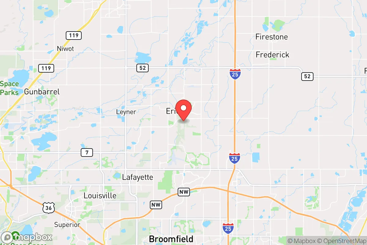
Strategic Assessment of Erie, CO
Multiple tactical vulnerabilities. Population density, target proximity, or disaster risk are likely compounding. A retreat property and exit planning is required.
What does the Strategic Assessment tell us?
Our Strategic Assessment grades tactical survivability of an area. Major population centers, military targets, fallout zones, natural disasters, and border exposure all drive risk — lower exposure means a more defensible position in a crisis.
This is heavily inspired by Joel Skousen's Strategic Relocation book. Highly recommended you checkout the book ($)What does this tell us?
Our Strategic Assessment grades tactical survivability of an area. Major population centers, military targets, fallout zones, natural disasters, and border exposure all drive risk — lower exposure means a more defensible position in a crisis.
This is heavily inspired by Joel Skousen's Strategic Relocation book. Highly recommended you checkout the book ($)Strategic Pillars

Key Distances
Regional Safe Places
Below is our recommended "safe zones" in Colorado and the surrounding area based on our strategic heuristics. For most people, it's unrealistic to live in a “safe zone” full-time due to work, family or other personal reasons. They tend to be more rural. However, many of these areas are perfect for second homes and retreat properties that double as a vacation home or even a short-term rental.


Important Note: For informational purposes only. This does not mean nothing bad ever happens in the green zones. Please use common sense. This is based on public data and modeled with AI. We tried to take a conservative approach but mistakes happen. We update this regularly as new information becomes available.
Solar Generator Recommendations
Backup power matters more here than in safer locations. We've picked three solar generators across budgets and capacity tiers — start with the budget unit if you only need a few essentials, or step up if you want to run a fridge and HVAC for days at a time.

Jackery Portable Power Station Explorer 300
Budget OptionPower on the Go: Weighing only 11 lbs, it's convenient to set up and store with book-sized foldable solar panels

BLUETTI Portable Power Station AC180
Designed for both indoor and outdoor scenarios, AC180 is highly capable as it has a robost capacity and continuous output power.

EF ECOFLOW DELTA Pro Ultra Power Station
Upgraded PickEcoFlow DELTA Pro Ultra is a whole-home energy system designed to grow with your family. Integrated with the Smart Home Panel 2, it scales to meet your evolving energy needs — keeping your home powered, intelligent, and secure through every stage of life.
We earn a commission, at no additional cost to you.
Strategic Assessment Analysis
Erie, Colorado, sits at a strategic inflection point: close enough to Denver and Boulder to access their economic engines, yet far enough to offer a meaningful buffer against the cascading failures that could follow a major civic disruption. For a relocator thinking in terms of resilience—not just commute times—Erie’s position along the I-25 corridor is both an asset and a liability. The town’s rapid growth from a farming hamlet to a planned suburb has created modern infrastructure, but that same development pattern introduces dependencies that a prepper must weigh carefully. The key question isn’t whether Erie is safe today, but whether its geography, resources, and community structure can sustain life when the systems we take for granted begin to fray.
Geographic position and natural advantages for long-term stability
Erie occupies a rare niche in Colorado’s Front Range: it sits on the high plains at roughly 5,000 feet, with the Rocky Mountain foothills rising just 15 miles to the west. This placement offers a dual advantage. First, the town is above the inversion layer that traps pollution and wildfire smoke in the Denver metro basin, meaning air quality remains better during crisis events. Second, Erie’s position places it within a 30-minute drive of multiple water sources—Boulder Creek, St. Vrain Creek, and the South Platte River—while remaining outside the 100-year floodplain that threatens communities like Lyons or parts of Boulder. The area’s aquifer, part of the Denver Basin groundwater system, provides a backup water supply that many Front Range suburbs lack. For a relocator, this means Erie has a fighting chance at water security when municipal taps run dry, though it’s not a guarantee. The town’s elevation also provides a modest defensive advantage: the surrounding terrain is gently rolling, with no major choke points, but the open plains offer long sightlines that would make organized movement or perimeter defense feasible in a grid-down scenario. Erie’s climate is semi-arid, with 14 inches of annual precipitation, which limits agricultural self-sufficiency but reduces the risk of mold, rot, and infrastructure collapse that plague wetter regions. The growing season runs roughly May through September, long enough for cold-hardy crops like potatoes, kale, and root vegetables, but not for corn or soybeans without irrigation. For a family planning a multi-year resilience strategy, Erie’s geography is workable but not ideal—it’s a compromise between access and isolation.
Risks, exposures, and proximity to fallout-relevant landmarks
Erie’s greatest vulnerability is its proximity to high-value targets along the Front Range. The town lies 20 miles from Denver International Airport, a major logistics hub that would be a primary target in any conflict involving strategic infrastructure. Rocky Mountain Arsenal, a former chemical weapons facility turned wildlife refuge, sits 25 miles southeast—its remediation status is public, but the site’s history of sarin and mustard gas production means any ground disturbance during a crisis could release residual contaminants. Buckley Space Force Base in Aurora, 30 miles south, is a critical node for space surveillance and missile warning systems, making it a Tier 1 target in a peer-level conflict. Erie itself is not a target, but its location within the blast and fallout radius of these assets is a serious concern. A single 300-kiloton airburst over DIA would produce lethal thermal effects out to 5 miles and second-degree burns out to 10 miles; Erie would be outside the fireball but inside the zone of shattered windows and potential fallout drift depending on wind direction. More immediately relevant for civic unrest scenarios: Erie is bisected by Colorado Highway 7 and U.S. 287, both of which connect to Boulder and Longmont—cities with large, politically active populations that could become flashpoints during a breakdown of civil order. The town’s population has exploded from 6,000 in 2000 to over 35,000 today, meaning many residents are newcomers with no deep community ties, no stored supplies, and no rural skills. In a prolonged crisis, Erie could become a pressure cooker: too many people, too few local resources, and too many escape routes clogged with refugees from Denver. The wildfire risk is moderate—Erie is not in the wildland-urban interface like Conifer or Evergreen, but grass fires on the plains can move at 40 mph, and the town’s open space corridors provide a fuel path straight into subdivisions. Flooding is minimal, but the area’s clay soils mean that heavy rain events can turn streets into impassable mud traps, isolating neighborhoods for hours.
Practical resilience for a relocator: food, water, energy, and defensibility
For a relocator serious about self-sufficiency, Erie presents a mixed picture. The town’s water comes from a combination of surface rights from the Colorado-Big Thompson Project and groundwater wells, but the municipal system is entirely dependent on electric pumps and chemical treatment. A multi-day power outage would leave taps dry within hours. The prudent relocator should plan for at least 30 gallons of stored water per person, plus a Berkey or similar gravity filter for local surface water. Rainwater collection is legal in Colorado but limited to 110 gallons per property without a permit—enough for garden irrigation, not drinking. The soil is alkaline clay, typical of the high plains, and requires significant amendment for vegetable production. Raised beds with imported topsoil are the standard workaround, but that creates a dependency on supply chains. Erie’s zoning allows for backyard chickens and small livestock on lots of one acre or more, but most new subdivisions have HOA covenants that prohibit them. A relocator should target the older, unincorporated pockets east of County Line Road or the rural lots near Erie Parkway and Arapahoe Road, where HOA restrictions are looser. Energy resilience is achievable: the area averages 300 sunny days per year, making solar panels a viable primary or backup power source. Net metering is available through Xcel Energy, but a grid-down scenario requires battery storage—the Tesla Powerwall or similar system can run a refrigerator, well pump, and lights for 24-48 hours. Natural gas is piped to most homes, but a gas generator is a better bet for extended outages, provided you store fuel safely. Defensibility is Erie’s weakest point. The town’s layout is a classic suburban grid with multiple ingress/egress points—there are no natural barriers, no choke points, and no centralized defensible position. A single-family home on a corner lot in a subdivision is a liability, not an asset. The better option is a property on the eastern edge of town, where lots are larger, neighbors are fewer, and the open plains provide a buffer. Erie’s police department is small—roughly 35 officers for 35,000 residents—and would be overwhelmed in a widespread crisis. Mutual aid from Weld and Boulder counties would be delayed by competing demands. The relocator should plan for self-defense capability, both in terms of firearms and community relationships. Erie has a growing conservative and libertarian population, but it’s not a monolithic enclave—political tensions could surface during a crisis, so knowing your neighbors before things go sideways is non-negotiable.
The overall strategic picture for Erie is one of calculated risk. It offers better odds than downtown Denver or Boulder, but it’s not a retreat in the style of rural Wyoming or the San Luis Valley. For a relocator who wants to maintain a professional career while building a resilience buffer, Erie is a viable middle ground—provided you treat it as a base camp, not a fortress. The town’s growth trajectory means that every year you delay, the window for securing a defensible property with water access and HOA-free land closes a little more. If you’re willing to invest in solar, water storage, and a deep pantry, and if you can find a property on the rural fringe, Erie can work. If you’re looking for a place to ride out the collapse without preparation, this town will chew you up like any other suburb. The choice is yours, but the clock is ticking.
* Values derived from national, state, county, city and local statistics and may differ in a specific area. Last updated: 2026-05-01T03:13:22.000Z
Narrative content on this page is AI-generated and may contain mistakes. Verify any details that matter before acting on them.
ReloMaps may earn a commission from affiliate links at no extra cost to you.