Photo: Wikipedia
Strategic Assessment of Pinellas County
Multiple tactical vulnerabilities. Population density, target proximity, or disaster risk are likely compounding. A retreat property and exit planning is required.
What does the Strategic Assessment tell us?
Our Strategic Assessment grades tactical survivability of an area. Major population centers, military targets, fallout zones, natural disasters, and border exposure all drive risk — lower exposure means a more defensible position in a crisis.
This is heavily inspired by Joel Skousen's Strategic Relocation book. Highly recommended you checkout the book ($)What does this tell us?
Our Strategic Assessment grades tactical survivability of an area. Major population centers, military targets, fallout zones, natural disasters, and border exposure all drive risk — lower exposure means a more defensible position in a crisis.
This is heavily inspired by Joel Skousen's Strategic Relocation book. Highly recommended you checkout the book ($)Strategic Pillars

Key Distances
Strategic Assessment Analysis
Pinellas County, Florida, presents a complex strategic picture for the conservative relocator focused on resilience. Its primary advantage is its peninsular geography, which creates a natural buffer against the kind of cascading chaos that can ripple through mainland corridors. However, that same geography is a double-edged sword, placing you in a densely populated, hurricane-prone region with a single primary evacuation route. For a prepper or survivalist, the key question isn't whether Pinellas is a perfect redoubt—it's whether its specific mix of natural barriers, infrastructure exposure, and community density can be managed with the right property selection and contingency planning.
Geographic position and natural advantages for long-term security
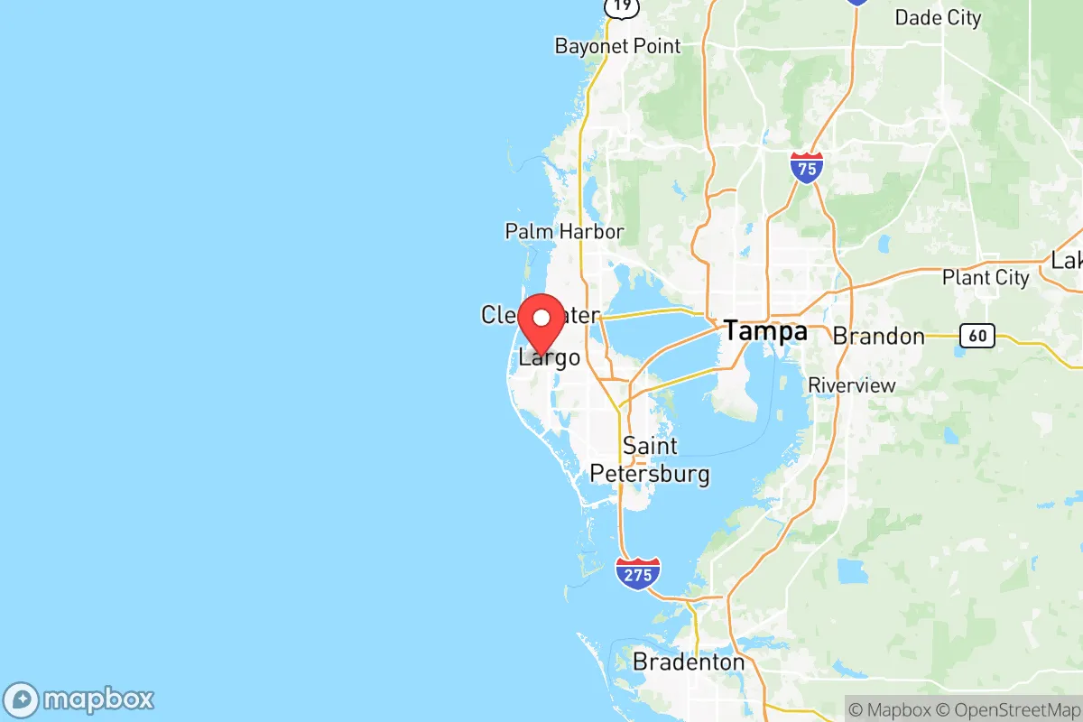
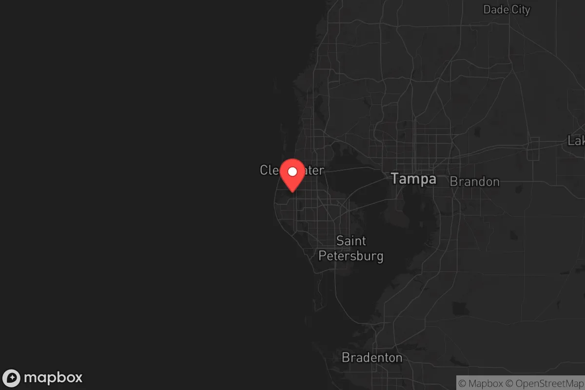
Pinellas County occupies a 280-square-mile peninsula bounded by Tampa Bay and the Gulf of Mexico, with Clearwater and St. Petersburg as its anchor cities. This water-surrounded layout offers a significant defensive advantage: there are only three land-based entry points from the mainland—the Howard Frankland Bridge, the Courtney Campbell Causeway, and the Gandy Bridge, all connecting to Tampa. In a scenario of civil unrest or mass evacuation, these chokepoints can be monitored and, if necessary, controlled by local law enforcement or National Guard units stationed at the St. Petersburg-Clearwater International Airport, which hosts the 290th Joint Communications Support Squadron. The county's position also places it outside the immediate fallout zone of major industrial targets like Tampa's Port of Tampa (a major fuel and fertilizer hub) or MacDill Air Force Base (home to CENTCOM and SOCOM), both roughly 20–30 miles away across the bay. For a relocator, this means you're close enough to monitor regional events but far enough to avoid the initial blast or chemical release from a targeted strike on those facilities.
Risks, exposures, and proximity to fallout-relevant landmarks
The most glaring vulnerability is hurricane exposure. Pinellas sits in the direct path of Gulf storms, and the 2024 hurricane season reinforced that storm surge is the primary threat, not wind. The county's evacuation zones cover nearly 60% of its land area, meaning most properties within a mile of the coast are mandatory evacuation zones during a Category 3 or higher storm. For a prepper, this forces a hard choice: live inland near Largo or Dunedin (lower surge risk but still vulnerable to flooding) or accept the risk of coastal living with a pre-planned bug-out route. Beyond weather, the county's proximity to Tampa International Airport and the aforementioned military bases means it's a secondary target in a major conflict—not ground zero, but close enough to experience fallout from a conventional or EMP attack on those assets. The Port of St. Petersburg, while smaller than Tampa's, handles petroleum and chemical shipments, adding a localized industrial risk. For the conservative relocator concerned with societal collapse, the density is the real issue: Pinellas is the most densely populated county in Florida, with over 1,000 people per square mile. In a grid-down scenario, that density translates to resource competition, looting, and difficulty maintaining operational security.
Practical resilience for a relocator: food, water, energy, and defensibility
For a single individual or family looking to establish a resilient homestead, Pinellas offers mixed prospects. Water is the county's strongest asset: the Floridan Aquifer lies beneath the entire peninsula, and many homes in unincorporated areas still have private wells. The county's water utility (Pinellas County Utilities) also maintains a network of emergency interconnects with Tampa Bay Water, but in a long-term collapse, well access is king. Food production is limited by the sandy, fast-draining soil, but the long growing season (February through November) allows for raised-bed gardening of staples like sweet potatoes, okra, and citrus. The Brooker Creek Preserve in Tarpon Springs offers 8,000 acres of wilderness for foraging and hunting (with proper permits), but it's not enough to sustain a population. Energy resilience is achievable: solar panels are common, and net metering is available through Duke Energy, but the county's tree canopy (especially in older neighborhoods like Safety Harbor) can limit solar exposure. Defensibility is the hardest factor. A single-family home on a quarter-acre lot in a suburban subdivision offers little standoff distance. The better bet is a property on the county's eastern edge, near the Pinellas Trail corridor, where larger lots and rural pockets exist. For a prepper, the ideal setup is a home with a well, solar panels, a propane backup generator, and a defensible perimeter—hard to find under $500,000 in Pinellas, but not impossible in areas like Palm Harbor or northern Tarpon Springs.
The overall strategic picture for Pinellas County is one of calculated trade-offs. It offers genuine natural barriers, a long growing season, and access to a deep freshwater aquifer—all critical for long-term self-sufficiency. But it also carries high population density, hurricane risk, and proximity to high-value military and industrial targets. For the conservative relocator who values community ties and a coastal lifestyle but is serious about preparedness, the smart play is to buy inland, invest in redundant water and power systems, and maintain a bug-out vehicle with a pre-planned route to a secondary property in a lower-density county like Citrus or Levy. Pinellas is not a survivalist's paradise, but with disciplined planning, it can be a viable base of operations for those who understand that resilience is about managing risk, not eliminating it.
* Values derived from national, state, county, city and local statistics and may differ in a specific area. Last updated: 2026-05-28T13:02:37.000Z
Narrative content on this page is AI-generated and may contain mistakes. Verify any details that matter before acting on them.
ReloMaps may earn a commission from affiliate links at no extra cost to you.